
Superstorm
-
Posts
3,222 -
Joined
-
Last visited
Content Type
Profiles
Blogs
Forums
American Weather
Media Demo
Store
Gallery
Posts posted by Superstorm
-
-
1 hour ago, Mount Joy Snowman said:
Saw that! MDT topped out at 89. Like I said, not even close

Low of 60 at my place. Feels like a hot one.
That was Millersville University, not LNS.
MU is not Lancaster's official station so it is not on the list. Although I think it should be.
LNS (airport) is official.
-
 1
1
-
-
46F as I head down. It’s a New England baseball night.
. -
Not much with these showers. Heading to Orioles game so need them out by 4:05 pm.
.-
1
-
-
The video footage from there is unbelievable.
. -
What a signature.

.-
1
-
-
34.9F for low. Again, no frost at the homestead, but plenty south of Lancaster and in northeast Maryland.
-
1
-
-
35F for low. No Visible frost in my neighborhood.
Saw a lot in southern Lanco and northeast MD.
.-
1
-
-
Back Door Cold Front Season

.-
1
-
-
1 hour ago, SACRUS said:
Highs Yesterday:
BLM: 83
EWR: 83
NYC: 82
New Brnswcl: 82
TTN: 80
LGA: 80
TEB: 79
ISP: 78
JFK: 77Not enough vegetation in Central Park to throw off the numbers.
-
1
-
-
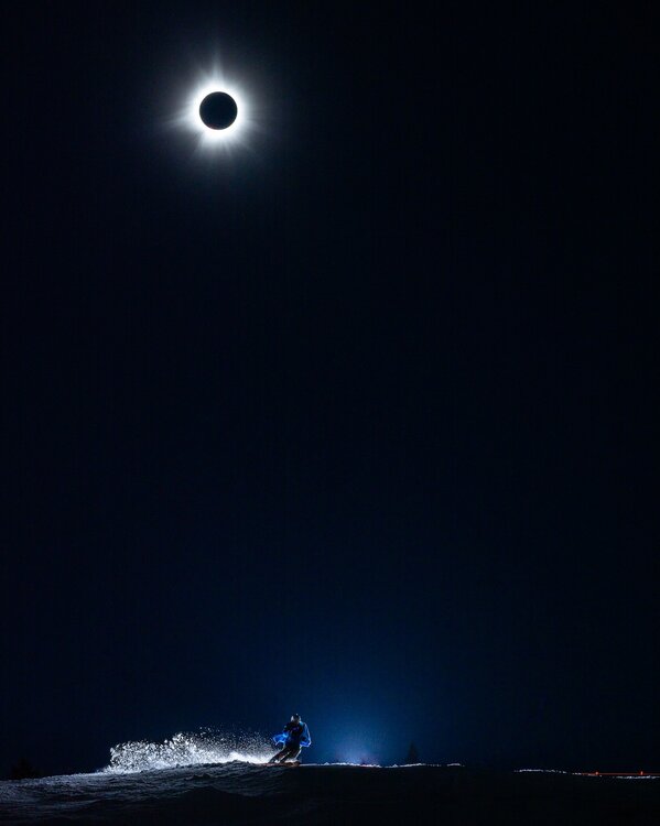
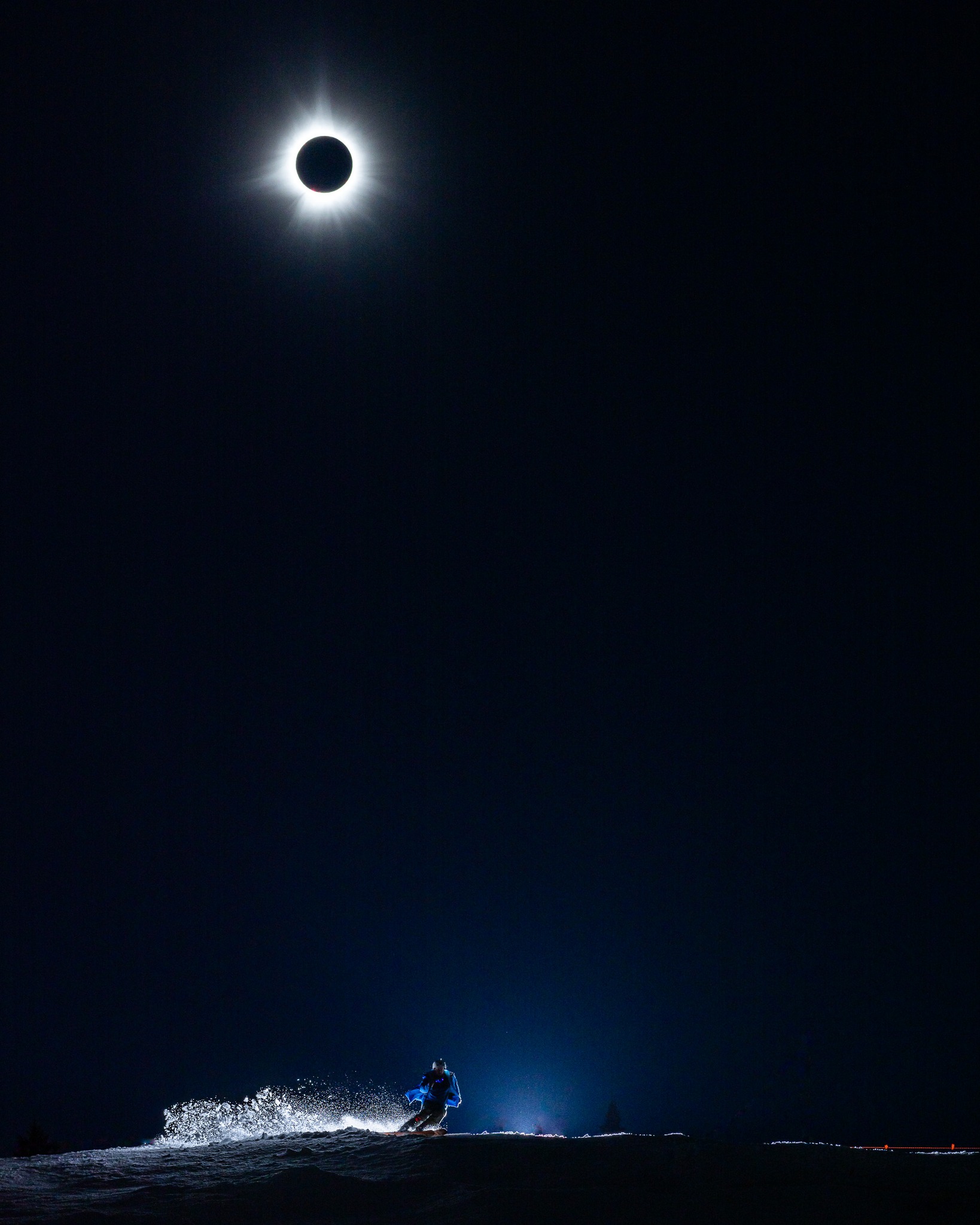
Location: Sugarloaf
Photo credit: Jamie Walker
That is a great photo!
.-
2
-
-

That’s a gorgeous pic
.-
1
-
 1
1
-
-
I went from Syracuse to Plattsburgh to Jackman, Maine.
.-
2
-
-
What would be your thoughts on Greenville Maine?
. -

.
Epicenter in Lebanon, NJ
. -
WTF earthquake? A pic fell off a wall
. -
Looks like epicenter was Lebanon, NJ.

.-
1
-
-
3.48” in my rain bucket for 3-day total.
.-
1
-
-
I have a room booked in SYR area, but just in case clouds sneak in faster, I’ve also booked a room just north of Albany. The plan would be to drive to Plattsburgh that morning. I assume 87 will be a zoo.
. -
I know people in here are focusing on one last potential wintry threat, I certainly respect and understand that. But the bigger story to me in the next 48 hours is the severe threat that's unfolding not too far away from us. I feel that the pretty colors aren't finished moving towards us, too.
Western PA could be in trouble.
I think our air will be too stable for severe.
.-
1
-
-
Got down to 38F.
Now at 51F. Beautiful outside today.
. -
8 minutes ago, Itstrainingtime said:
Wow, 61 at home currently.
My grass went nuts over the past 24 hours. Over half of it needs mowed soon.
Many reporting stations around MDT are at or near 60F also.
-
1
-
-
49.6 to be exact in Maytown. I'd like to know the last time Clearfield County was 20 degrees higher than here. It isn't super unusual for SW PA - but in that area, yes.
Think it happens more often than you think when we get those backdoor cold fronts in spring.
. -
About an 1” of rain today.
. -
Yeah that's the right word for it.......interesting. All kinds of disjointed in regards to SLP placement but worth keeping an eye on. A LOT to be sorted out yet.
Heading up to Stowe next weekend so could be good timing.
.-
2
-
Central Pa. Spring 2024
in Upstate New York/Pennsylvania
Posted
I was able to get to 58.1F at 6:04 am. Now up to 60.3F.