
Superstorm
-
Posts
3,892 -
Joined
-
Last visited
Content Type
Profiles
Blogs
Forums
American Weather
Media Demo
Store
Gallery
Posts posted by Superstorm
-
-
56.7 F in Lancaster.
Refreshing.
.-
 1
1
-
-
@MUweather
Due primarily to oppressively warm nights and a slew of days with highs between 89-95F, #July2025 concluded as the 2nd-hottest on record @millersvilleu since 1914. It was also the 10th-wettest on record thanks to a seemingly endless onslaught of slow-moving, drenching T-storms.
Going to be a recurring theme in our new high humidity climate.
.-
2
-
-
1.56” in rain gauge.
Got down to 64F.
Beautiful 68F right now.
.-
3
-
-
1.50" so far.
-
3
-
-
And so it begins....Flood Warnings have been issued.
-
11 minutes ago, Itstrainingtime said:
Storms are already rapidly developing east of the river currently.
https://weather.cod.edu/satrad/nexrad/?parms=CCX-N0B-1-24-100-usa-rad
Was just about to post that.
-
1
-
-
could get a sneaky 90F today
-
53 minutes ago, Itstrainingtime said:
From CTP:
Southern/Southeastern PA/Lower Susquehanna Valley
Farther south, this area is more removed from the jet-streak
dynamics to the north. However, this region is closer to the
deepening surface low with strong surface-925mb southerly
theta-e advection directed into the southeastward advancing
surface front. A tropical air-mass (depicted by 2-2.25" PWATs
and low-mid 70s dew points) will coincide within a warm sector
that becomes increasingly unstable (MUCAPE between 1,000-2,000
J/kg). It is worth noting that SST anomalies along the Mid-
Atlantic and Southeast coasts are well above normal too, acting
as an abnormally rich moisture source for southerly low-level
flow to draw from. By this afternoon, low-level WAA into the
front will support storms enveloping the region with additional
storms from the Laurel Highlands/south central Alleghenies
tracking east. Modest vertical wind shear aloft will also
support organized clusters of storms, some of which will have
the potential to backbuild and train between the I-81 and I-95
corridors into tonight. Latest 12Z HREF guidance shows 24-hr
probabilities for >3" of rainfall are high (>70%) across southeast
PA. Just as concerning is this same region sports 30-60%
chances for >5" of rainfall with 24hr PMM/LPMM values close to
the ensemble maxima approaching 8 inches.
That is nuts. Whoever gets in the deluge will be suffering some serious flooding.
-
1
-
-
URGENT - IMMEDIATE BROADCAST REQUESTED
Flood Watch
National Weather Service State College PA
219 PM EDT Wed Jul 30 2025
Adams-York-Lancaster- Including the cities of York, Lancaster, and Gettysburg 219 PM EDT Wed Jul 30 2025
...FLOOD WATCH IN EFFECT FROM THURSDAY AFTERNOON THROUGH LATE THURSDAY NIGHT...
* WHAT...Flash flooding caused by excessive rainfall is possible.
* WHERE...A portion of central Pennsylvania, including the following counties, Adams, Lancaster and York.
* WHEN...From Thursday afternoon through late Thursday night.
* IMPACTS...Excessive runoff may result in flooding of rivers, creeks, streams, and other low-lying and flood-prone locations. Flooding may occur in poor drainage and urban areas.
* ADDITIONAL DETAILS...
- Thunderstorms capable of producing very heavy rainfall rates in excess of 2 inches per hour may result in flash flooding. Rainfall amounts of 2 to 3 inches are expected with localized amounts of up to 5 inches possible.
- http://www.weather.gov/safety/flood
PRECAUTIONARY/PREPAREDNESS ACTIONS...
You should monitor later forecasts and be prepared to take action should Flash Flood Warnings be issued.
&&
. -
39 minutes ago, Itstrainingtime said:
Unfortunately, it also now appears that flood concerns are elevated on Thursday:
.LONG TERM /THURSDAY THROUGH SUNDAY/...
Models show t-storms accompanying the southeastward moving
front through CPA on Thursday. A wave of low pressure is now
progged to move along the boundary, which has trended slower
with its southward/southeastward progression. There also appears
to be some enhanced large scale lift to support +RA in the form
of right entrance region (RER) upper jet dynamics. High rain
rates combined with ample deep layer moisture will continue to
support an excessive rain/flash flood risk particularly across
the southern tier of CPA on Thursday/D4.

The slower southward movement may also delay north to south
clearing, and we can`t rule out a stray shower lingering early
Friday morning in southern tier/far southeast PA. That said,
much of the area will be firmly in the dry/cooler sector by
Friday afternoon.

Behind the front, a comfortably cooler and refreshing airmass
(much lower humidity) is poised to arrive just in time to begin
the month of August. Slightly below average daytime highs
70-80F and lows 50-60F are forecast along with no rainfall through
the first weekend of August. Dewpoints will plummet into the
This is not good.
-
 1
1
-
-
In this new climate, the south is going to be unlivable.
. -
Wow, Tampa, FL hit 100F for first time ever.
. -
1 hour ago, Itstrainingtime said:
11:15am and it's 89. Feels so much worse. Late next week can't come soon enough.
Yesterday was not too bad....today, it is BRUTAL.
-
1
-
-
From MU:
Here’s a fun little stat: there have only been 3, 90-degree days at @millersvilleu so far this month. However, the high temp has reached 89F on an additional 8 days. One single degree is separating us from having 20, 90-degree days so far this season. Instead, there have been 12.
That’s why I am not into these stats when it comes to maximum high temperatures or cold minimum temperatures. Still felt like 90F.
And the 90F mark is real not a good barometer anymore. 95F is the new 90F.
.-
2
-
-
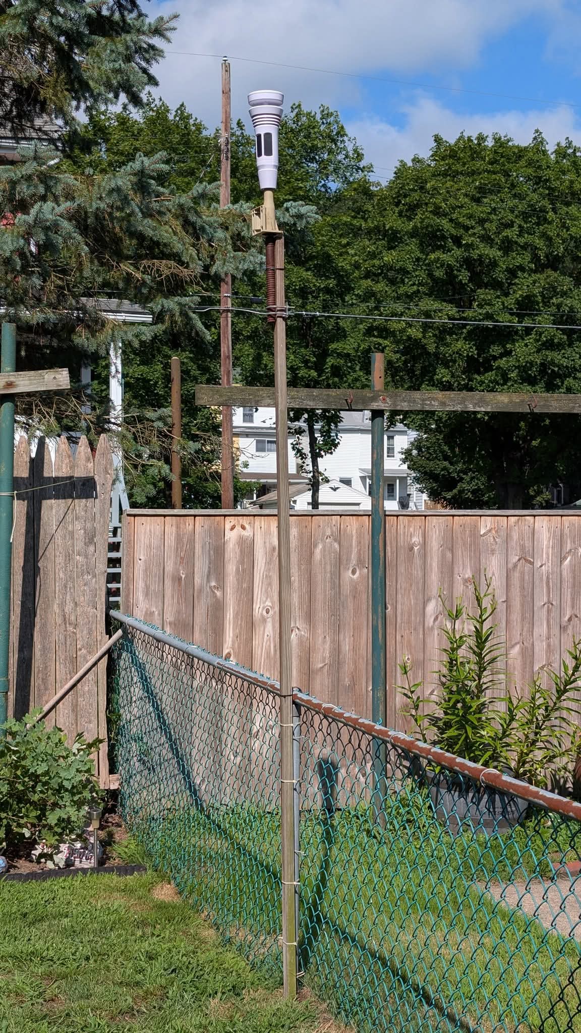
Well, I got the Tempest elevated. It's above the standard 2m height for temperatures, but now it's more open, and above the fence tops for a better opportunity for more accurate wind speeds and directions.
It's a homemade setup using one of the wife's clothesline props, so time will tell how well it holds up. I may need to get a more rigid post, but for now it's better than where it originally was.

Looks pretty solid
. -
Radar estimates of 5 to 6 inches.

. -
Lots of high water rescues being called into Mt. Joy and surrounding areas with numerous reports of over 5".
Brutal
. -
I can wait.

lol
.-
 1
1
-
-
10 hours ago, Itstrainingtime said:
Depends on what Superstorm got. His area got rocked last evening.
I finished with 1.70".
-
1
-
-
18 minutes ago, pasnownut said:
Hey everyone......looky who stopped in...the wondertwins.
Now do the forum a favor.....and deactivate.
(many old timers will get this)
He offers far more credible info than you guys ever will.
i am GenX. I got the reference.
-
1
-
-
11 hours ago, Jns2183 said:
Grass is as green in July as I have ever seen it
Sent from my SM-G970U1 using Tapatalk
Very green.
-
[mention=423]Superstorm[/mention] about to get some legit severe stuff there in the Willow Street area.
I can only report what my weather station says and my ring camera. I am in Hagerstown for work tonight.
.-
2
-
-
This rain is making yesterday's look pedestrian. It is a monsoon.
Slow moving and training
.-
 1
1
-
1
-
-
Think I’m seeing a bad scenario starting to develop in Lancaster County again.
.
Central PA Summer 2025
in Upstate New York/Pennsylvania
Posted
55.6F
Very nice fall like morning.
.