
gritsnc
-
Posts
671 -
Joined
-
Last visited
Content Type
Profiles
Blogs
Forums
American Weather
Media Demo
Store
Gallery
Posts posted by gritsnc
-
-
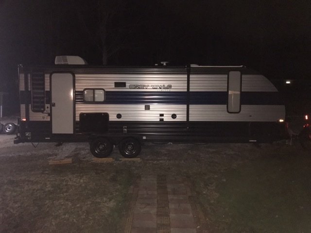
Got the camper pulled up to the house. Our house is on a well so when we lose power we lose water. Got the water and propane tanks to the camper all filled up so we can have it as backup. It also has solar power. Hoping we don't have to use it but thankful we have it if we do.
-
 5
5
-
-
All the way up to 40/22. Southern Stokes County (Walnut Cove). We are a 3 miles from the Duke Power power plant and I swear the steam from the stacks makes it warmer here.
-
4 minutes ago, srobby76 said:
Long time follower of these events and most have fallen apart on us, with that being said would yall cancel a training for people driving to Durham from the triad and Triangle for thursday and Friday. I have to decide today to prevent any charges for cancellations.
Yes. We have already started calling all of our Thursday morning patients to change their visits to video visits or reschedule.
-
1
-
-
2 minutes ago, WinstonSalemArlington said:
Praise God for your detector. Consider doubling up on detectors in the house.
I have already ordered 2 more. Another one for myself and one for my daughter and her husband. Our reading got up to 226 on our carbon monoxide detector. The fire department said that was extremely high.
-
2
-
-
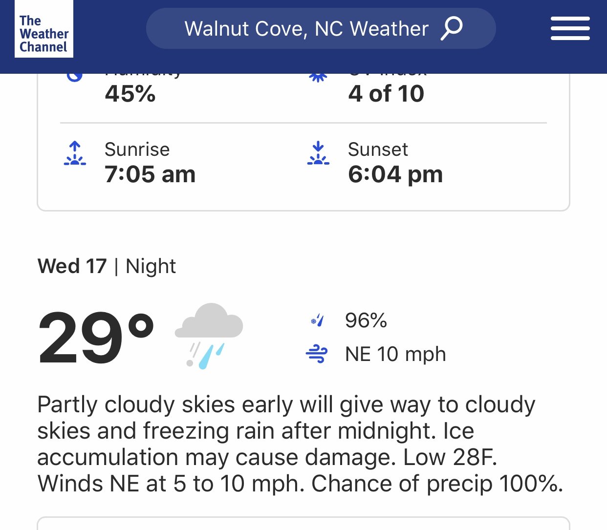
We had to evacuate our house Sunday due to carbon monoxide from our kerosene heater Sunday. Our carbon monoxide detector saved our life. So seeing the words that ice may cause damage gives me a bit of anxiety because I'm scared to use our kerosene heater now if we lose power.
-
1 hour ago, NTriadwx said:
 What’s the deal with this? Anyone seeing lightning or hearing thunder?
I don't know what is going on with their observations. Yesterday they showed us with snow. We had no snow at all.
-
Just lost power in Walnut Cove (Southern Stokes County).
-
Forsyth definitely got more accumulated ice than up here in Stokes County. Thankfully we've lost no trees or limbs and our power only flicked off and on a few times. All of my friends in Kernersville are posting pictures of multiple trees down.
-
Do you think temps will rise once heavier precip moves in? That's what the hourly forecast is showing.
-
30 minutes ago, btownheel said:
Betcha a nickel we both make it to 29 in darkness.
My car is reading 29° here in Stokes County. I just called my daughter and told them to keep their phones on charge. She is due to give birth to their first baby any day now and I'm stressing that she will go into labor tonight.
-
Temp down to 31° now
-
Issued By
Roanoke/Blacksburg - VA, US, National Weather ServiceAffected Area
Portions of north central and northwest North CarolinaDescription
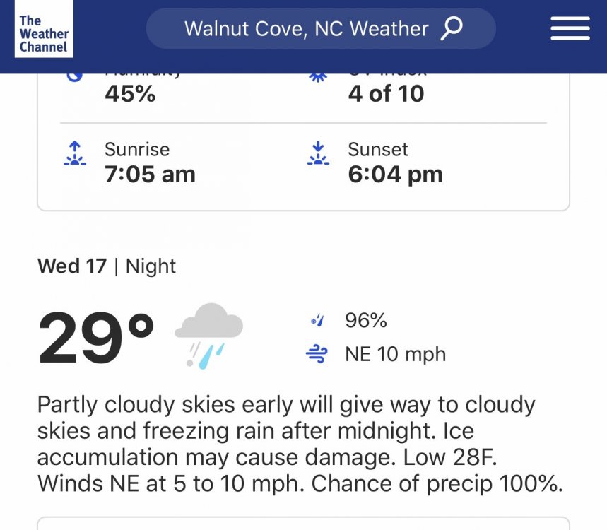
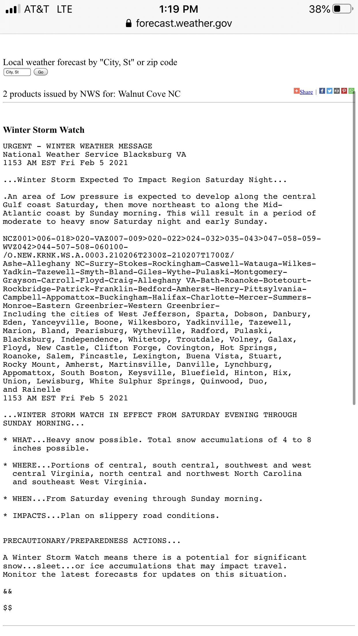
...WINTER WEATHER ADVISORY IN EFFECT UNTIL NOON EST TODAY... ...WINTER WEATHER ADVISORY IN EFFECT FROM 9 PM THIS EVENING TO 11 AM EST SATURDAY... WHAT...For the first Winter Weather Advisory, freezing rain. Additional ice accumulations of a light glaze. For the second Winter Weather Advisory, freezing rain expected. Total ice accumulations of up to one tenth of an inch. WHERE...Portions of north central and northwest North Carolina. WHEN...For the first Winter Weather Advisory, until noon EST today. For the second Winter Weather Advisory, from 9 PM this evening to 11 AM EST Saturday. IMPACTS...Difficult travel conditions are possible. The hazardous conditions could impact the morning or evening commute. PRECAUTIONARY/PREPAREDNESS ACTIONS... Slow down and use caution while traveling. Prepare for possible power outages. Please report snow, sleet or ice accumulations via email at [email protected] or by calling the National Weather Service toll free at...1...866...2 1 5...4 3 2 4. Leave a message with your observation and the specific location where it occurred. You can also post your report to National Weather Service Blacksburg Facebook page and on Twitter. The latest road conditions for the state you are calling from can be obtained by calling 5 1 1.More Information
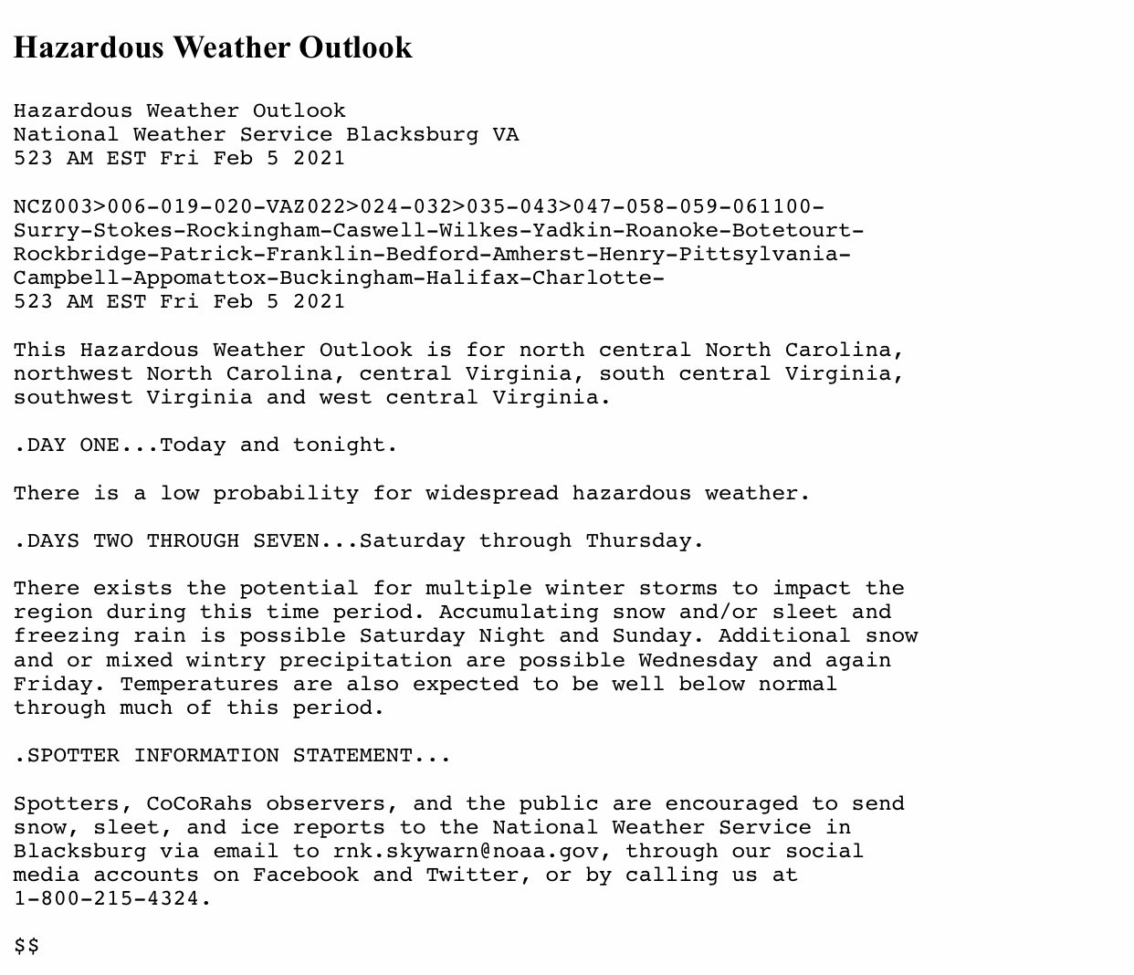
...Wintry mix tapers off by noon today... ...Additional wintry weather begins late tonight and lasts into Sunday morning... Freezing rain, sleet, and snow will impact the region today before tapering off around noon. After a brief break, additional wintry weather begins tonight and last through early Sunday morning. Snow, sleet, and ice accumulations will be slightly higher with the second round than with today's event. Travel will continue to be treacherous. -
We've had thunder and lightning in the past hour here in Kernersville. Since the weather models often stink maybe the old wives tale will happen and we will get snow in 10 days.

-
 1
1
-
 1
1
-
-
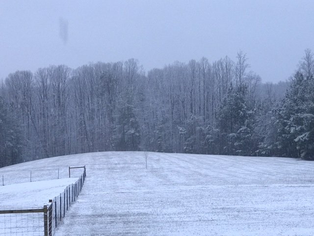
Just woke up to a heavy dusting. It's still snowing but looks like it will be ending soon per radar.
-
2
-
-
1 minute ago, BornAgain13 said:
Anyone have any ground reports of snow near Winston or Greensboro? Just curious as it heads up this way
I'm in Walnut Cove and it's plain rain here.
-
It's gotten really windy here suddenly. My wind chimes are going crazy and temp down to 44° now.
-
Temp just went from 45° to 47°.

-
DH and I have a big bonfire going out in our field while sipping on adult beverages waiting on whatever may fall and on baby watch (expecting our first Grandbaby any day now)!
-
4
-
-
It was sunny and beautiful all morning and about 30 minutes ago clouds quickly moved in.
-
1
-
-
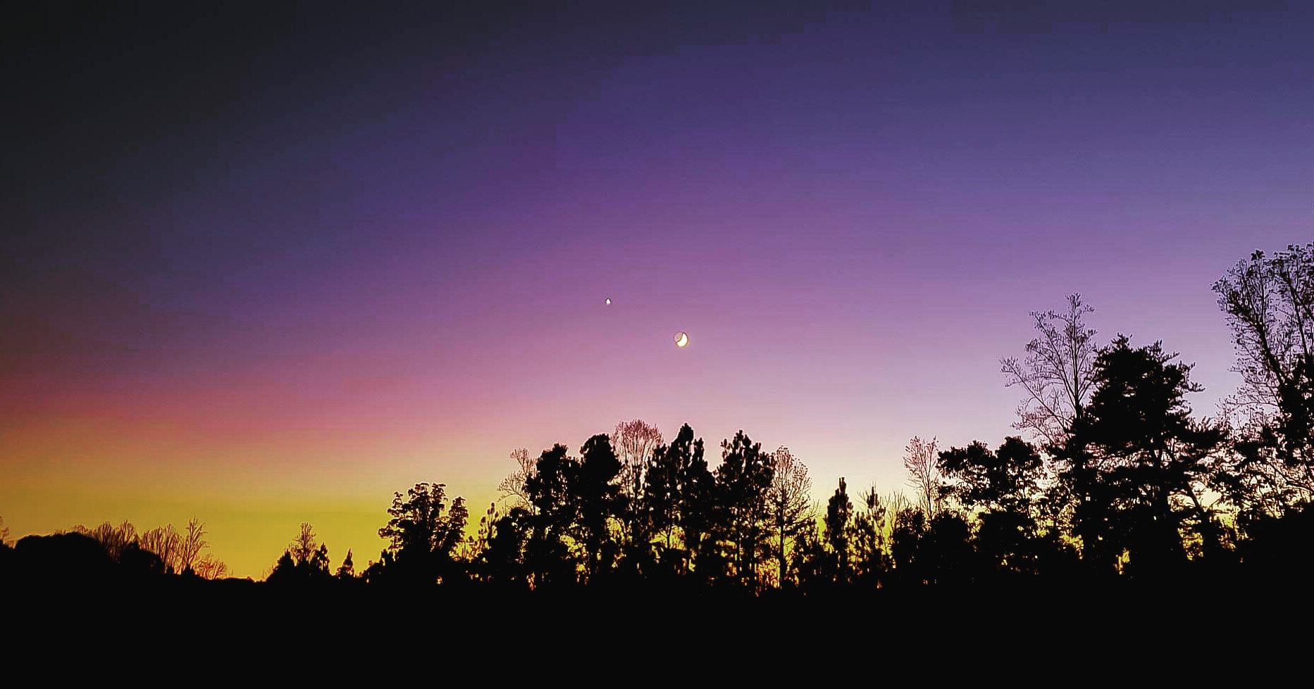
It's a beautiful, sunny 52° here.
-
Brad P just said basically rain for everyone outside of the higher elevation mountains. On to the next one, if there is a next one.
-
1
-
 2
2
-
-
-
From the NWS:

-
4 hours ago, Billypg70 said:
That was the storm of my life and I'm now 50.
I was in elementary school and it was my first winter in NC. We missed so much school that we had to go to school 2 Saturdays for a half day to make up all of the school we missed.
-
1
-
February 18-19 MAJOR Ice Storm Threat
in Southeastern States
Posted
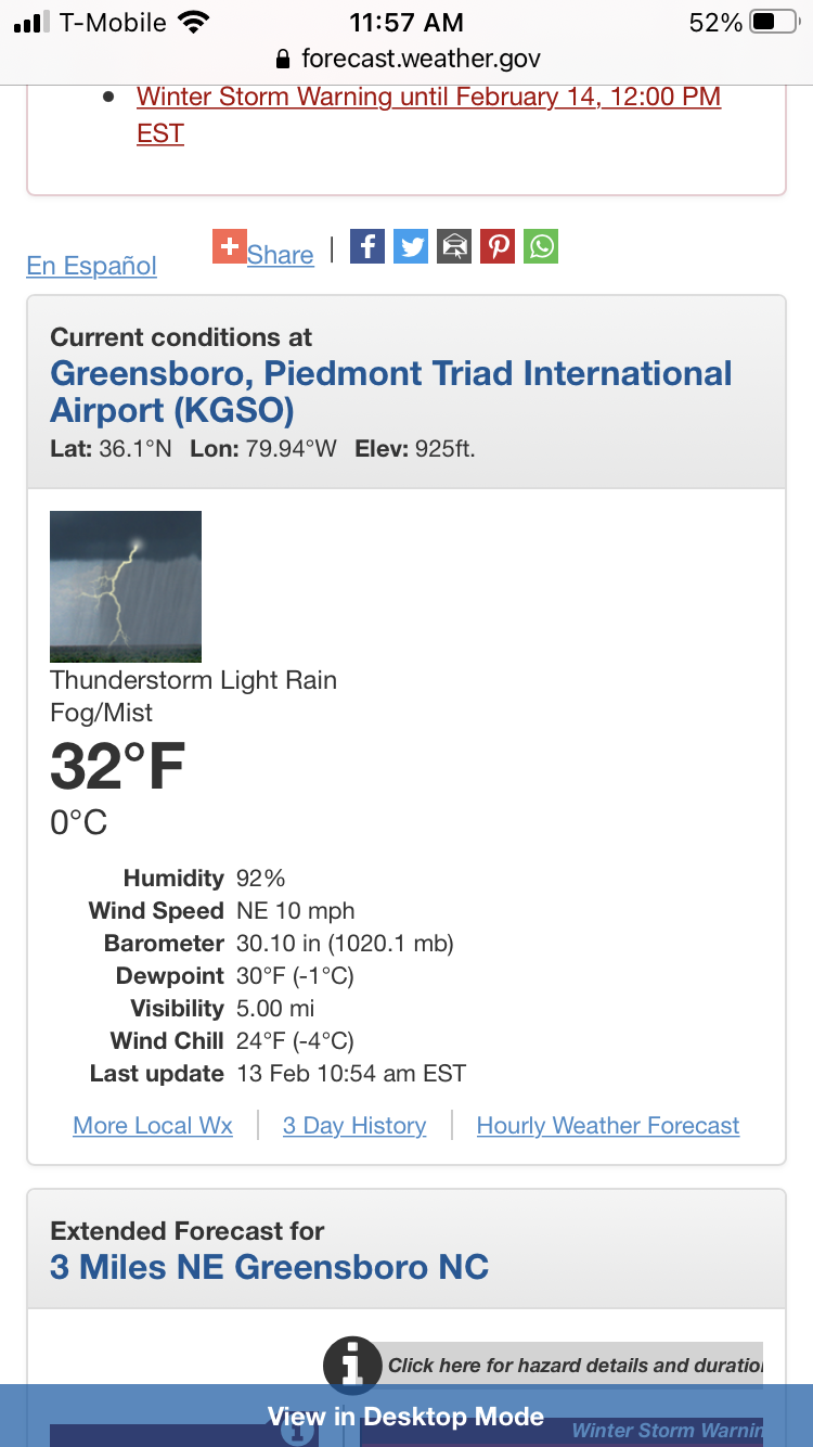
What site do you rely on for current conditions? TWC has me currently at 35°, NWS has me at 40° and Accuweather has me at 40°.