Anduril
-
Posts
816 -
Joined
-
Last visited
Content Type
Profiles
Blogs
Forums
American Weather
Media Demo
Store
Gallery
Everything posted by Anduril
-
Getting noah wid'it
-
Models look all over the place again. Most seem to like rain in northern or eastern PA with scattered cells throughout. So having said that, somehow the west shore won't see a drop and it will be a biblical flood on the other side of the river
-
Cell near Halifax/Newport looks like its gonna have a nice hail core
-
It is disgusting out
-
Finally on par with the Euro's cluster in performance (roughly)
-
Nice
-
69F outside. 0.22in of rain and 0.05in of that was overnight...
-
Still hear steady thunder to the South/east but right now just a light rain falling. Driving from Harrisburg through Lemoyne/Camp Hill saw some nice lightning around 5-5:20 but just some light wind gusts and rain drops. What a weird, weird weird storm line for this exact area
-
Damn...storm line hit western Cumberland county and just...how
-
Agreed. Pretty surprising actually
-
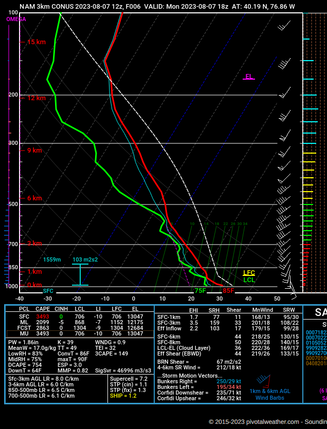
Yea, I didnt think we have actual measurements for harrisburg since there's no weather balloon releases?
-
-

-
Looks like the baby bow echo is formed along the state line
-
Is TBWI radar down? Cant get it to show anything on radarscope
-
Welp sun's punched through in Harrisburg. Let the games begin
-
Maybe (hopefully?) MU's new radar is up and functioning and the data is being shared
-
I know this is unscientific garbage but it felt and smelt like storm this morning
-
we got some rain drops in (discount) Camp Hill
-
Sun punched through here in Harrisburg about 20-30mins ago. Quite bright (I dont like it)
-
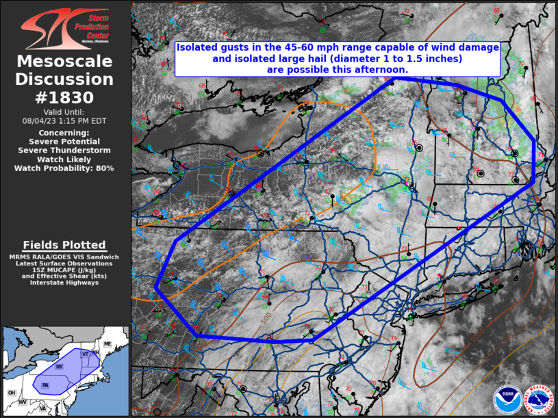
Also according to NWS AFD central PA is under a severe thunderstorm watch till 8pm but Im not seeing it pop up yet
-
-
Oh, right, our radar is down. Could be fun
-
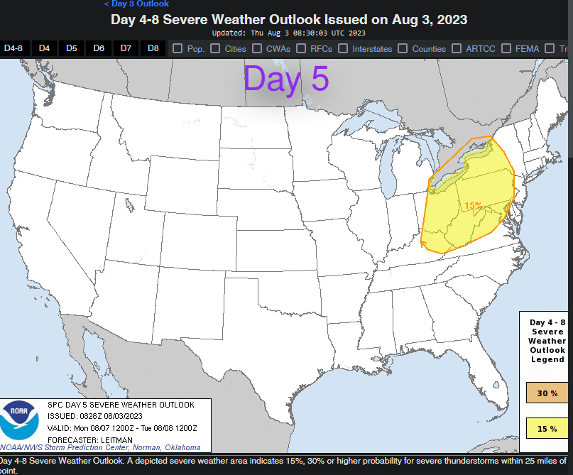
Anyone else notice SPC has most of PA under a Day 5 outlook?
-
Gonna be a warm one today; perfect day for Baldurs Gate 3 launch and stay inside and play! (Who am I kidding Im working)