

SnowNiner
-
Posts
1,905 -
Joined
-
Last visited
Content Type
Profiles
Blogs
Forums
American Weather
Media Demo
Store
Gallery
Posts posted by SnowNiner
-
-
43 minutes ago, Orangeburgwx said:
18z GFS suites

Sent from my LML212VL using Tapatalk
Well, honestly that's pretty anemic IMO. Two members seem to make up the mean (separate of eastern nc) . Coming around perhaps but I wouldn't say the GFS caved. The NAM is the NAM, but it's showing the real deal by itself at the moment. If it hangs tough through tomorrow showing a similar wet/cold solution I'll climb back up the cliff. Hopefully it'll survive past about 9:30 pm though, lol.
-
23 minutes ago, griteater said:
It's a package deal Mack - precip north / cold air north. You and I went from being right were we want to be with the 12z NAM, to yikes, too amped with the 18z. Great for the folks north of us though. Let's see what happens going forward. Need the big high pressure to come thru
I'd take the 18Z all day for MBY. I didn't move to Mooresville for nothing! lol. I got NAM'd!
Although I don't buy it, it's interesting that the configuration of the precip seems consistent with the EPS, just heavier.
-
Just now, ragtop50 said:
RAH not biting:
Mid and high level moisture will increase rapidly on Thursday ahead
of a positively tilted trough digging through the Midwest.  Precip
will spread along the stalled frontal zone over the SE US, with
cyclogenesis induced off the SE coast.  Models continue to trend a a
bit closer to the coast with the surface low bringing more moisture
inland.  The low is still relatively weak, however, and moves east
with the digging trough.  The bigger question is whether or not the
arctic air associated with a 1045+ mb high over the central US will
spill across the mountains in time to cause a mix of rain and snow
or changeover to rain.  The high is not in a favorable location for
the dense cold air to make it into NC very quickly...likely having
to filter across the central Appalachians and south through VA...and
so the probability of probability more than a rain/snow mix appears
very low at this time.  If there is an opportunity for phasing of
sufficiently deep moisture/omega and cold air, it would be north and
east of the Triangle, which is where the outlier EPS solutions
lie..while the the GFS and GEFS appear to be too aggressive with
with cold air.
GSP says kinda sorta, hey maybe, remember last week?
There now looks to be a brief break in the precip Wednesday night as
the first wave of forcing moves east and some drier air moves in. Of
course, this sets the stage for the potential for some wintry precip
as moisture moves back in Thursday ahead of the surface wave moving
along the front and some upper divergence associated with a coupled
jet streak. The guidance still doesn`t agree on how far north the
moisture moves or just how cold the air will be. That said, it is
now looking like there will be precip at least as far north as the I-
85 corridor and likely the NC mountains. Precip tapers off quickly
Thursday night as the wave moves east of the area. The thermal
profiles and partial thickness progs show the precip to be rain or
snow with no significant warm nose. I`m beginning to become wary of
the snowfall potential given the previous 2 snow events where the
thermal profile and thickness values were quite similar. I suspect
this event could be similar where precip begins as snow over the
western CWFA along and north of the I-85 corridor with accumulations
developing where precip can fall for the longest period of time.
That said, have followed the national guidance for now which keeps
the accumulating snow across the higher elevations and mainly rain
outside of the mountains. Of course, this forecast could go either
way, so interested parties will need to stay abreast of the latest
updates.
-
 1
1
-
-
19 minutes ago, griteater said:
I mean, it depends on where your expectations are. Yes, I think a light to moderate event with some surprises is possible....it all has to come together though. Still 3 days out.
The Euro has trended better at 500mb. At a timeframe of Wed aftn, the western ridge is taller...the wave out west is has trended west...and the flow across the south is better....all good trends.

Then by Thursday morning, the wave over the Great Lakes that is acting to keep everything suppressed to the south has trended farther north - again, good trend for precip to climb north as long as temps work out.

Thanks Grit. A couple inches of accumulation and I'd be happy. Hope you're right!
-
8 minutes ago, griteater said:
3 days prior to go time, this is what storms that hit us look like. It's far from perfect, but we're in the game here.
Man, I don't know grit. I'd understand if we were on the fringes of the juice, but no model has significant precip near us that I can tell (maybe the nam long range). You expecting a powerful NW trend here? Storms that are legitimate usually have some models in our court. I'm just not seeing anything close.
-
 2
2
-
-
5 minutes ago, Wow said:
I ain't impressed. Better hope for a last minute tweak to make this more than just more token flakes (at least for W NC)
Yeah I agree sadly. Ironically when we actually need a moisture laden system, it just doesn't look like we're going to have it. Western NC I think is on the outside looking in. Eastern NC and what happens with the coastal is an interesting question imo.
-
CFS or nothing. All in. Lol.
No really, NAM's our only hope. Sigh.
-
 1
1
-
 2
2
-
-
5 minutes ago, griteater said:
The NAM really likes the idea of crashing temperatures in areas of steady precip
We just need to move that steady precip north a 100 miles. Such a flat flow, what do we need to look for at H5 to push more moisture north?
-
4 minutes ago, mackerel_sky said:
Euro was on board yesterday, it’ll be back by Sunday, then here comes the NAM...
I don't know man. I'm not a big believer in the "it's fine it lost it it'll come back" theory. The good ones get latched on to and usually hang in there imo. At least on the ensembles. The ensembles really aren't great anywhere yet. By Monday I think we'll know what's coming.
-
4
-
1
-
-
14 minutes ago, StantonParkHoya said:
If you can’t make thermals work with a 1043 high banana’d all over the SE, might as well pack it up and call it a season.
Yeah I'd have to agree with that. The high is really as good as we've been able to get in years (minus CAD). If that doesn't get us down to freezing I'm not sure we have any hope! lol. With that said, I'm always worried about surface temps. Hopefully it'll be good drama this weekend hoping the euro comes on board. Then, I'll start worrying about temps.

-
2 minutes ago, ILMRoss said:
While you are correct for the heavy precip core, I want to emphasize that *people on the fringes* of events like this still will have to worry about BL issues. In a hypothetical where the I-40 corridor gets an E-W spanning streak of the heaviest rates, places N of that (South Hill, Danville etc in this scenario) would still deal with mixing.Exactly. If you're stuck with lighter precip, you've well, wet ground from some snow showers. This system/set up reminds me of the temps and precip of this last weekend IMBY. Mid to upper 30s, had decent snow showers but it was light and didn't amount to anything. I could foresee the same for clt.
-
8 minutes ago, burrel2 said:
Surface temps are a non-issue with this storm for most folks, as modeled.
Let me explain:
If per say, the models were showing a profile with -4c 850mb temps, 0c 925mb temps, 1c 950mb temps and 3c surface temps. We would be in trouble in that scenario as we would be dealing with lots of white rain and a thick boundary layer that wouldn't want to give up the fight.
That is not what any of the models are showing for this storm. There are (on average for mby) showing -4c 850mb temps, -2c 925mb temps, -.5c 950mb temps, and 3c surface temps. As a result, the above freezing layer is only a few hundred feet deep at most on the globals, and any decent precip rates in that profile will quickly get the surface to 32/33. The globals never pick up on this, especially at this range. So it's no surprise they are showing 6 straight hours of 37 degree rain/snow. In reality,(if their thermal profiles are right). that would mostly be 32/33 snow for everyone fortunate enough to get good rates, assuming your location has the good thermal profile I described above.
Thanks Burrell. I'd agree the boundary layer temps look good/decent at the moment. However depending on getting the temp down with rates is problematic when you're not dealing with a strong system. It looks like currently we're struggling to get a good amount of precip in, assuming say we take the average between the EURO/UKMET (strange their on the opposite sides of the spectrum huh?). With a lack of rates, we're not that cold like you say because we don't have good rates. I'm probably getting too far in the weeds this far out, but surface temps are a pet peeve of mine. If we're dealing especially with limited moisture or a light event, I'd of course much rather have cold surface to aid in accumulation. At this point though in this winter, I'll be happy with seeing some flakes fly.
-
5 minutes ago, griteater said:
The modeling today actually looks surprisingly similar IMO. Dual shortwaves drop into WA state and Montana next Tues. The WA state wave pinches off / closes off over the Great Basin and the Montana wave works toward NE Colorado. The UKMet keeps the two waves together, with a stout wave closing off over Utah.
The UKMet and CMC are the most aggressive with getting the subtropical jet stream moisture involved (streaming northeast out of Baja), with the GFS next in line.
The Euro and ICON are the least aggressive with getting the Montana wave to dig far enough to the southwest to ignite precip from Texas to the Carolinas.
All things considered, I thought the 12z suite was a step in the right direction. We haven't lost our cold high dropping down, and the path to victory with the southern slider overrunning precip is more than just a pipe dream.
Here's the aggressive look with Baja moisture streaming in on the UKMet...


Thanks Grit, you've got a real great way of not only understanding the model variables, but communicating them in a clear way. I always appreciate it!
Assuming we do get some moisture tap for the overrunning, the surface temps along all modeling seems to be very marginal, mid to upper 30s. Is there a likelihood to get those temps colder? It doesn't look like CAD is involved with this so I'm not sure what I'm rooting for to see that. High further east? stronger? That variable seems to have remained pretty much the same so far.
-
2
-
-
1 hour ago, ILMRoss said:
Focus on Thursday. Thursday is a no frills, overrunning event where the atmosphere is hair trigger sensitive to disturbances due to the thermal gradient. The closing coastal needs a lot more to go right. Focus on Thursday.
Yeah, the problem is there may no energy to work with. The euro took a step toward the gfs in wanting to hang the energy back in the SW. Always something...especially so this winter. I don't think it's dead yet but the euro suite (including the EPS) makes me think this is going the way everything else has this winter.
-
 1
1
-
-
1 minute ago, frazdaddy said:
You do know this is all virtual and no matter what I say I can't change it ....Right?
Just messing around. Fantasy snow is an art form.
")
-
1
-
-
Just now, frazdaddy said:
That was a Burger Boom!
Please don't prematurely use a Burger Boom. That's bad etiquette if not a great run. Let's see the run first prior to usage. lol.
-
2 hours ago, griteater said:
MJO amplitude continues to grow on the MJO plots. Shown are the Euro MJO changes over the last 6 days...and the CFS MJO changes over the last 3 days. The GFS plots are similar to the CFS though the CFS holds a higher amplitude into Phase 8. Personally, I believe the CFS has the right idea here.
The 2 most likely outcomes IMO are: 1) We get an Aleutian Low developing in the mean pattern, with western ridging, and a nice split flow of storm waves into California in the southern stream <OR> 2) The westerly flow is too overwhelming and attempts at western ridging aren't as aggressive, leading to pattern that is maybe cool at times, but not cold enough.
It is interesting to note that the Euro/EPS has been the least aggressive with western ridging - but it is also the least aggressive with the MJO circuit. It's possible that the EPS trends colder in late Jan / early Feb if it continues to correct the MJO with more amplitude.


That's my hope as well Grit. Perhaps the EPS won't pop a ridge in Alaska because it's not "seeing" the higher amp 7/8. 12z seemed to have a bit of one further out in time but yeah, it's way out there in time.
-
1
-
-
6 minutes ago, griteater said:
That’s what it’s going to take to get the job done. I’d like to see a colder look on the EPS with the 500mb pattern. GEFS can have more of a cold bias at range
Agreed. The lack of a -EPO on the EPS concerns me. That's where the key lies IMO for a true pattern change and sustained cold in the east. Rooting for the GEFS but very wary of it overmodeling pacific ridging.
-
2
-
-
9 minutes ago, Extreme NEGA said:

Ouch. It'll hopefully bounce back overnight.
-
4 hours ago, griteater said:
GEFS 5 day avg loop from days 8-12 to days 12-16
Very nice. I love how through the whole time referenced the west coast ridge axis and east coast trough axis just sits there in the perfect spot. Pretty much opposite of the last 2 weeks.
-
That's one of the best gefs runs in the long range I've seen.
Eps as always not as enthused but still looks very good at h5. Hopefully it ticks up in the mean. Getting to the point where im afraid to keep looking at the models because im afraid theyre going to fall apart. I'm a weenie.

-
2 hours ago, mackerel_sky said:
MJO 7, gives CLT a lot of winter storms, so 7 is good
Yeah, I just don't want it high tailing it to the cod and back out to 4 and 5 for February. Take a stroll and hang out in 8, 1, 2 for a while it's nice there, lol.
-
1 hour ago, griteater said:

I really hope the MJO doesn't stall out in phase 7, and start back to loop around.
-
4 hours ago, griteater said:
Best run I've seen of the GEFS in the extended. Core of the cold air is in the lower 48


That's beautiful right there. GEFS has officially joined the party. Bonus: cold and wet.
Hopefully the EPS didn't decide to quit overnight and take its ball home.
-
1
-

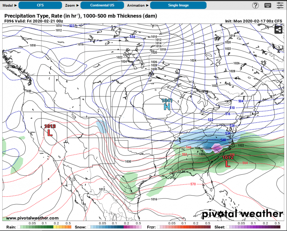
One More Shot: Feb 20-21 Event
in Southeastern States
Posted
That's pretty bad. It's really hard to get excited about this when the euro/ukmet combo says this is a non-event. But if the short range models continue to honk the horn consistently I don't know.