

snowfan
-
Posts
9,375 -
Joined
-
Last visited
Content Type
Profiles
Blogs
Forums
American Weather
Media Demo
Store
Gallery
Posts posted by snowfan
-
-
-
Pretty cool.

-
 11
11
-
-
46 minutes ago, nj2va said:
Just got to our rental north of Jackson, NH. Solid snow cover on the ground - currently in the mid 50s and sunny.
How far north are you planning to go?
-
The playbook is there for everyone’s knowledge re traffic. You should expect gridlock after totality. Better to be in a spot that will not require you to be on the road to view.
-
1
-
-
Enjoy this day outside before rain returns later Tuesday. Another inch + on its way.
-
NNE looks optimal right now. It being the start of mud season up there should make for some fun stories coming out of this.
-
Wind. More at 11.
-
6 games and this Os season has been wild already.
-
This weather needs to GTFOH.
-
4
-
-
Are we doing this tonight? Storm blasting thru dc late evening.

-
1
-
-
Who ordered a wedge salad for tmrw? 3k nam is gross.
-
1
-
-
So we’ll see the sun again on Friday? At least it looks like things may warm up heading into next week.
-
Happy Easter all. Enjoy it outside if you can because this week looks like a real winner

-
 2
2
-
-
41 minutes ago, Interstate said:
Like usual. Precipitation is moving out faster than modeled
Most guidance in the last few days had precip exiting midday to early afternoon.
-
2
-
-
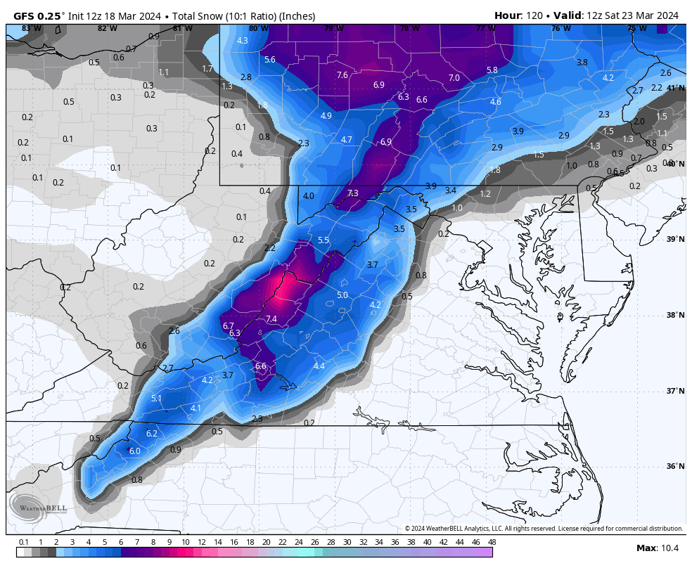
On 3/18/2024 at 12:20 PM, stormy said:
12z GFS still likes accumulating snow for the Valley Friday night. Quebec high, ENC low, timing could work.

GFS was like, just kiddingggggg.
-
Lots of noise about cold temps this week, so I look at my P n C and see M-W Hi temps of 51, 51, 60 with sun. Meh.
-
Another warm one out there. Blooms opening everywhere.

-
7
-
-

-
2
-
 1
1
-
-
Short drive to a winter wonderland tomorrow. You know what to do.

-
2
-
-
Gorgeous day. Got some yard work done, biked, walked, opened the windows. Sitting here listening to loads of peepers sounding off in the woods behind the house.
-
2
-
-
1 hour ago, psuhoffman said:
My 5 year old daughter came in excited because she found flowers growing and saw a bee.
It’s great to hear that your new base state is bringing your daughter joy. At the end of the day, that’s all that matters.
-
2
-
-
48 minutes ago, jayyy said:
“Next year is going to suck! I won’t be here tracking”
Yes you will. So will I. We all secretly love the torture.
Breaking news: snow hunting in the mid Atlantic becomes newest category of BDSM.Next year is going to suck says the same people that thought this year would be above average for snowfall. They have no fng clue how it’s going to play out. And we’ll be right back here tracking.
-
5
-
-
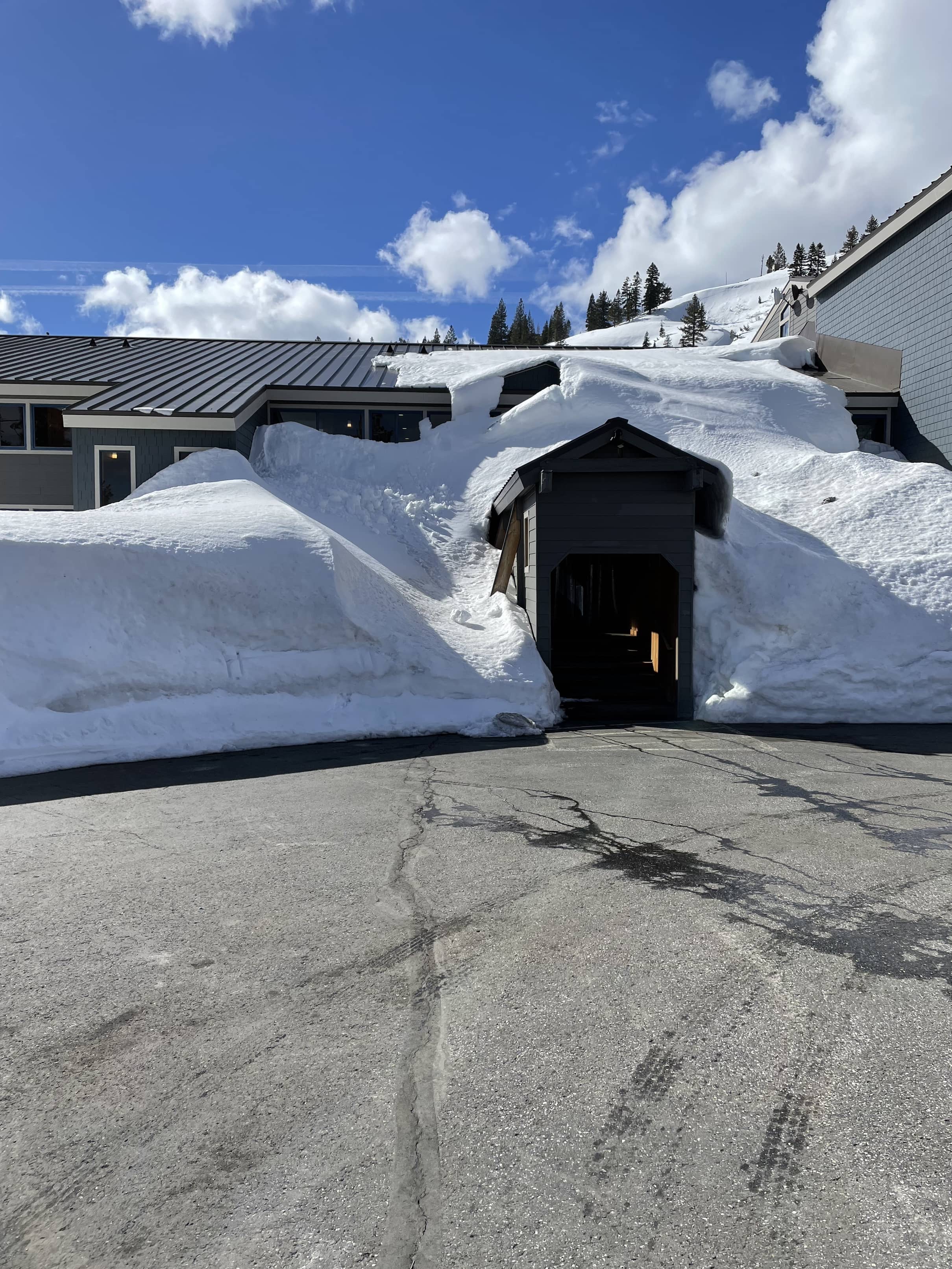
14 minutes ago, katabatic said:
Your yin to my yang. Calm before the storm here. Finally made it to Donner Summit last night - and now looking at a forecast for the ages. The pic is the entrance to my Airbnb condo. Will be interesting to see what it looks like post storm.
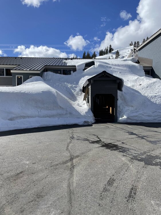
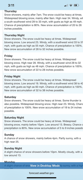
Not joking here….i hope the structure you’re in is sound. After they got pummeled last yr, I’m sure some structures have some unfixed weaknesses. Dropping 10 ft of snow on a roof takes a toll. That being said, enjoy and send pics!
-
3
-
-
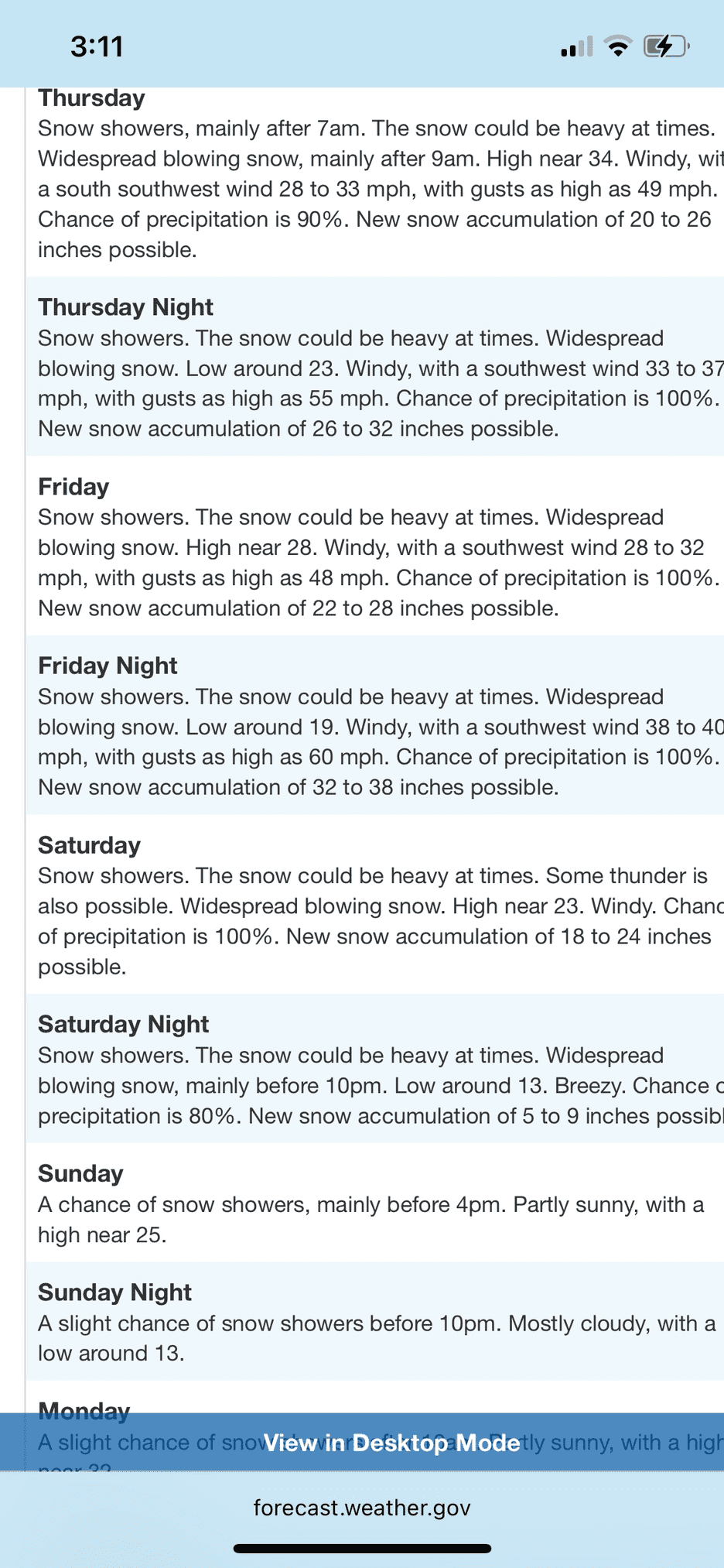
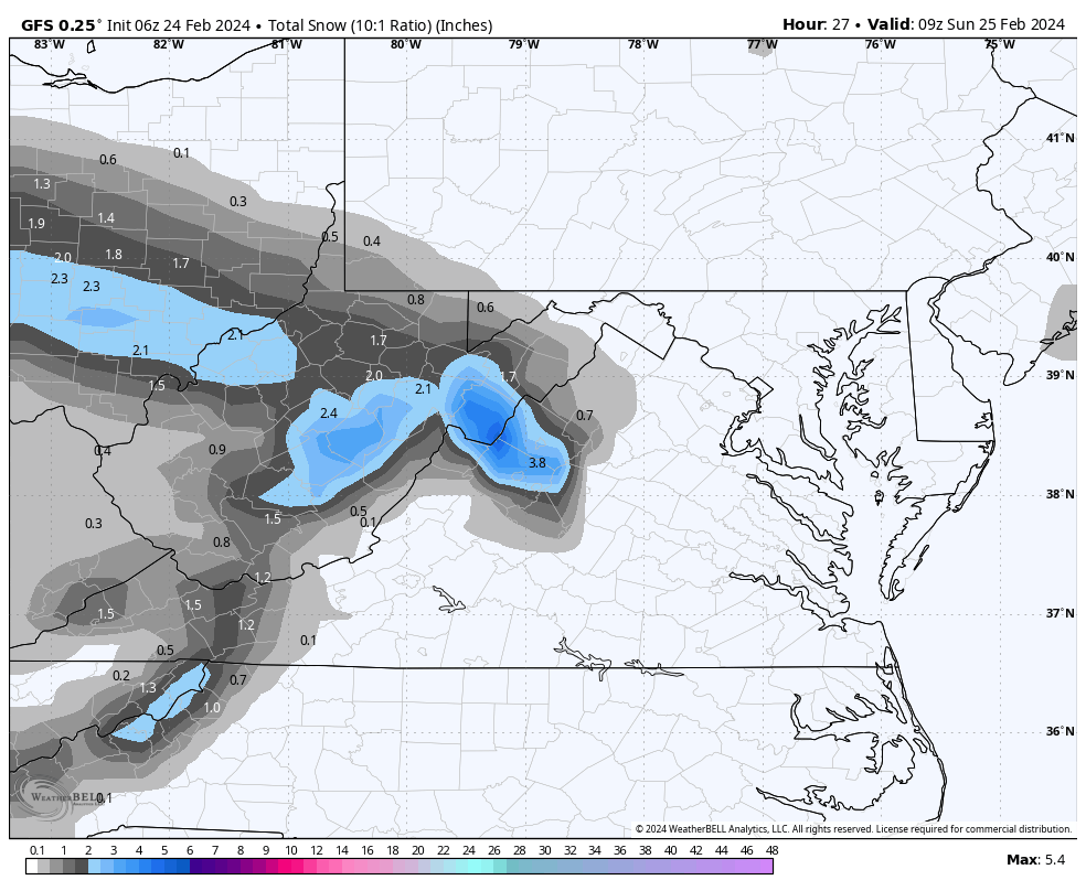
8 minutes ago, stormy said:
Weak low pressure over southern Ohio will move southeast across west/central Va. this afternoon and evening. NAM/GFS/ECM and GEM all give accumulating snow across portions of Augusta late afternoon and evening. Surface temps. below 2000 ft. will be marginal though column temps. look fine. Accumulation expectations range from 2 - 6 inches. This will be an elevation event for accumulations. 2000- 4000' 2 - 6 inches, 1000 - 2000 ft. a dusting - 1 inch.

None of the local nws offices are enthused about this. PIT has Davis getting 1.5” and Charleston has Snowshoe receiving about the same. So snow looks likely, but those higher end amounts seem not so likely. From Charleston…
Lowering temperatures behind today`s front should support snow or a rain/snow mix to the north and along the higher terrain. Mainly rain is expected to the south, though some flakes could briefly mix in before precipitation ends. Snow accumulations of an inch or two are possible for portions of southeast Ohio and northwest West Virginia this morning, and in the higher elevations of the northeast mountains by the end of the day. Outside of these areas, any accumulation should be minimal.-
1
-
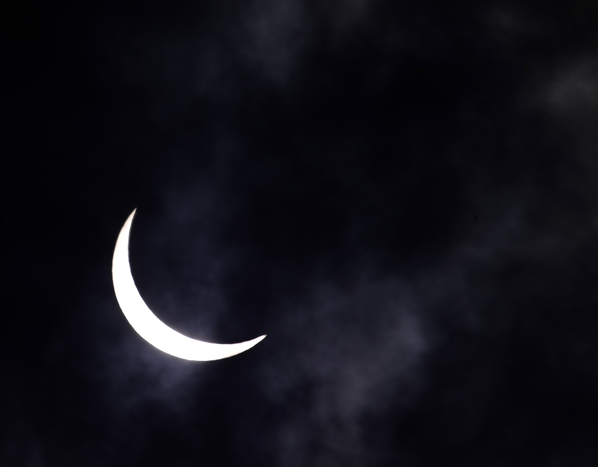
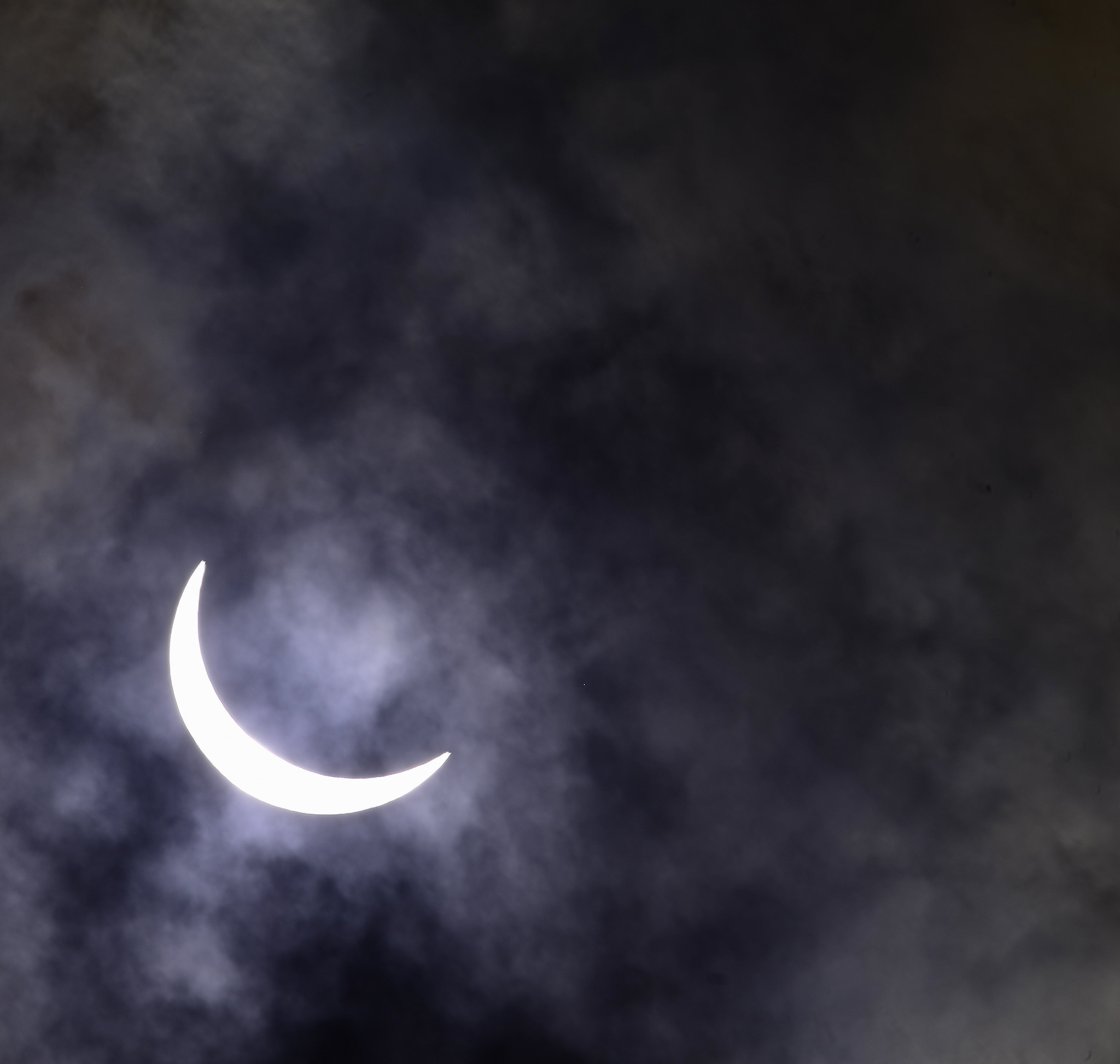


Total Solar Eclipse, April 8, 2024
in New England
Posted
Damn. 93 S heading into Franc notch.