

GoAPPS
-
Posts
115 -
Joined
-
Last visited
Content Type
Profiles
Blogs
Forums
American Weather
Media Demo
Store
Gallery
Posts posted by GoAPPS
-
-
Pretty decent snow shower in Asheville.
-
27 minutes ago, eyewall said:
967 LOL:

We're gonna be chasing snownadoes lol.
-
 1
1
-
 1
1
-
-
9 minutes ago, NavarreDon said:
I realize it’s off topic for this thread but, I thought you all might get a kick out of this.

.Is the red sleet/mixed precipitation?
-
 1
1
-
-
FYI, light snow has broken out in parts of the mountains, not depicted on any model. It could bode well for those downstream.
-
The models keep showing a band of light snow blooming around 7 p.m. then moving east.
-
2
-
-
Snow shower in Asheville.
-
2
-
-
18Z Nam's like...

-
The NAM's treatment of the surface low still looks very odd. Don't CAD setups tend to guide the surface low toward the margins of the CAD?
-
1 hour ago, BlueRidgeFolklore said:
That “V” of lower totals on the GFS coming into Asheville from Madison County, is due to the French Broad River Valley funneling in warmer air from TN. That’s always a battleground area with CAD. In these setups, AVL isn’t Black Mountain. Black Mountain will do well.
Why is it that warm air can get in here and lower our snow totals but cold air never makes it over the mountains in time? Is it simply that the warm air has an easier time rising over the mountains and funneling in?
-
I know we're talking about this weekend, but the models are also hinting at a winter storm next weekend.
-
I won’t put much stock in these model runs until Thursday at the earliest.
-
2
-
-
-
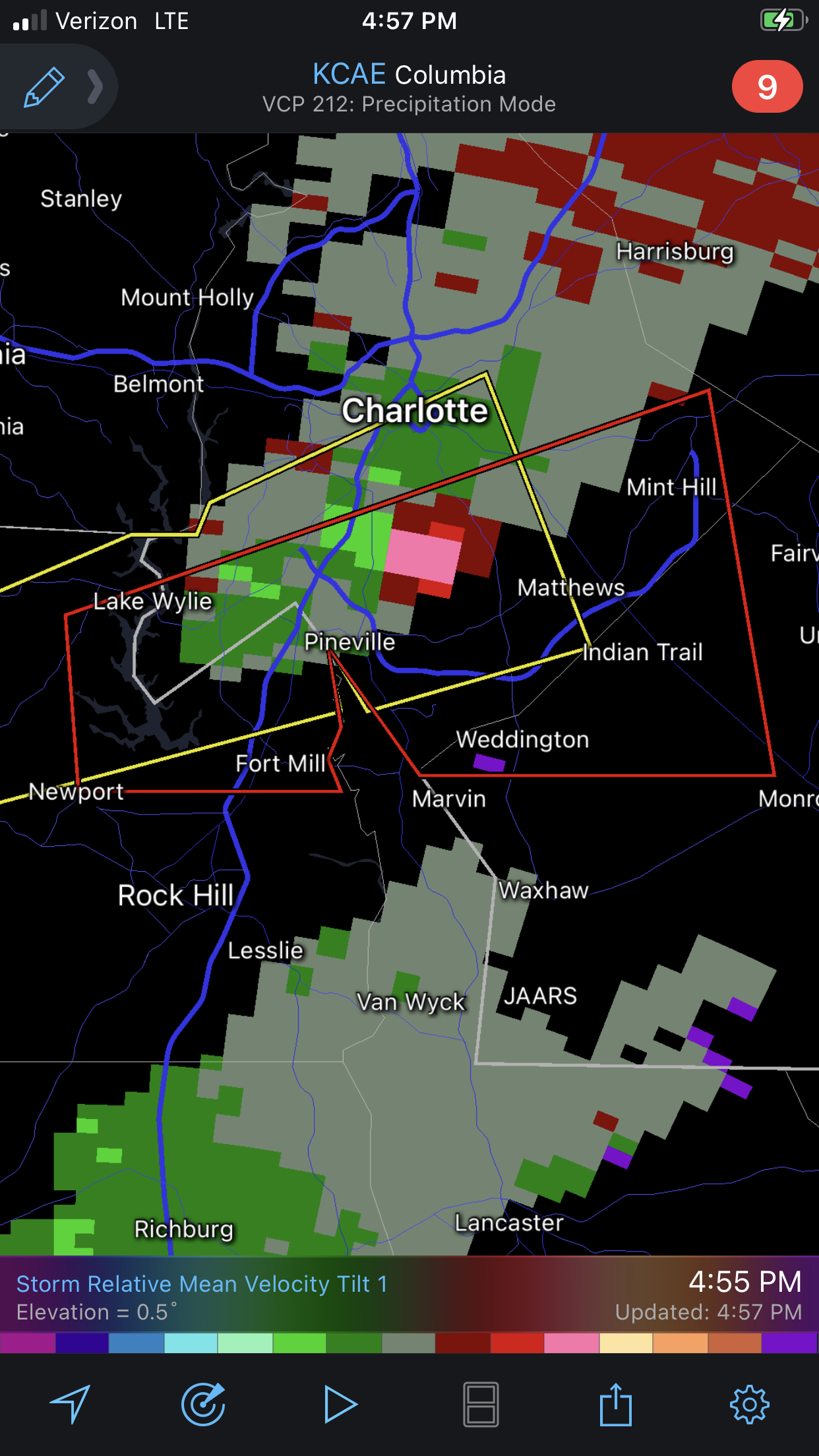
The cell just north of Pittsburgh looks like it has a TDS.
-
-
-
-
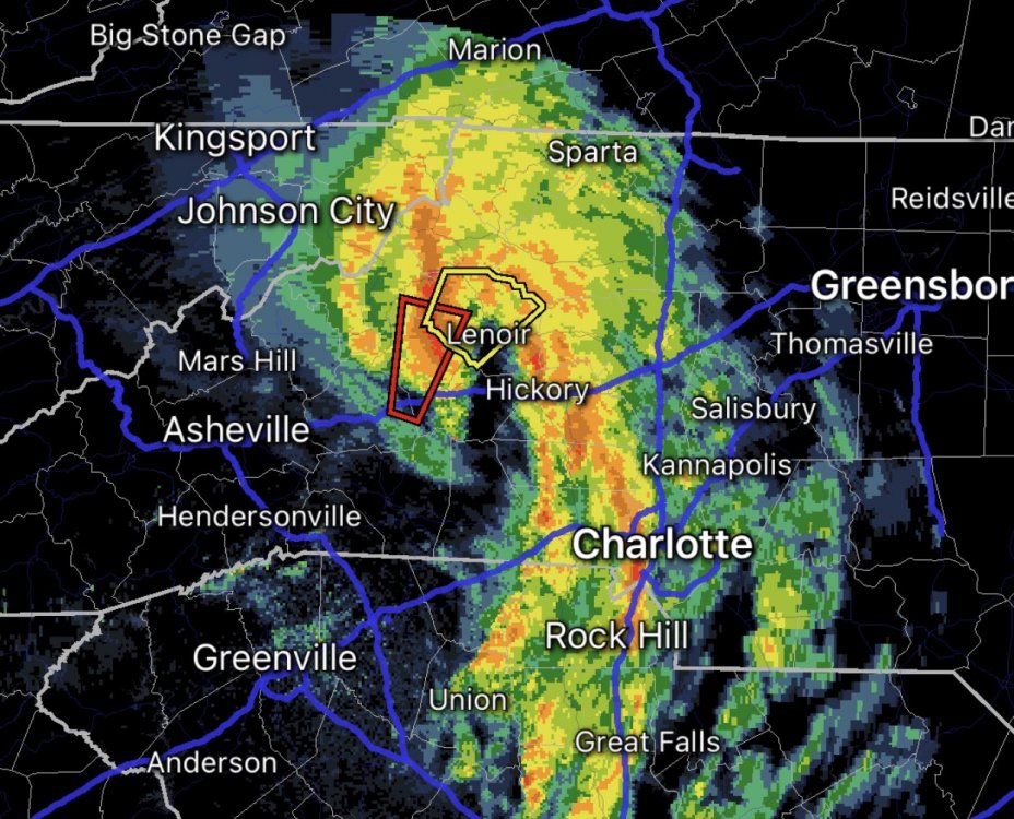
What is that structure in the foothills, a mesolow? It keeps producing tornado warnings.
-
Yeah, I headed out to the Bent Creek area for some mountain biking, but it started hailing just before I got there. I saw some miserable folks riding their bikes back to their cars while getting hailed on and said "screw that."
-
1
-
-
A tornado outbreak -- including the threat of a few long-tracked,
violent tornadoes -- is expected today into early this evening over
the Southeast, especially parts of Mississippi, Alabama and
Tennessee.  Tornadoes, large to very large hail, and damaging winds
to hurricane force also are possible over a broad area from the
central Gulf Coast to the Ohio Valley and southern Appalachians.
Not sure I've ever seen language that strong used to describe a situation in the Southeast.
-
37 minutes ago, Bob's Burgers said:I went back to read the April 14th, 2012 D2 discussion and it doesn't mention the word "violent" in the right context. In fact, the discussion seems to suggest that violent tornadoes may not be likely.
Are you telling me someone misinterpreted the data on Twitter?
-
-
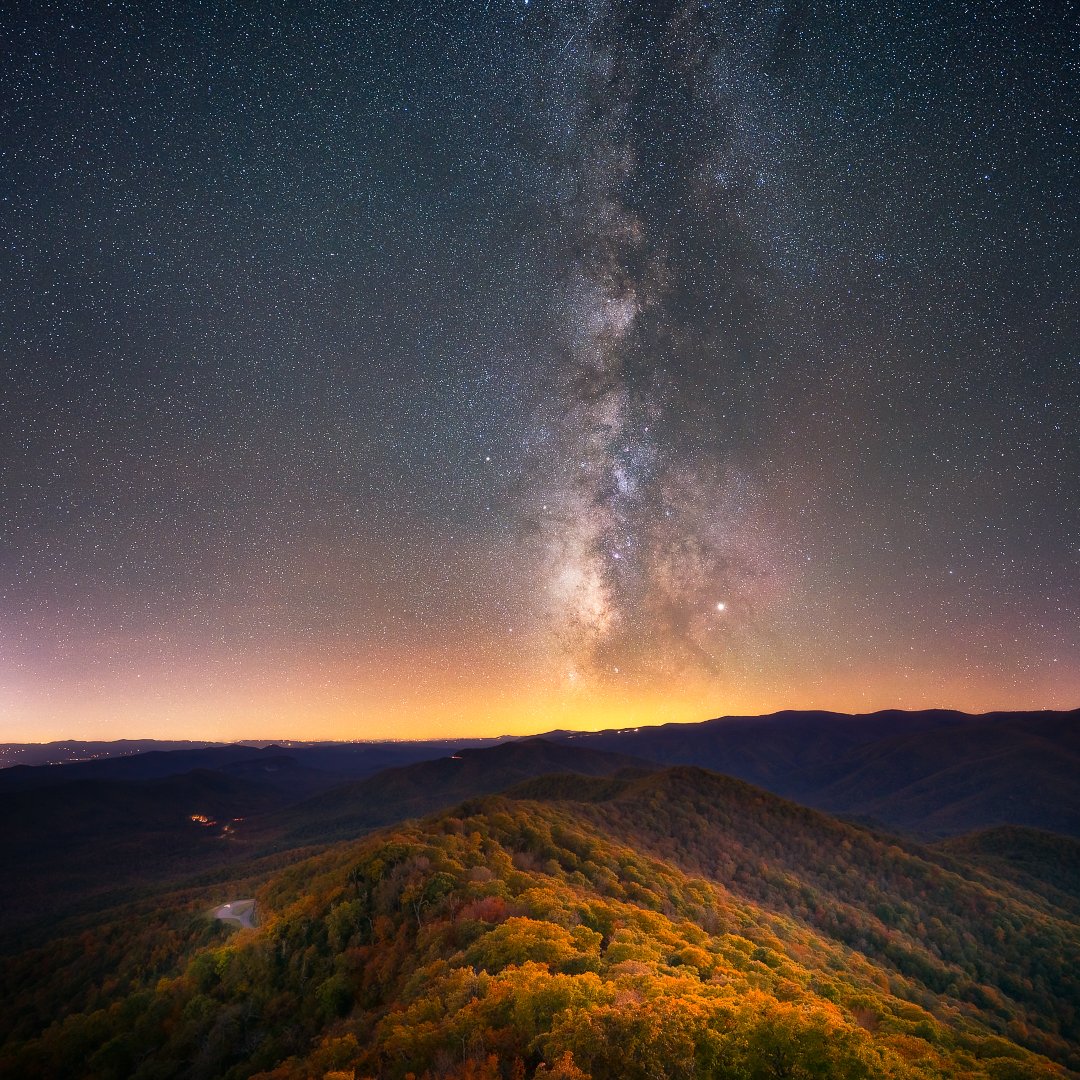
Here's a blue-hour blend photo from a lookout tower along the Blue Ridge Parkway (North Carolina, October 2019).
Using a planning app (PhotoPills), I was able to determine that the Milky Way would align with my position along a colorful ridge line after dark. I took a series of blue hour photos to capture the foreground while it was still dimly lit by the fading twilight. I combined the data of these photos into one image that could pull out the color detail of the foreground landscape.
When dark fell, I took a series of long exposures and combined their data in a program called Sequator. I brought the detail of the Milky Way out of the background using Photoshop, then I blended the foreground data with the night sky data for a composite.
I used a Sony A7RIII camera body and a Sigma 14-24 f/2.8 lens, but you can get similar results with much cheaper setups. It's all in the processing.
When I say "combining data," I'm talking about stacking, a process that aligns several images and averages out the data so that what stays behind is only the pixels that stay the same through the sequence. This eliminates transient objects, like hot pixels and thermal noise - the reason so many low-light photos look so grainy.
The weather conditions were cool and clear, so clear that you can actually see a little airglow in the photo.

-
4
-
 1
1
-
-
Snow in Asheville.
-
4
-
-
Light snow in Asheville.
-
2
-
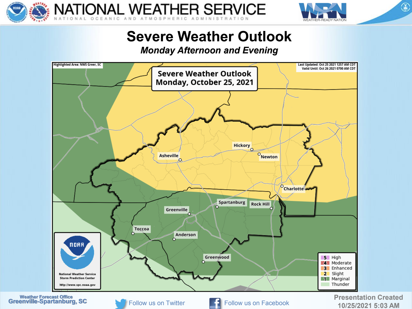

General Severe Weather Discussion
in Southeastern States
Posted
Pretty big expansion of the slight risk area over yesterday.