

GoAPPS
-
Posts
114 -
Joined
-
Last visited
Content Type
Profiles
Blogs
Forums
American Weather
Media Demo
Store
Gallery
Posts posted by GoAPPS
-
-
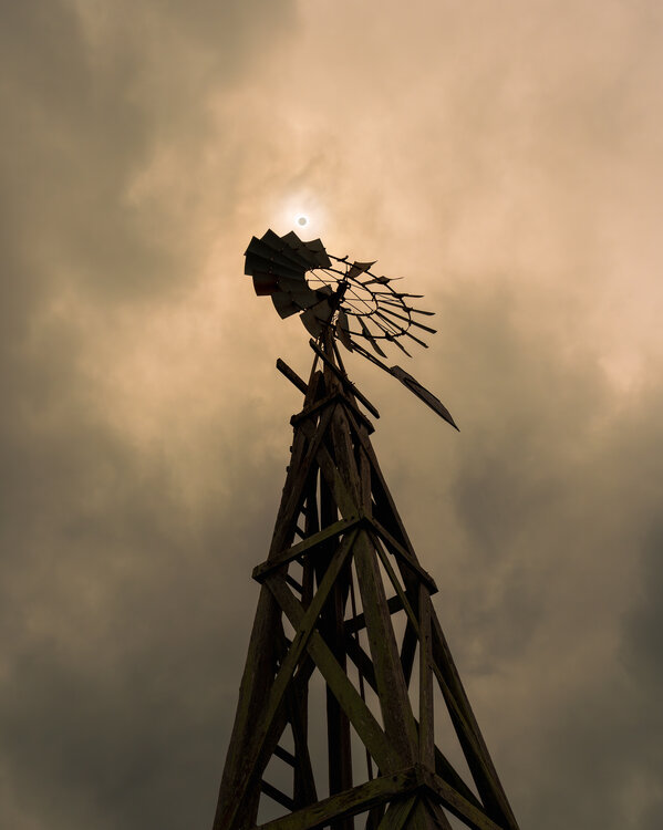
I went to the climatologically best place to see the eclipse without clouds (South Texas) and saw... clouds. Oh well, at least I got one good shot out of it.
-
 3
3
-
-
On 1/21/2024 at 11:41 AM, Buckethead said:

This picture would make a great magazine cover.
-
1
-
-
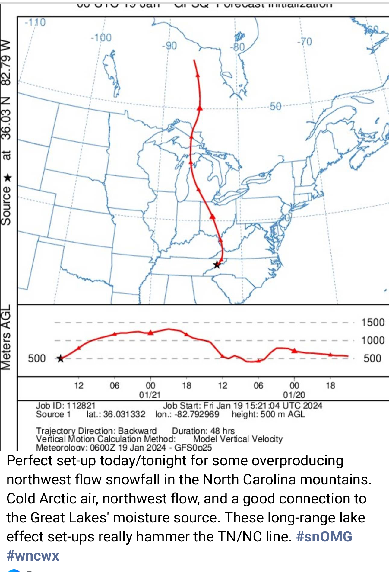
1 hour ago, nchighcountrywx said:

What is this depicting?
-
If it's snowing this hard in Asheville, I can only imagine what's going on further west and higher up.
-
3
-
-
Sleet and rain in Asheville.
-
1
-
-
The HRRR modeled this little band coming through the mountains as having precipitation reach the ground. We’ll see.
-
1
-
-
Took the drone out to Balsam Grove on Sunday.
-
1
-
-
Pinhole eye forming.
-
This is one of those rare events when continuous snow manages to grace even Asheville. It’s not really accumulating, but it’s still fun to watch.
-
2
-
-
Hello! I've really enjoyed this forum over the last several years. I'm traveling to the UK over the next couple weeks, and I was wondering if there's an equivalent online weather community. Anybody know?
-
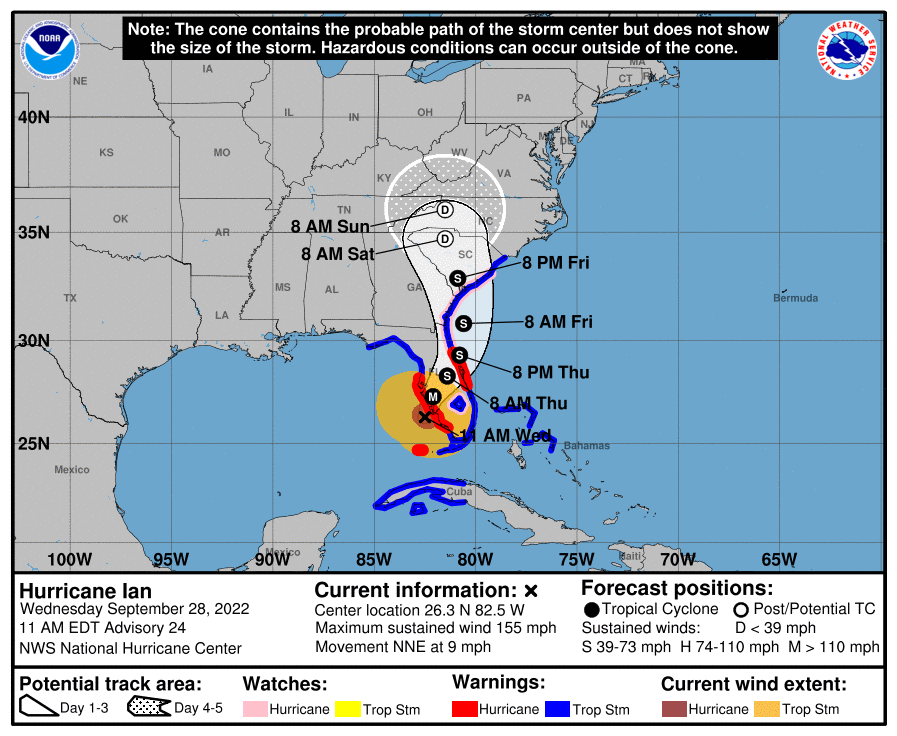
Ian seems to be deviating from the expected N to NW track. It's trajectory looks more WNW at the moment. Looks like it will make landfall near McClellanville, SC, within the hour.
-
1
-
-
There's definitely a westward component to Ian's movement now.
-
1 hour ago, jbenedet said:
Still Reminds me a lot of the perfect storm. More Extra tropical, then more sub tropical then more tropical. It was in the “grey” in terms of classification the whole time—shades of everything at once.
What’s cool about this, is it’s the closest example of the perfect storm since (in my opinion), except this time we get to see what would have happened if it made a close approach to land and ultimately landfall.
Key difference will be that Ian had less time to churn up the Atlantic, so the wave factor won’t be *as* impressive.
That sounds really interesting! Do you mind going into more detail about the synoptic setup of both and how they compare?
-
-
5 minutes ago, jm1220 said:
Should be noted too that those surge heights are WITHOUT waves added on top.
And tides... next high tide in Cape Coral is just after 6 p.m. -> https://www.usharbors.com/harbor/florida/cape-coral-bridge-fl/tides/
-
 1
1
-
-
Eye is clearing out in the last couple of visible frames.
-
10 minutes ago, Eskimo Joe said:
Ian now doing gulf storm things
I bet the 2 p.m. advisory will raise some eyebrows.
-
14 minutes ago, bustmusty said:
who thought this was a good idea?

That there's a testament to the folly of man.
-
 1
1
-
-
40 minutes ago, NYGiantsFan99 said:
is this incorrect? i thought this was a major part of the latest IPCC report. confused as to why im getting weenie’d. i do not mean to spread misinformation or start anything so please correct me if im wrong, fairly new at this (just graduated)
It’s generally seen as a weenie take to attribute the behavior of an individual storm to climate change. The effects of climate change manifest in aggregate trends over years and decades. The connection with individual storms is weak.
-
3
-
1
-
-
https://www.facebook.com/watch/?v=505523217991608
Fascinating behavior from that MCS that came through this morning. -
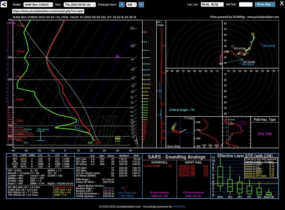
That's quite a sounding for Asheville of all places.
-
1
-
-
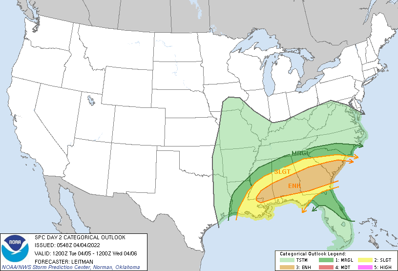
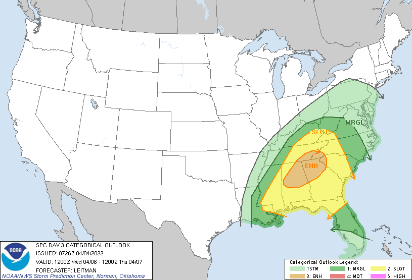
Tuesday and Wednesday are looking more interesting.
-
-
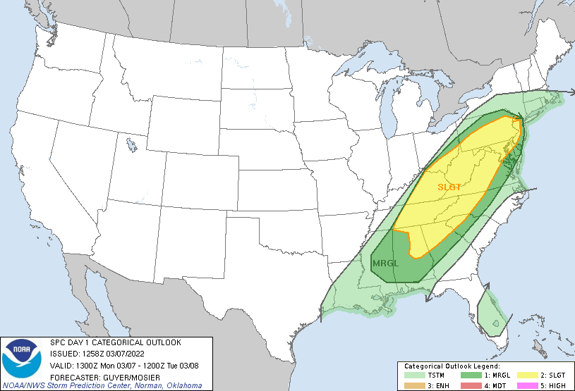
Pretty big expansion of the slight risk area over yesterday.


Eclipse photos
in Outdoor and Weather Photography
Posted
Let's see 'em! Here's mine from South Texas.