f2tornado
-
Posts
290 -
Joined
-
Last visited
About f2tornado

-
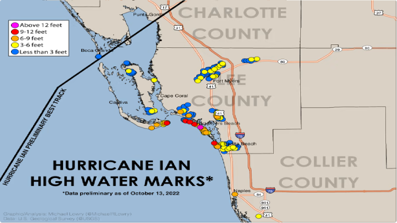
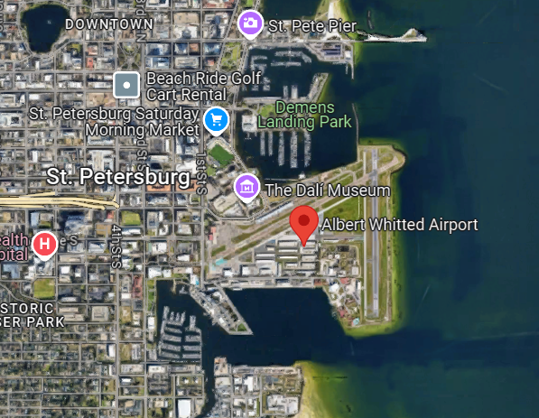
A highly localized area from Ian exceeded 12 feet that and aided by the bite shaped coast that makes a good collector of water. The RFQ of Ian was also more intense than Milton in terms of peak winds.
-
The shape of the coast immediately south of the landfall point is not as conducive to massive surge like would be possible in Tampa, Charlotte Harbor, or around Cape Coral. That said, I'm sure someone along Mansota got a significant beating regardless. The hype was legit. It just happened the storm took about as good of a track as it could to minimize absolute dollar value loss from storm surge. On the flip side, the track resulted in about a worst case scenario for flash flooding in the Tampa area. A lot of people are going to return home to big messes.
-
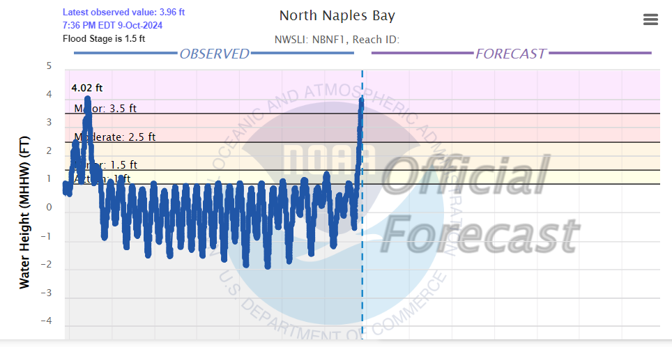
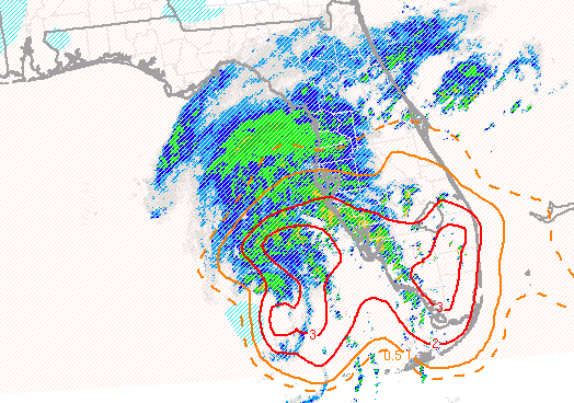
Naples up to 4 feet surge and rising rapidly,
-
Sure looks like that forecast bend to the right is occurring. If it holds, it spares Tampa from the worst surge effects but puts them square in the firehose. The overland flooding still do a lot of damage in that area. Starting to see water rises at Venice and Naples.
-
Wind is coming right off the bay.
-
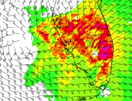
But, they are progressing toward more populated areas along US 27. The entire SPC Tornado Watch area is primed.
-
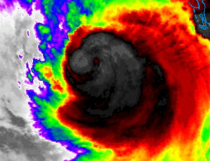
Maybe getting better defined on the IR but hard to base that on just a couple frames. Pretty small if the little "warm" spot is where its at.
-
It's certainly useful for mesoscale parameters. STP is bonkers this afternoon. Potential, if not probable, tornado outbreak.
-
The NAM is not a tropical model but offers disaster porn by taking a small eye the full length of Tampa Bay to go with 112 kt wind gusts in Tampa. For whatever reason, it doesn't suggest dramatic weakening prior to LF. The GFS is very similar on track and also looking relatively stout at LF.
-
In the synoptic realm, 977 is plenty for synoptic/global models to handle. That's a banger in the mid-lats. It's the smaller less mature storms models tend to be "screwy" with.
-
The 18z GFS mirrors the 12z ECMWF and is is spitting image of Project Phoenix 2.0. The 00z guidance may give us a better picture with a fresh set of obs and a fully bombed out storm. Of course, what's good for Tampa, if it transpired, would be bad for Fort Myers.
-
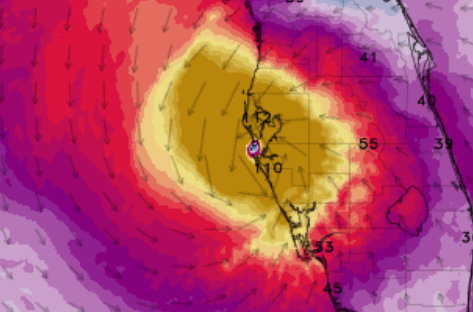
It's not the beatuty it was Wednesday morning but the coldest tops I've seen all day are sprouting near the center. We should see some enhancement as we get closer to the diurnal max. Model guidance ramps up the wind field in the right quad later tonight into the morning. Not exepecting much in the way of max wind increase but have a feeling the surge in Georetown vicinity could be fairly impressive given what must be a massive amount of IKE around this thing.
-
I didn't say that. I even said it's worthy of discussion (implying it's banter thread material). But, attributing one potent hurricane to climate change during a cold ENSO phase without supporting evidence is speculative junk "talking points" science.
-
Straight out of a talking points memo? A hurricane is weather, just like when someone in Chicago asks about that global warming when it's 20 below. That's weather too. Sea level rise is a worthy discussion, but not here, though I doubt the 2mm/yr rise changed the outcome much here.
-
Cape Coral cam definitely has water rising. https://www.webcamtaxi.com/en/usa/florida/capecoral-chiquitalock.html