

Doorman
-
Posts
1,582 -
Joined
-
Last visited
Content Type
Profiles
Blogs
Forums
American Weather
Media Demo
Store
Gallery
Posts posted by Doorman
-
-
-
28 minutes ago, matt8204 said:
Have they nailed down a start time?
SHORT TERM /THURSDAY NIGHT THROUGH SATURDAY/...

***Quick hitting system to bring snow Thursday night into early
Friday***

The main story for this part of the forecast will be coastal storm
system forecast to bring snow overnight Thursday night into early
Friday. There are still some differences in the forecast models with
the NAM being a weaker, farther south/east outlier while the GFS
continues to be a bit fast. Leaned towards a blend weighted heavier
towards the 12z GEM Reg / 12z HRRR/ 6z NAM. These models are a bit
stronger with the low and farther N/W compared to other guidance
that`s trended a bit farther south/east over the past day or two.
However given the set up of a fairly robust upper level wave and the
history of these types of systems tend to favor this slightly
stronger solution. Bottom line, we have become confident enough in a
fairly widespread 2-4+ inches of snowfall accumulation to issue a
Winter Weather Advisory for most zones, excluding the coastal strip
south of Monmouth Co, NJ and the southern Poconos where
confidence and amounts are a bit lower. Also, sleet and even
some rain could mix in near the coast.

In terms of the details, deepening low pressure moves northeast off
the Virginia / NC coast Thursday night in response to a strong upper
level wave moving eastward from the Great Lakes region. Snow
overspreads the region west to east late Thursday evening into the
overnight (mostly after 10 PM) with the heaviest precip likely
falling in the 1am - 7am period. While our official snowfall
forecasts remain capped to the 2 to 4 inch range for much of the
CWA, there are a couple important things to note: 1) This will be a
fast moving system with snow falling over just several hours that
will unfortunately coincide with the Friday AM commute. 2) We
still think there is the potential for an embedded heavier band
of snow with totals in the 4-6+ inch range. Uncertainty still on
exactly where this would occur but somewhere near or just south
of the I-95 corridor appears most heavily favored.
For this reason, this could still be an impactful event despite the current snowfall forecast not being that high. This will be monitored closely and if confidence for this increases, Winter Storm Warnings will be considered.
-
 1
1
-
-
WPC winter disco
This
forecast cycle showed an eastern trend, keeping the low track far
enough offshore such that the QPF/snow forecast trended downward,
especially inland/interior areas. With the signal for the system
to be 1) more offshore and 2) very fast moving - probabilities of
heavy snow have decreased this cycle, however there continues to
be some ensemble support for a stronger/closer system so over the
next several days the details will ironed outhttps://www.wpc.ncep.noaa.gov/discussions/hpcdiscussions.php?disc=qpfhsd
-
1
-
-
-
6 minutes ago, Torch said:
Jackpot?.
6+ Newark NJ

-
-
money guidance here....for a nice track to work with
https://psl.noaa.gov/map/images/ens/spag_f072_us.html

bonus images add to the upside 4ta6 call atm

 o
o
enjoy your snow metro

-
5
-
-
 OPC near benchmark prog
not a bad look overall.... for the crew here imho

https://ocean.weather.gov/Atl_tab.php
-
6
-
-
17 minutes ago, Rjay said:
you said it was the same as the Euro... unless it was another riddle
We posted the weaker euro prog sir

nice work for a mod......
-
41 minutes ago, Rjay said:
Your mustard must be in your eyes because either,
A. you're blind
B. you're a troll
C. you're a liar
Which is it?
The forecasted-----wpc map
was issued out of their office at 10:08pm EASTERN DAYLIGHT TIME---- last night----
almost 5 hours before the euro is available
he must be a joker or a genius......
we done here

-
27 minutes ago, Franklin0529 said:
I enjoy your input. What do u think suppressed/strung out like gfs? Or amped tucked an mostly rain for coastal areas
I think 6 plus for the metro will be a stretch.... this is the noaa metro prog for 7:00 pm Wed night
1 inch prog
the euro has it weaken to about 1004mb trucking east 12 hours later
do the math....

where is my mustard....

-
 2
2
-
-
18 minutes ago, USCG RS said:
I agree
Hello Coasty.....see the 1004mb bubble on the euro
and the match to the wpc prog....
they get an early looks at things ....the wpc time stamp is just after midnight 0530Z

digital snow maps
I think some forum has a thread for that
-
 1
1
-
-

trend this.
small window for big snow in the metro...trust me
-
3
-
-
weak sauce at 1004mb 7:00 am edt Thursday

reset your hopes for this system
p.s. the euro will back it up
-
1
-
1
-
-
-
4
-
 1
1
-
-

https://www.psl.noaa.gov/map/images/ens/prec_f144_us.html
https://www.psl.noaa.gov/map/images/ens/mslp_f144_us.html
just a tad late for the thursday mess ...imo
no stream interaction atm
-
51 minutes ago, JakkelWx said:
Where's the other flying cow?
In the eye sir........Of course !!!!!
-
1
-
-
-
 2
2
-
-
Canadians........ get no love at all.....
980.mb ..swirl of greatness

run the loop .....
yeah... that swirl is making the SPC work overtime on their severe products in the North East today
but no one will notice or give a rat's azz
get a life weather nerds

p.s. hope you get smoked FORKY
-
5 minutes ago, notlikethis said:
The outflow channel from Bavi across the ITCZ back to the Gulf is particularly impressive for this time of year!
NLT.....thanks for the confirmation.

isn't the Outflow Channel on Direct TV?????
-
4 minutes ago, Nibor said:
I prefer CAT5e or CAT6. Faster speeds.
You have been in rare form my friend.....laffin me ass off....
keep it up....king of sarcasm .. u rolling
dm
Somebody get me the CRASS model ASAP
we need to nail this down
-
2
-
-
6 minutes ago, notlikethis said:
Obviously paying close attention to Laura, but meanwhile in the west Pacific, Typhoon Bevi is undergoing steady intensification to a peak of around 105-110 kts today as it enters the Yellow Sea on an approach to the North Korea/China border
https://himawari8-dl.nict.go.jp/himawari8/movie/720/20200826_pir3.mp4?uid=1598407851234
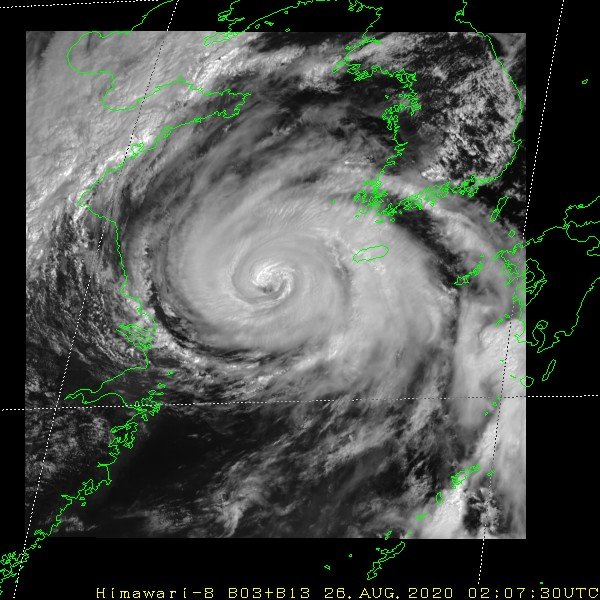
Speak to me of that Typhoon Rule that teleconnects to Laura ......so a Cat 5 is on the table?????
-
Cat 5 ANNULAR-----book it

I will show myself out
-
1
-
-
-
1
-


Small or possibly moderate wintry event possible for a portion of the NYC subforum Friday morning-early afternoon 1/7/22
in New York City Metro
Posted