
dmcginvt
-
Posts
470 -
Joined
-
Last visited
Content Type
Profiles
Blogs
Forums
American Weather
Media Demo
Store
Gallery
Posts posted by dmcginvt
-
-
-15F here
-
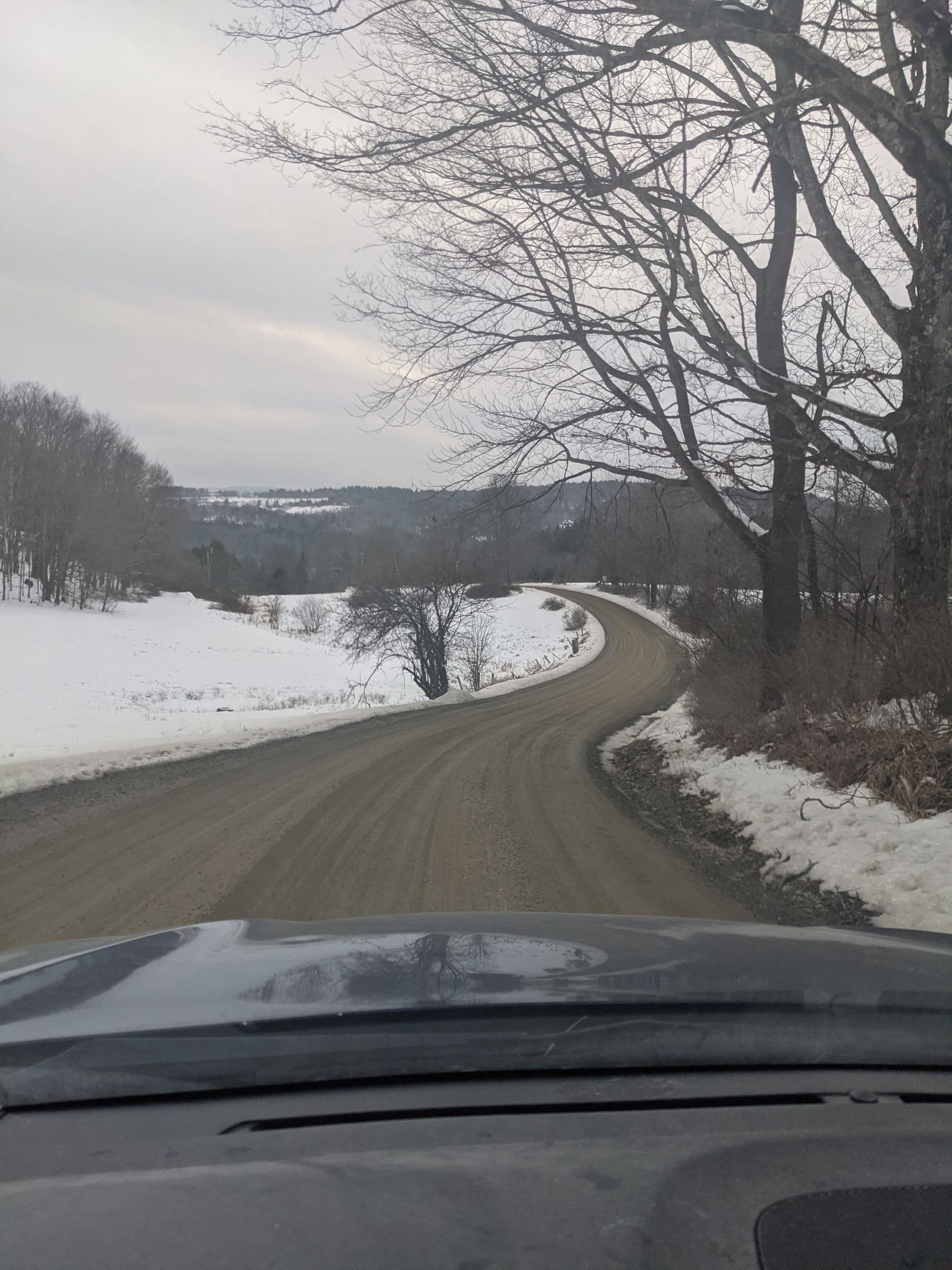
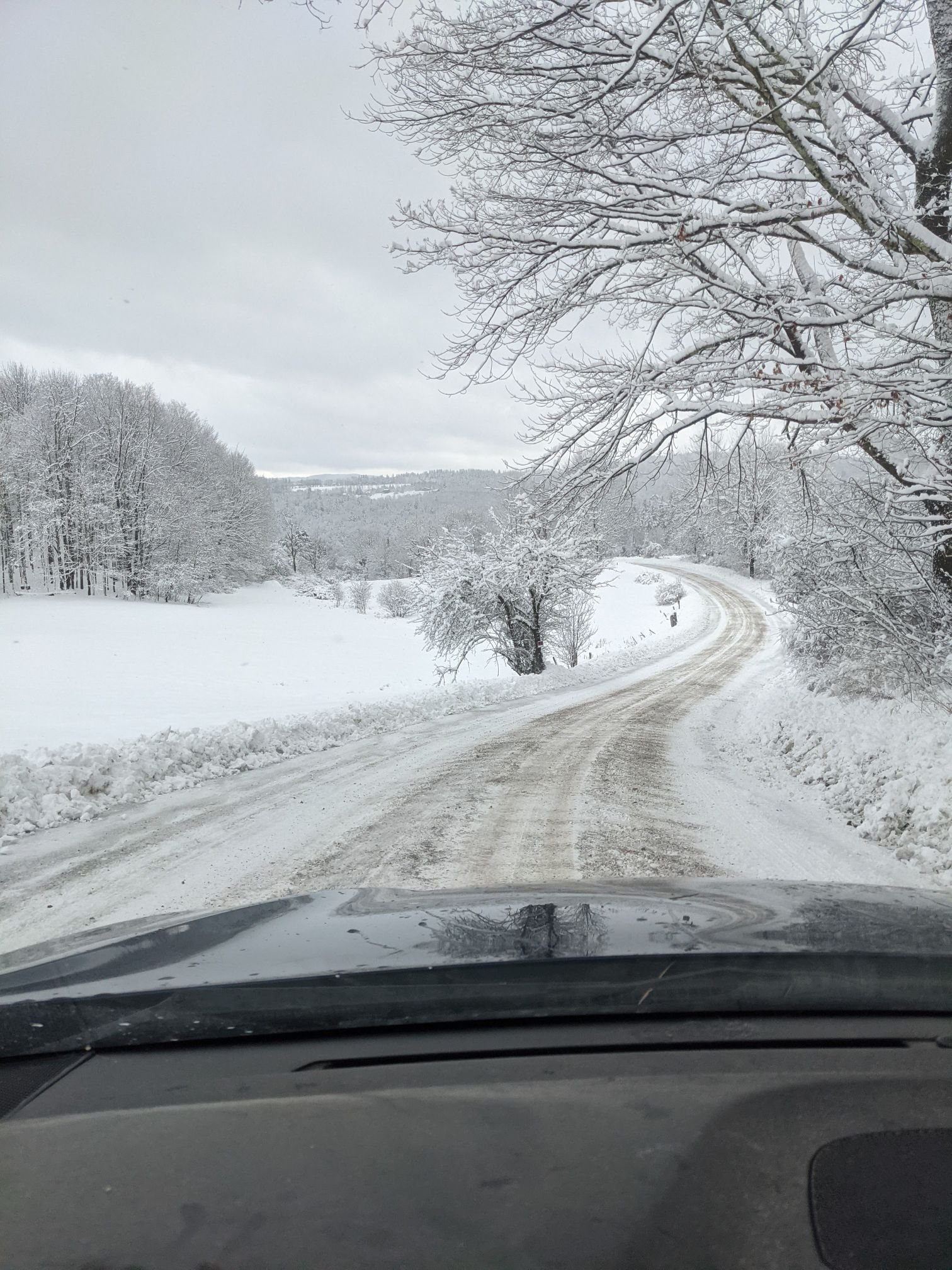
gonna try and get this shot again tomorrow,...first pic is 15th, then 17th
-
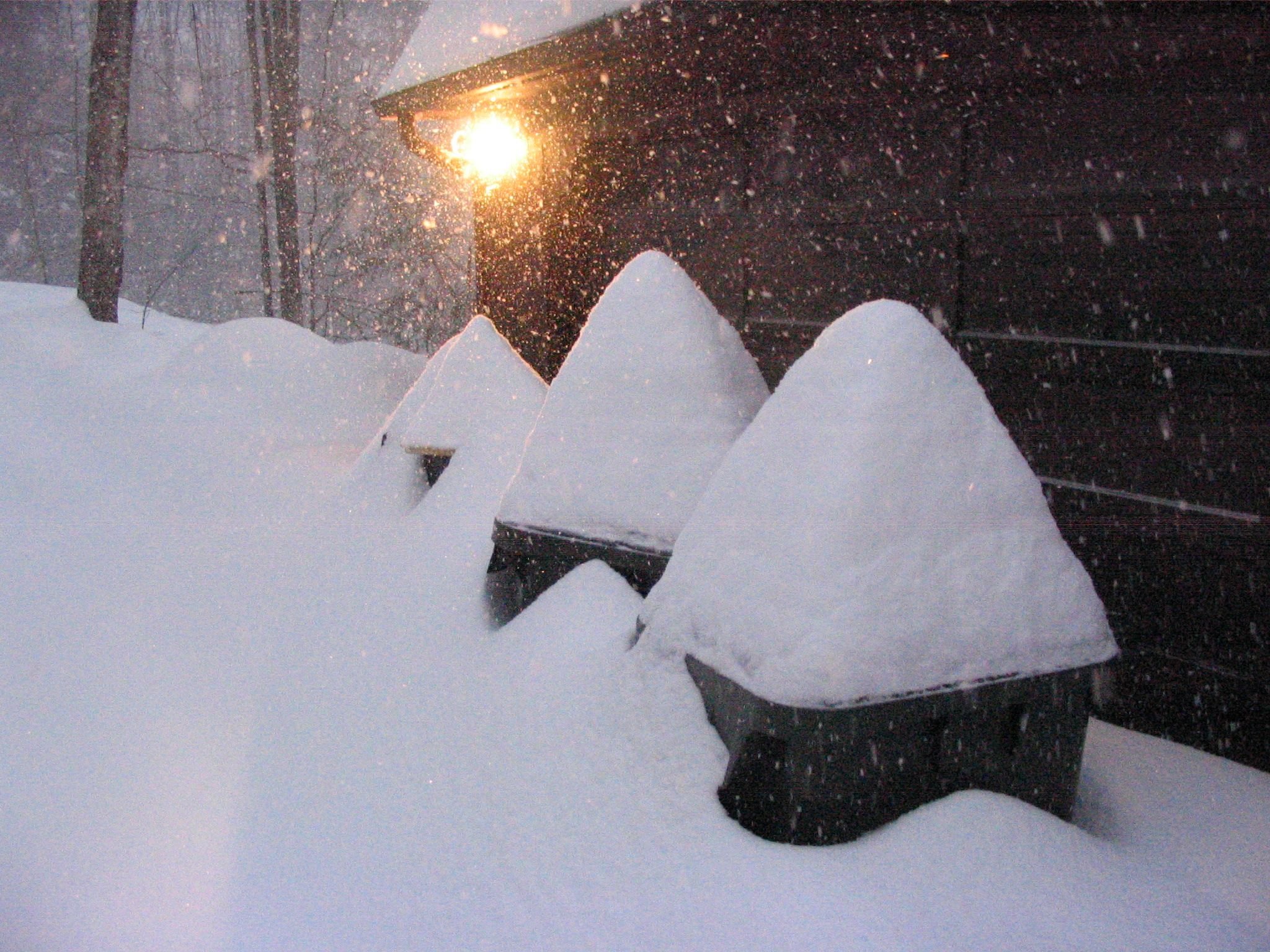
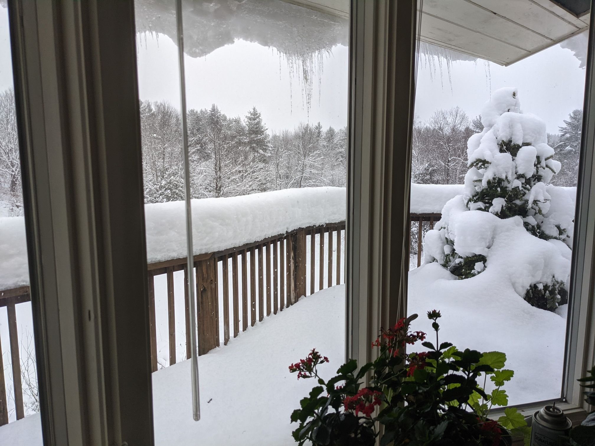
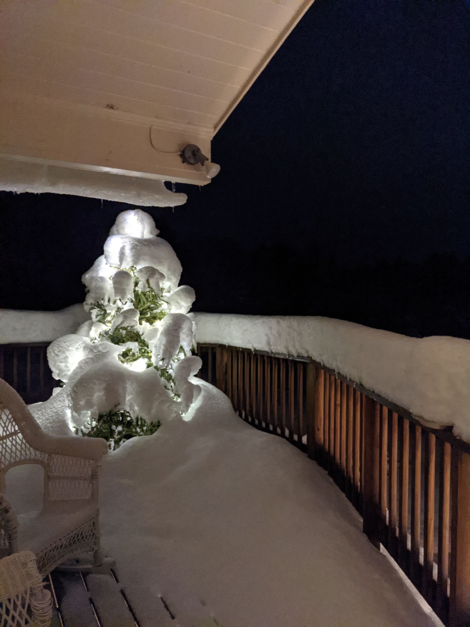
What a delightful week, it's just unreal what a difference a week makes in the nickel and dime world after 1 synoptic with NO WIND! I put my xmas tree on the deck


-
 3
3
-
-
The Walt Drag AFD
FXUS61 KBOX 042114 AMD AFDBOX AREA FORECAST DISCUSSION..FINAL AFTN.. NATIONAL WEATHER SERVICE TAUNTON MA 414 PM EST SUN MAR 4 2001 ...SEVERE STORM COMPARABLE OR WILL EXCEED THE BLIZZARD OF 78 FOR SNE WITH 60 HR DURATION OF SNW AND MAX INTENSITY OF WORST CONDS 18Z TUE-00Z WED AND HURRICANE FORCE WIND GUSTS ARE HIGHLY LIKELY TO OCCUR PARTS OF E MA COAST... KEY IS SLEET IN I 95 CORRIDOR...OTRW ITS GOING TO BE EXCEEDINGLY DIFFICULT HERE FOR AT LEAST 3 DAYS. FOR US HERE IN SNE A SLOW FADE OF STORM WED AM...SNOW QUITS NW TO SE FIRST THEN THE WIND. SFALL: 1 TO 3 FEET IN THE ALL SNOW AND SLEET REGION. WSW WILL GO AT 5 PM...ZONES HOPEFULLY AT 6PM. THANK YOU FOR YOUR PATIENCE ON DELAYED ZONES. WE/VE GOT 140 PM ZONES THE WAY WE WANT FOR NOW AND WE WANT TO GET THIS NEXT PKG DECENTLY ACCURATE. BLIZZARD WARNING WBIS AT 430 PM MA 4>7 12 14>16 AND NH 12 (MHT-LWM- ORH). REQUIREMENTS FOR THIS DIRE PREDICTION ARE 3 OR MORE HRS <1/4MI S+/BS AND G>30 KTS). 18Z ETA SAYS WE CAN INCLUDE BOSTON...ITS ON THE CUSP WITH SLEET BUT WE ARE GOING FOR WORST CASE AND EVENTUALLY BLV WE CAN HIT THIS. ETA TENDS TO RUN A BIT TOO WARM. HIGH WIND WARNING WBIS MA 19 22>24 FOR MON AFTN THRU TUE. COASTAL FLOOD WATCH WBIS AT 430 PM FOR POTENTIAL DESTRUCTIVE FLOODING TUESDAY AND WEDNESDAYS HIGH TIDES. ANTICIPATING NNE WIND DIMSHG AT 44013 TO 35 TO 45 KTS AT 12Z WED. ANTICIPATE 3-5 FT SURGES AT HIGH TIDES BOTH TUE AND WED. HERES BOSTON TIDES TIME ASTRO PREIDCTION WITHOUT SURGE AND WAVE 3/5 640 AM 10.2 727 PM 8.9 3/6 743 AM 10.6 829 PM 8.9 3/7 845 AM 11.0 927 PM 10.0 IT IS MY BLV NEAR RECORD WAVE HTS PROBABLE 44013 AND POSSIBLY 44008 ...TUESDAY A KEY DAY FOR DAMAGING COASTAL FLOODING. MAX WAVE HTS OF 30 TO 35 FT EXPECTED FOR THIS EVENT TUESDAY AT BOS BUOY AND 30 TO 40 FT FOR 44008. POWER OUTAGES: SCT PWR OUTAGES FROM WIND AND OR SNOW PROBABLE ORH TO BOS AND PVD AND CC. WIND: FIRST PULSE 40-55KT 18Z-03Z MONDAY AFTN AND EVE THEN I THINK IT CRANKS FROM THE NNE ON TUESDAY WITH SEVERE BLOWING AND DRIFTING WHERE >6 OF SFALL. 65 KT GUSTS POSSIBLE PYM-PVC TO ACK. REFIRE A SECOND WIND MAX..POTENTIALL STRONGER 50-65 KT TUESDAY. SFALL: 1-3 FT XCPT MIX ZONE 3-12 TOTAL STORM BY 06Z WED. WORST AXIS FORESEEN SOMEWHERE ALONG OR JUST NW OF A HFD-BOS LN. MAY NEED TO ADJUST THIS IN FUTURE RUNS. RDF: DOES NOT NECESSARILY REFLECT ZFP WORDING... PLS DONT LOCK US INTO RDF YET. JUST CANT GET IT DO WHAT WE WANT. EVENTUALLY IT WILL THEN IT WILL PRODUCE PICTURES ETC. YOULL LIKE IT. IF YOU USE THIS PRODUCT...WE WANT TO KNOW AND YOUR IMPRESSIONS. GWAVE: WATCH IT FOR EXCESSIVE MODULATATION OF THE QPF FIELDS INCLUDING 4-5/HR SNOWFALL RATE IN SNOW REGION (MAYBE SOMETIME MON) AND CUTBACK ON QPF IN SLEET REGION SE MA AND RI. TX FOR COORD T0 LOUIS UCCELLINI ON POTENTIAL AND HAVE OFFERED ITS POTENTIAL IN THIS PGH PER MY OWN CONSIDERATION. HAVE NOT CONFIRMED ONE WILL HAPPEN HERE. BATTEN DOWN AND ROUND IT UP NOW. THIS IS GOING TO BE HUGE AND LONG LASTING. WE WILL TRY TO GET A STMT OUT ON PREPAREDNESS NEEDS AND COMPARISONS TO PAST BLIZZARDS SINCE 1978. OUR TAKE (TX RMT) IS THAT THIS WILL B VLIZ OF 78 EVENT BUT FURTHER NORTHWEST MODELS: WE HOPE NOT TO LET YOU DOWN ON THIS BUT HAVE CONSIDERABLE CONFIDENCE IN THE ETA ON HUGE EVENTS THO WE KNOW A SURPRISE WILL OCCUR SOMEWHERE. PER HPC...ETA MODEL HAS BEEN EXCT ON BIG QPF NE USA N OF 40N ...BUT WOEFUL BUSTS DC REGION..POSSIBLY BECAUSE BCS OF GULF STREAM WALL SPINUP PBLM. ETA IS PRIMARY GUIDE QPF: WE ARE GOING TO FCST A CT RVR VALLEY SHADOW GOING ONLY 1-2 WE THERE...UPSLOPE THO WATCH OUT. WE ARE GOING 3 TO 5 W.E QPF E MASS. 3-5 QPF PVD-PYM-ORH-LWM-BVY-BOS-PYM. DRY SLOT MAY IMPACT SE NEW ENG FOR A TIME LATE MON? CAVEAT: SOMETHING GOES WRONG WITH THESE BIG STORMS EVERY TIME. DONT KNOW YET WHERE IT WILL B...BUT CONFIDENT WE/RE ON TRACK. IF YOU KNOW...WHERE WE/RE LIKELY TO BUST. CALL ME BY 430 PM. SKYWARN STARTS HER EIN OFFICE 4AM MONDAY. A LONG SEIGE CHH RAOB: 18Z RAOB IS IN. FURTHER INTERIM CHH RUNS SCHEDULED 06Z AND 18Z MON AND 06Z TUE. ALTERNATE SOURCES OF ENERGY: BE PREPARED FOR POWER OUTAGES. DONT USE CANDLES FOR LIGHT...CAUSES FIRE IF KNOCKED OVR. TRAVEL: NOT RECOMMENDED BY OUR OFFICE IN ALL SNOW REGION MONDAY- TUESDAY THO THERE WILL B PRDS OF RECOVERY AS WE GO INTO BANDED PCPN ALTERNATING LIGHT AND HVY. REMEMBER JUST A COUPLE OF CARS IN ACCIDENTS CAN CLOG A ROAD AND IF ITS SNOWING 2/HR - CAN BE BAD NEWS AND BASICALLY NOT GETTING HOME. WARMEST QPF RROUTE...COASTAL 95 MONDAY....BUT WATCH IT WHEN YOU GET INTO CT IF YOU CATCH THE DRY SLOT RIGHT.. YOU GET HOME AOK. AUTO SURVIVAL KITS: SUGGEST HAVING EXTRA CLOTHING AND WATER...PLUS FLASHLIGHTS...BLANKETS...DONT RUN YOUR CAR IF STALLED...AT LEAST NOT WITH WINDOWS CLOSED. ENVISION LONG DURATION OF AIRPORT CLOSURE AND FERRY TRANSPORT SHUT DOWN. COASTAL FLOODING: PYM..PVC-CHH..ACK/MVY PARTICULARLY VULNERABLE TUESDAY WITH MINOR XPCTD MONDAY AFTN/NIGHT HIGH TIDE. ROAD CREWS: ARDUOUS LONG DURATION EVENT...SFALL POSSIBLY LASTING 48 TO 60 HRS HOURS WITH POST STORM CLEANUP LASTING THRU ALL OF WEDNESDAY INTO THRUSDAY. STREET FLOODING: POSSIBLE URBAN AND POOR DRAINAGE FLOODING PARTS OF SE MA AND SRN RI ALONG OR 20 SE SE OF A PVD-PYM LN IF MOSTLY RAIN. FRZN GROUND A PBLM. RECOVERY: WED/THU. ASOS: AFN AND BOS FIXED. AFN ASOS MAY GO BAD AGAIN BY MON MORNING ...BUT ASOS FIXES IN SNOW REGION NEXT 2 DAYS MAY BE NEXT TO IMPOSSIBLE. LR: A NOTE...SUSPECT 1 OR POSSIBLY 2 MORE MDT OR GRTR SNOWSTORMS FOR PARTS SNE BY 4/15. NAO STAYS NEG AND OTHER PATTERN INDICATORS THAT OVERALL NORMAL WINTER TEMP PATTERN AND ACTIVE SRN STREAM WITH SOME BLOCKING MAKES IT FAVORABLE AGAIN SOMEWHERE ROUGHLY BTWN 3/14-21... HAVE NO ENSEMBLE SUPPORT AND NOT TIME FOR THIS NEXT 72 HRS. FYI: I WORKED A STORM LIKE THIS IN MKE IN 1982... DOUBLE SHORT WAVE ROTATOR...WAS IMPRESSIVE GRB TO LSE .BOS...BLIZZARD WARNING NH 12 MA 4>7 12>16 WINTER STORM WARNING CT 2>4 RI 1>5...MA 2/3/8>11 17/18 NH 11 WXA TNGT AND MON AM MASS 19>24 RI 6/7 THEN WATCH FOR LATE MON AFTN THRU TUE NIGHT FOR POTENTIAL LARGE BACKLASH. CFA MA 7...14>16 19 22>24 TUE AND WED HIGH TIDES. HIGH WIND WARNING MA 19 AND 22>24 MON AFTN THRU TUE WITH HIGH WIND WARNING IMPLIED NE MA COAST IN BLIZ WARNING. MARINE: STORM WARNING MON-TUE. DRAG-
3
-
-
1 hour ago, 40/70 Benchmark said:
You give me a 3-5-01, and it's a deal.
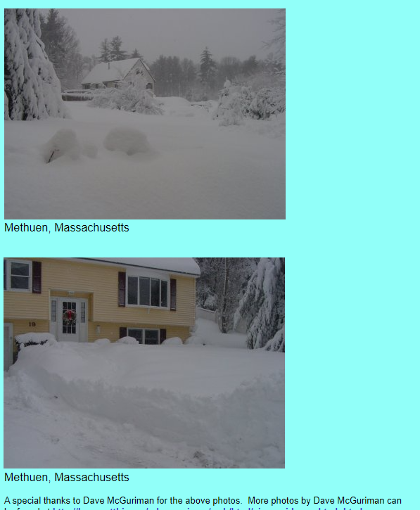
Oh that was a goodie, I was in Methuen back then.
-
1
-
 1
1
-
-
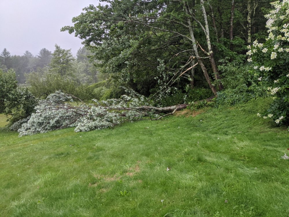
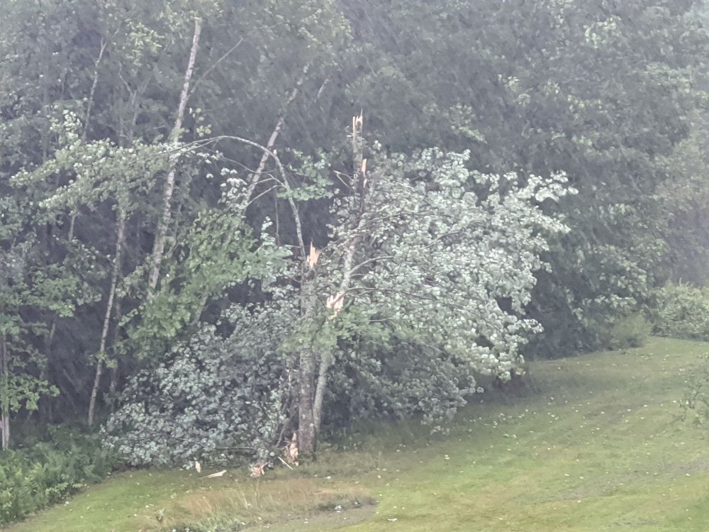
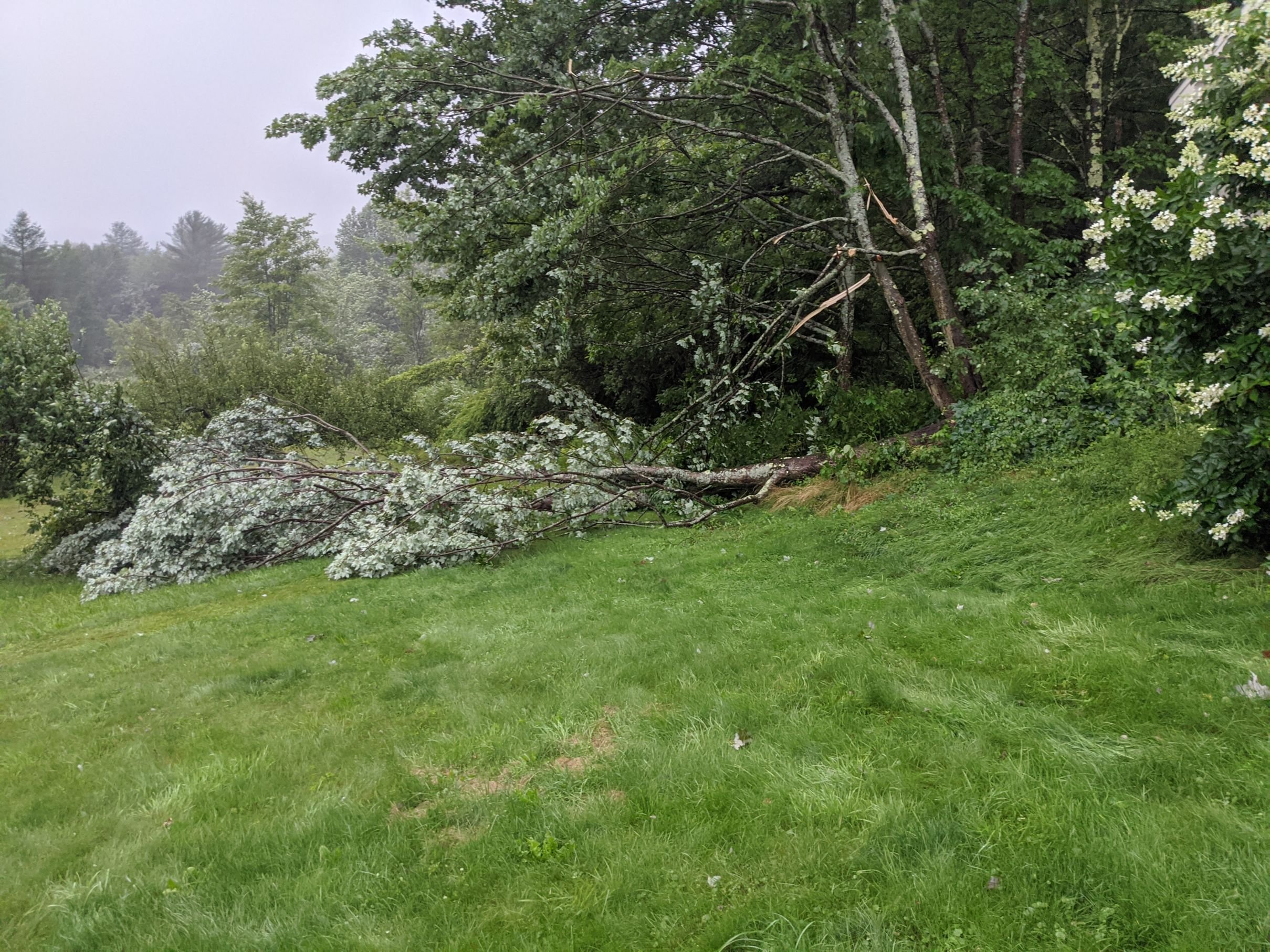
2 different trees down in Waterbury Center VT
-
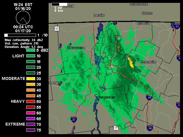
1 minute ago, powderfreak said:
Power is out to a large portion of the Mountain Road here in Stowe. No bueno but I’m on the line with a bunch of restaurants and lodges so hopefully they sort it out soon.
Heavy wet snow after icing last night and now high winds. Trees starting to drop...Fukkin white pines.
Time to hit the bar though that has power...
Yup, my workplace is on the mtn rd and I'm waiting for it to come back on as I have to go fire the servers back up, and damn if that dont mean no drinking yet!! The snow makes it worth it though.
-
-
5 minutes ago, USCAPEWEATHERAF said:
Lol, yes that was me being a moron and an emotional weather enthusiast who wants to see amazing snowstorms, but the norm is against that happening especially for my neighborhood. So I should be more realistic in my ideology
say this to yourself every time before you post, every...single...time! Until you move to Stowe or Northern NH or ME, where you might actually get the amount of snow you want.
-
 1
1
-
-
48 minutes ago, mreaves said:
It is. It happens once or twice a year and is usually good for a few unexpected extra inches. In 2007 we had some sort of lake effect streamer that absolutely pounded us with about 10”. A couple miles either direction had less than half that. We then got an MLK Day sleet bomb that sort of limped is along to the great VDay storm and a string of big snows through most of March. Town meeting day storm, St.Patricks Day storm were all 12”-20” if memory serves me.
2007 was epic, worst winter ever, until late Jan and the Vday happened to this day my penultimate experience. 38" of joy. And it snowed for the next 2 months like it was going out of style. The company I work for used to have a ski day every year for the owners bday on March 18th, but for some reason that yr it was April 5th and with the base we had from the previous 2 months and the heavy snow that day (that wasn't wet it was like January that day) it was just absolutely unreal. There was so much snow there was no boulder on the lower narrow section of goat, it was like a little mogul on gulch. Makes me think of 2005 too which was no slouch in extreme snow and not the nickel and dime we usually get (which I'm not complaining about simply acknowledging that's how we typically get our snow). Sigh, I'm just loving the snow and pontificating about old snow and speaking parenthetically way too much. I digress. Looking forward to more this weekend even if lacks the original hype, more is just cake at this point. I'm not greedy likes those sne'ers
-
This is the storm that keeps giving. 6 inches by 10 am here in Waterbury Center several hour lull and then 3 more in the last 2 hours. About 8 inches of depth. Looks like the snow isn't making over the spine as much anymore but the western slopes sill getting pounded for those super lucky special magic reasons.
-
I'll see your blurry pic and match it with another
") Yup absolutely mental!! Wind gusted to 30 for about 10 seconds then bam, we got about 1/2' in 10 minutes over here on Gregg Hill (820' elev.).
Yup absolutely mental!! Wind gusted to 30 for about 10 seconds then bam, we got about 1/2' in 10 minutes over here on Gregg Hill (820' elev.).
-
1
-
-
1 INCH IN WATERBURY CENTER
-
I was in shorts and a t-shirt today and as i was coming into work someone walking out said, "jesus you think it's summer?" and I didnt think anything of it because it's what I always do, suck it up until it's too much. By the time i left today I was cold walking back to the car. I thought hmmm, it's time for long sleeves. I will definitely wear long sleeves as another layer tomorrow. Looking forward to our snow.
-
1.5 inches so far in montpelier
-
22 hours ago, powderfreak said:
It has been very light (heaviest has probably been 2-3 mile visibility) but man has it been consistent. I think there have been flakes in the air now for like 7 hours straight even in town.
The "persistent flurry" as I like to think of it...just keeps going. Met up with a BTV met here in Stowe earlier today and we couldn't believe how cold it has to be for good snow growth from orographic precip in October all the way to the valley floor.
Ground is still warm like you said, so the brief whitening is elevated surfaces and cars with a tenth of an inch or so, but quite the wintry vibe with flakes floating around all day. First snow globe type day of the season though radar seems to finally be on the decrease.
I think that met is clearly expecting a photo from you in 2 days
.SHORT TERM /WEDNESDAY THROUGH THURSDAY/... As of 444 PM EDT Monday."Wouldn`t be surprised to see an image from Mt Mansfield with 3-6 inches total from Tuesday night through Wednesday."

NNE Cold Season Thread 2020-2021
in New England
Posted
nice little ditty coming on through snowing very nicely here in h20bury center