
Lava Rock
-
Posts
12,777 -
Joined
-
Last visited
Content Type
Profiles
Blogs
Forums
American Weather
Media Demo
Store
Gallery
Posts posted by Lava Rock
-
-
90f for the high. Cooler than yesterday
Sent from my SM-S921U using Tapatalk-
 1
1
-
-
Lightning and thunder woke me around 11pm. Must have been big gust cause our deck umbrella blew out of the table and into the woods. No rain though.
Sent from my SM-S921U using Tapatalk-
1
-
-
24 minutes ago, Damage In Tolland said:
92.5/77
We heaven
with AC on inside?
-
 7
7
-
 1
1
-
-
-
11 minutes ago, weatherwiz said:
Should be another loud night for some tomorrow night
Beans and franks?
-
 1
1
-
-
31 minutes ago, wxeyeNH said:
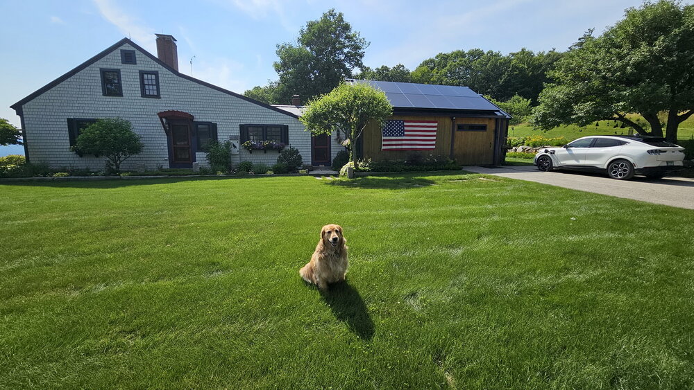
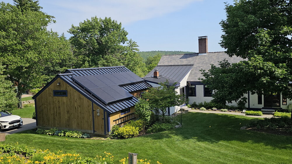
We have a standing seam newer metal roof. The panels are clamped on the standing seams. 2 years, no problems. Just panels east/west on the barn. Today I'm running 3 window ACs and charging my 4 year old Mustang Mache and the system is generating more power than I can use. I'm sending the extra back to the grid and getting paid for that about $3 so far today. Other people might have problems but going with my electric car and roof has been a huge W for us. (Picture taken around 3:30pm). Golden Retriever approved!
4pm 92/74F
Such a cool spot.
-
0.32". Nice surprise
Sent from my SM-S921U using Tapatalk -
98f frcst for thurs. Puff puff pass
Sent from my SM-S921U using Tapatalk -
0.48" at home, not bad. Been steady rn at work in PWM.
-
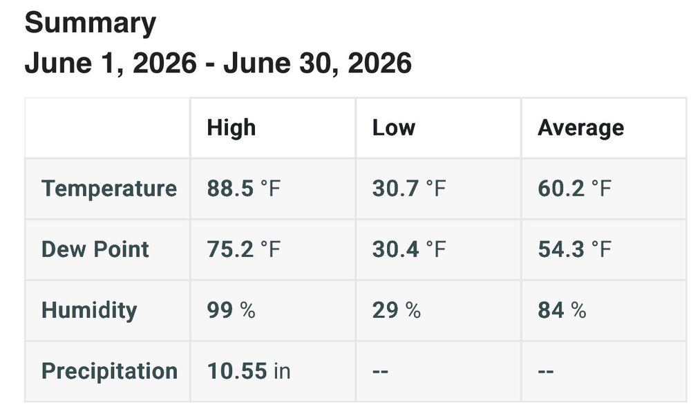
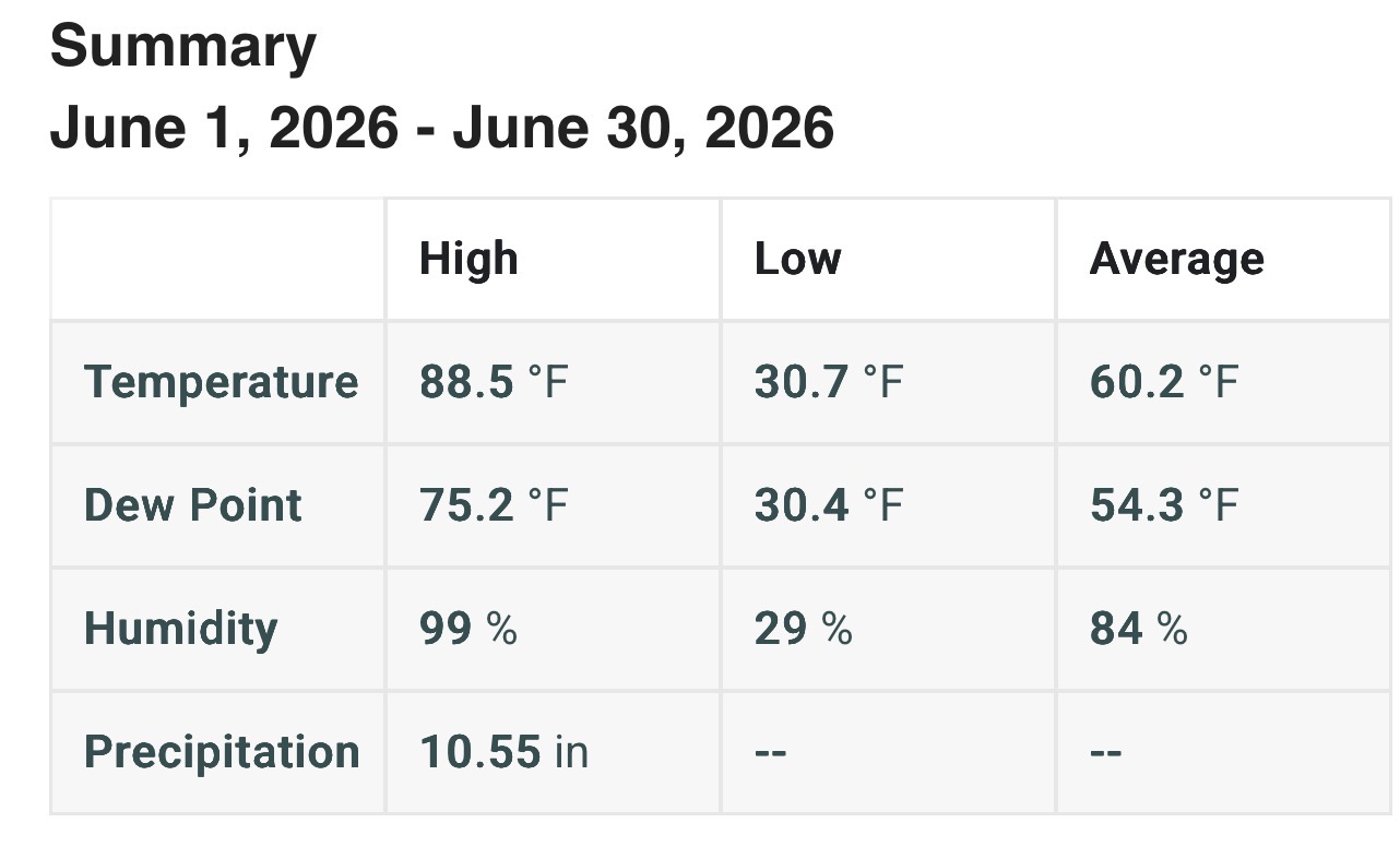
Damn. After last night's rain, we're only at 4".We are now at 10.55” for June. That’s pretty impressive, considering we haven’t had any major flooding.
Sent from my SM-S921U using Tapatalk
-
Beautiful night in roxbury now that the wind has died
Sent from my SM-S921U using Tapatalk-
6
-
-
0.89". Pretty meh with the fropa. No lightening or thunder, briefly gusty. We rebuild
Sent from my SM-S921U using Tapatalk -
Bring it to mama
Sent from my SM-S921U using Tapatalk-
1
-
 1
1
-
-
0.40" round 1.
-
1
-
-
Decent drink this morning. 0.51"
-
Lol, damn. I was surprised to get 0.77". Most fell around 2-3amLol wtf happened
1.93" overnight
Sent from my SM-S921U using Tapatalk
-
2
-
1
-
-
0.77".Min 65.9°
0.67”
We wet
Sent from my SM-S921U using Tapatalk
-
1
-
-
Nice light show snd thunder last night knocked out power. 0.44"
Sent from my SM-S921U using Tapatalk -
Google prematurely released their 60million genetically modified mosquitoes.I had noticed the same but they seem to be returning now. Noticed them last couple days.
Sent from my SM-S921U using Tapatalk
-
man, the mugwort is getting bad. So hard to get rid of, but thankfully it's in a lawn expansion project that I did several years ago, but don't care much about, but still, stuff is a bitch to get rid of without nuking it.
-
Wtf. This is getting annoying

Sent from my SM-S921U using Tapatalk-
1
-
-
Wildcat

Sent from my SM-S921U using Tapatalk-
1
-
-
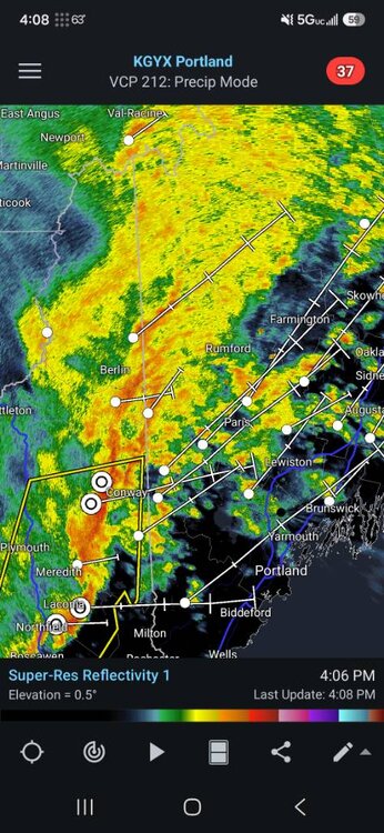
Can you comment on tomorrow's frcst in the pinkham, gorham, evans notch areas. Supposed to have 80mi cycle club ride out of fryeburg at 9am. Looks showery late morning through afternoon, but not sure how widespreadIt went to the model hallucination hall of fame.
But really I think our biggest issue locally was that the precip ended too fast. The bottom of the melting layer was probably only a couple hundred feet above your place when the precip ended.
Sent from my SM-S921U using Tapatalk
-
What happened to the modeled 2" for our area?Definitely snowing on the summit of Sunapee right now, so it's down to around 2,500 feet.
Sent from my SM-S921U using Tapatalk


Ju-ply 2026 Obs and Disco - Kicking it off with heat, humidity, and ... severe?
in New England
Posted
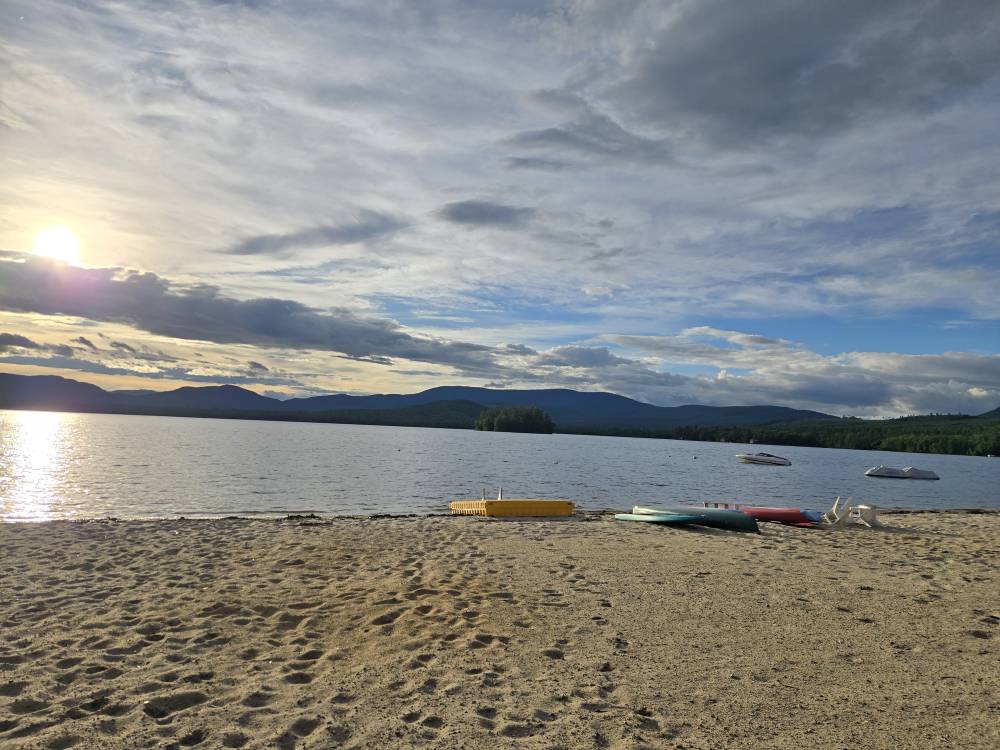
Not the worst seat in the house
Sent from my SM-S921U using Tapatalk