metalicwx367
Members-
Posts
78 -
Joined
-
Last visited
Content Type
Profiles
Blogs
Forums
American Weather
Media Demo
Store
Gallery
Everything posted by metalicwx367
-
I'm back in Georgia briefly visiting the family before I go back to Australia this weekend. I just happen to be here during this snow event lol.
-
These high-resolution models are very interesting on our snowfall amounts now. Even the GFS ensemble mean doubled snowfall compared to previous run and is a lot wetter. If the freezing rain does happen to be limited as these models are starting to suggest, we might be in for a lot more than 2 inches of snow/sleet if temps cooperate as well.
-
1/21-1/22 Winter Storm OBS Thread
metalicwx367 replied to metalicwx367's topic in Southeastern States
Nah haha. I'm back home visiting in S GA for a little bit. I return to Australia this weekend. -
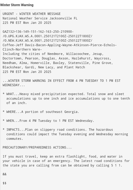
How did the HRRR do? That 12Z run is trying to give us nearly 10 inches of snow. Most likely overdone but it also has no freezing rain. Just straight to sleet and then all moderate to heavy snow. Euro also has barely any freezing rain. It just has half the QPF that the high-res models are showing. Our winter storm warning amount has increased from 1 inch of snow to 2 inches with 0.10 of ice on top of that.
-
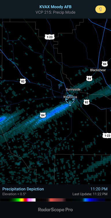
Had some surprise sleet earlier on south side of town. Interestingly enough on the north side of town people were seeing snow.
-
-
-
17Z HRRR is running rn. The 0Z, 6Z, 12Z, and 18Z are the ones that go out to 48 hours. 18Z should be running around 3PM EST.
-
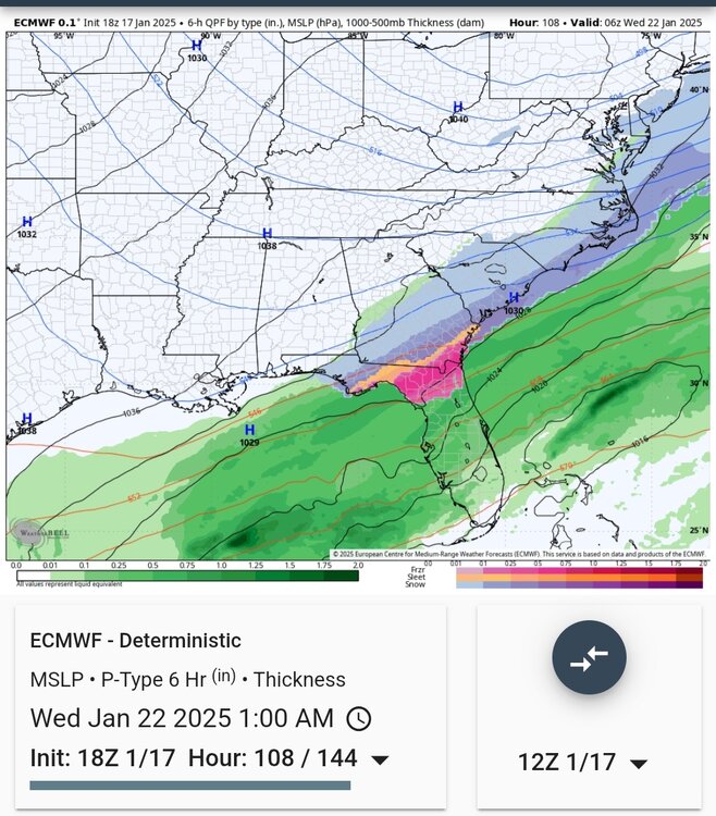
Loving all the model differences and changes for us each run from a major winter event less than 36 hours out. NWS Jax is expecting mainly freezing rain here. Starts out as snow briefly before changing over to predominantly freezing rain. GFS has been trending colder each run and 6Z run had nearly all snow and sleet. Last Euro run trended warmer and drier again. Very little freezing rain though. 12Z ICON trended significantly wetter and has snow starting out and transitioning to freezing rain. Canadian and RGEM show an all sleet event. UKMET is dry af and all rain with the little precip that does fall. Graphcast is sleet to snow. Less QPF than previous runs. EC AIFS has trended drier. But nearly all snow.
-
-
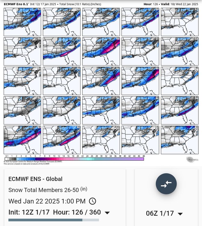
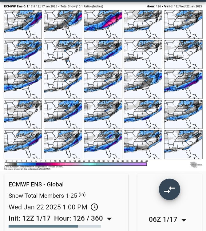
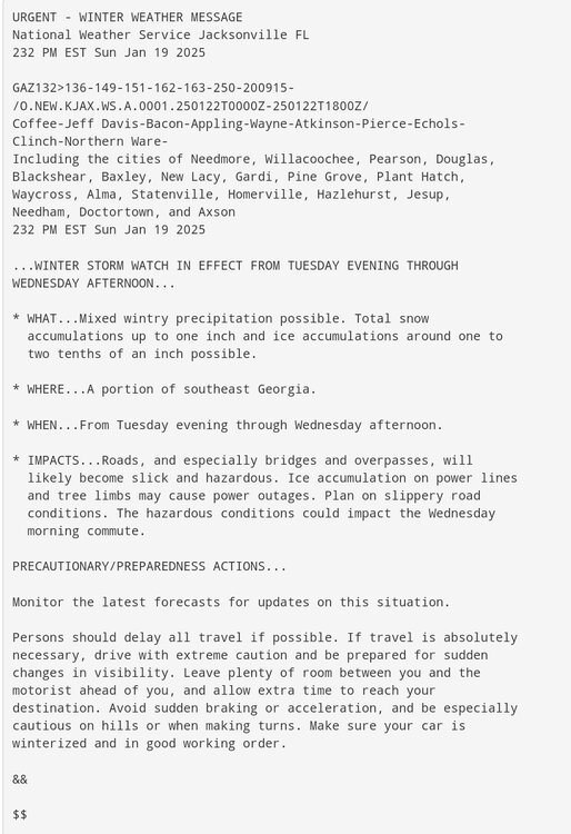
Exactly. Expected precipitation type is still a mystery here in South Georgia for this storm and we are less than 3 days out. Expecting to be under a Winter Storm Watch later. Gonna ride the Euro and Euro ensembles for this one. They've been consistent. If we manage to switch over to snow earlier than expected, might have a shot at breaking our record snowfall of 3 inches back in the 1970s.
-
Yeah it'll probably take out the rest of the trees that are left standing here that Helene's 100MPH wind gusts didn't take out.
-
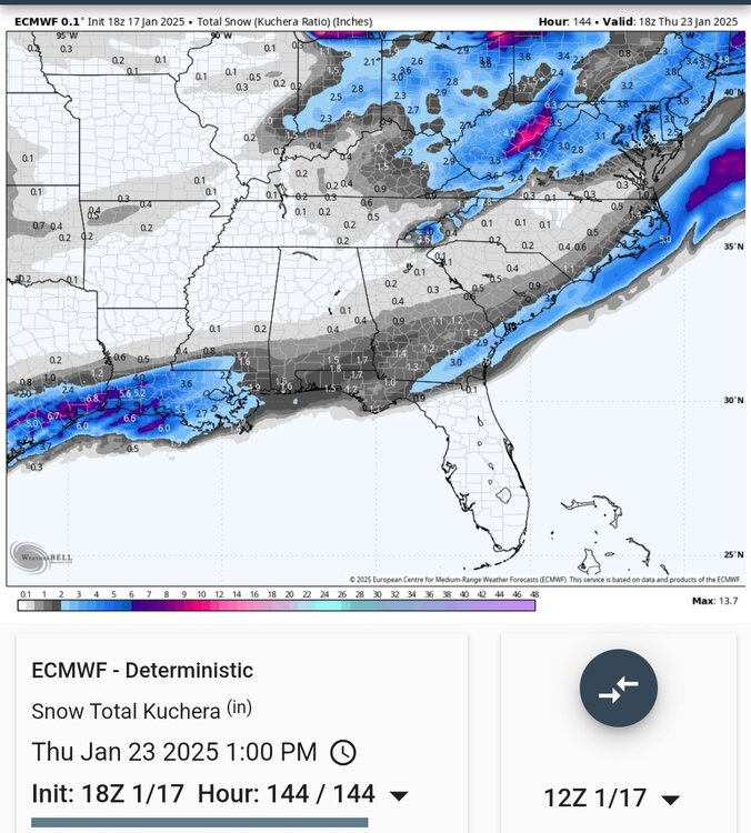
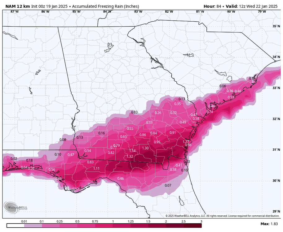
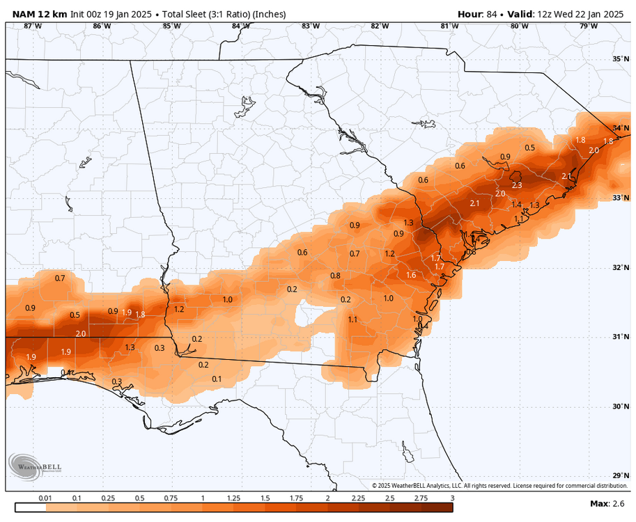
The NAM snowmap and a couple of other models on tropical tidbits counts all frozen precip as snow. That map is not an accurate depiction as all of Southern GA and Northern Florida was freezing rain during that run. Here's a more accurate map.
-
Don't let us down Euro. GFS was all rain and temps in mid 30s for most of southern GA. UKMET same but warmer and less precip. Most recent AIFS and Graphcast were big ZR events based on 850s and SFC temps around 30F. ICON was a step in the right direction, but not much precip.
-
Nah I'm with you on that here in South Georgia. Very low confidence forecast though especially on precip type down here.
-
I'm riding the Euro for this storm. 5 inches of snow and 2 inches of sleet for most of south GA. Anything less I'm calling a bust. /s
-
Yeah lol. It feels like I'm forecasting in Australia where none of the models agree with each other 12 hours out. I'm just gonna go with the models that don't show any wintry precipitation and use that as an excuse not to expect snow and then be surprised and appalled if it does snow. I'm on vacation rn so my forecasting skills don't matter. Not talking to any airforce pilots.
-
Yeah lmao. Still warming trend continuing here. At this rate, it's gonna be 70F and chasing tornadoes and shit.
-
18Z EC AIFS shifted slightly south. Barely anything across NC. Like the Euro, it's very cold at the SFC over S GA and looks like predominantly sleet event based on 850s. Again much better than the 2 inches of freezing rain it had earlier across our area.
-
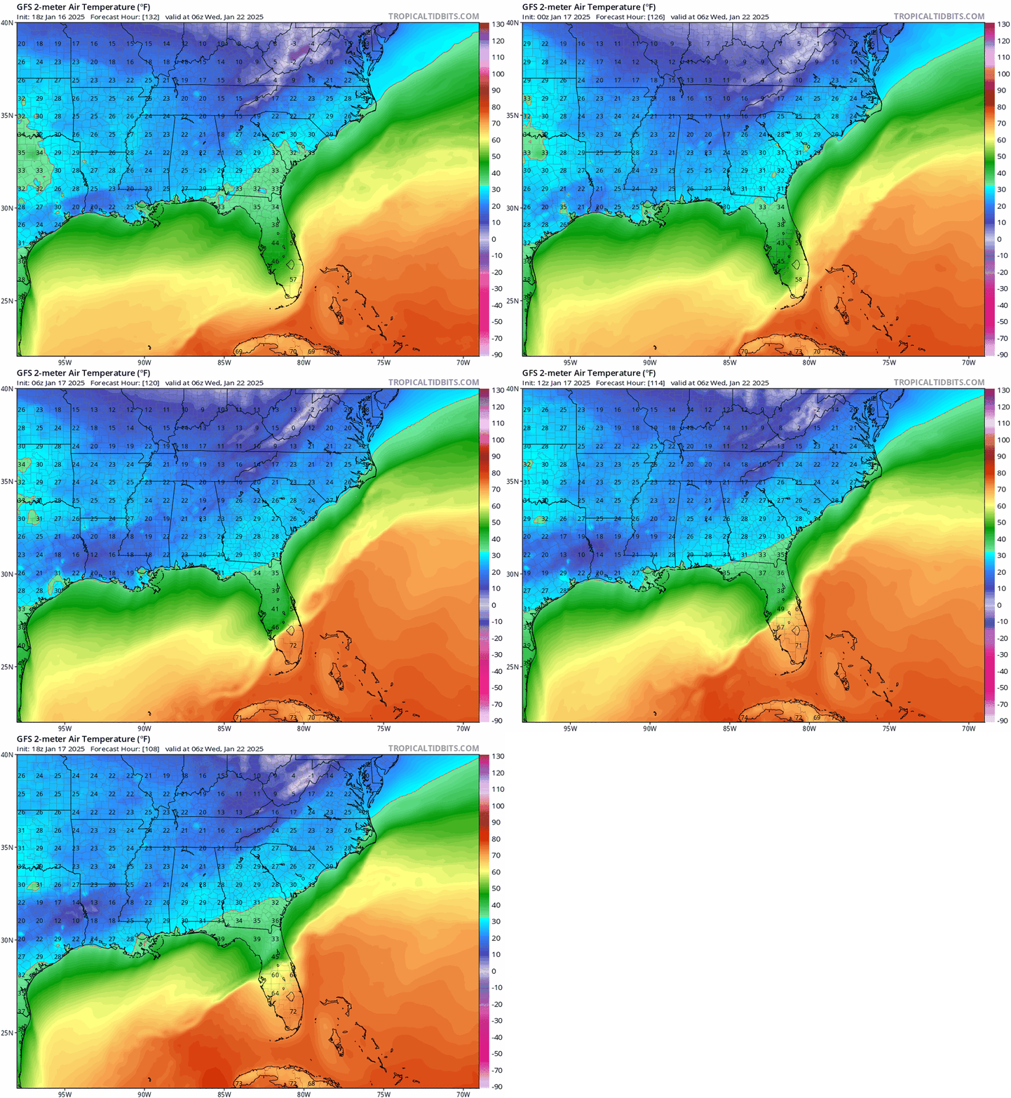
GFS keeps trending warmer here. Almost an all rain event on 18Z. Almost as warm as the UKMET and Graphcast model at the SFC. CMC, EC AIFS, and Euro are much colder at the SFC.
-
-
I'm not gonna get excited until 2 days out lol. It's awesome though being back home for first time in a few years and potentially getting a historic winter weather event. Then a few days later I'm heading back to Australia where the town I'm in is getting a close call with potentially a major hurricane this weekend. HWRF shows nearly a Category 5 storm.
-
-
I'll take the 3 inches of snow and inch of sleet. Better than the ZR.
-
It's unreal seeing that for this location in NWS forecast. At this rate if this keeps trending NW, we will end up 33F and rain lol. GFS actually changes us over to rain during the heaviest precipitation period.






.thumb.png.35819732159a7880fb6b30416a0d80dd.png)
