

TheGhostOfJohnBolaris
-
Posts
59 -
Joined
-
Last visited
Content Type
Profiles
Blogs
Forums
American Weather
Media Demo
Store
Gallery
Posts posted by TheGhostOfJohnBolaris
-
-
54 minutes ago, jbenedet said:
The lack of weakening advertised on the 6z GFS as storm traverses Florida is insightful - to my mind it points to storm entering most conducive environment to strengthening right as it nears landfall.
We need to watch this aspect closely - track at landfall we are zeroing in on, but intensity looks like a big question mark. I believe we could see big shifts in this regard inside 24 hours
The track further south also means more time over warmer water. Being November 7, 100 miles means a lot in terms of SST's even off the southeast coast of Florida.

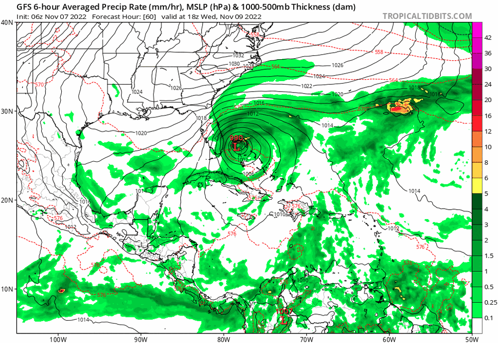
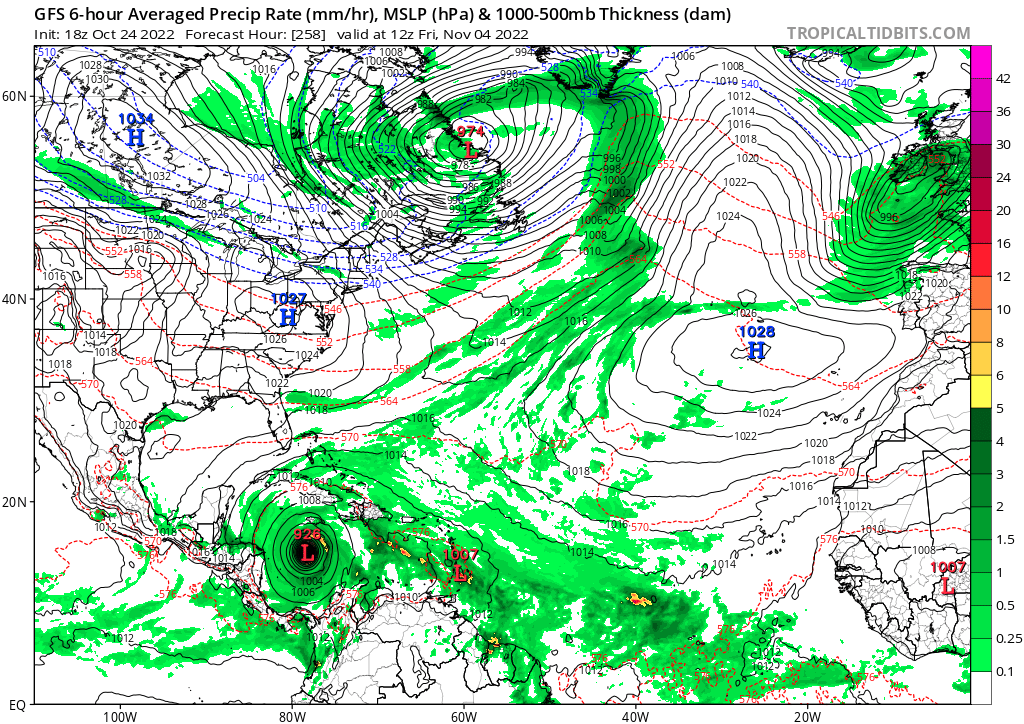
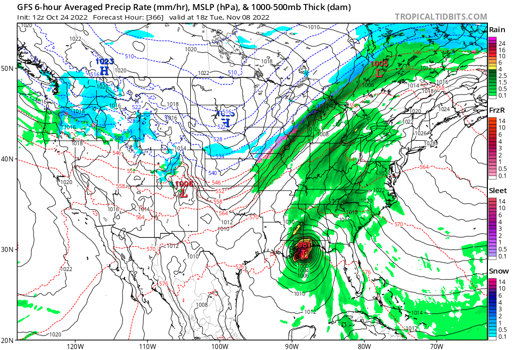
6z GFS showing it maintaining mid-980s across the state and emerging just south of Tampa at 984
-
Question for those of you who have been around the block longer than I have. Say the GFS solution or close to it actualized. As someone who lives in Tampa, would I expect a hurricane warning or just TS? I operate a hotel right on the bay that has to evacuate for any hurricane warnings. Ordering product when these threats are around is always a challenge.
-
Pretty strong consistency run to run for GFS
-
3 hours ago, olafminesaw said:
GFS developed a TS only 84 hours out. May not be so far fetched this time

Euro seems to like it, albeit much less, around that same time
-
18z GFS seems like a much more reasonable run
-
18z picked up the crack pipe
-
Sure enough here’s the 12z GFS
5 hours ago, AChilders said:Only 2 of the 50 Euro members have formation of any type in the Caribbean

-
GFS seems to be putting Florida in play
-
 1
1
-
-
20 hours ago, Windspeed said:21 hours ago, TheGhostOfJohnBolaris said:Huge shift west this last one after an east trend

That's nearly a pattern flip. Notice the WAR appear out if nowhere versus previous runs. New Foundland low gone. May be a flook or something to watch for upcoming runs.
Interesting..
-
33 minutes ago, MJO812 said:
5 runs now in a row
Huge shift west this last one after an east trend
-
1 hour ago, bigtenfan said:
That map is for tropical storm winds and depending on the exact detail shows the landfall area at a 50 to 80 percent chance of TS winds
I am sure that the 50 and 64 kt wind maps showed even a lesser chance
I am sure that map was based on the GFS which failed miserably in this storm at the cost of many many lives
I strongly disagree with the notion it would’ve changed a damn thing. People who didn’t evacuate weren’t going to have their minds changed.
-
2 hours ago, TPAwx said:
No threat to the US as this eventually goes into Central America, if it develops.
Didn’t Ian initially show the same thing? Slamming into the Yucatán?
-
1
-
 1
1
-
-
Euro still not developing anything on the 12z
-
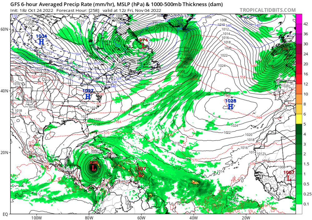
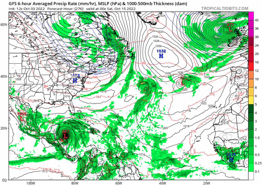
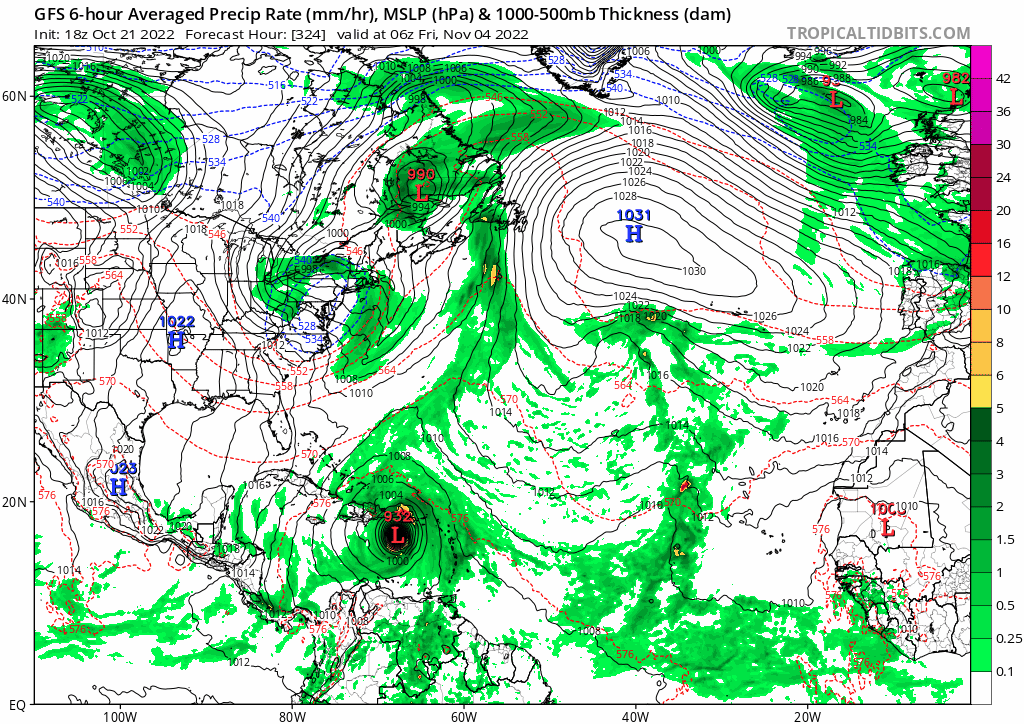
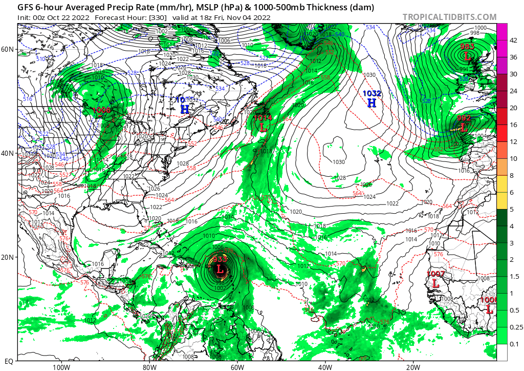
GFS with a monster just south of the Yucatan at 312
-
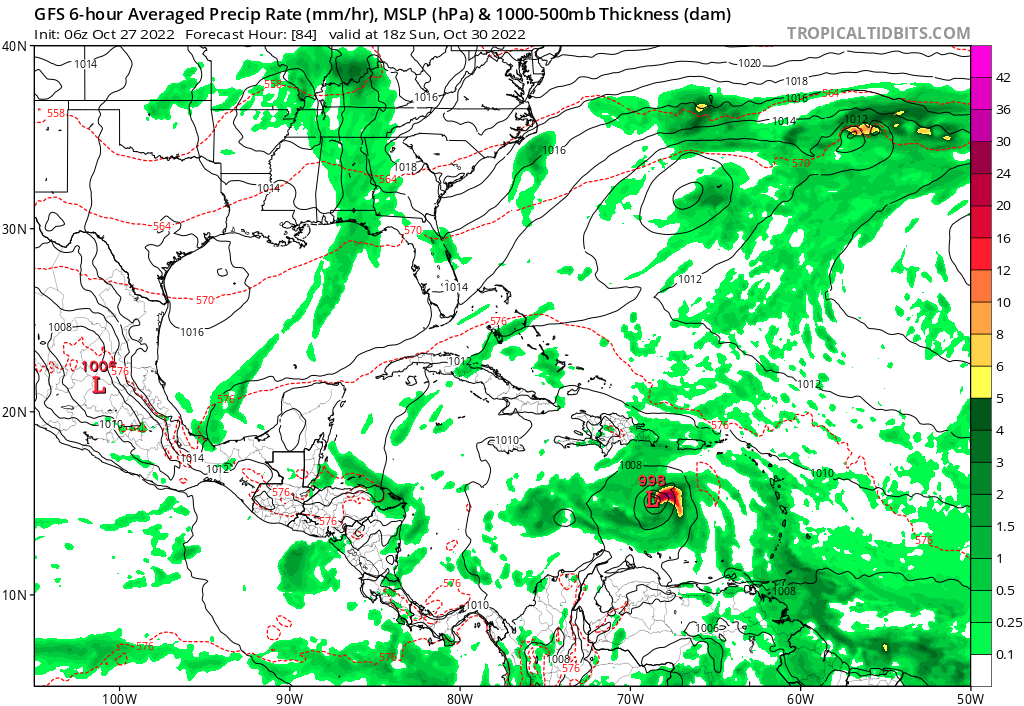
Makes sense, the radar presentation is rapidly improving
-
1 hour ago, NorthHillsWx said:
Sadly I don’t blame anyone but the people who choose to live in these hurricane prone areas and especially those who don’t evacuate. My family had property on the NC coast and we know the risks. TWC interviewed a couple who lost their house in a California Wildfire a few years ago. Their solution? Put everything into a house boat the left docked in fort myers… I mean I’m sorry they lost their boat (house) but at some point you just have to shake your head at the decisions some people make for their lives.
Some people want to live by the ocean in this blink of an eye we call life. I don’t really see a reason to be judgmental here.
-
2
-
 1
1
-
-
2 minutes ago, jbenedet said:
Really curious to know what’s going on in Tampa Bay Area right now. Have to imagine some severe coastal flooding all along the e south sections of the bay with the persistent northerly fetch.
I’m in Clearwater (Safety Harbor) and we’ve barely seen any impacts all day. Very fortunate.
-
5
-
-
We seem to be trending towards a more northern path
-
1 minute ago, gymengineer said:
Folks, just read the advisory. NHC has already stated Ian is moving NNE at 15 degrees. Exact NNE is 22.5
Wouldn’t be surprised to see it tick back north a bit. Still a wide range of outcomes here.
-
I believe that the models over corrected east a bit with the movement this morning. Ultimately still see it somewhere between Tampa and Fort Myers.
-
2 minutes ago, lee59 said:
The track has been shifting more east in recent runs, going from landfall near the Big Bend to just north of Tampa.
I don’t know if I buy the landfall south of Tampa. Doesn’t feel like there’s enough to steer it to make that happen.
-
 1
1
-
-
Just now, Bubbler86 said:
Manatee as well.
Pinellas sheriff said earlier that it’s happening for Zones A-C tomorrow
-
2 minutes ago, NJwx85 said:
Hearing unconfirmed rumors that they have started issuing evacuation orders for portions of Tampa area.
Can confirm Zone A has evacuated
-
Just now, CampergirlFL said:
City of Tampa is now offering sandbags
.Just as the models shift west

-
 1
1
-


Hurricane Nicole
in Tropical Headquarters
Posted
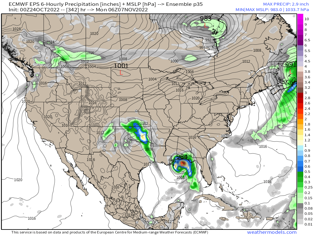
12z GFS a touch more south and a touch slower than 6z through 48
Edit: A little stall from hours 48-54 causes it to go north sooner