

TheGhostOfJohnBolaris
-
Posts
59 -
Joined
-
Last visited
Content Type
Profiles
Blogs
Forums
American Weather
Media Demo
Store
Gallery
Posts posted by TheGhostOfJohnBolaris
-
-
2 minutes ago, dbullsfan said:
I really don’t see all the continued hype regarding Tampa for this storm. I think the local Mets have it right, maybe the coast gets a little storm surge but this thing isn’t even coming close to the coast until well after passing the TB area. The biggest worry here should probably be tornados in the extreme outer bands. It still is far enough out it could take an extreme right hand turn but I don’t think there is a single reputable model predicting that at this point. I feel like last year with Ian there were at least a few outlier models predicting it coming in further south.
.https://twitter.com/nbergwx/status/1696283190271398172?s=46&t=R5sol24bP9u2QcPDXfW3Tw
-
9 minutes ago, TheGhostOfJohnBolaris said:
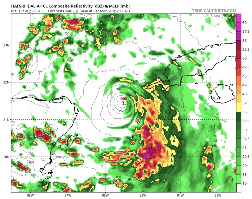
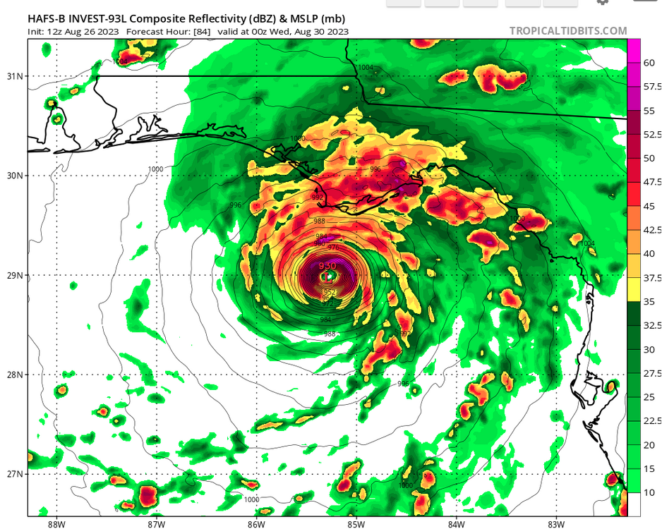
Is it just me or is HAFS initializing way too far west?
Again, am I missing something here?
-
 1
1
-
-
Is it just me or is HAFS initializing way too far west?
-
Just now, Hotair said:
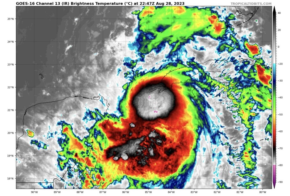
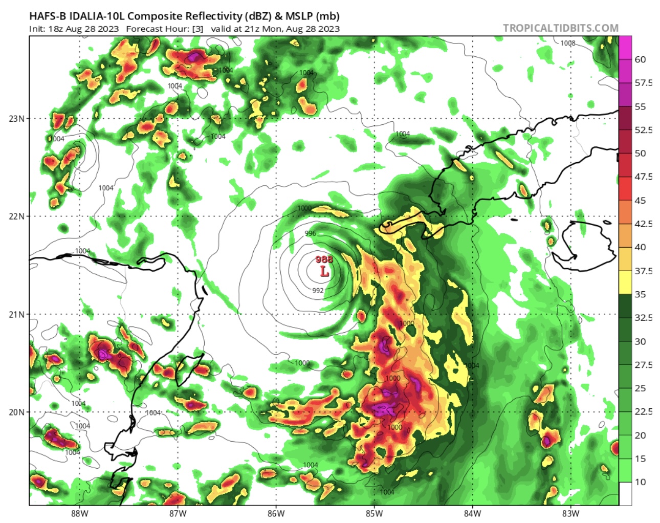
Satellite presentation now looks much better organized. Idalia could easily set records for RI given the hot waters in its path
It’s really trying to clear out that eye, shouldn’t be long
-
HAFS-B picked up this current east wobble pretty well, curious if it shifts back west soon like it seems to show
-
6 minutes ago, StormChaser4Life said:
Last few frames of the satellite loop seem to have a more ne component to the storm motion. Could be a temporary wobble as the center establishes itself but curious if it will hold. This motion could cause more land interaction with Cuba. However, with Ian last year this actually helped to tighten up the core. The terrain isn't too mountainous on the western tip to cause a lot of disruption to the LLC.
I’m in Clearwater so have been wary about a further east track. My house was right on top of the center of the cone a day before Ian hit, then it shifted massively. A similar shift east would put us in the crosshairs.
-
 1
1
-
-
If IMBY posts aren’t allowed I’ll delete, however curious if anyone knows how soon we’ll see watches and warnings? Im new to Tampa and run a business in level 1 evacuation zone that would require a bit of prep to close. Seems like we won’t have much time to prepare.
-
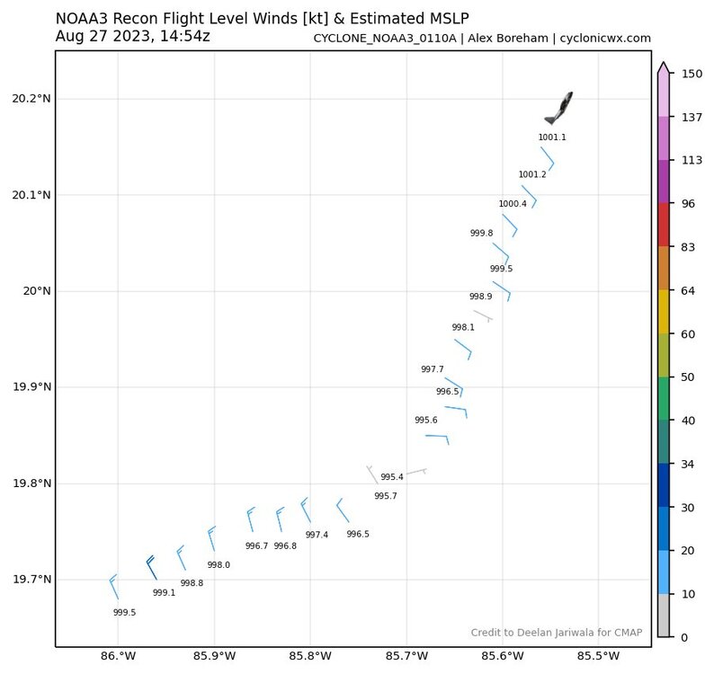
Is the 12z HAFS using any of the recon data? Strong start..
-
Should have Idalia very shortly
-
ICON has been incredibly consistent with a hit just north of Tampa these past few runs. Now HAFS-A and B showing a shift SE. Curious to see if that continues.
-
HAFS noticeably more SE than the last run
-
We’ll just be spinning our wheels on track and intensity before the recon gets there tomorrow. Not putting much stock into either before then.
-
3
-
-
ICON with another landfall around Tampa. It’s been very consistent with this track.
-
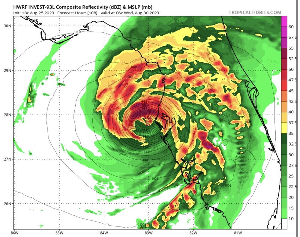
HAFS-A and HAFS-B showing a big increase in intensity from 6z to 12z. Through 72...
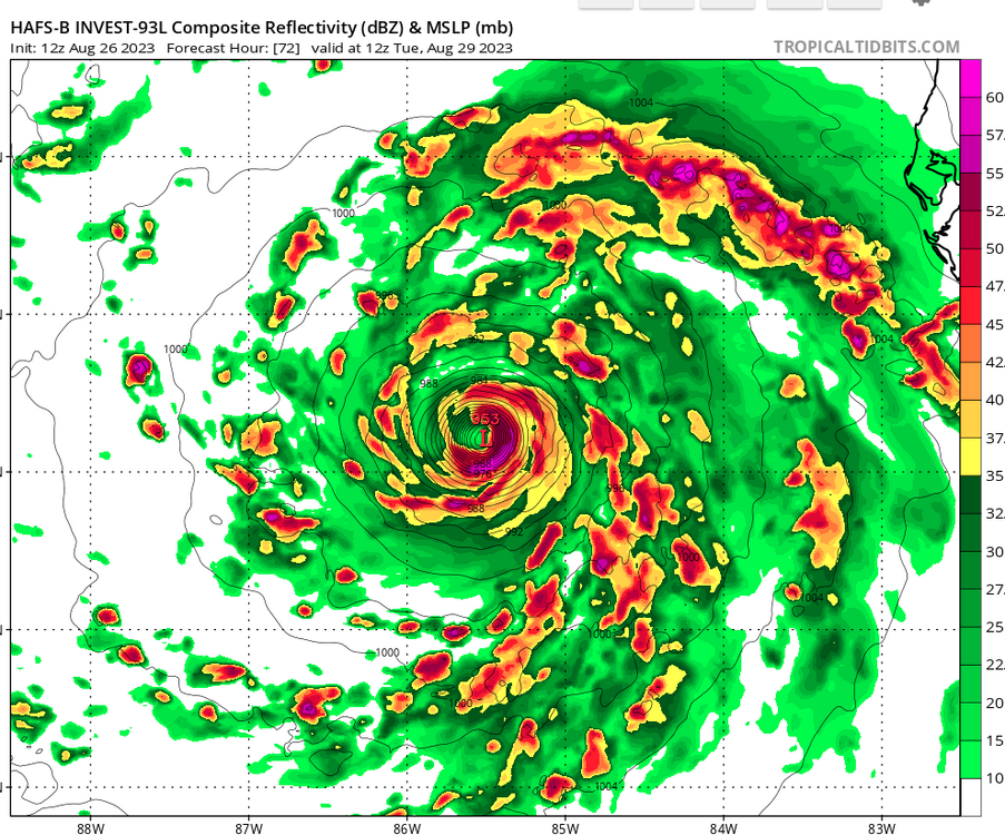
Edit: Lord...
-
GFS not giving up it's hit near Panama City
-
6z Euro a good bit west
-
18z HWRF is a pretty dramatic change in intensity
-
1
-
-
Fort Myers has to be a little nervous looking at the 12z GFS..
-
1
-
1
-
-
Just for a good laugh
-
 1
1
-
-
It seems like we’re headed for a bad underestimation of the intensity by most of the models. Would this happening in November be the reason? Since there aren’t many analogs?
-
6 minutes ago, TPAwx said:
18z GFS a bit SW of 12z as the system heads across the peninsula.
Gives Tampa the northern part of the storm..
-
6 minutes ago, Sandstorm94 said:
4pm
55kts (65mph)
990mb
W@10mph
Sent from my SM-S102DL using Tapatalk
As of 18z GFS yesterday had landfall at 990. Woops.
-
HAFS jumps on board and has a similar intensity as HWRF with a similar path. It wasn’t showing landfall in FL until this run.
-
HWRF continuing to show mid-970s landfall around West Palm Beach


Idalia Banter
in Tropical Headquarters
Posted
Seems to be wobbling east quite a bit..