

SteelCity87
-
Posts
107 -
Joined
-
Last visited
Content Type
Profiles
Blogs
Forums
American Weather
Media Demo
Store
Gallery
Posts posted by SteelCity87
-
-
1 hour ago, Rd9108 said:
Thanks to our lovely city workers the streets around my parents house were a disaster. I may or may not have totaled my car because of it. Oh well I'm not hurt atleast.
Glad you're ok
-
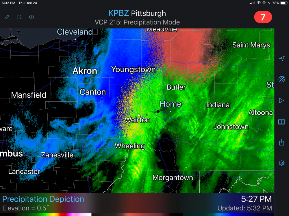
Might be that dry slot they mentioned creeping in here. Very wintry out there though for now

-
Some light stuff back home in Ingram. That was a fun ride home from work
 Maybe an inch or so down here currently.
-
Seems to be some sleet mixing back in here. Close to an inch otg. Now that I check radarscope it looks like a bubble of mixed preciop right over the agh county
-
14 minutes ago, CoraopolisWx said:
Oh yeah, used to live near the cargo facility.
Moving in the right direction. Unlike last week, the 850's are making us grind it out tonight.
It's a very distinct smell lol. Been pouring snow here for a good 45 min now
-
 1
1
-
-
8 minutes ago, CoraopolisWx said:
Deicing better be in full force tonight and tomorrow morning.
I can already smell it out there lol. Looks like mostly snow out there. Coming down at a good clip and coating the ground alreadym
-
Seeing more and more snow mix in at the airport.
-
1
-
-
Roads are slick by the airport. Sleet mostly.
-
4 minutes ago, CoraopolisWx said:
Would like to get that 0C 850mb push here,that folks our getting up north.
The surface has cooled nicely, just waiting on these stubborn 850's
Mixing a bit in Robinson
-
14 minutes ago, Ahoff said:
Greedy for me is 4”,
 . I definitely don’t expect two feet for any storm. I just want a few inches, at any opportunity, as that’s how we reach our average.
Haha. It's strange how storms work sometimes. When you're expecting 3" and get 5" you're elated. On the flip side you watch models all week hoping for 10" and when you end up with 6" you're letdown.
-
2 minutes ago, Ahoff said:
Yes, and I’ll stay greedy, lol!
it’s just we’ve seen this kind of thing many times and I’ve been screwed many times. I hope it isn’t one of those.
We live in the wrong region to be greedy lol. Last week's 11" was the third largest storm in the past two decades.
-
1
-
 1
1
-
-
6 minutes ago, Ahoff said:
Sucks. Looks like the screw job may happen. Figures.
We just had 10" last week and will 100% have a white Christmas. All is well lol.
-
3 minutes ago, Mailman said:
.NEAR TERM /THROUGH FRIDAY/...
The leading edge of shallow cold air at 2200UTC is straddling the
forecast area, stretched from near Marienville PA to near Pittsburgh
to near Fairmont WV. Atop this shallow layer remains a relatively
warm tongue of air, leading to a PTYPE transition across wrn PA/ern
OH and the nrn WV panhandle. Farther west near ZZV, cold air has
successfully eroded the warm tongue, leading to a region of all snow
from near PHD to ZZV.

Prior forecast (see below) identified a focused region of ern OH
where conditions will be favorable for considerable snowfall rates
this evening as still colder air invades and lift/saturation are
maximized through the dendritic growth zone. This region still seems
to be where the highest totals are likely. Headlines were continued,
but upgraded for a few counties adjacent to the ongoing warning in
line with the latest information available.

The latest expectation is that snow rates in ern OH could potentially
reach 1-2" per hour for a window this evening. By 0600UTC, a dry
slot will erode moisture aloft, which should bring an end to
widespread threat of heavy snow. This dry slot brings some concern
about snow amounts for wrn PA, where a late transition to snow (as
most models suggest) may preclude totals quite as high as previously
forecasted. Dry, fluffy snow likely will continue past 0600UTC, but
fall rates will be limited. The ridges, however, will remain at a
temperature favorable for highly efficient snow ratios, and still
could see notable totals by mid-day tomorrow.
Just give me 3" and I'll be happy. No Grinch dry slot should be able to stop that I hope.
-
33 minutes ago, Rd9108 said:
It was supposed to slow down like this. Don't worry.
Just the weenie in me hoping for a quicker changeover

-
2
-
-
2 minutes ago, north pgh said:
RadarScope is the best.
That snow line has not budged for a good while now.
-
Snow line is nearing the WV panhandle. 31 degrees and light snow in eastern Ohio currently.
-
It's times like these where I miss the old Weather Channel. Nothing brought me more joy as a child than seeing that orange warning scroll across the bottom of the screen
 Back then 3-6 was warning criteria.
-
6
-
-
I just never understand why they put out graphics showing a certain number then put out an entirely different total in the advisory/warnings. They flip flopped the warning last week 3 times in a day. 5-9" to 4-8" then right back to 6-9". Very minor changes but why even bother? Some differing opinions in that office it seems
-
2 hours ago, Ahoff said:
From Accuweather, they put us in 3-6".
Has any recent model even showed that amount?
-
59 minutes ago, ChalkHillSnowNut said:
Don’t look at the 12z euro it’s a rain storm for western pa even....last storm it was king but still Plenty of time!
Definitely not the preferred solution but even that run manages 5.7" in the metro by the 27th. A white Christmas would be iffy but we wouldn't wait long to replace the snowpack.
-
1
-
-
44 minutes ago, Rd9108 said:
I'm surprised how many posters we have on this subforum. Definitely more than I thought. We basically have the same amount of snow as all of last year. Let's continue it.
We've built up a nice little group over the years. Came a long way since the Eastern weather forum days!
-
Credits to JWilson for his write up last week about the potential for this storm. Awesome job

-
1
-
 1
1
-
-
Awesome storm! Had all the emotions of a typical storm in the lead up as well haha. A little surprised by nws total give they were around 7" at 7pm. It makes sense for sure. Just thought it'd be higher considering they were getting decent radar returns for a good 4-5 more hours after that.
-
9" here in Ingram. Might be able to squeak out 10"
-
2
-

Western Pa / Pittsburgh area Winter Discussion ❄️☃️
in Upstate New York/Pennsylvania
Posted
Yeah, we've definitely added on. Doesn't really make much of a difference but for records sake? Lol