

Snowstorm920
-
Posts
91 -
Joined
-
Last visited
Content Type
Profiles
Blogs
Forums
American Weather
Media Demo
Store
Gallery
Posts posted by Snowstorm920
-
-
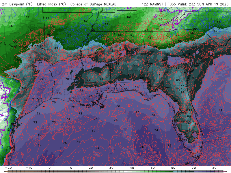
Noticing the models are mixing out low level moisture in a large swatch across the risk area during the day tomorrow from surface heating. Check out the surface dewpoint map below. That could really lessen the tornado/severe threat atleast for a time tomorrow afternoon/evening. LCLs get pretty high
-
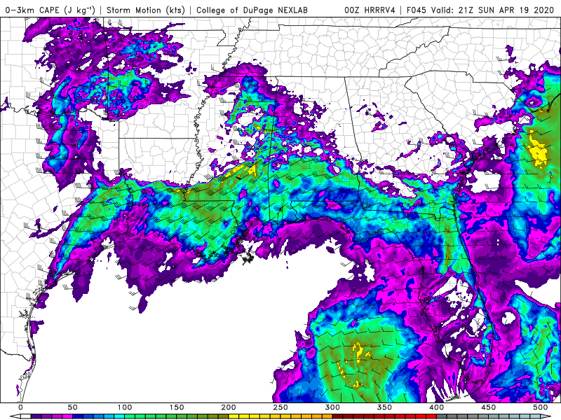
Lots of 0-3km CAPE showing up on the HRRRv4
1km SRH is also high
Several signs pointing to another dangerous tornado environment across the deep south Sunday
-
 1
1
-
-
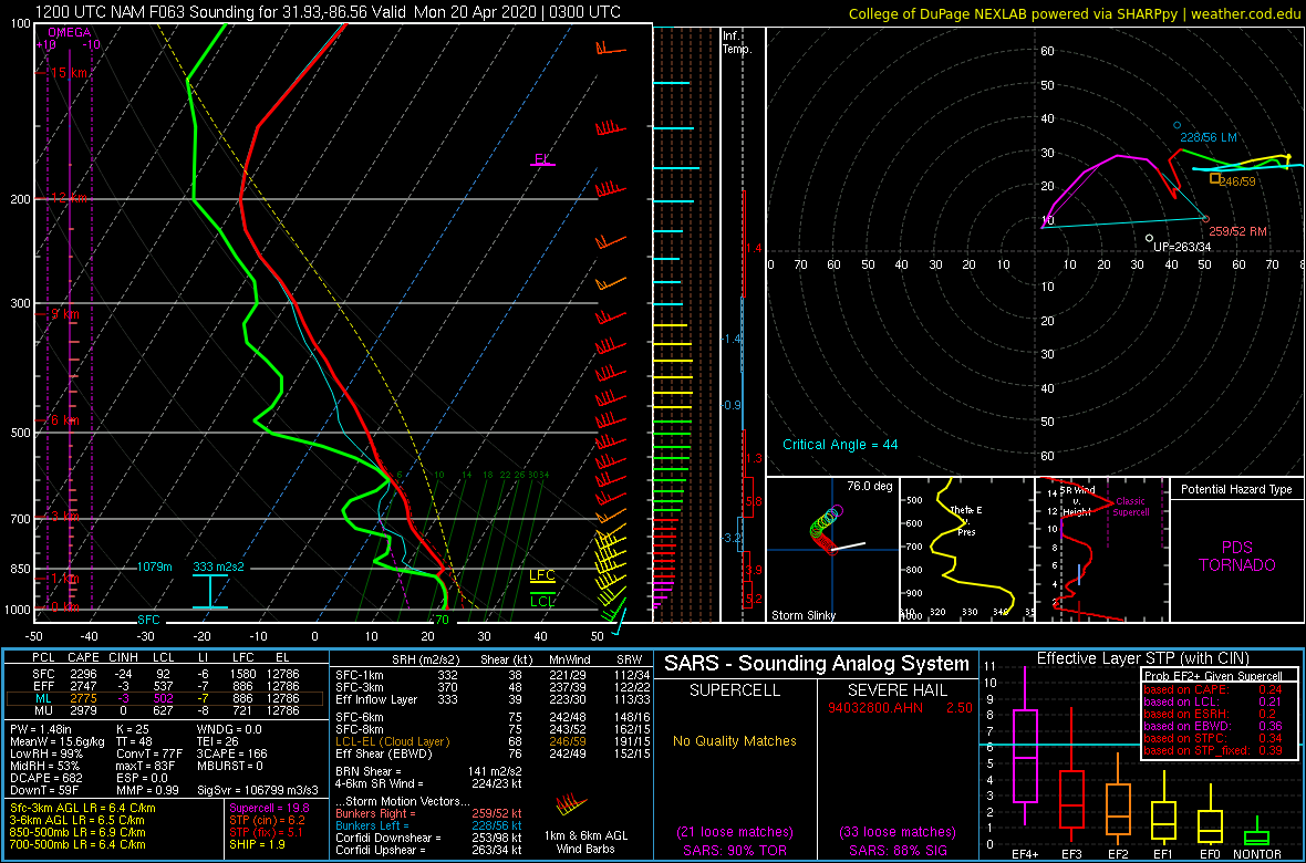
Loaded gun sounding on the 12z NAM in southern Alabama

-
30 minutes ago, LansingWeather said:
Very true but those people have the most incredible videos. As long as they understand the risk then that is their choice.
I watched this video this old guy filmed. It was the most amazing video i've ever seen, not sure where it was taken but it shows a tornado come directly over his house. Unfortunately it killed his wife but somehow he was relatively ok.
I think your talking about this video. Taken in Fairfield, IL in April 2015. An amazing video but also sobering knowing what happened -
7 minutes ago, BrandonC_TX said:
Tuscaloosa reporting 72/70, so there is plenty of humidity around. While the circulation near Union is weakening, the situation could change quickly given other parameters.
That storm doesn't seem to be in an overly favorable tornado environment atm. Low level lapse rates/3km cape are poor. I certainly wouldn't let my guard down in Tuscaloosa though. Things can change fast
-
Latest HRRR run is pretty concerning. It shows a string of pearl supercells forming and sweeping east across the SE tonight
-
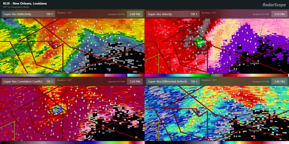
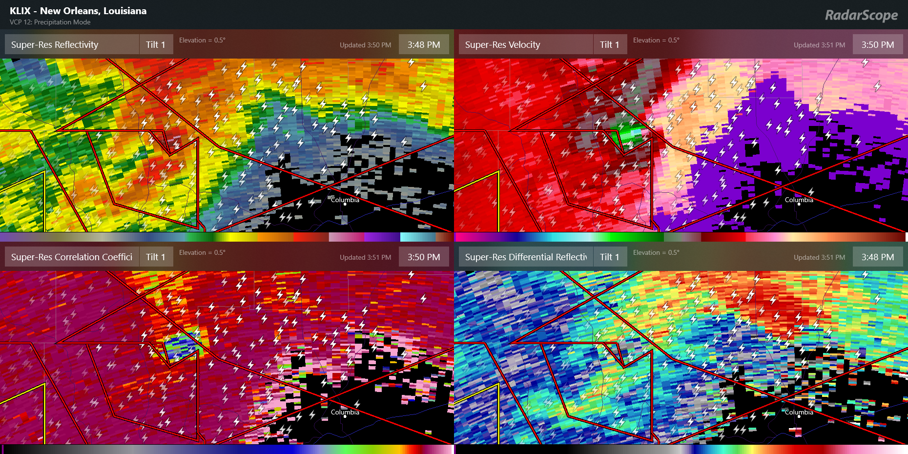
Two debris balls on radar about 40 miles from each other moving over the same area. Insane

-
1
-
-
Just now, StormySquares said:
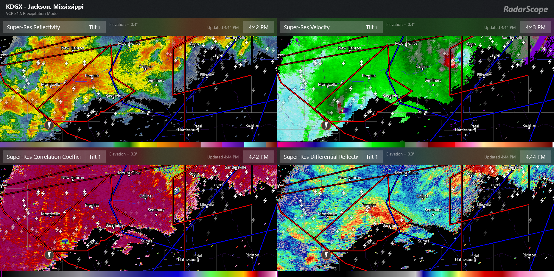
No big cc hole on the storm now, is it still on the ground?
The couplet over Bassfield is insane right now. Latest scan showed CCs lowering over Bassfield but too soon to tell if its debris
-
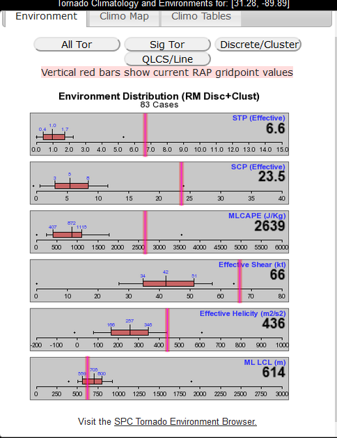
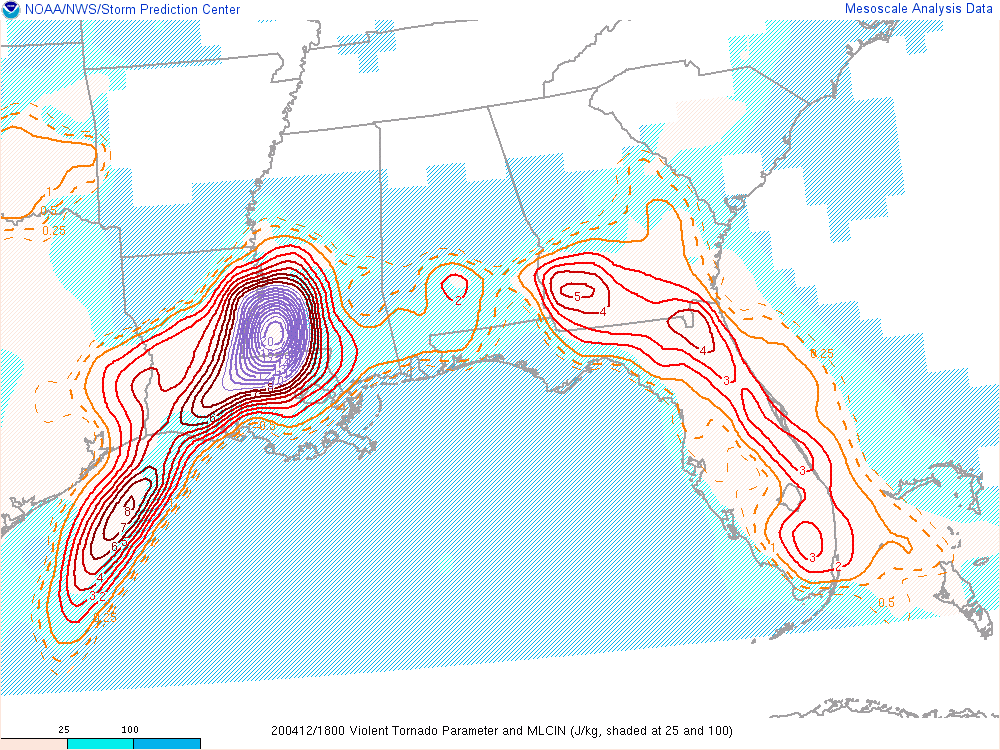
Environment breakdown on that tornado emergency cell from the SPC meso page. Talk about a pristine environment
-
Not going to see a clearer debris ball than this
-
Violent tornado parameters are off the charts in SW Mississippi
-
1
-
April 19th Severe Event
in Southeastern States
Posted
Ya I have my doubts to. CAMs seem to be to aggressive mixing out at times. Something to keep an eye on though