

Snowstorm920
-
Posts
91 -
Joined
-
Last visited
Content Type
Profiles
Blogs
Forums
American Weather
Media Demo
Store
Gallery
Posts posted by Snowstorm920
-
-
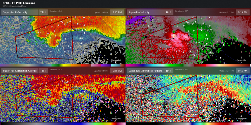
Wow that couplet is really getting its act together
-
That is one heck of a couplet forming just east of Woodworth
-
Definite debris ball
-
2 minutes ago, 1900hurricane said:
I wonder if it’s starting to collapse now. Not much rotation anymore. There’s a big spike in reflectivity, which would suggest the opposite, but maybe some of the hail that has been suspended in the updraft is starting to fall out all at the same time as the updraft weakens. Not sure, just speculating.
EDIT: really doesn't look that way now...
Check out the Lake Charles scans of the cell. Still excellent structure and rotation.
-
 1
1
-
-
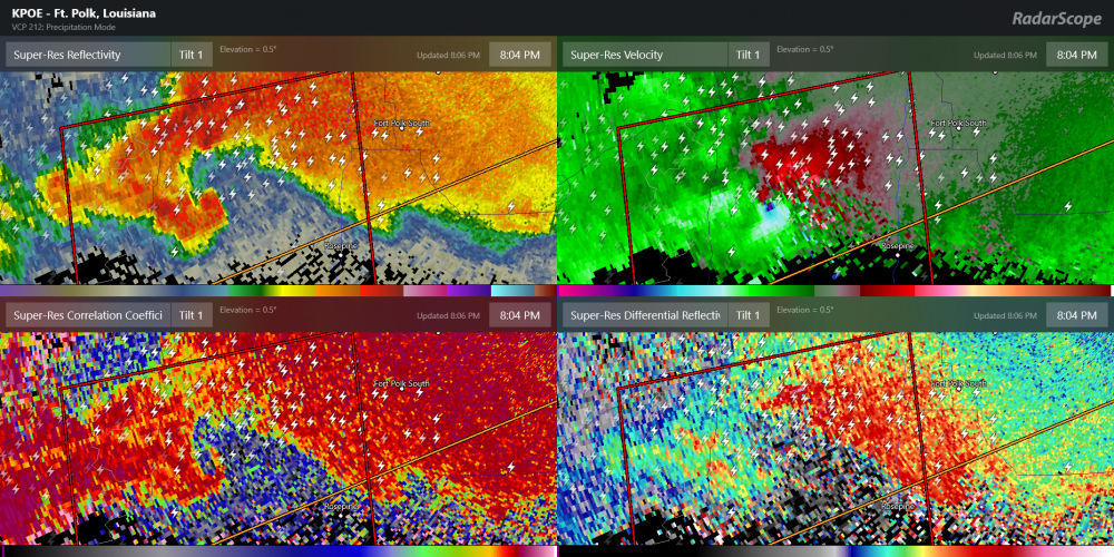
Looks like a TDS again
-
1 minute ago, JasonOH said:
The eastern circulation is side lobe so there aren’t twins. It’s centered over the inflow region, not the hook.
Yep just switched radars and no sign of two couplets
-
1 minute ago, vman722 said:
Was thinking the same. What an incredible storm.
Definitely looks like twins on the latest scan
-
Might have some twins
-
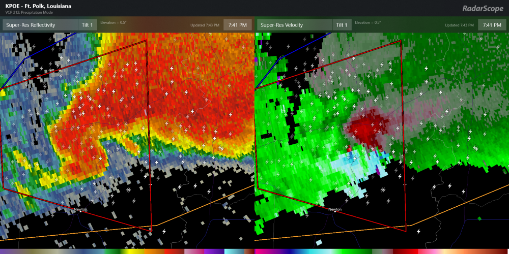
Rotation seems to be tightening up again
-
Current motion looks to take it right into Jasper. Not good
-
The radar presentation of that cell is amazing currently
-
6 minutes ago, Bob's Burgers said:
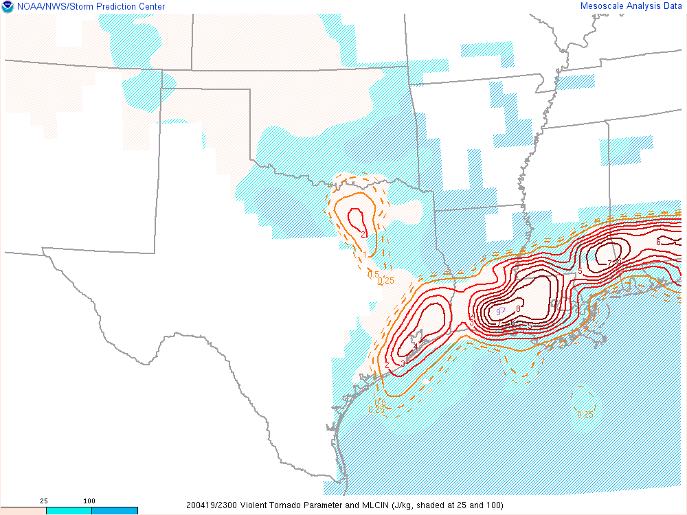
Right in the STP bullseye... again... ugh
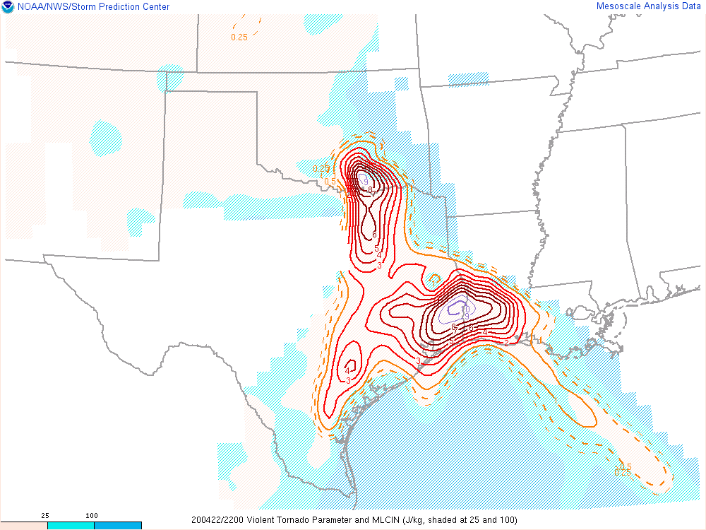
Check out the Violent Tornado Parameter(conditions for EF4/5 tornadoes). That cell is moving into a very favorable environment
-
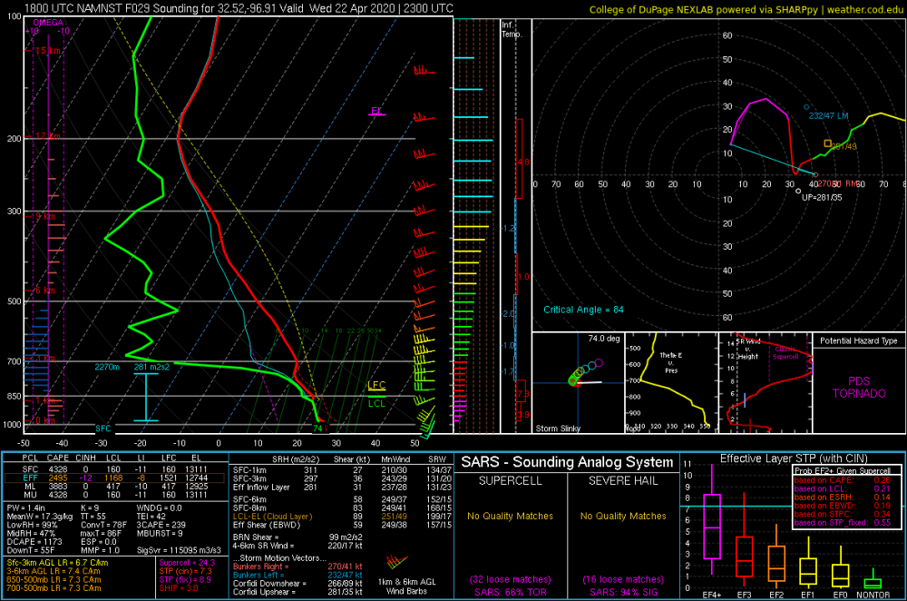
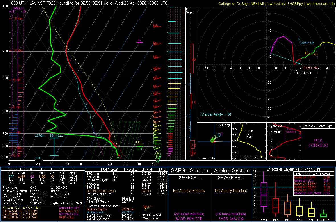
A bit of veer back in the profile otherwise this is an ominous sounding over DFW tomorrow evening. Taken from the 3km NAM with a supercell forming
-
18 minutes ago, Wmsptwx said:
Dixie Alley has kinda taken over in recent history. Tornado alley has had its moments obviously, but it feels we’re tracking Alabama, MS, TN far more often.
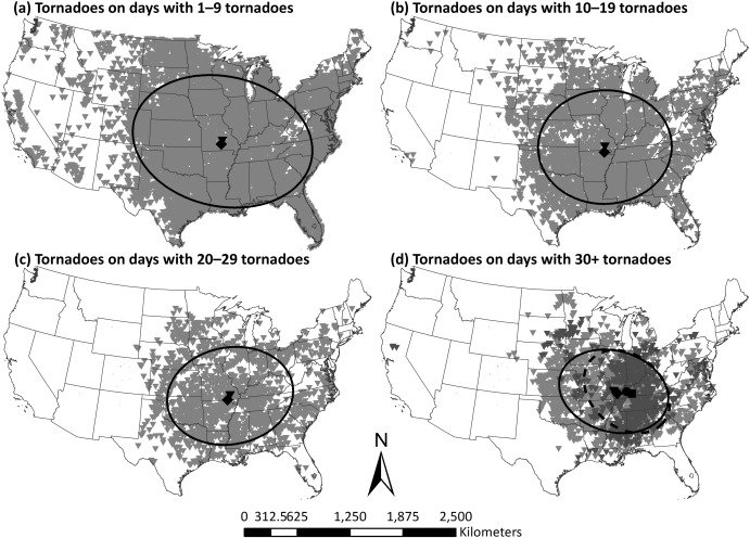
I always found this chart from this article interesting. Study period was 1974-2015. Large outbreaks are almost always focused east of Tornado Alley
-
1 hour ago, DanLarsen34 said:
Dixie Alley is tornado alley at this point.
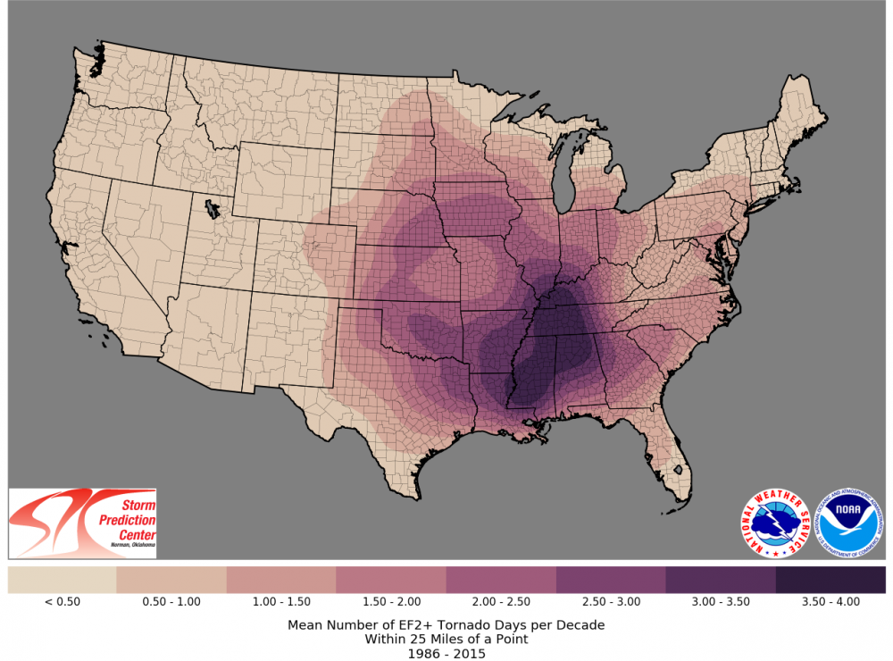
Mean number of EF2+ tornado days per decade from 1986-2015
-
1
-
 2
2
-
-
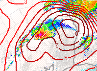
KEOX Radar has 102mph winds just 2.5k feet off the ground
-
Pretty good couplet just west of McIntosh
-
Might be trying to wrap up again just south of Hattiesburg
-
1 minute ago, Wmsptwx said:
About disappeared on CC.
Differential Reflectivity shows a debris ball
-
3 minutes ago, cheese007 said:
Might be on Reed's stream as well? Camera keeps flinging around
I think his phone mount in his car broke
-
That could definitely be a wedge on the ground. Velocities are showing a very impressive couplet
-
3 minutes ago, jojo762 said:
The difference between actual obs from VWPs and model (in this case RAP) forecasts is remarkable..
Ya there’s definitely something going on the modes aren’t catching. Be interesting to see how things evolve tonight. Some short range models are showing the environment becoming increasingly favorable for tornadoes as the night goes on
-
2 minutes ago, WestTennWX said:
Good call....Tornado warned now
The environment that cell is in is very favorable for strong to violent tornadoes
-
Latest run of the RAP really has the tornado threat increasing after sunset with the LLJ cranking up. Sig Tors actually rise after dark and continue to rise all night long


Severe Weather for 4/19-4/23
in Central/Western States
Posted
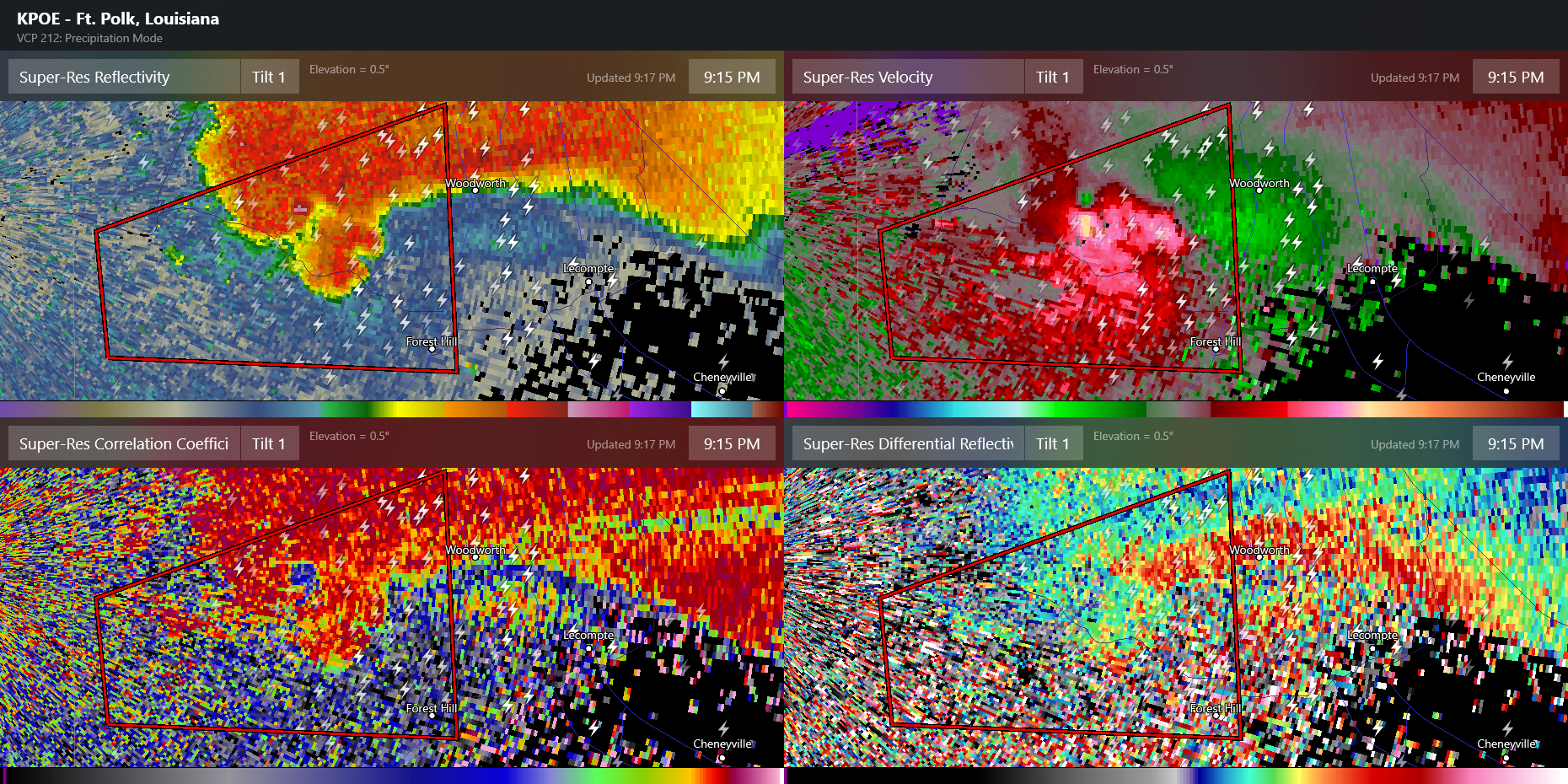
That cell just south of the KPOE site is in a pretty ripe environment. Might have to keep an eye on it