Snowstorm920
-
Posts
91 -
Joined
-
Last visited
Content Type
Profiles
Blogs
Forums
American Weather
Media Demo
Store
Gallery
Everything posted by Snowstorm920
-
Ya I have my doubts to. CAMs seem to be to aggressive mixing out at times. Something to keep an eye on though
-
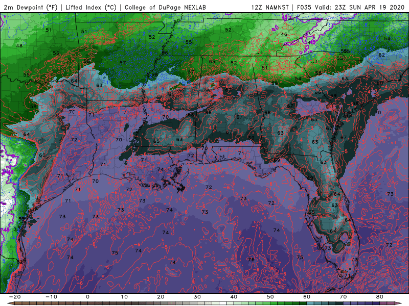
Noticing the models are mixing out low level moisture in a large swatch across the risk area during the day tomorrow from surface heating. Check out the surface dewpoint map below. That could really lessen the tornado/severe threat atleast for a time tomorrow afternoon/evening. LCLs get pretty high
-
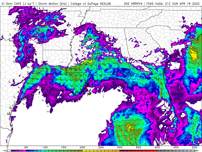
Lots of 0-3km CAPE showing up on the HRRRv4 1km SRH is also high Several signs pointing to another dangerous tornado environment across the deep south Sunday
-
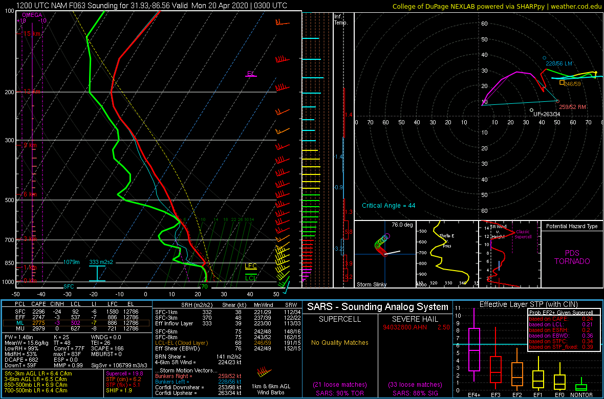
Loaded gun sounding on the 12z NAM in southern Alabama

-
I think your talking about this video. Taken in Fairfield, IL in April 2015. An amazing video but also sobering knowing what happened
-
That storm doesn't seem to be in an overly favorable tornado environment atm. Low level lapse rates/3km cape are poor. I certainly wouldn't let my guard down in Tuscaloosa though. Things can change fast
-
Latest HRRR run is pretty concerning. It shows a string of pearl supercells forming and sweeping east across the SE tonight
-
Two debris balls on radar about 40 miles from each other moving over the same area. Insane

-
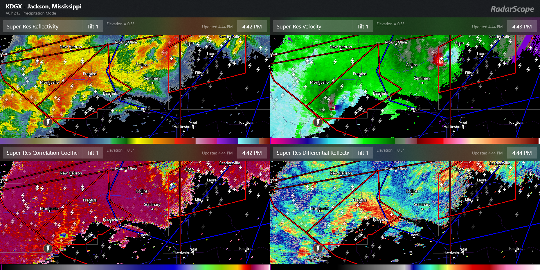
The couplet over Bassfield is insane right now. Latest scan showed CCs lowering over Bassfield but too soon to tell if its debris
-
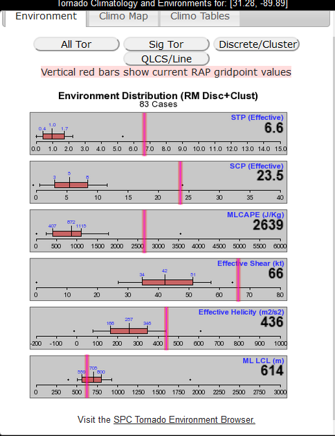
Environment breakdown on that tornado emergency cell from the SPC meso page. Talk about a pristine environment
-
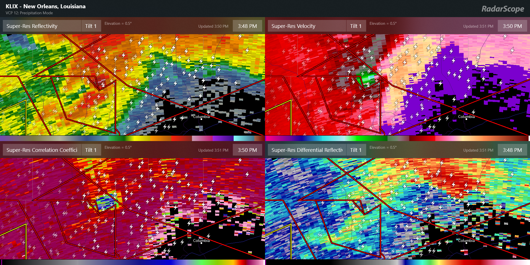
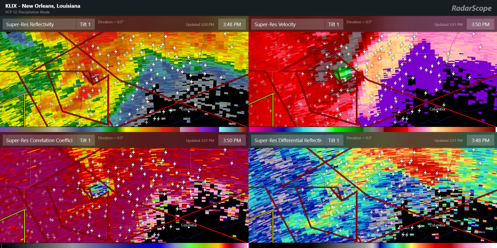
Not going to see a clearer debris ball than this
-
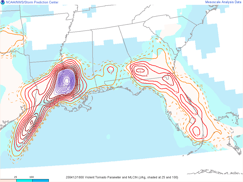
Violent tornado parameters are off the charts in SW Mississippi