

Snowstorm920
-
Posts
91 -
Joined
-
Last visited
Content Type
Profiles
Blogs
Forums
American Weather
Media Demo
Store
Gallery
Posts posted by Snowstorm920
-
-
Tornado Emergency now
-
There is a lot of infrastructure in Newnan where the couplet is headed
-
Still a very prominent TDS...
-
Prominent TDS now
-
2 minutes ago, Wmsptwx said:
Looks like it lifted
Still looks like a small debris ball on the Atlanta radar
-
 1
1
-
-
Just now, Snowstorm920 said:
Latest velocity scan from KMXX has that wedge look to it
Almost 80kts of vertical rotation
-
Latest velocity scan from KMXX has that wedge look to it
-
1
-
-
-
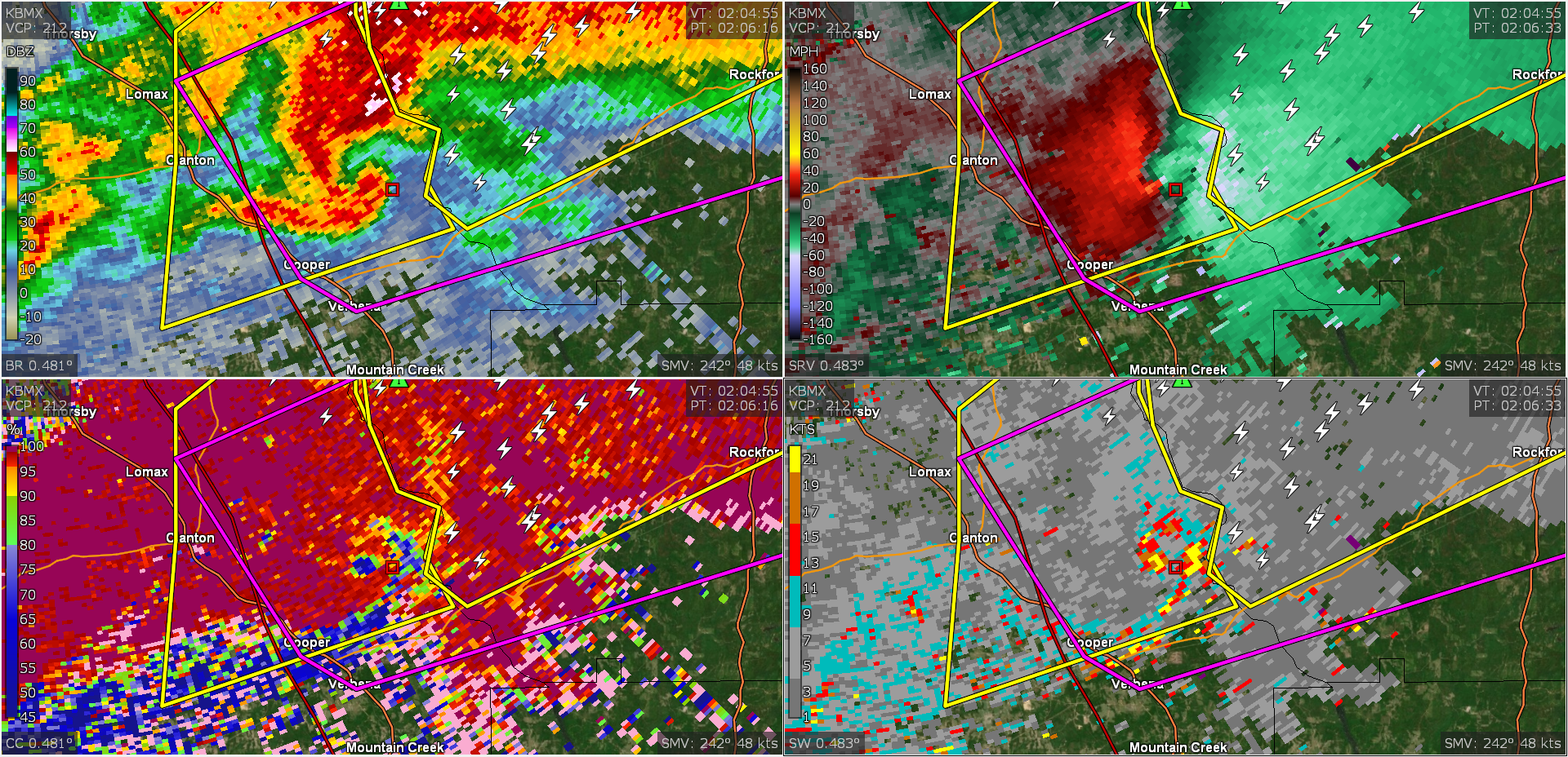
Looks like a TDS on the cell near Moutain Creek
-
Just now, dan11295 said:
looks like that storm weakened a bit on the last scan?
Lots of rain developing in its inflow. That might weaken it
-
70kts of vrot on the latest scan
-
Thankfully that monster looked to miss the most densely populated part of Greensboro
-
Rotation really tightening up near Forkland Alabama
-
Possible debris showing up on that cell north of Eutaw
-
Just now, DanLarsen34 said:
Reed confirmed this to with his drone in the air
-
1
-
-
Strong rotation just east of Gainesville, AL
-
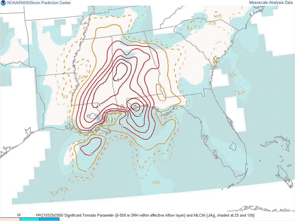
2 minutes ago, VOLtage said:
Those cells in Southern mississippi look like they have lots of potential
SigTor values are very high around those cells
-
 1
1
-
-
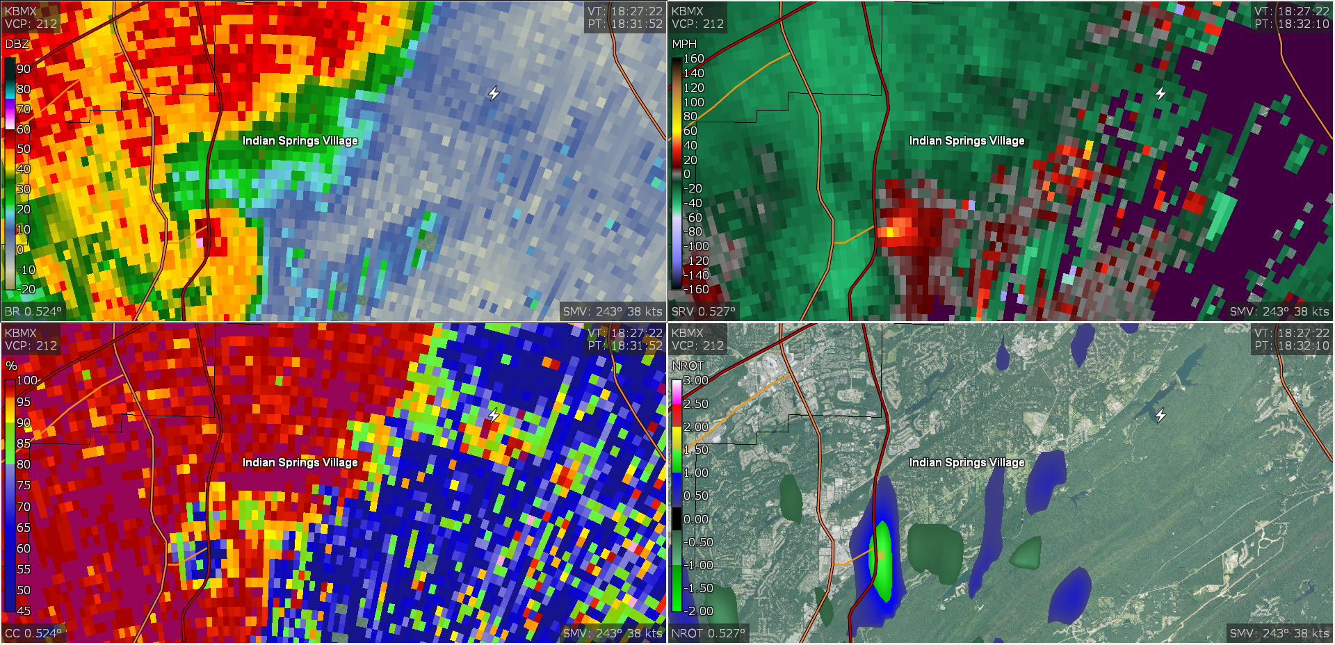
Possible TDS just north of Pell City
-
That cell might be trying to tighten up again. Clear ZDR arc present
-
That's on the ground

-
Tightening back up and possible TDS again
-
Debris ball showing up on CC and ZDR
-
Tornado warning on that AL cell extended well NE into Birmingham suburbs
-
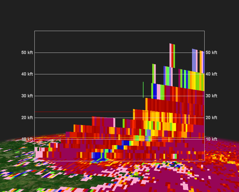
Looks like CC had debris getting up to 20k feet
Severe Event March 25th 2021
in Southeastern States
Posted