
WHEATCENT
-
Posts
290 -
Joined
-
Last visited
Content Type
Profiles
Blogs
Forums
American Weather
Media Demo
Store
Gallery
Everything posted by WHEATCENT
-
Dang being in a ECMWF and Canadian bullseye 7 days out
-
It was a nice early November set up where it was too warm for anything to accumulate within a mile of the lakeshore
-
Lake effect warning til 7pm seems the winds are a bit more west friendly this time
-
1st blizzard warning in 10 years
-
Nws is seeing 12-15 but uh....well ill hope

-
HRRR quite aggressive with temps afternoon Friday around -5... ezgif-5-bb61155495.mp4
-
hahaha if only

-
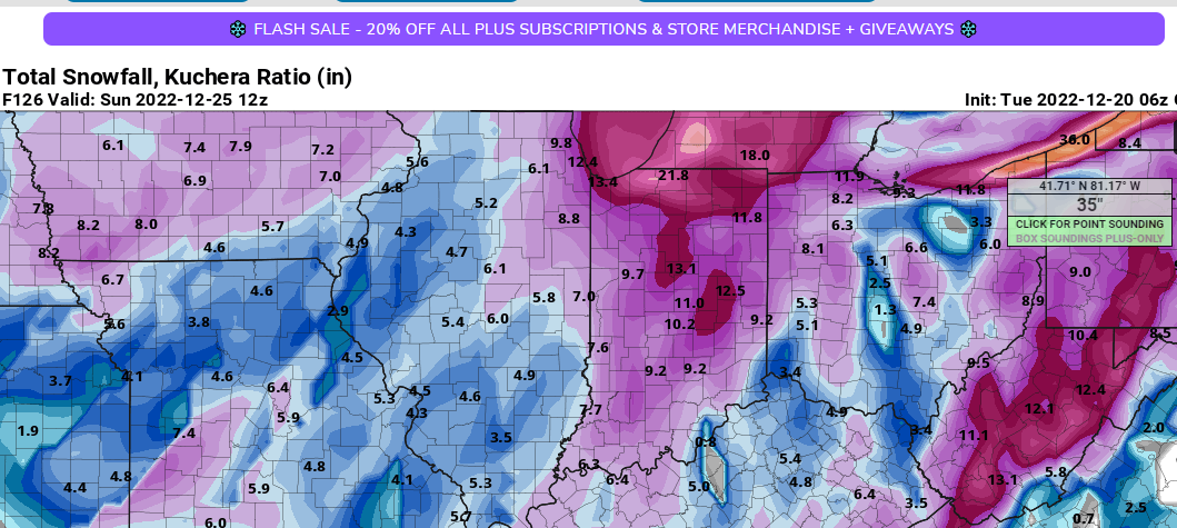
gfs consistent with at least giving the lakeshore of lake and ashtabula significant accumulations but don't have much faith in that actually verifying, and it seems without it inch or two from the main storm now.
-
i was a bit negative this morning my bad. shouldn't get worked up over the models. been a bad week
-
well model trends no so good. congrats michigan and indiana typical 40s and rain then 10 degrees and no snow
-
sweet gfs run tonight
-
prob will change as the models do but both the canadian and Euro have us dropping from near 50 to 0 in like 6-12 hours 22nd/23rd LOL
-
such a depressing December forecast not counting the like 2 weeks before this too.
-
The Canadian is the only one that favors the lake county lakeshore not sure how i feel about that haha
-
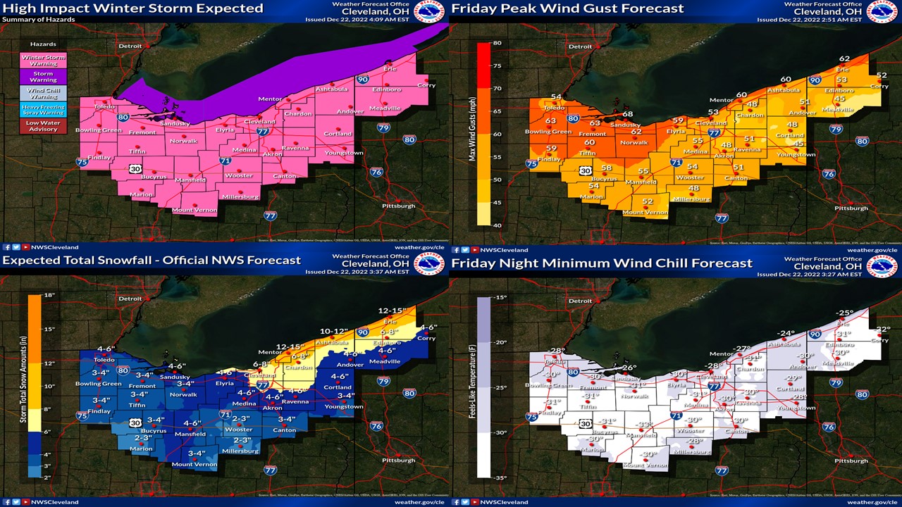
NWS watch posted, interesting.
-
Hmm wonder what made my pivotal image disappear Unfortunately the band never set up here just missed KCLE - Precipitation Depiction, 1_37 AM.mp4
-
dang lol the HRRR is pretty consistent in giving me 8-12 in far north Mentor
-
Damn lake effect thunder i feel like this is kinda uncommon
-
If only this was November KCLE - Super-Res Reflectivity Tilt 1, 9_53 AM.mp4
-
ready for around 90 on Friday and then mid 50s for Sunday haha
-
the struggle to hit 60 around here this spring when forecasted 70 is real lmao
-
I mean i'll take whatever the RAP is smoking. (even if it's sleet)
-
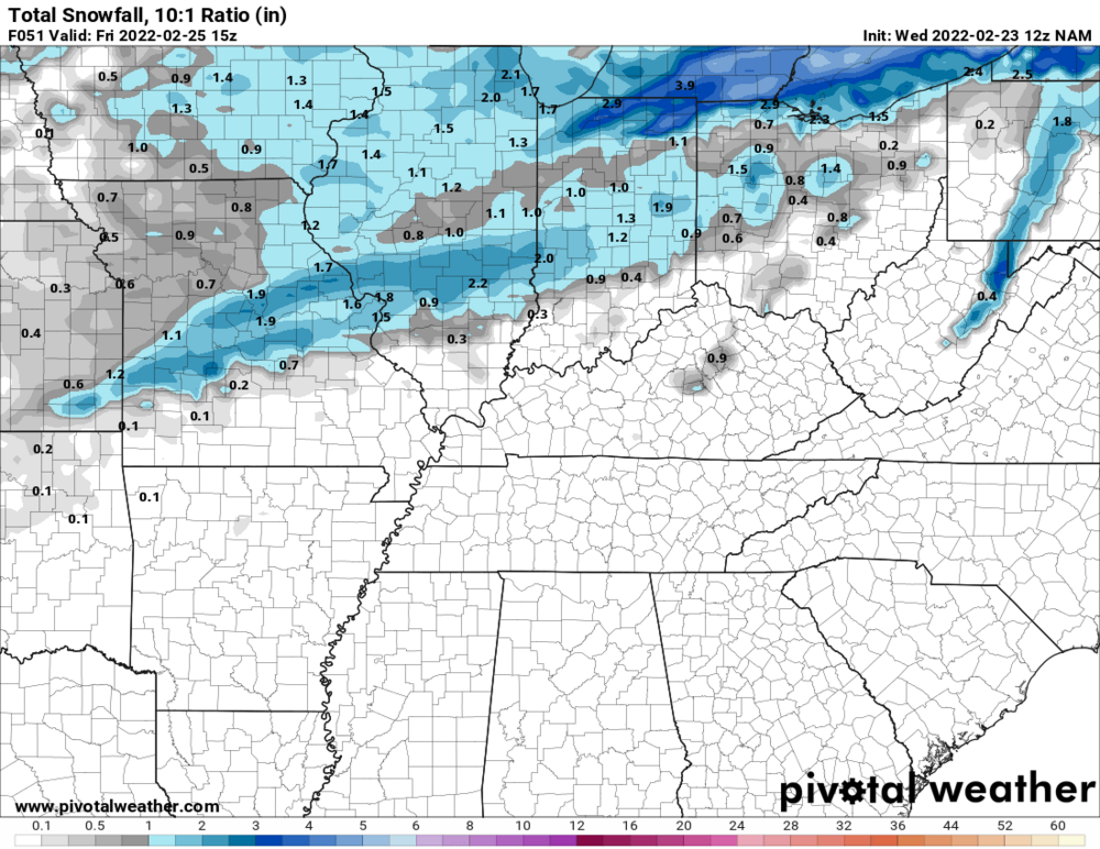
NAM not looking interested for any accumulation.
-
Damn upgraded to warning
-
Orrville is in Wayne County looks kinda close to Orwell tho which is in Ashtabula