Weather Will
-
Posts
6,327 -
Joined
-
Last visited
About Weather Will

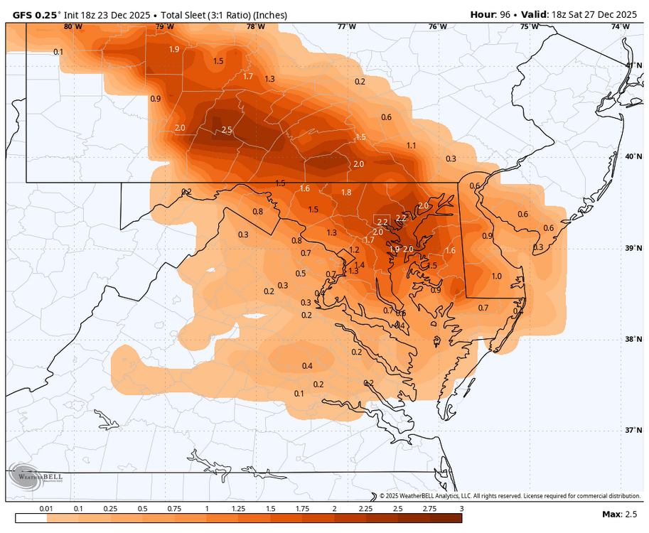
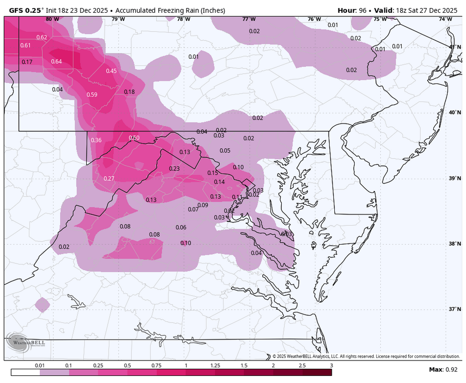
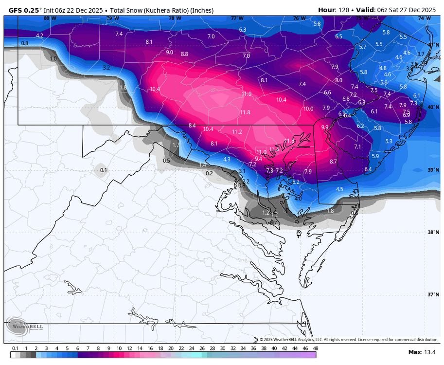
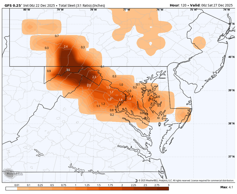
- Currently Viewing Topic: Boxing Day Ice Ice Baby!
-
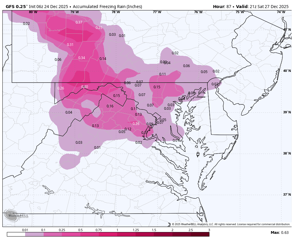
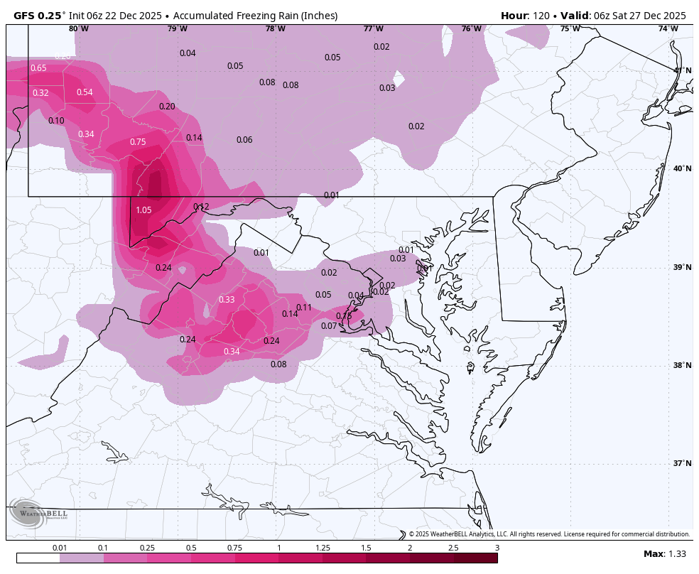
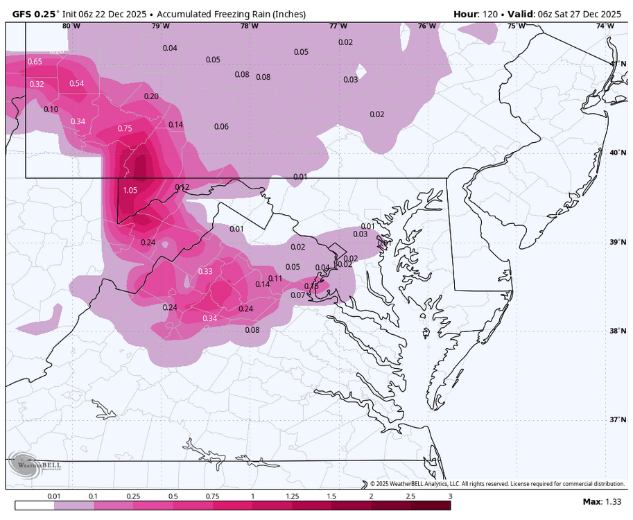
WB 6Z GFS
-
I think we go from torch to icy/ cold rain this storm with a more positive long range and call it a win...
-
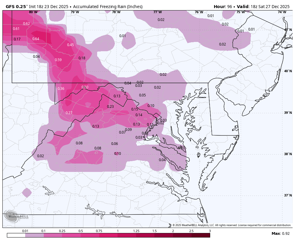
WB 18Z GFS
-
WB 6Z GEFS. No support for operational run in the 5 day storm,

-
I think it is going to be a wild ride this winter....it may not work out but it will be fun to find out!
-
Where is the torchmas? WB 6Z GFS...
-
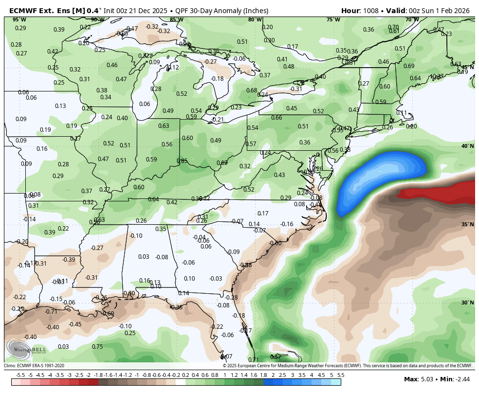
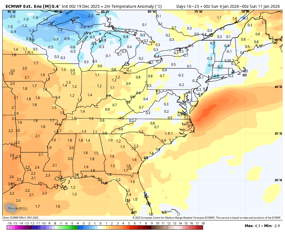
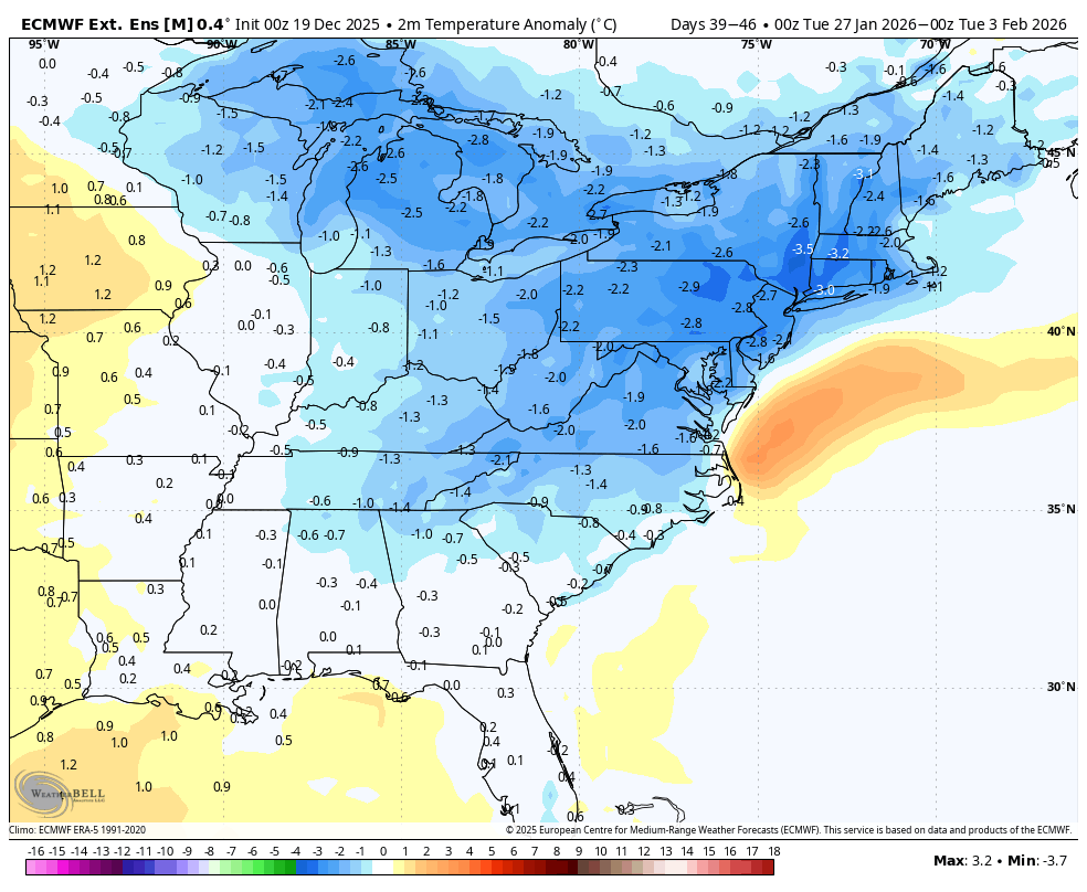
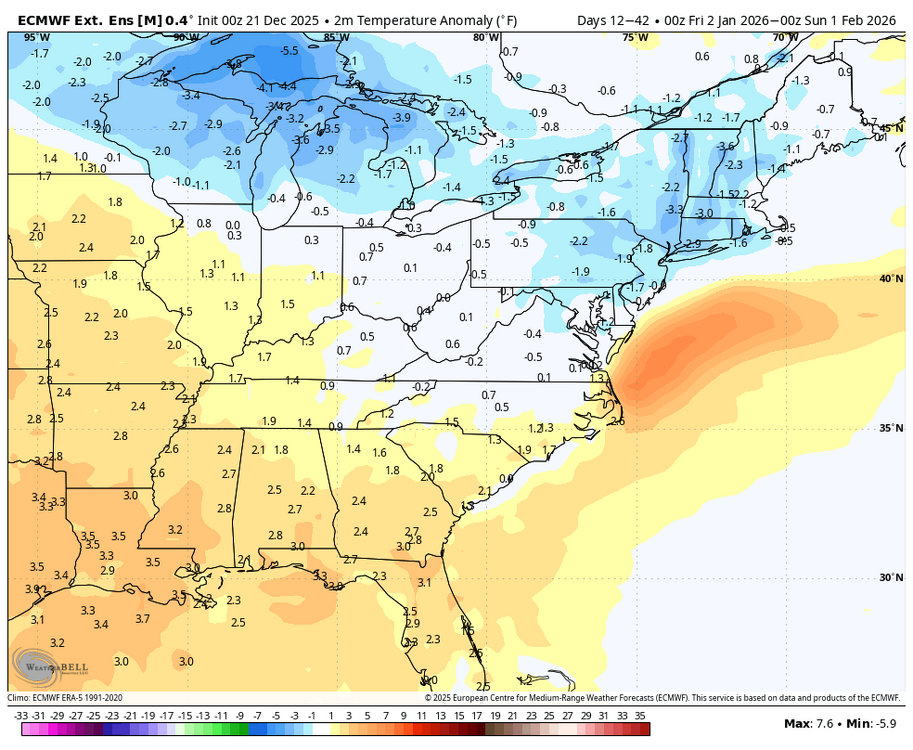
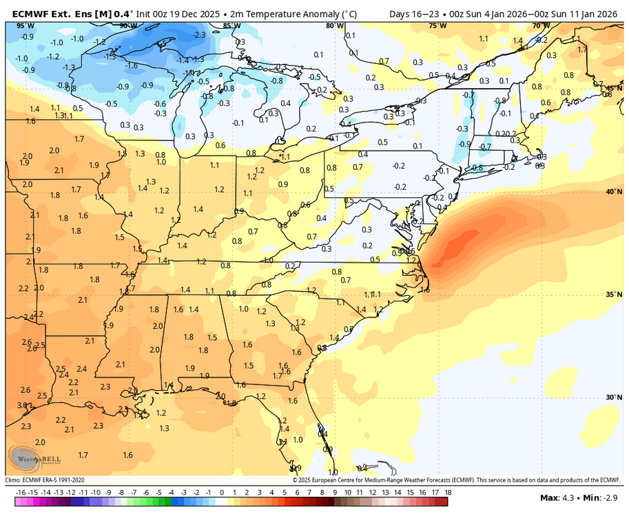
WB extended EPS 30 day anomalies for Jan.

-
EPS daily extended ticked colder this run with normal temps into second week of January and with below normal end of January into early February. Control is much colder. Definitely not a "winter is over" run.
-
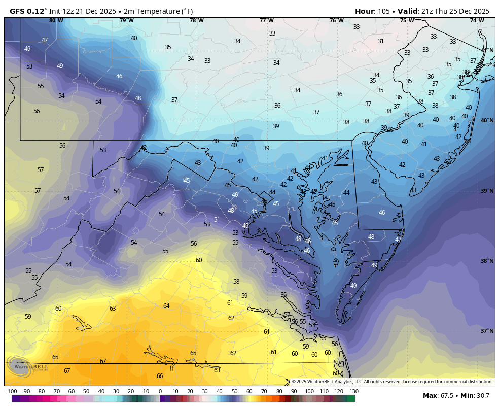
WB 12Z GFS for Christmas....rain and 40s....our specialty. Also perfect example on taking models with a BIG grain of salt outside a few days. No torchmas, just rawmas...

-
WB 18Z EURO stays below 50 on Christmas...
-
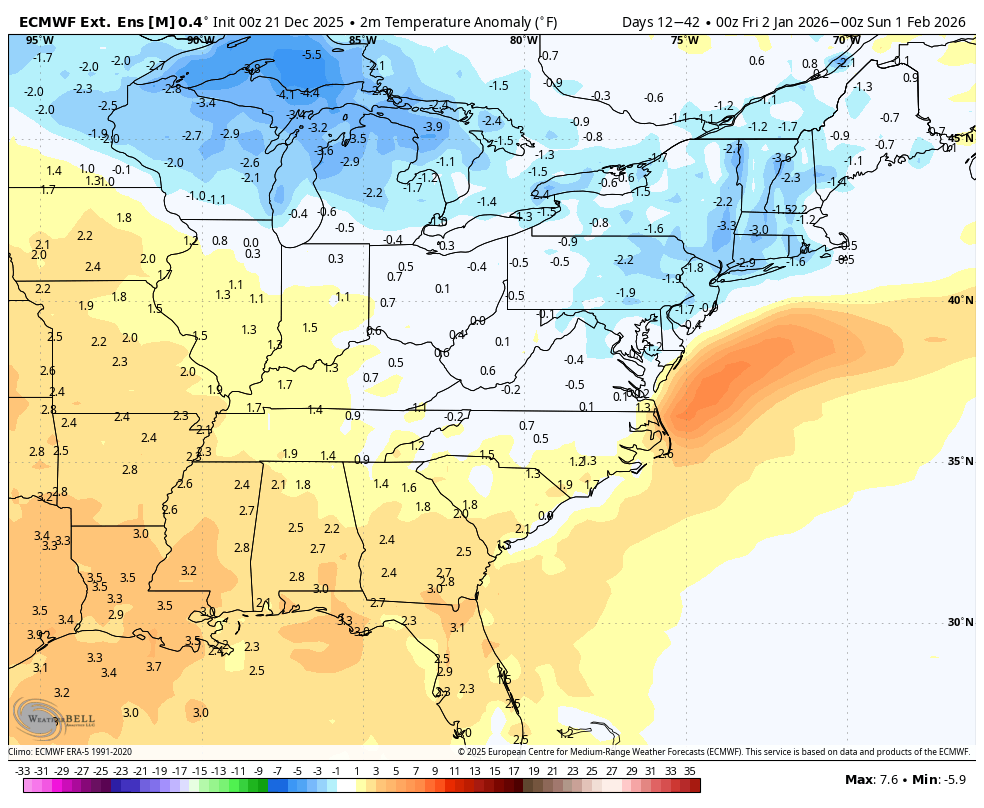
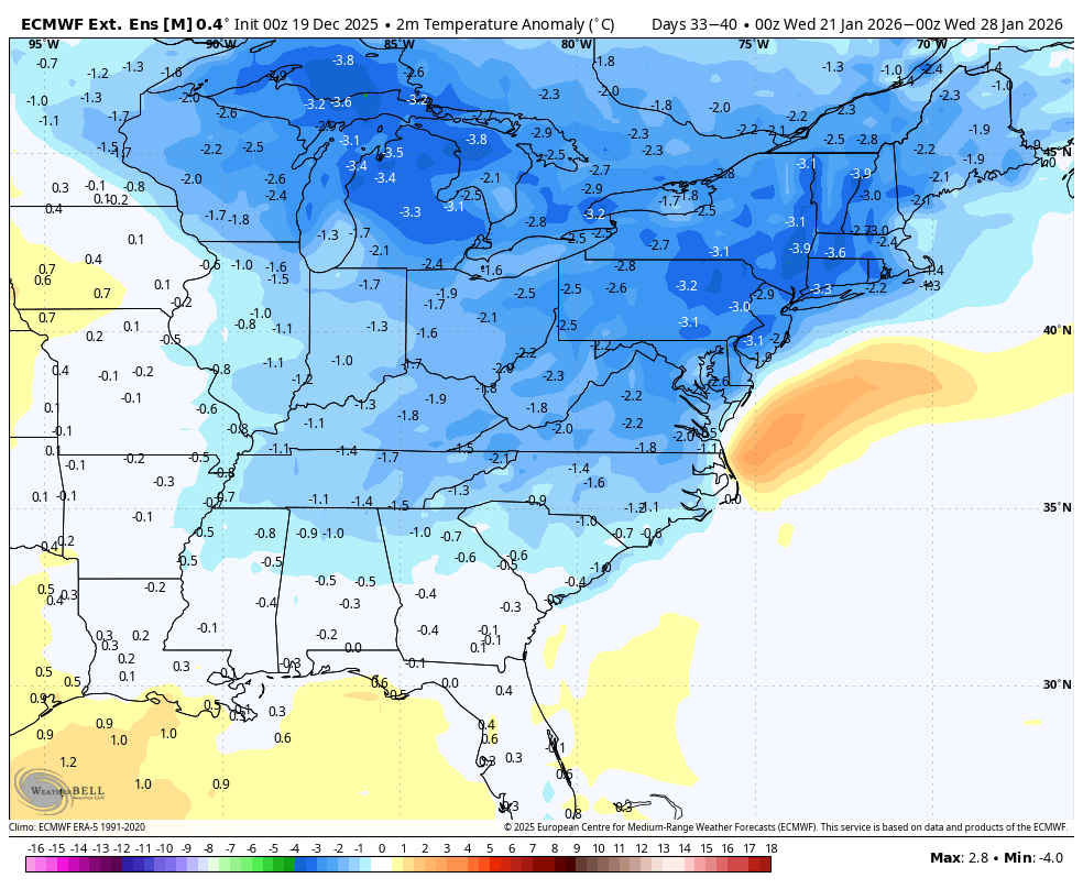
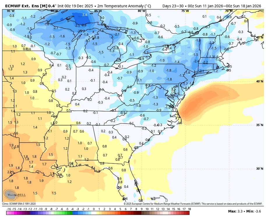
Latest Euro weeklies really cut back on the below normal cold air for January. Hopefully just a blip...
-
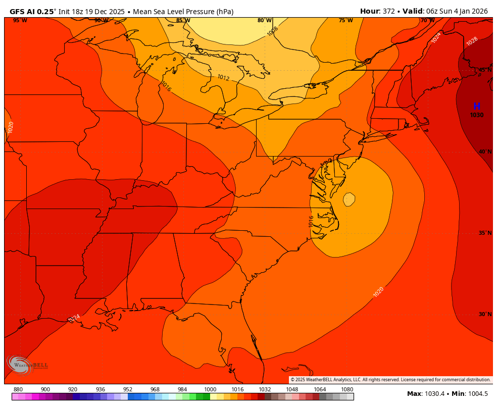
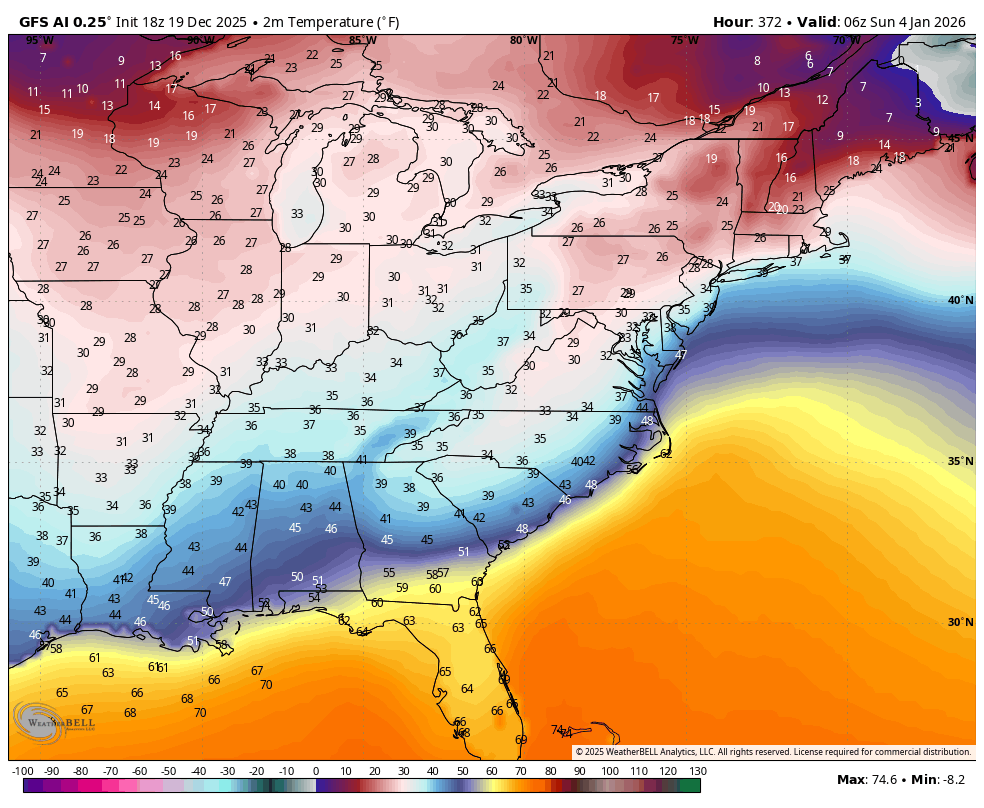
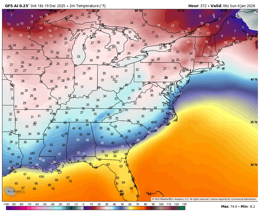
Anyone know anything about the AI GFS....trying to form a coastal after the NY....(WB 18Z). Too many models...it would be nice if one of them would start to stand out like the EURO used to....

-
WB latest EURO weeklies bring normal temps by week ending Jan. 10. Rest of month is below normal.

-
I only post those in the digital thread now, I try not to piss off Cape.....
-
Why do you care what a global model is showing at hour 360?!!!! They are rarely right even at 120 hours out.