

Ecanem
-
Posts
126 -
Joined
-
Last visited
Content Type
Profiles
Blogs
Forums
American Weather
Media Demo
Store
Gallery
Posts posted by Ecanem
-
-
3 minutes ago, TimB84 said:
My threshold for what would be “acceptable” is 4” or more, and 0” of plain rain.
I see the NWS hasn’t issued a watch yet. We’re about 48 hours, maybe a little less, from onset, depending on which model you like. Is the lack of a watch due to not wanting to confuse the non-weather-enthusiast peasants before this event is completely done, or because they’re nervous about issuing one after this past model bust?
I can tell you
i would be apprehensive if I were them after this storm.
-
1 minute ago, Rd9108 said:
Id be happy with 6 inches after our last debacle.
I’ll take 2” as long as it’s not rain.
-
 1
1
-
-
1 minute ago, north pgh said:
A batch of heavier snow about to move in.
Hoping this front end over performs if just for a brief bit of joy.
-
9 minutes ago, Ahoff said:
It’s not the storm being in warm air it seems as much as the low going to our west, to naturally put us in the warm sector where warm is is basically the only solution.
And let be honest. Less than 48 hours ago. This low was looking like it would be on the NC/SC line. Now it’s going west and north of us!!
-
23 minutes ago, MikeB_01 said:
Honestly it sounds like they think anything can happen too. Maybe I’ve got my snow goggles on, but I’m feeling positive. I want to smell the sleet but never transition over to it. I’m pumped for the next 48 hours. LFG
.Call it luck but we certainly have seen the benefits of the last minute track changes this season.
-
 2
2
-
-
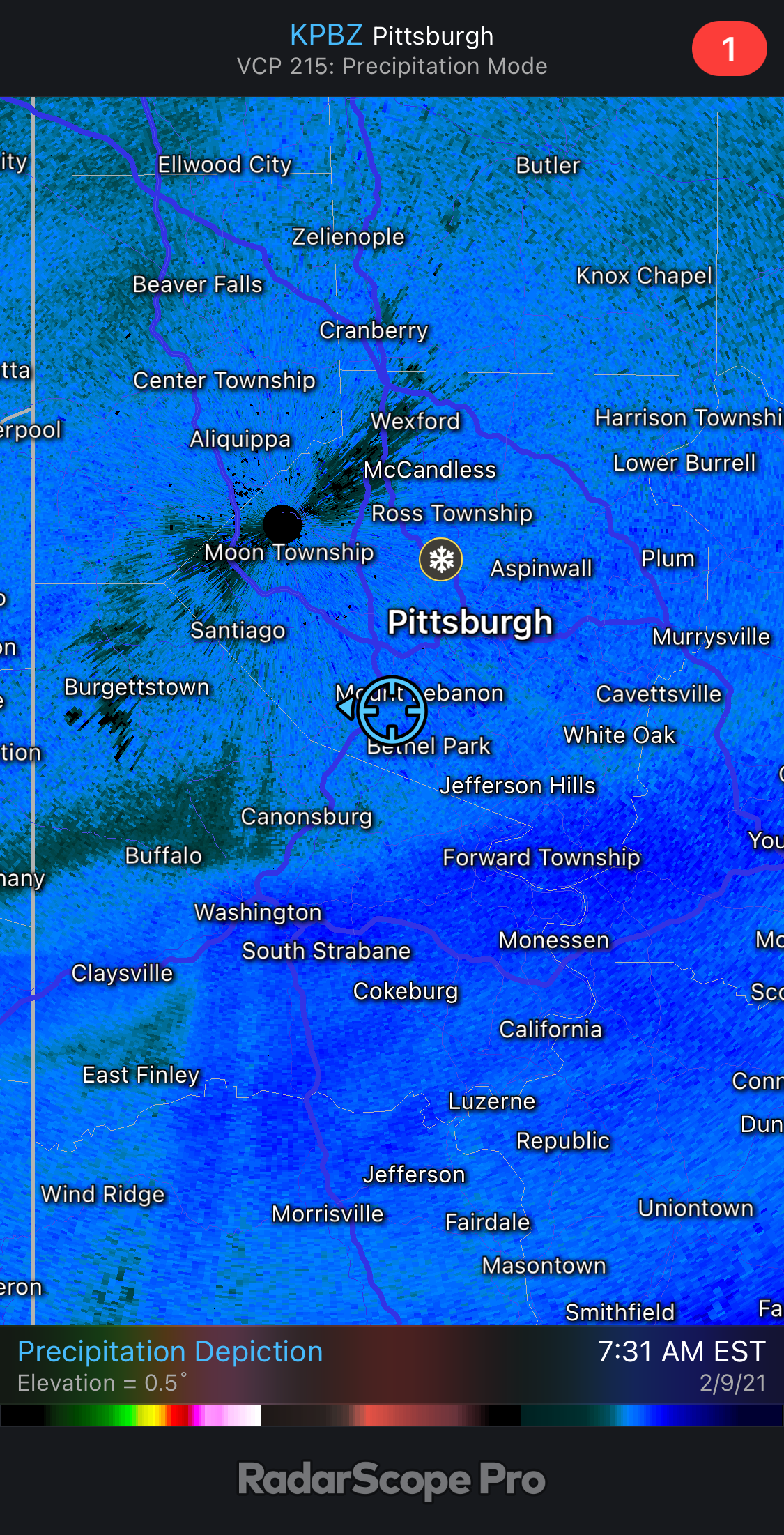
This cutoff is giving me nightmares from previous years.
-
The NAM manages to bring the surface low literally right over allegheny county.
-
NAM is running. Not looking good vs gfs so far for the second wave.
-
1 hour ago, Ahoff said:
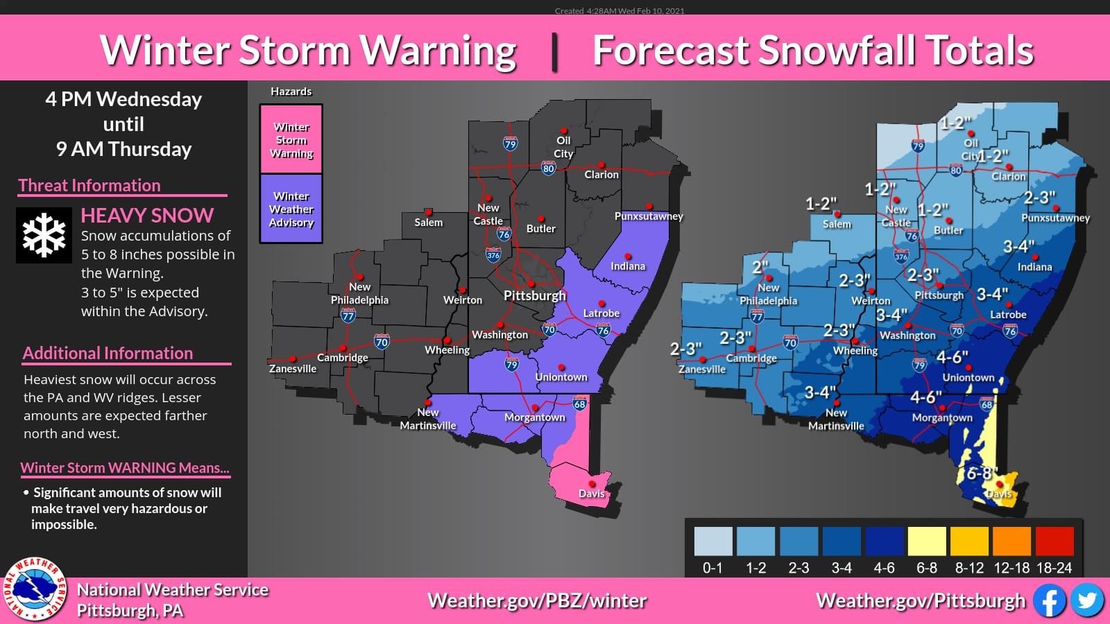
Also, age old theme to gripe about here, but why would NWS not put out some type of advisory, whether WWA or Storm Watch. They're calling for 6-8" right now, but the possibility isn't a lot of snow or little snow, it's a lot of snow, or snow and ice. Either one should get an advisory. I'm sure we'll have one but it'll probably go up tomorrow afternoon, smh.
Correct me if I am wrong but I thought watches and warnings are only issued 24h in advance. I thought past that it’s Hazardous weather outlook.
edit: looks like it’s max 48 hours. So we are still just getting into that range.
-
15 minutes ago, TimB84 said:
Agreed. Don’t get me wrong, I wouldn’t complain about 13.4 when it could have been 17.3, but too close for comfort.
I wouldn’t complain about 3” or 6” as long as it’s not rain.
-
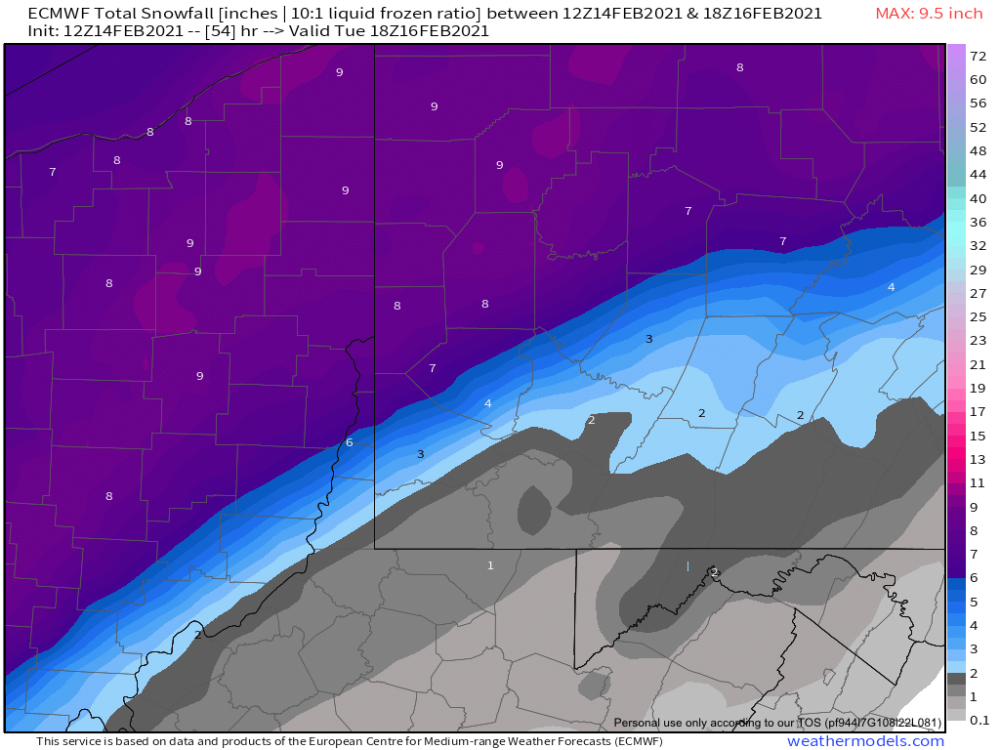
Euro right now seem to be caving to the GFS. Let's see how things go over the weekend.
-
45 minutes ago, Rd9108 said:
Looking at the Euro seems like it took a huge step back. 6z GFS looks about the same.
In what way? Sure the overalL totals are a little lower but I never really thought we would get 12”
edit: for the gfs that is. I just loaded the euro and it’s wet on tuesday.
-
Ugh. In the bullseye of the gfs 5 days out. It’s a curse I tell you.
-
So much to digest.
GFS shows basically nothing on Sunday while the Euro and Canadian border on ice to snow.
GFS and Euro are closer in alignment for Tuesday with a big hit but its very close.
Honestly there is so much activity it's hard to keep track.
-
1
-
-
1 hour ago, Ahoff said:
This already came down from 3-4" yesterday, so they look to be adjusting down.
Yesterday they were posting totals through Friday. This is just tonight. I don't think they are adjusting down.
-
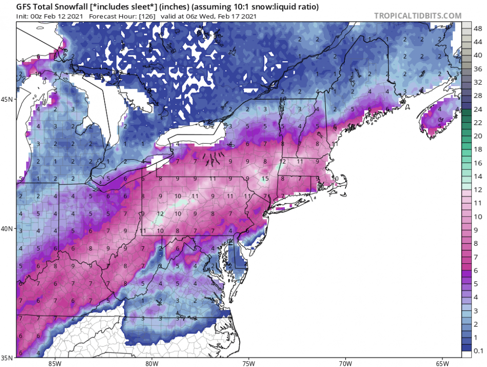
The nws seems to think we are getting more than most models are saying. Assuming because they are using ratios much higher than 10:1.

-
4.5” this morning. I’m about to get a little dry slot on me.
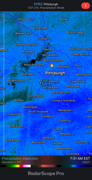
-
I’ve been sitting on the edge of the big snow for hours. Driving me nuts.
-
Apparently roads are a mess back in the south hills and city. I’m at seven springs and it’s clear here for now.
-
5 minutes ago, Rd9108 said:
3k NAM looks pretty warm at first with some mixing. No idea about the layers and what not that is above my pay grade.
Yeah when I switched over to my weather models sub and looked at the snowmap it looks west but the radar on tropical tidbits looks like it’s all snow. I’m guessing it has to do with the mixing layers
-
2 hours ago, Ahoff said:
Seems a little far east, no? Most guidance seems better for Eastern Ohio, but either way. Looks good here.
0z NAM looks like a track right on that patch. Looks like a jackpot for us. Hopefully it holds.
-
3
-
-
Wow that would be awesome
-
Running over 10” in the yard and 8” on the driveway in USC near Bridgeville.
Still snowing. This is probably the most we have had in a decade.-
2
-


Western Pa / Pittsburgh area Winter Discussion ❄️☃️
in Upstate New York/Pennsylvania
Posted
So back on the old accuweather forums. There was this adage that all big storms shift west around 24-48h before the storm.
Looking back at this last storm, I even said that being in the jackpot zone 48h out is a curse. Right now we see that zone in eastern pa and the DC area. So hoping we get that western shift to move the jackpot to us.
I would have to go back but I’m pretty sure the December storm was a similar shift.