

Ecanem
-
Posts
126 -
Joined
-
Last visited
Content Type
Profiles
Blogs
Forums
American Weather
Media Demo
Store
Gallery
Posts posted by Ecanem
-
-
I’m glad I stayed away from this up at springs this weekend. Between Friday and Today they got probably 6-8inches total. Bad part was tons of ice under the snow
-
30 minutes ago, CoraopolisWx said:
Euro still showing 1-2” for Sunday and 2-4/3-5 for Wednesday.
Not the big storm we want, but better than what we’ve had.Ill be up in the mountains, hoping for a good blast.
-
Just enjoying some mid-January thunder and lightning.
-
 1
1
-
 1
1
-
 2
2
-
-
Looking like MLK is our next chance. Euro and GFS are currently worlds apart.
-
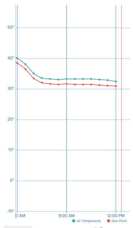
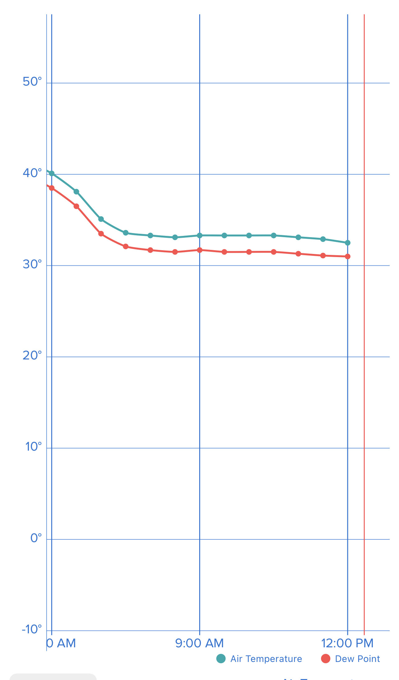
-3.3 DP -9.6 this is happening
12:40 slights raise to -3.1 but dew point -10.5
-
I’m down to -2.4 the dew point got down to -9.1 at one point but is now -6.6
-
11:05 AM 0 degrees. Dew point -4.5
-
Power is back on for me.
wind gust before power went out was 59.4 mph.
Current temp is 1.8 and dropping. -20 wind chill with sustained 20+ mph winds
-
My tempest recorded a 53mph gust before the power went out.
-
-
Power out and so is my tempest but I’ve lived on this hill through some big storms. The wind has never been as strong as it is right now. I would guess I’m getting 50-60mph gusts. My fascia has ripped off my (new) house
-
Great. I’m supposed to drive from Upper St Clair to Harrison City tomorrow for brunch with the in-laws And back. We drive a Yukon xl. Everything is telling me this is going to be a nightmare.
-
It's very interesting how this thing is shifting back east and multiple models are back to showing the coastal interaction.

-
2
-
-
7 minutes ago, Ahoff said:
Hmm...this isn't over.
When is it ever over? These things have shifted 100+ miles in 24 hours before. I cant remember the storm but one of the storms last year was projected to destroy the DC area with snow up until 24 hours out and then they got all rain and we got snow.
-
Back for another fun season.
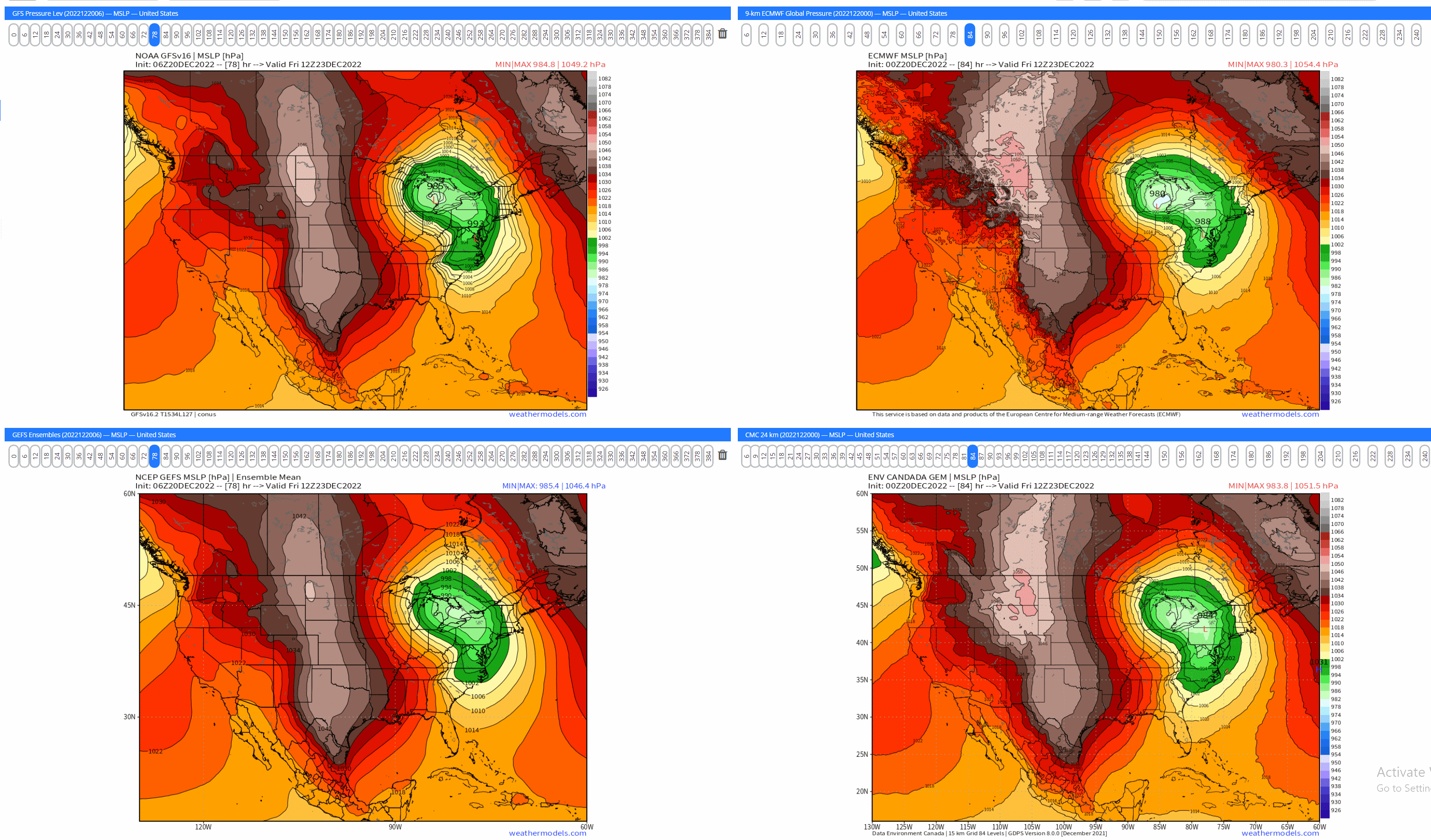
It looks like the models still don't have consensus on this thing.
ICON has this much further east and faster.
Euro is faster and West
GFS is west but slower
CMC looks like it still wants to transfer off the coast.
Obviously the bullseye a week out is bad. With that said, we have seen these things shift massively with just days notice. The energy for this looks like its not coming until Tuesday/Wednesday which means we have a lot of shifts to come.
-
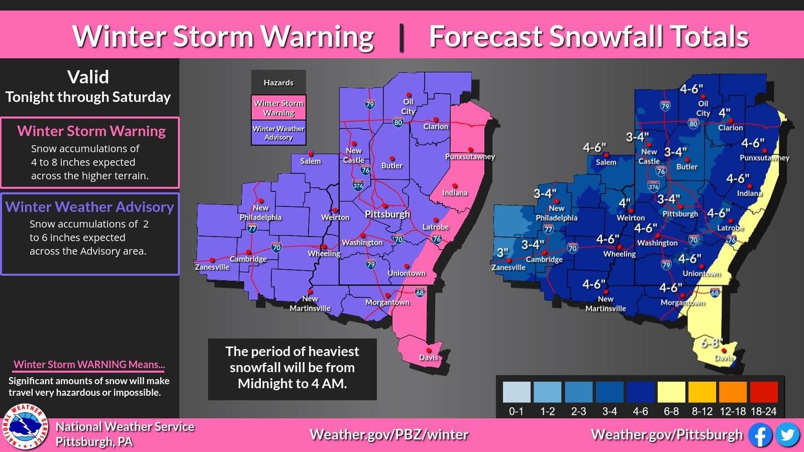
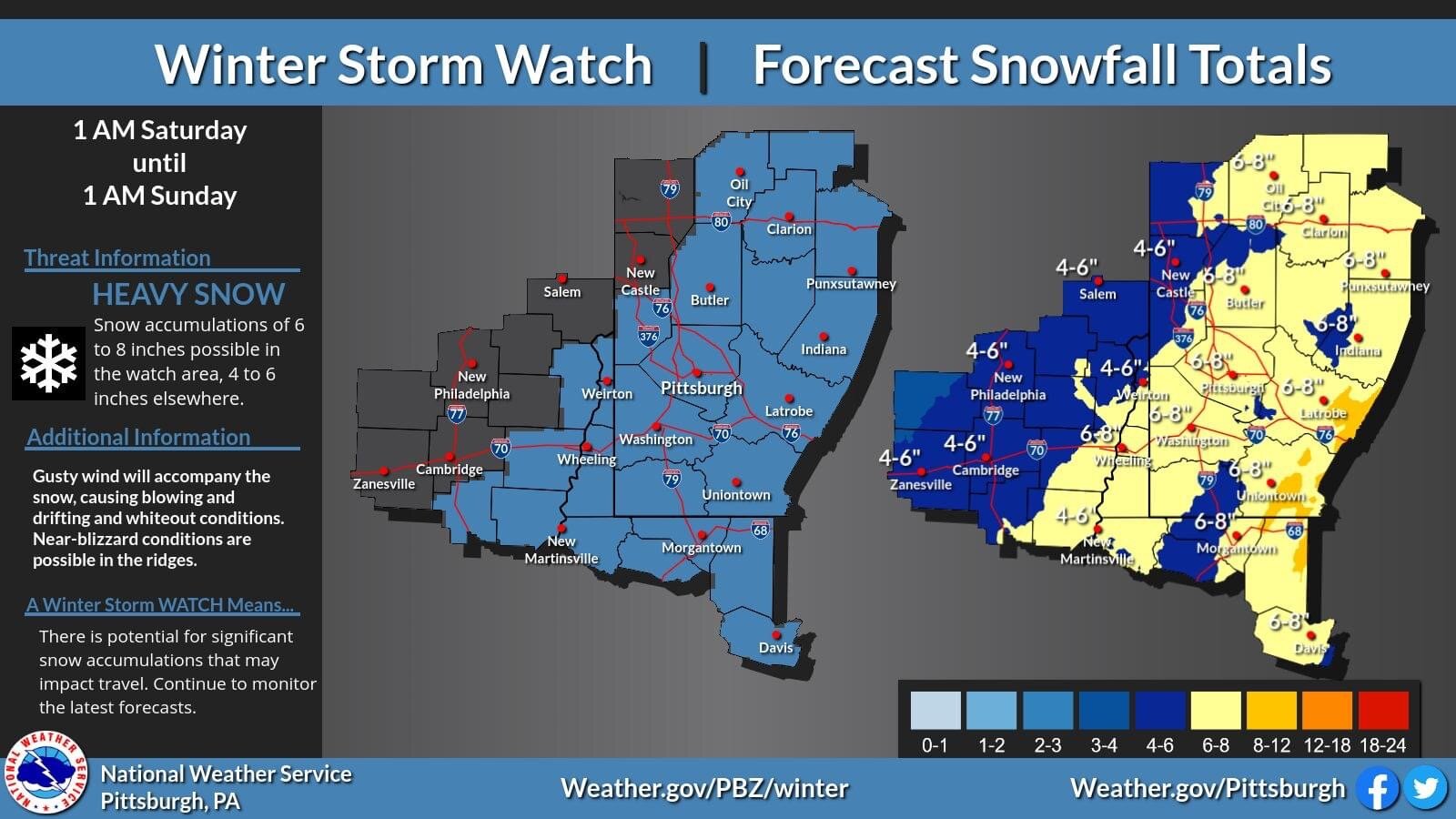
Nws lowered totals.
Wwa now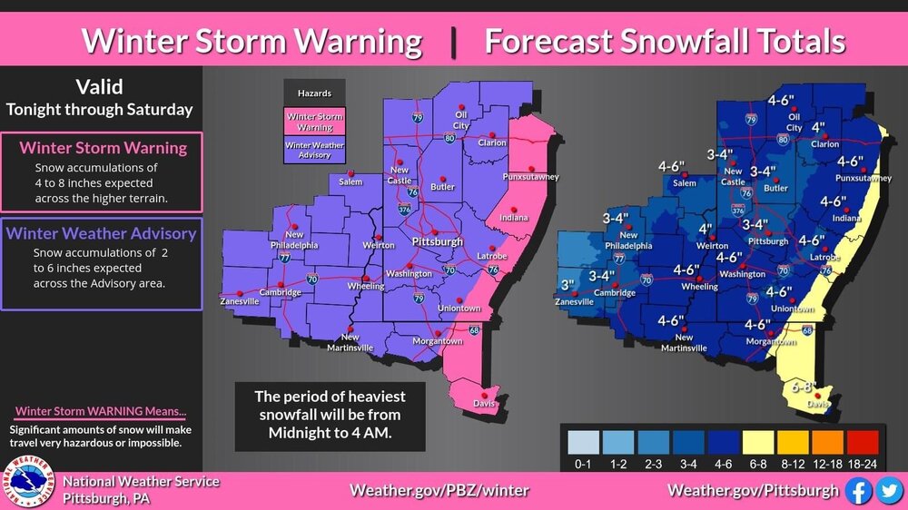
-
-
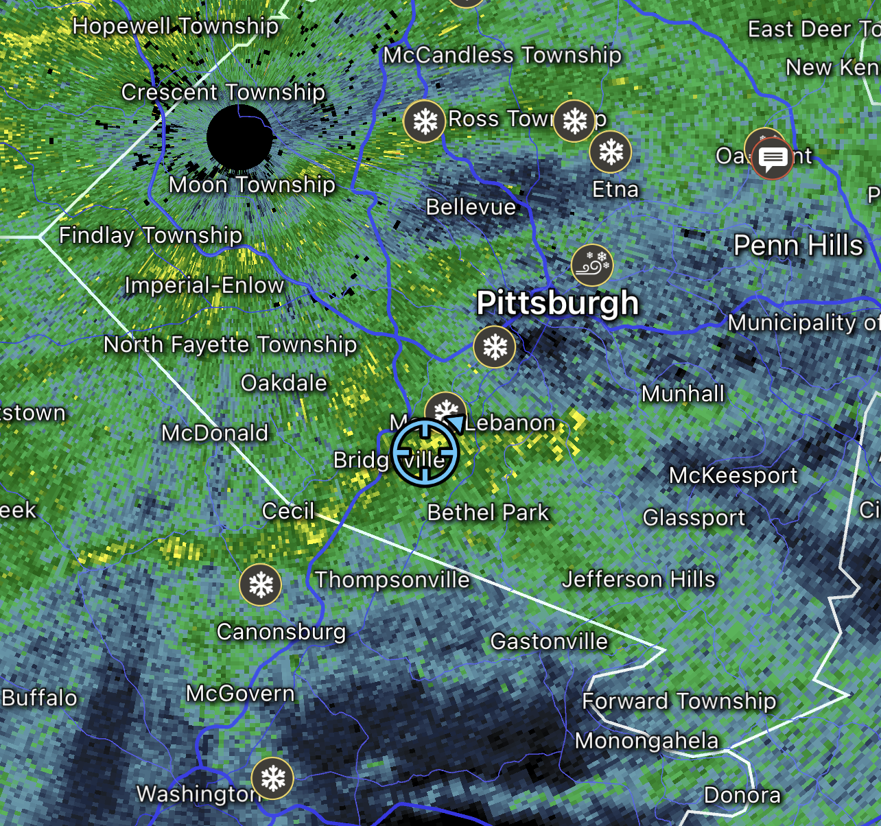
I’m up at seven springs and we got a Nice 3+ inches of snow last night. Nice and fluffy too.
-
Just woke up to what seems like a mess of wintry mix on the ground. 23.9 degrees and currently in a dry slot with what looks like a strong snow band on the way
-
31.6 and a trace of ice on metals
-
Just crossed 1” of rain. Also still holding at 32
-
I don’t understand these schools. Today cancelled. Tomorrow 2 hour delay.
-
My backyard near Bridgeville 79 exit has been hovering just above freezing
-
1
-
-
We’re looking at like a 20 mile shift on the hrrr. It could be anything tomorrow. We are right on the border.
Pittsburgh, PA/Western PA Fall/Winter Discussion 2022-23
in Upstate New York/Pennsylvania
Posted
The shield is up.