SouthernVAwx
-
Posts
19 -
Joined
-
Last visited
Content Type
Profiles
Blogs
Forums
American Weather
Media Demo
Store
Gallery
Everything posted by SouthernVAwx
-
December 8-10, 2018 Winter Storm
SouthernVAwx replied to Orangeburgwx's topic in Southeastern States
In my opinion a very good map. Has amounts that would have significant impacts with wiggle room to go up or down. -
December 8-10, 2018 Winter Storm
SouthernVAwx replied to Orangeburgwx's topic in Southeastern States
Winter storm watches issued by RNK for a good chunk of their forecast area. -
December 8-10, 2018 Winter Storm
SouthernVAwx replied to Orangeburgwx's topic in Southeastern States
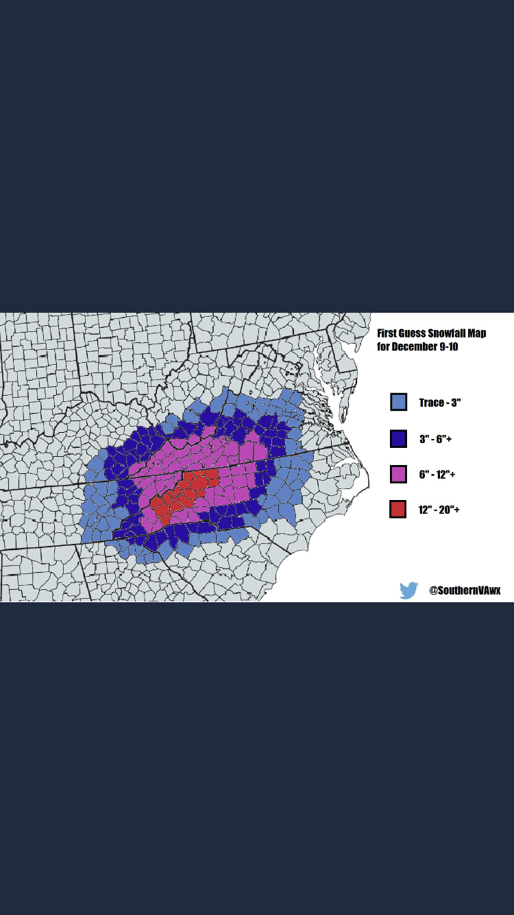
Here’s my first call map, take it for what it’s worth. Only a senior in high school so still learning the ropes so to speak, but really satisfied with this as a first call.
-
December 8-10, 2018 Winter Storm
SouthernVAwx replied to Orangeburgwx's topic in Southeastern States
Canadian model doing its thing
-
December 8-10, 2018 Winter Storm
SouthernVAwx replied to Orangeburgwx's topic in Southeastern States
I am willing to rent a bedroom here for the price of having to shovel our sidewalk, which stretches onto 2 bordering streets... Last time I had to my back was left feeling like a coal miners after years working in the caves. -
December 8-10, 2018 Winter Storm
SouthernVAwx replied to Orangeburgwx's topic in Southeastern States
Well ladies and gentlemen, after a brief successful revive, it appears the GFSFV3 has flatlined again. Please pray that the defibrillator works again and we can see this run out. -
December 8-10, 2018 Winter Storm
SouthernVAwx replied to Orangeburgwx's topic in Southeastern States
Funny thing is that still doesn’t account for almost 24 hours of light snow afterwards. -
December 8-10, 2018 Winter Storm
SouthernVAwx replied to Orangeburgwx's topic in Southeastern States
Let’s have a moment of silence for the GFSFV3, it has failed to initialize after a very poor 12z load time. -
December 8-10, 2018 Winter Storm
SouthernVAwx replied to Orangeburgwx's topic in Southeastern States
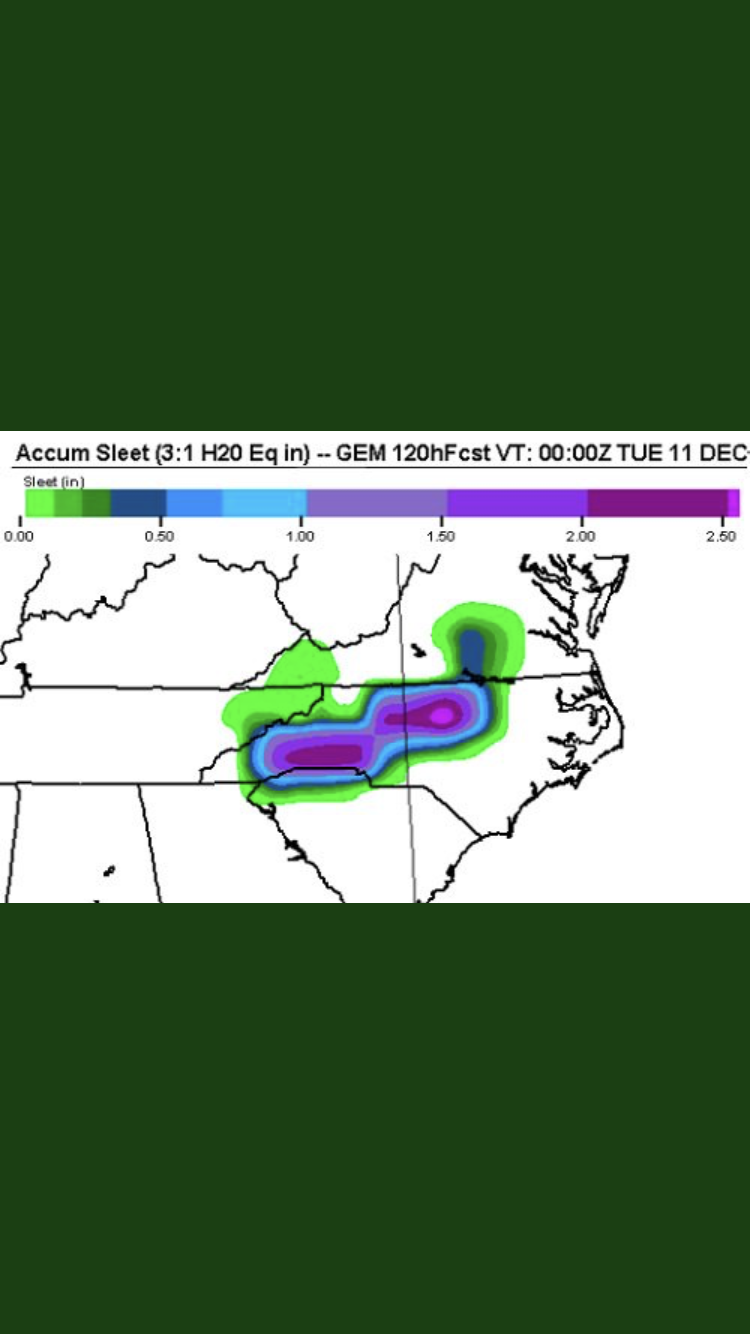
Pretty sure that is 10:1 ratio. -
December 8-10, 2018 Winter Storm
SouthernVAwx replied to Orangeburgwx's topic in Southeastern States
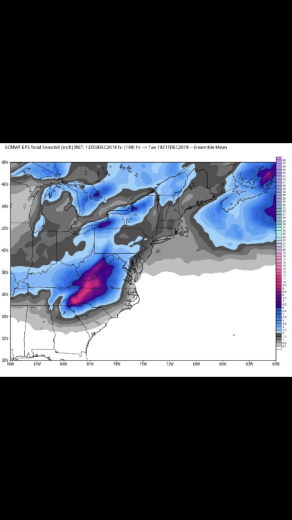
Despite the fact it’s slightly suspicious I like this run for my area! Snow 8 am Sunday to 8 pm monday with 16 inches kuchera ratio. Despite the fact it seems off interesting to note the coastal trend. -
December 8-10, 2018 Winter Storm
SouthernVAwx replied to Orangeburgwx's topic in Southeastern States
This is from Virginia Weather Network on Facebook.