

ForsythWx
-
Posts
113 -
Joined
-
Last visited
Content Type
Profiles
Blogs
Forums
American Weather
Media Demo
Store
Gallery
Posts posted by ForsythWx
-
-
Finally starting to stick to sidewalks and slushy on side roads in Greenville, NC
-
Snowing hard near ECU now. Cars and roofs already covered
-
Snow beginning to mix in with sleet now. Probably 50/50 right near ECU
Edit - BIG flakes now -
7 minutes ago, StantonParkHoya said:
Any PGV folks with a report?
Pretty much 100% sleet coming down now. Light accumulation on cars
-
Sleet, rain, and a snowflake here and there near Vidant in Greenville.
-
50/50 rain and sleet here in Greenville. Just became a lot more sleet in the last 10 minutes
-
2 minutes ago, snowbird1230 said:
Forecast discussion doesn't mention a Watch?
Yeah, not sure about that. But MHX has it on their homepage and also tweeted it out.
...ACCUMULATING SNOWFALL EXPECTED THURSDAY NIGHT AND FRIDAY
MORNING...

.Rainfall will transition to a wintry mix, and then to all snow
for much of eastern North Carolina Thursday evening through Friday
morning as low pressure strengthens off the coast. Greatest
snowfall accumulations are generally expected along and north of
the Neuse River, where sub-freezing temps will arrive earlier in
the night. The heaviest snow will fall through the overnight
hours, with potential banding leading to locally higher amounts.
Snow will gradually taper off from west to east early Friday
morning as the low moves further off the coast.

NCZ029-044>046-079>081-091-193-200815-
/O.NEW.KMHX.WS.A.0001.200221T0000Z-200221T1200Z/
Martin-Pitt-Washington-Tyrrell-Greene-Beaufort-Mainland Hyde-
Lenoir-Northern Craven-
Including the cities of Williamston, Robersonville, Oak City,
Jamesville, Greenville, Bethel, Farmville, Grifton, Grimesland,
Plymouth, Roper, Creswell, Columbia, Gum Neck, Snow Hill,
Hookerton, Walstonburg, Washington, Chocowinity, Belhaven, Bath,
Aurora, Engelhard, Fairfield, Ponzer, Scranton, Swanquarter,
Kinston, La Grange, Pink Hill, Vanceboro, Ernul, Dover,
and Cove City
302 PM EST Wed Feb 19 2020

...WINTER STORM WATCH IN EFFECT FROM THURSDAY EVENING THROUGH
FRIDAY MORNING...

* WHAT...Heavy snow possible. Total snow accumulations of up to
  three inches possible.

* WHERE...Portions of eastern North Carolina mainly along and
  north of the Neuse River.

* WHEN...From Thursday evening through Friday morning.
-
Winter Storm Watch just issued for Greenville, NC
-
 1
1
-
-
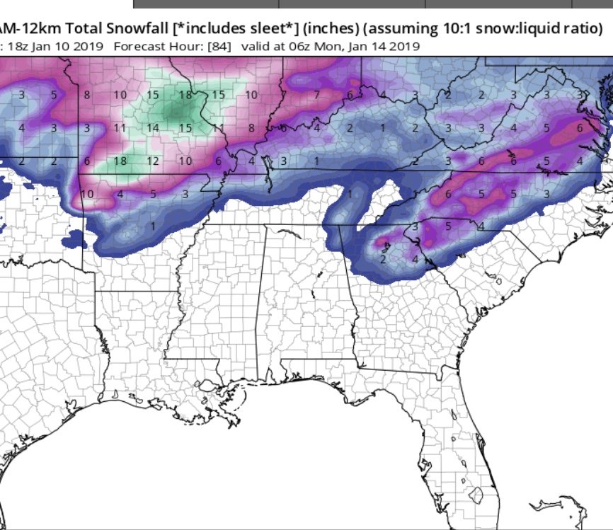
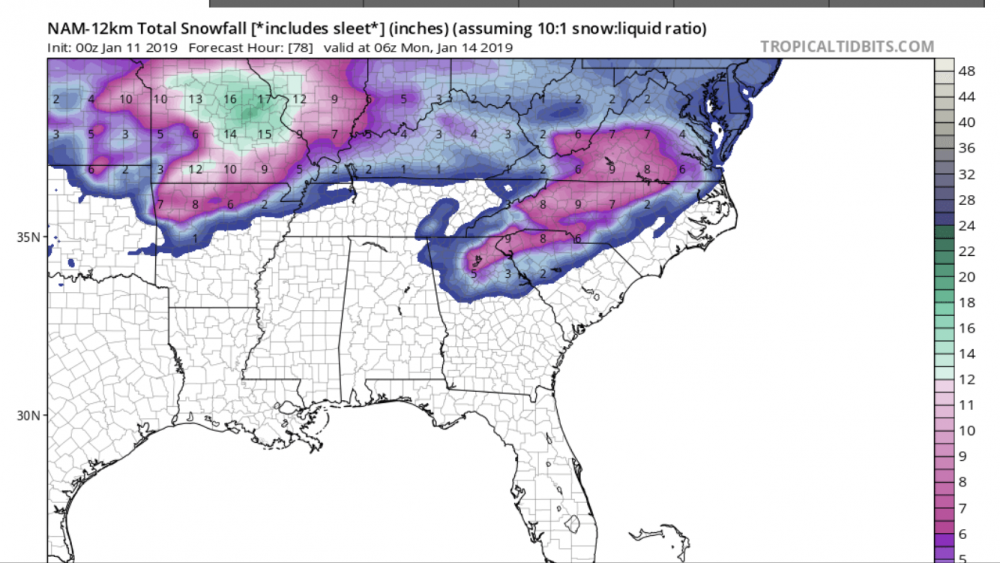
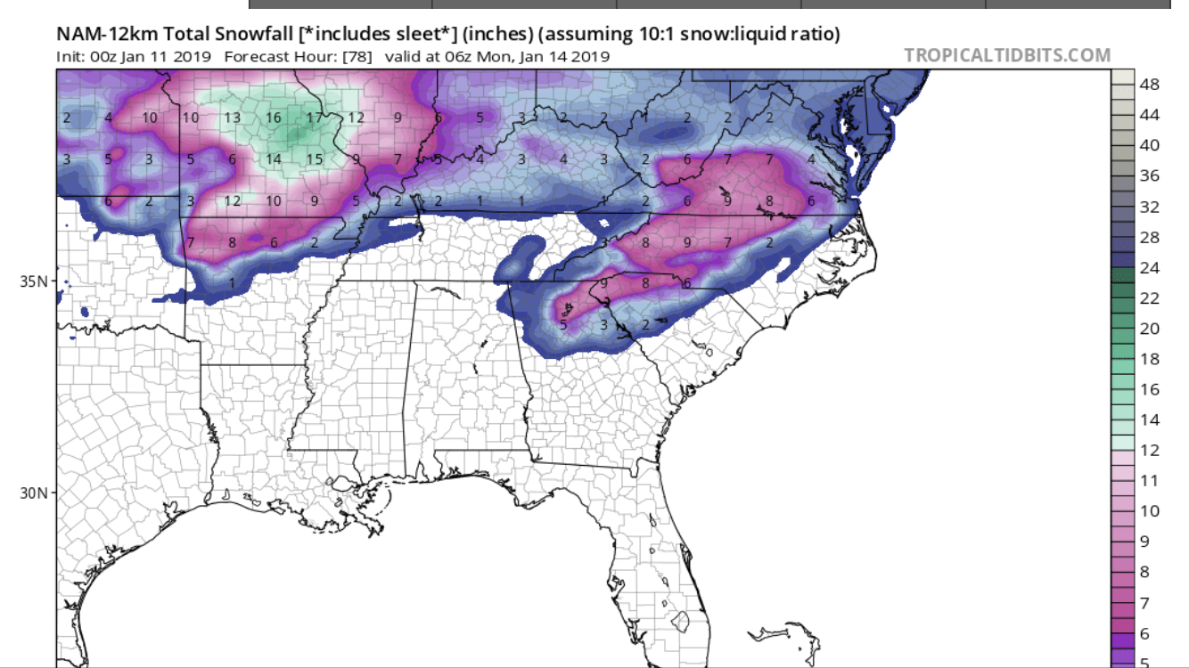
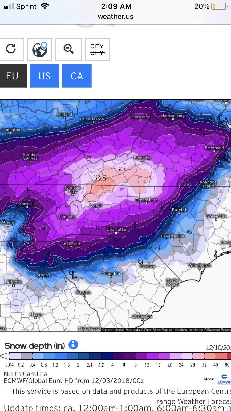
6z NAM just snapped..
3km
-
 1
1
-
-
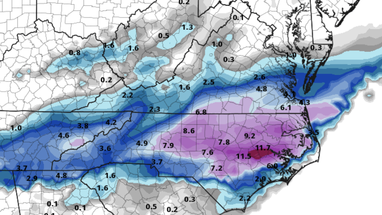
6z NAM. wow.

-
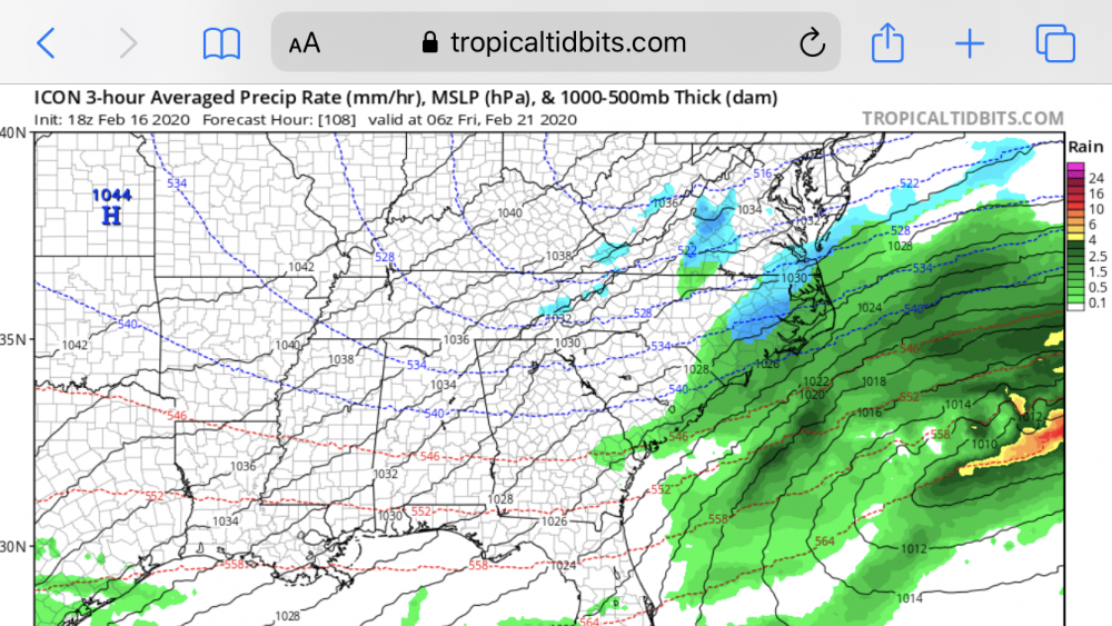
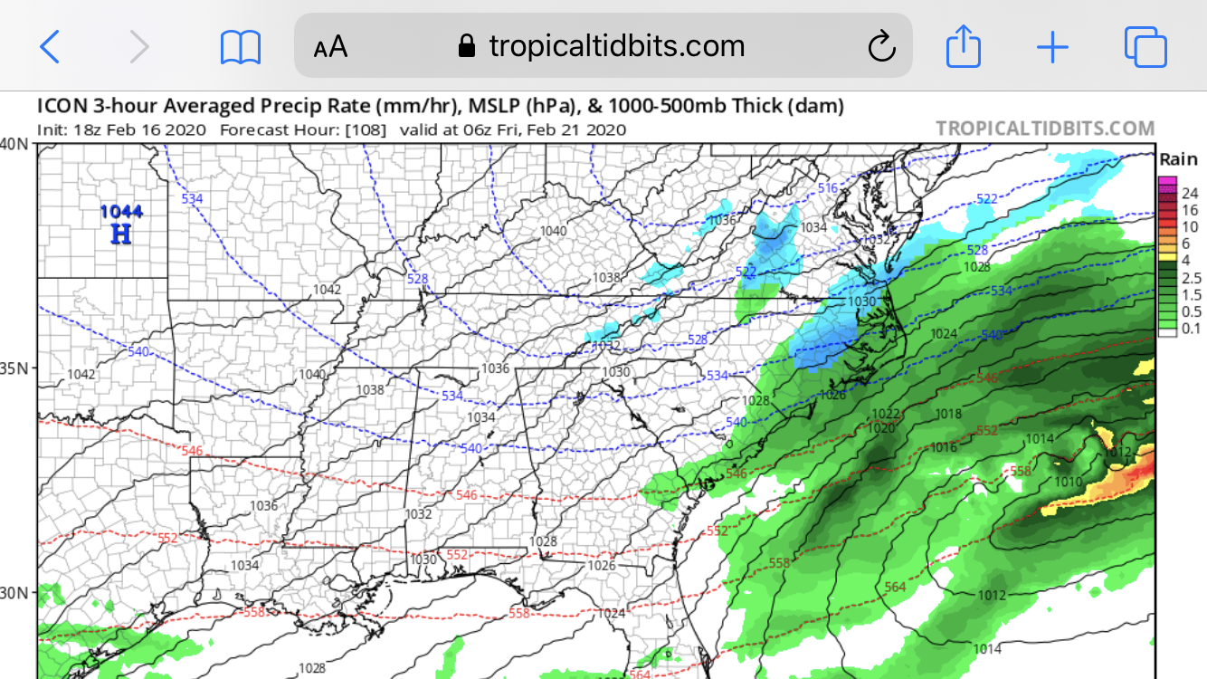
ICON looking interesting for the first time in days
-
1
-
-
21 minutes ago, Queencitywx said:
I feel like the further south it makes landfall, the worse it could be for us. I still doubt that it's too bad in Western and Northern areas of the triangle but Johnston and Wilson counties and points east? Ehhhh.
Yes. And schools like ECU out in Greenville said they are not planning on altering class schedules Thursday/Friday. We will see. Other hurricanes in the past have caused a lot of headaches out there.
-
Very heavy mix coming down now in Lewisville. 31.7/30 WB: 31.4
-
1
-
-
Lots of sleet coming down for the first time just west of Winston-Salem
-
1
-
-
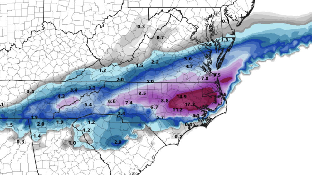
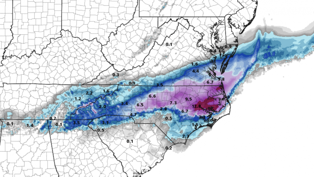
 Super misleading map, but 18z vs 0z frozen precip on Nam
-
12z vs 18z GFS

-
2
-
-
~ 11 inches. 27.6 degrees - western Forsyth county.
-
32.9/31 Clemmons. Temp has dropped 4 degrees in 90 minutes. Light/moderate snow now! ☃️☃️☃️
-
Now 36/29 with light flurries just west of Winston-Salem
-
2
-
-
37/26 in Lewisville, still dry. Wind picking up though.
-
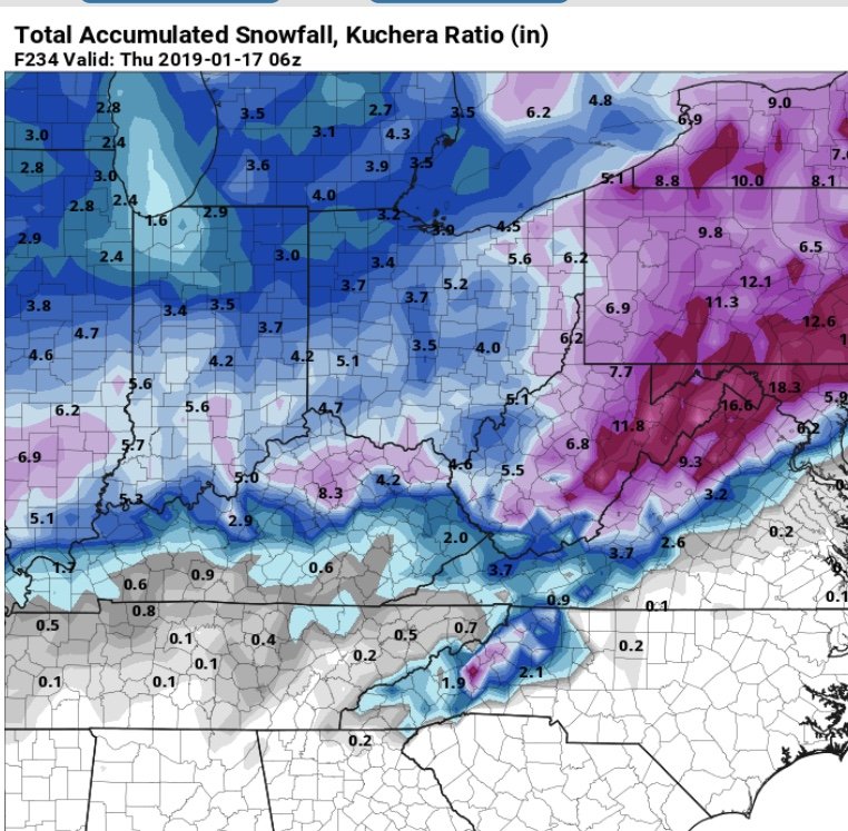
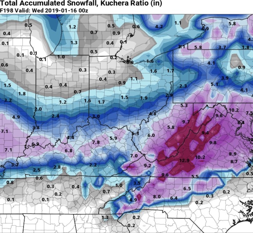
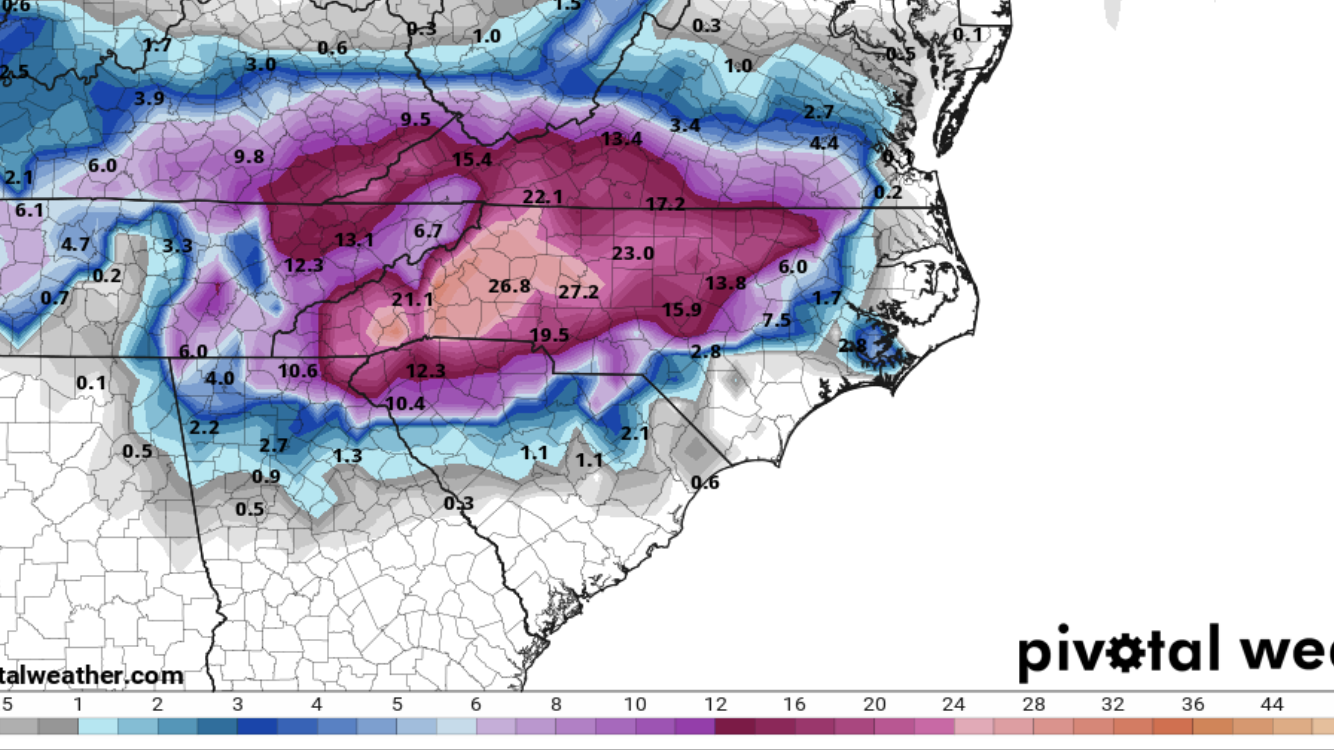
18z FV3 Kuchera ☃️
-
1
-
-


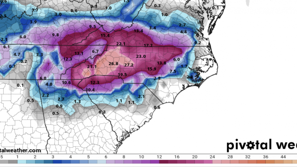
Feb 20-21 OBS ( all bets off)
in Southeastern States
Posted
This wind out here in Greenville is crazy. Snow is blowing sideways