

ForsythWx
-
Posts
113 -
Joined
-
Last visited
Content Type
Profiles
Blogs
Forums
American Weather
Media Demo
Store
Gallery
Posts posted by ForsythWx
-
-
Radar filling in to the west and south of Winston now. We’ll see.
-
Light sleet in Lewisville
-
Been absolutely ripping in western Forsyth county for about 15 minutes
-
 2
2
-
-
Snow picking up a little now near Lewisville. Looks like a heavier pocket finally came through. Weather app says it’s raining but it’s not ⛄️
-
Finally light snow in western Forsyth county
-
Rain/sleet mix just west of Winston-Salem
-
1
-
-
Love to see it


-
3
-
-
6z NAM - ⛄️⛄️
-
Winter Storm Watches for Forsyth, Guilford, and Davidson counties.... nice to see from Raleigh NWS
-
3
-
 1
1
-
-
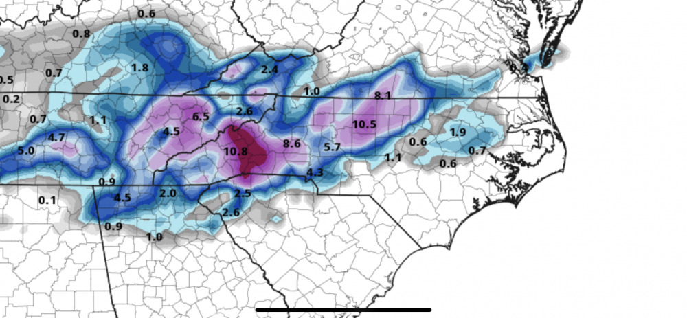
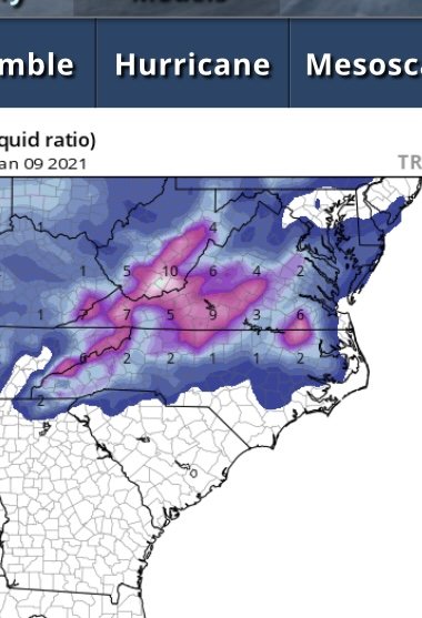
12z GFS Para - looking good for a lot of us... sharp cutoff though
-
1
-
-
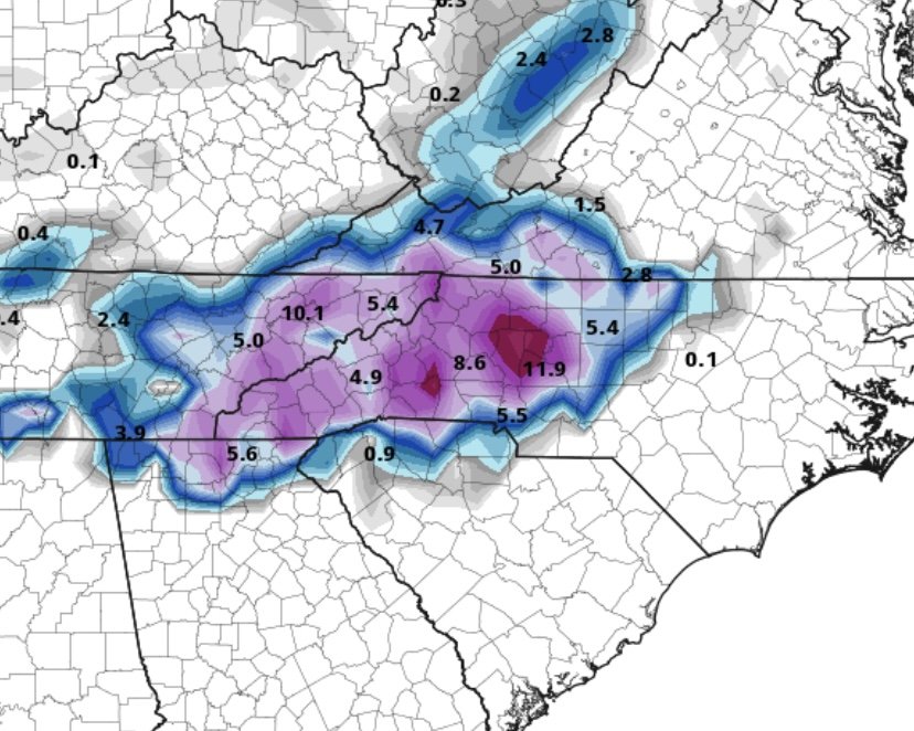
00z euro looking good for triad
-
1
-
-
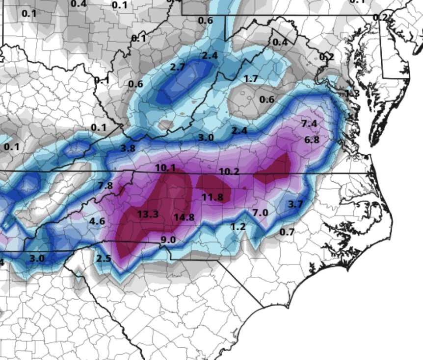
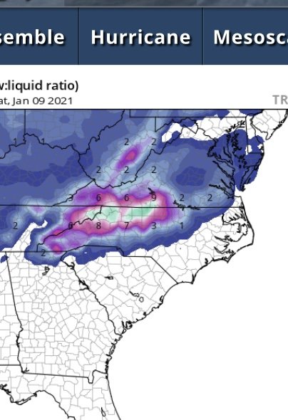
GFS Para 6z........
-
 1
1
-
2
-
-
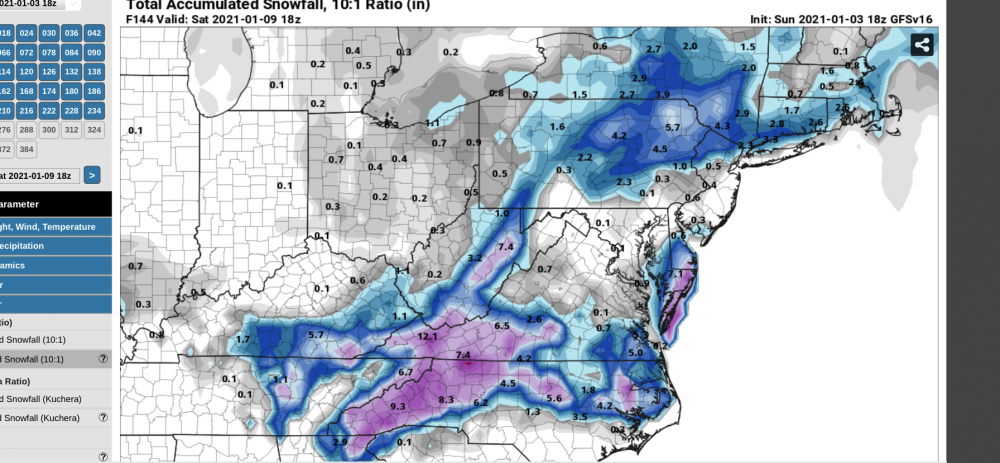
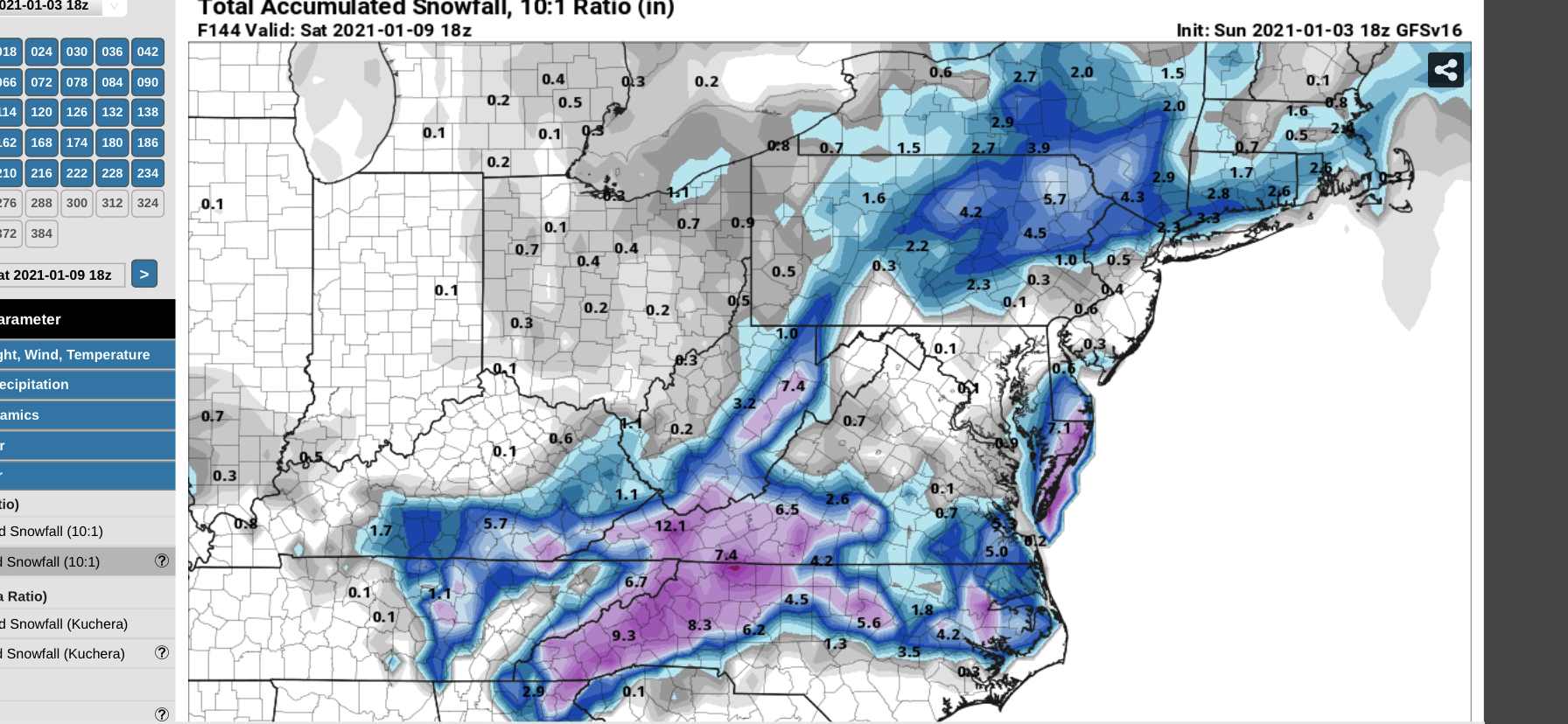
Wow, GFSv16 (18z)
-
3
-
-
0z Canadian vs. 12z Canadian (Friday-ish)
-
6 minutes ago, kvegas-wx said:
Good. We're at the end game. we have about 90 minutes of precip left and need a solid hour of that to be snow to have any chance of eeking out a dusting. I just want the pic.
It’s a mix of sleet and snow at this point. Was rain and snow.
-
Flakes mixing in just west of Winston Salem now.
-
53-39 in just over 30 minutes west of Winston-Salem. Starting to smell like snow ⛄️
-
7 minutes ago, BullCityWx said:
Extracted data has 1.7” for INT. Hoping for a Christmas miracle for y’all.
Yeah some of the sref plumes near GSO have a decent little hit as well. HRRR looks like some backend snow. We’ll see.
-
Interesting. Just want to see a few flakes in the triad. 18z GFS
-
1 minute ago, BornAgain13 said:
The HRRR Temps that its showing at the beginning of its cycle are 2-3 degrees or so warmer than what it actually is...
I’ve noticed it seems to be inconsistent. The rain/mix line can be a whole county or 2 further north/south run to run as well.
-
39 currently in western Forsyth county
-
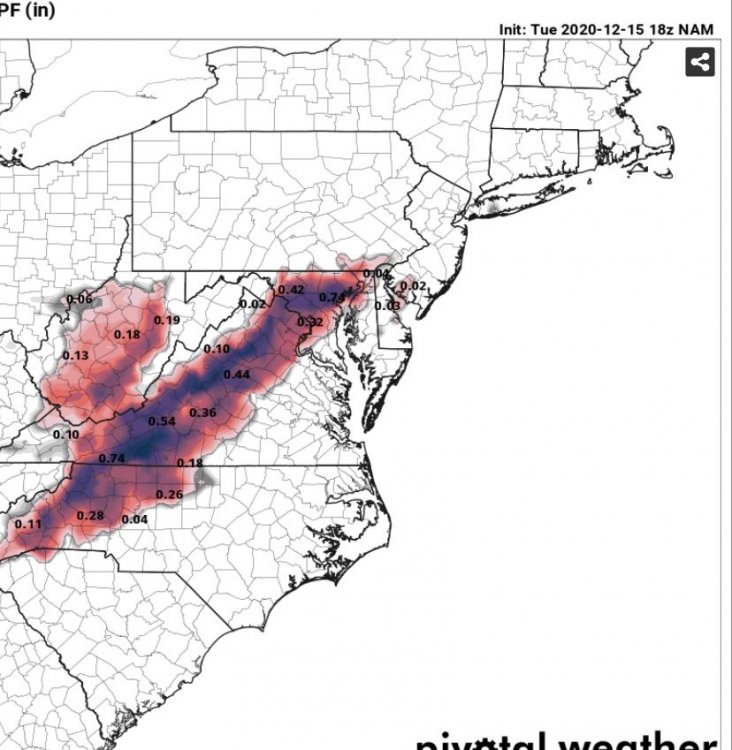
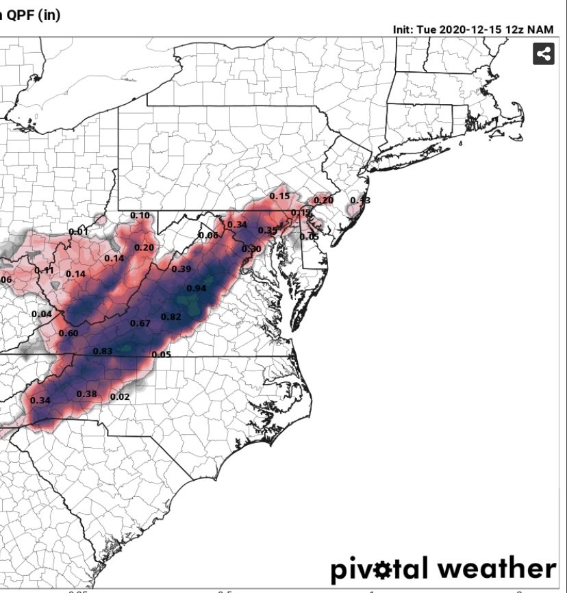
12z NAM vs. 18z NAM - upping ice totals east a bit.

-
Bigger flakes in PGV now
-
Probably about 1.5" near Vidant in Greenville. Kinda surprised there's not more considering how long its been snowing at a good clip. But as I said, the wind is whipping out here, so may be hard to measure


January 8th event obs
in Southeastern States
Posted
Seeing flurries for the first time in several hours in western Forsyth