

StormChazer
-
Posts
1,193 -
Joined
-
Last visited
Content Type
Profiles
Blogs
Forums
American Weather
Media Demo
Store
Gallery
Posts posted by StormChazer
-
-
Is it too soon to be talking about this already?
The big 3 are all sniffing something next weekend.


-
Checking in after a serene and beautiful snowy night in Tulsa.
It looks like we picked up around 5-6 inches of snow in Owasso on the north side of Tulsa and it was still snowing on my way to work this morning, so we might have added another 1/2 inch.
Southern side of town got closer to 6-7.
It's very rare we get a model trend change in the last 24 hours that drastically IN OUR FAVOR. We went from 1-3 inches predicted in Tulsa, to 4-6 predicted.
Other places on this forum got an even more drastic snowfall prediction change.
It reminds me of when I was a kid in the early 2000's. I loved the weather just as much back then, but as a 10 year old in 2000, I didn't have access to weather models, etc. I just sat in front of the TV watching the weather channel or every local news station, obsessing over any minor change. So it was easier back then to be surprised by a storm in a good way, because I simply didn't have the models at my fingertips like I do now.
So this storm felt like a nice throwback.
-
 1
1
-
-
New NWS Map.
Widespread 8-12 inches!
-
 1
1
-
-
There we go. Tulsa caved. Winter Storm Warning issued.
-
1
-
-
It's now lightly snowing in Tulsa. Looked out my window at work.
-
 1
1
-
1
-
-
OKC Just majorly expanded the warning area. Come on Tulsa, do it already!

-
7 minutes ago, MUWX said:
Tulsas warning map doesn’t make a whole lot of sense, given their forecasted snow map.
I think as soon as the snow begins to impact the southern metro area, they will include it. But yeah, I'm surprised they didn't do it when they upgraded Okmulgee County to the south.
-
Another Warning expansion by TUL.
Now backs up to the Tulsa metro area. I expect as this snow gets closer, that is when they will pull the trigger on including Tulsa county.
-
2
-
-
Sraight from the Tulsa NWS page. This should in theory justify them upgrading most of the office area to a Winter Storm Warning.
-
OKC Upgraded to Winter Storm Warnings. I'm sure Tulsa will be the same shortly.
-
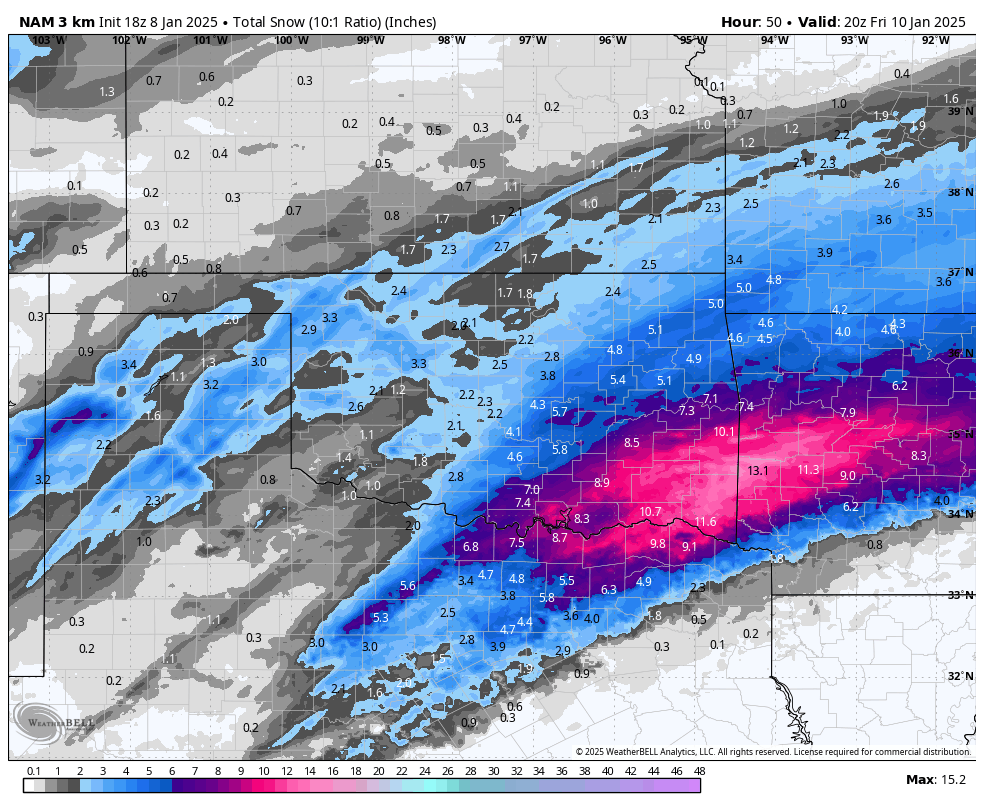
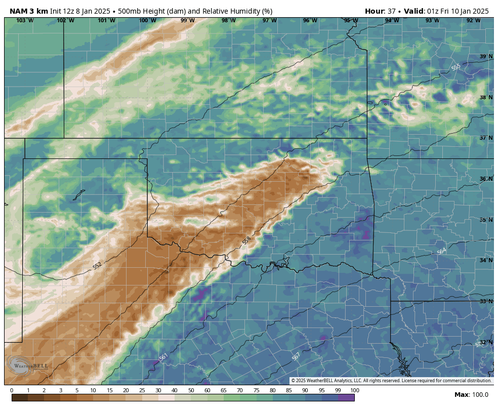
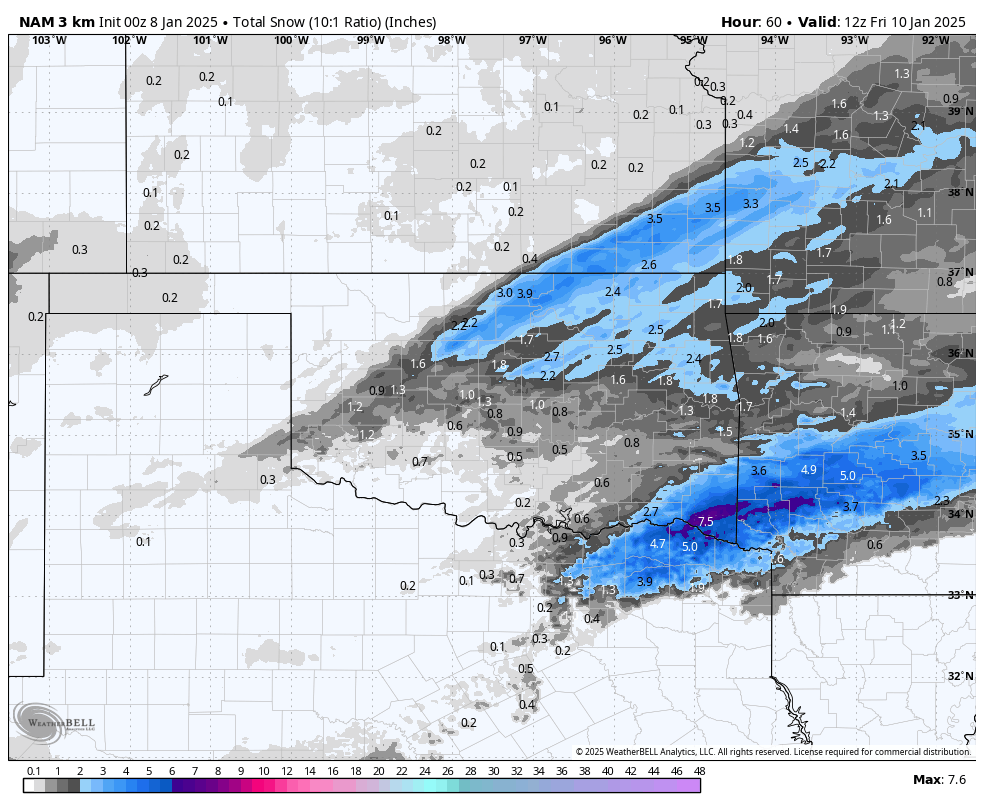
NAM held onto Its crazy idea from last night on this morning’s run.
Let’s see what the morning runs say here in the next hour.
Winter Storm warnings expanded north, almost to Tulsa.
Also appears to be a few hours ahead of schedule.
-
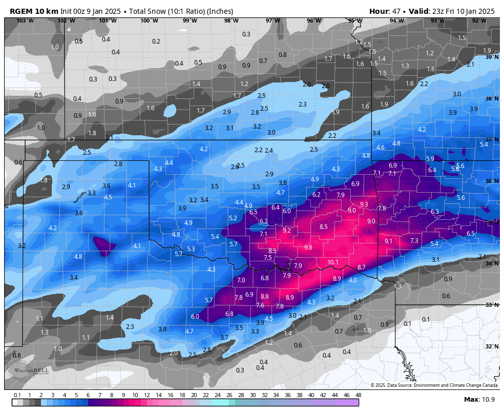
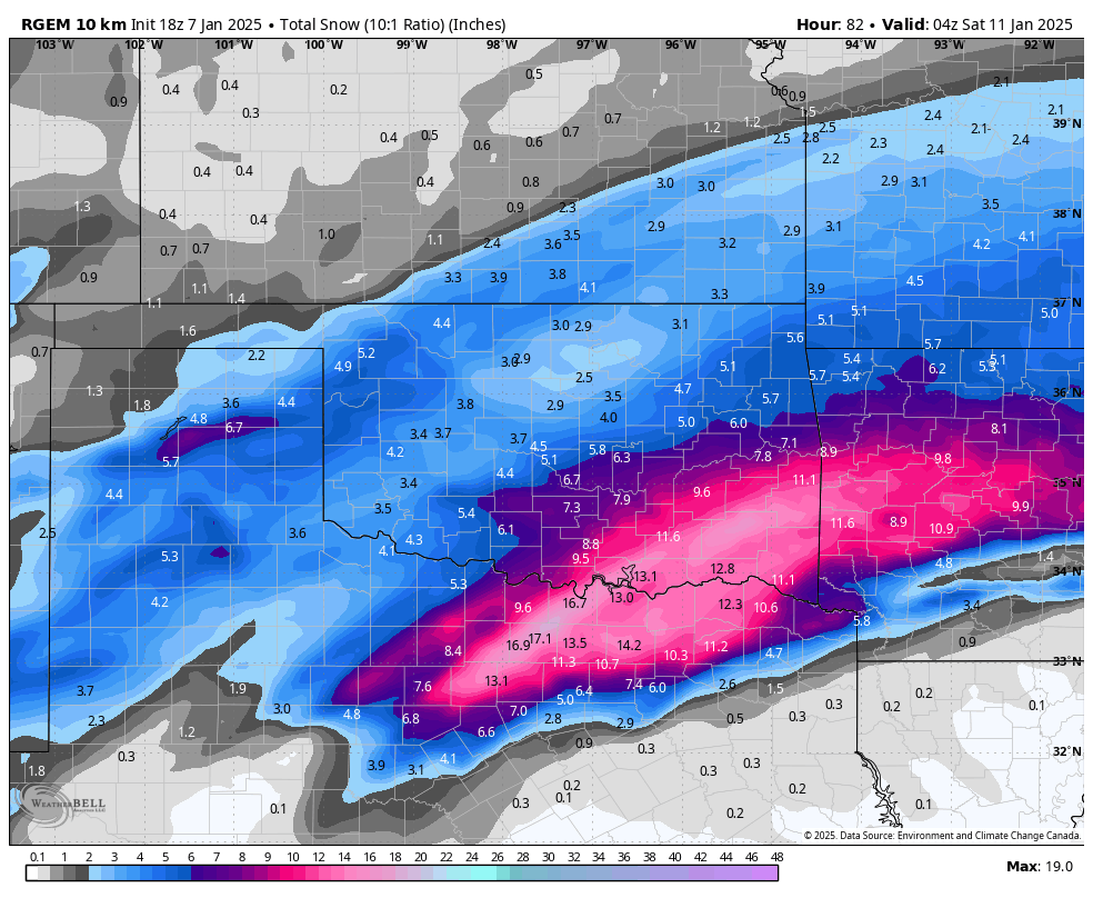
Here's a model dump of the NW trend.
-
2 minutes ago, JoMo said:
Trough is more neutrally tilted on the 00z NAM with the 500 MB winds backing more to the south. Interesting NAM run, but, it is the NAM.
Yeah, like someone just said. A day ago it abandoned the storm altogether for everyone in TX and OK. So will want to see other models trend that way too before buying it.
Still, 16 hours out from the onset of a storm, and these are the trends you want to see.
-
2 minutes ago, MoWeatherguy said:
Let's hope it's onto something tonight. Do you have the latest HRRR run?
I do but I can’t post it right now.
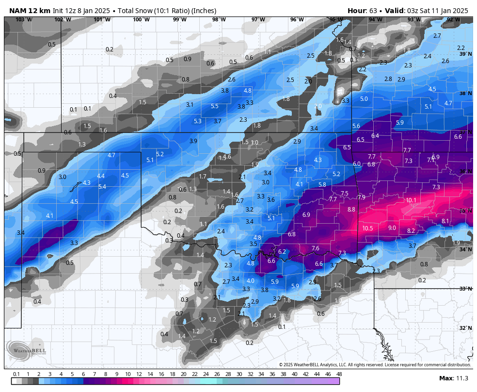
The 0Z HRRR dumps 4-5 inches in NW AR and SW MO and about 3.5-4 in Tulsa.
It’s an uptick across the board.
-
 1
1
-
-
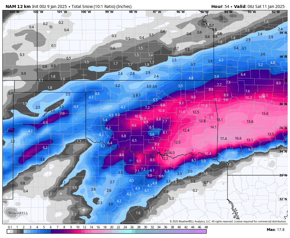
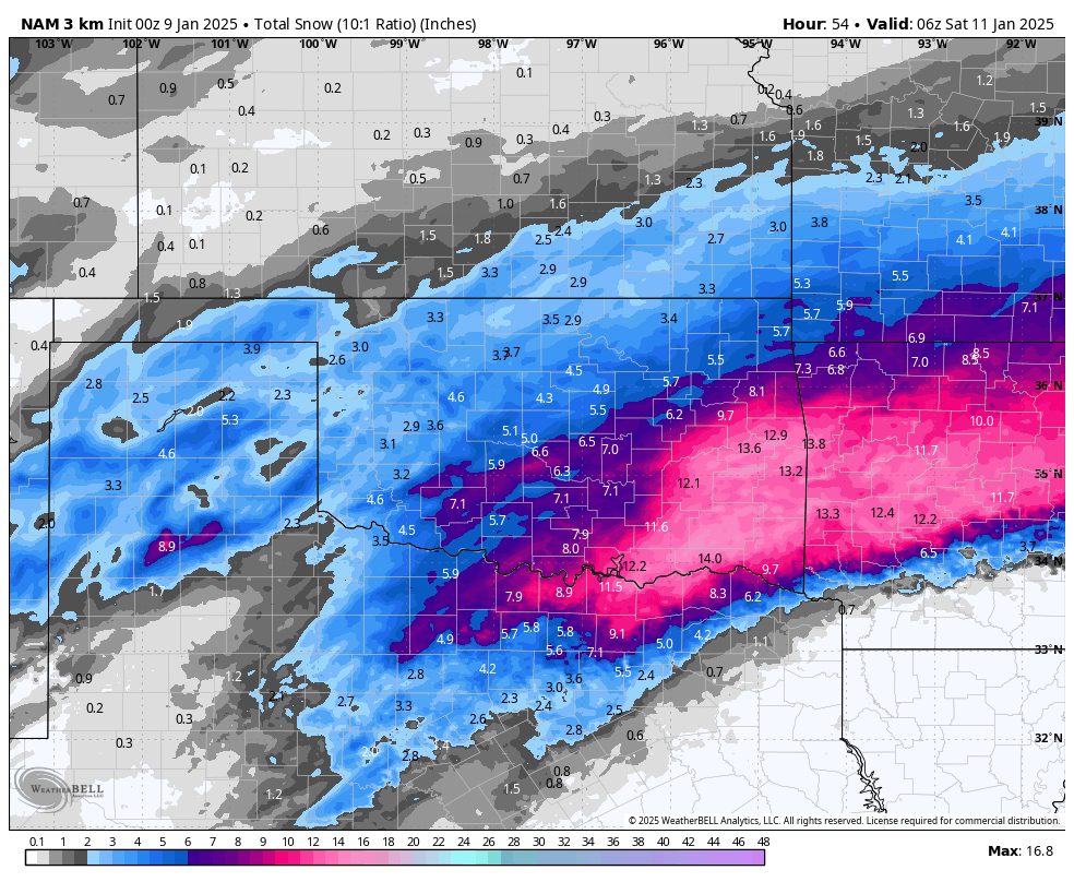
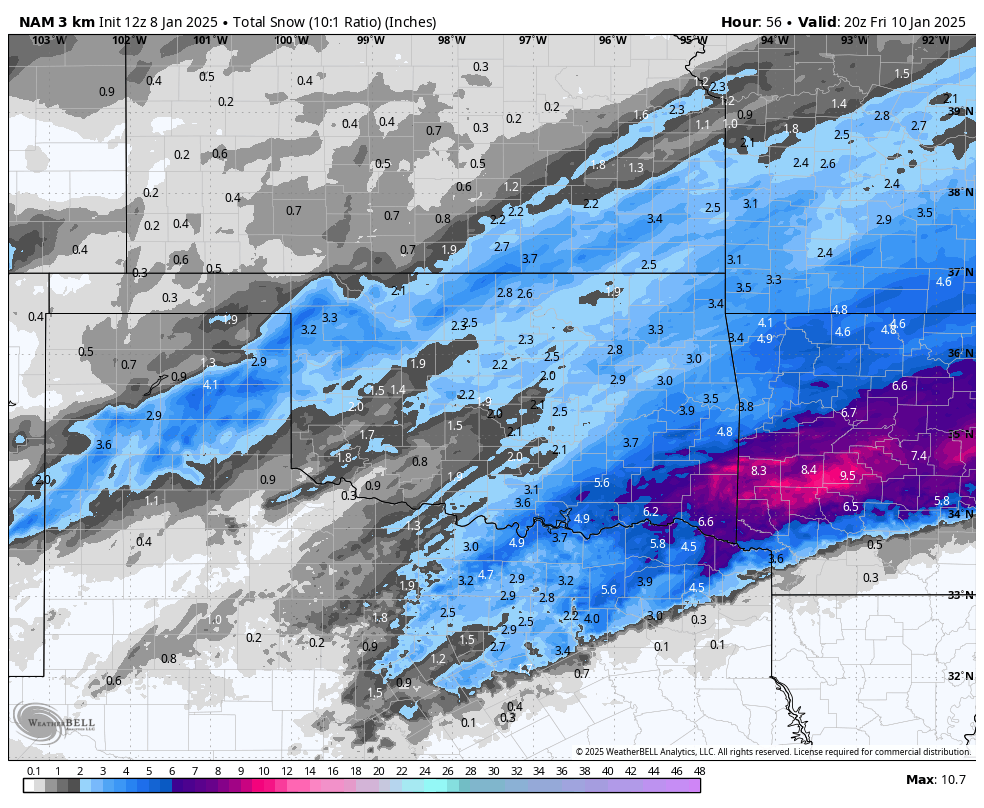
The NAM just lost its ever loving mind.
The high res version drops 6 inches in Tulsa, and the lower res drops close to a foot of snow in Tulsa….
-
NAM isn’t done yet, but looking to me like a NW shift right now.
-
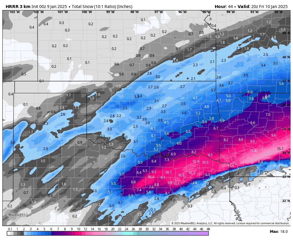
12Z NAM vs 18Z NAM.
I'll gladly take the 18Z
12Z
18Z
-
1
-
-
-
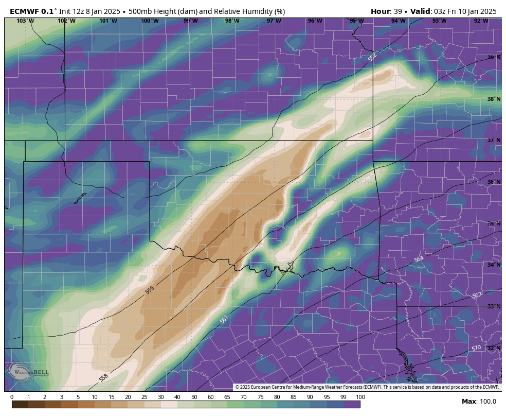
12Z Euro
There's that dry slot trying to break my heart in Tulsa.
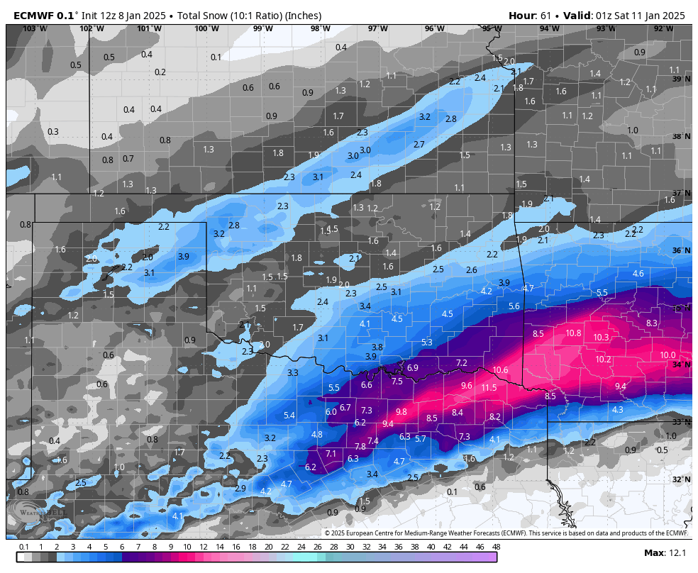
9:00PM Thursday night
-
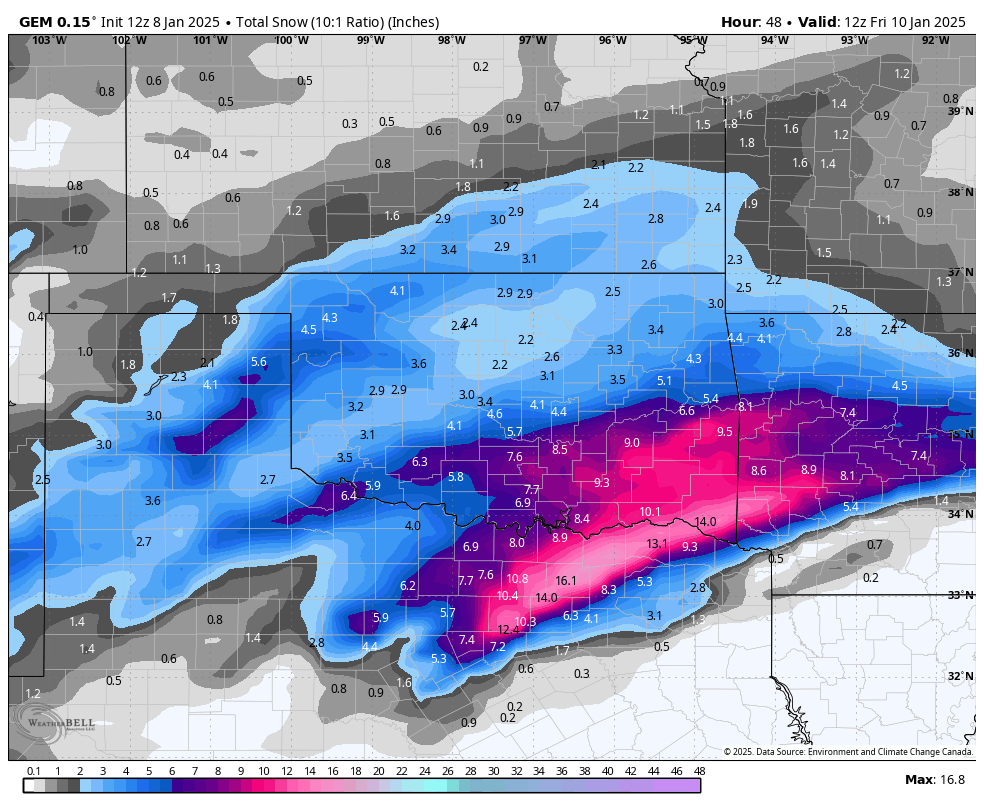
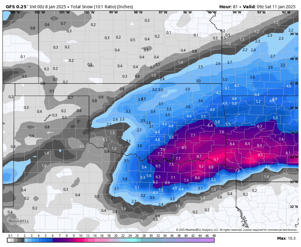
GFS and GEM essentially both look about the same from their previous runs. The only differences are they are defining where that cutoff of the precip shield is going to be.
It's looking right now like Stillwater to Bartlesville to just north of Joplin will be the line.
But the dry slot is going to really damper someone here.
So far, the Canadian and NAM are identifying the dry slot. I'd prefer it stay there and not come any closer. Thanks!

-
If this dry slot manifests, it will definitely limit amounts during what would be the peak of the storm. So here's to hoping that doesn't happen.
-
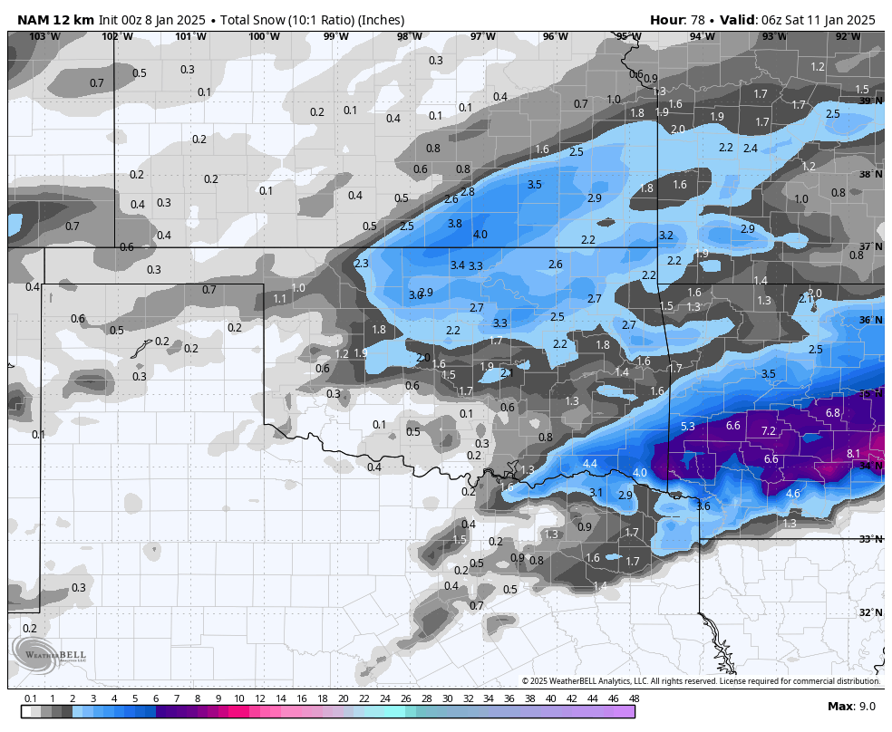
All of the high res models are moving the precip further north, widespread 2-3.5 for most everyone here.
-
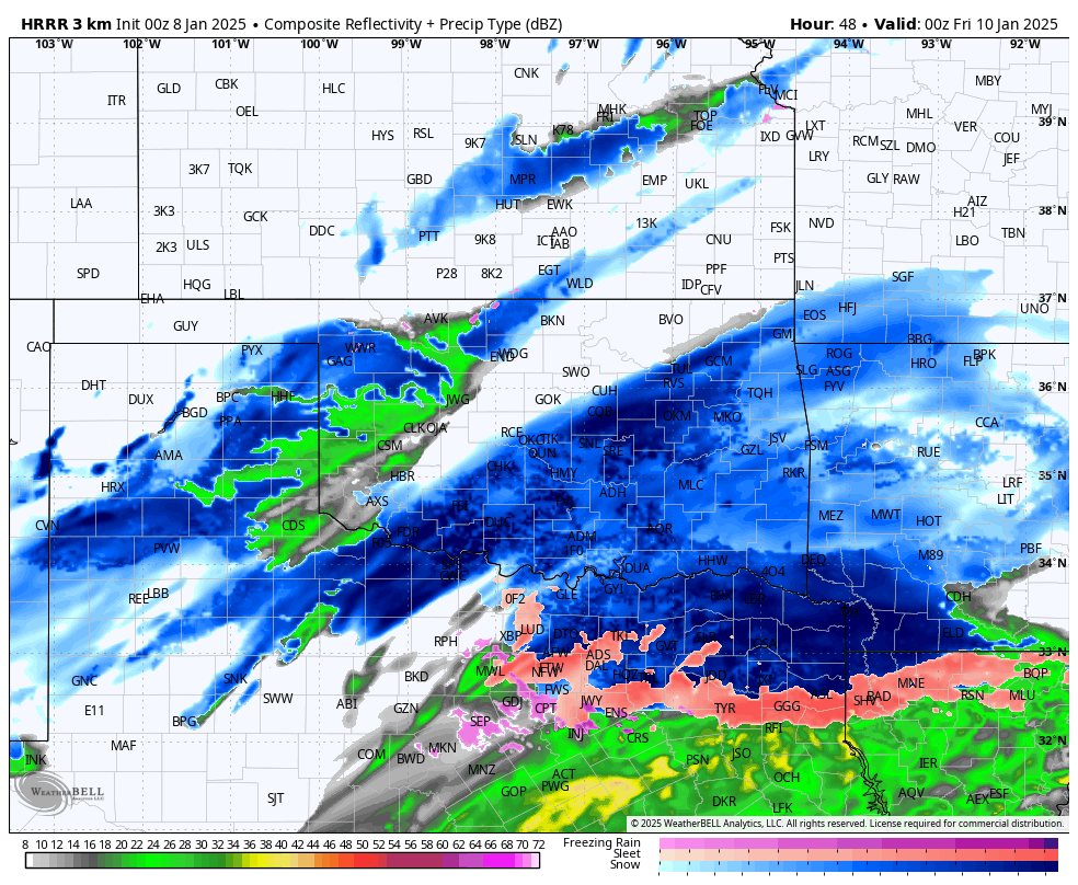
12Z HRRR
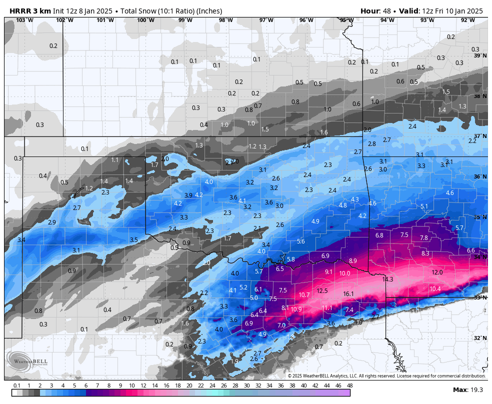
12Z NAM
I'm noticing a nice trend here.
-
Beginning to notice a favorable trend. It appears there will be a decent bit of energy on the northern side of this storm that benefits us. Here is some examples.
Last frame of the HRRR shows the second bit of precip.
About as good of a trend we can ask for under 48 hours out.
MO/KS/AR/OK 2024-2025 Winter Discussion
in Central/Western States
Posted
This is amazing. Thank you!