

Greg
-
Posts
1,775 -
Joined
-
Last visited
Content Type
Profiles
Blogs
Forums
American Weather
Media Demo
Store
Gallery
Posts posted by Greg
-
-
Just now, STILL N OF PIKE said:
Fatties return to N And/LWM
I'm with ya.
")
-
snow picked up again now. I think Ray and I may do we'll if this band can do what I think it might.
-
Actually there are two low pressure centers. One to the Northwest and one southeast of each other in that satellite pic. Can you see it?
-
1 minute ago, DomNH said:
I thought it'd pivot in the 495/128 region but I guess not.
Careful what you say that band is moving east and starting to fill in with darker shades again (128 - 495)
-
3 minutes ago, Ginx snewx said:
Pivot, Milford already up to 20
Seems a little high for surrounding areas.
-
4 minutes ago, HullMA said:
That ORH deathband looked like it was gonna pull east but i think it may stall for a bit! wow.
It's very slowly starting to pull east. I can see in in the closeup movement.
-
1 minute ago, 40/70 Benchmark said:
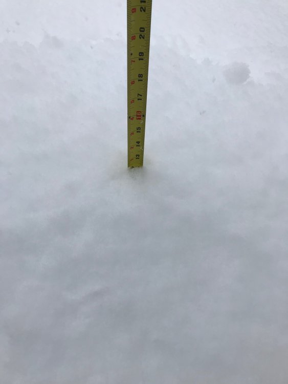
13.5"
12" depth.
Caught in subsisdence for now.
S-
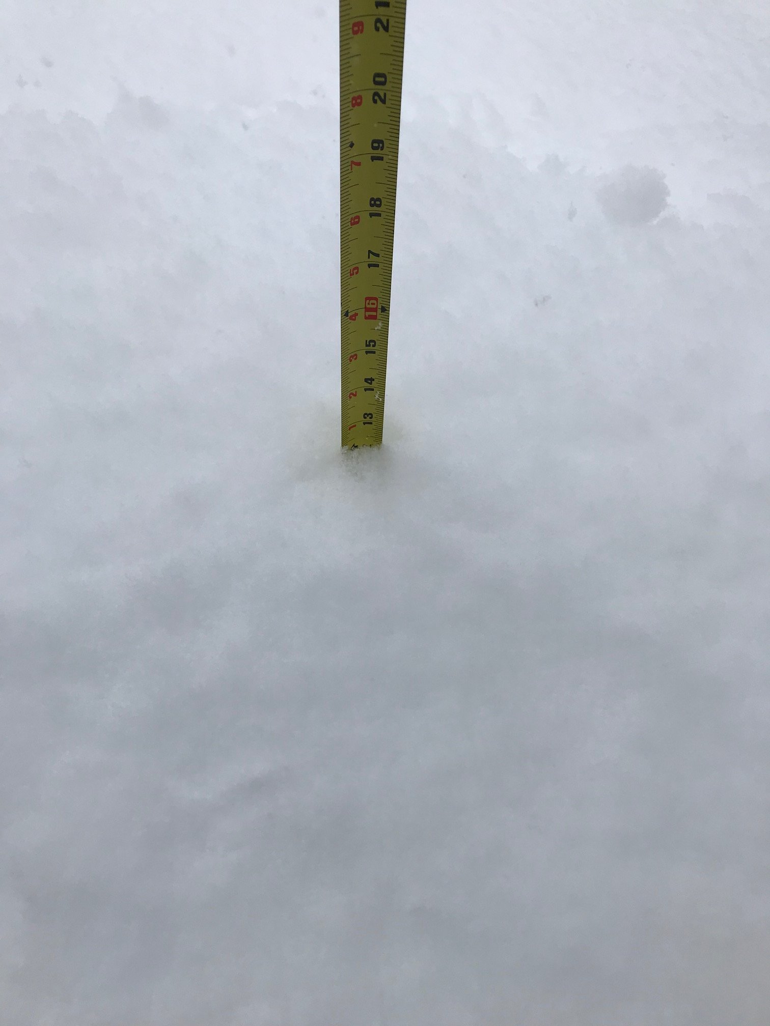
Me to Ray, hopefully we grow again in precip shield as things swing eastward and add to the 13 to nearly 14" we have. Great storm so far!
-
Just shy of 13" here in the southwest part of Wilmington.
-
3 minutes ago, rboarderi said:
Almost 13” in East Lyme, big heavy flakes for hours now.
You have a little way to go still before you hit 13" on the nose.
-
1 minute ago, Dotb said:
WBZ just reported 6" in Lawrence. That is comical. We're at least double that, about a half mile from the Andover/Lawrence line.
That's an older observation. They had that a couple of hours ago.
-
3 minutes ago, Ginx snewx said:
13 here friend in Canterbury Ct under that death band 15. Still getting heavy snow and wind.

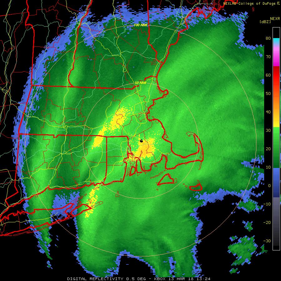
Big band is starting to move east again now.
-
1 minute ago, SR Airglow said:
Looks like the ocean band is dying. Congrats IJD-ORH-MHT on this storm it looks like.
Not quite.
-
38 minutes ago, sbos_wx said:
495 and 128 is about to enter a period of subsidence. Band rotating toward BOS and super band over the typical areas west.
I still haven't seen subsidence yet. It filled in.
-
Approaching the 5" mark now on my deck. Just measured it . This main band means business. Ray may be right, it will deliver the goods. I don't use a snowboard. I let it settle like it should to get a real amount.
-
2 minutes ago, Baroclinic Zone said:
Ground truth to radar
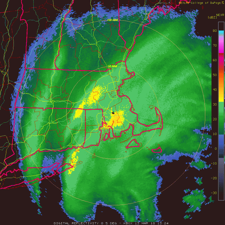
Like I said earlier and Ray illuded to this, if that band from the northshore arching to northeast conneticut stays mostly put, we'll see some serious accumulation.
-
Biggest band seems to be parked from Northeast CT to the far Northshore, around and inbetween 128 and 495.
-
8 minutes ago, Henry's Weather said:
Thats gonna pivot right over ORH
From just about in an arch from Northeast CT to just east of Worcester through Ray and I and the far northshore is the most important band. It will tell the tale.

-
Have about 3" so far and counting. Need these bands to hold together in our area and rot
 .
.
-
3 minutes ago, MarkO said:
No worries, it's below freezing about 1000' up. You can actually see the snow. It's coming!
I'm actually talking about the Cape and Islands, not really us at all. We will do well, I think. Our ratios won't be huge but will make up some of the difference in the end.
-
Generally about 20" - 30" Eastern Mass with about 15" - 20" outer Cape / Nantucket.
-
Just now, bobbutts said:
Looks truly epic for the cape. All snow, winds into the 60's, inches of qpf.
Not sure it will be all snow, most but not all.
-
Very light snow/snizzle pellets.
-
Look at the water loop and you'll see generally where the low will be and track.
-
Where is the center of the low now? A met posted it a little while ago.

March 12/13/14 Blizzard/Winter Storm/WWA etc
in New England
Posted
When the precipitation lets up down there, the mix gets in because there are less intense echoes to help bring the colder air down to the surface.