Tucker1027
-
Posts
330 -
Joined
-
Last visited
Content Type
Profiles
Blogs
Forums
American Weather
Media Demo
Store
Gallery
Everything posted by Tucker1027
-
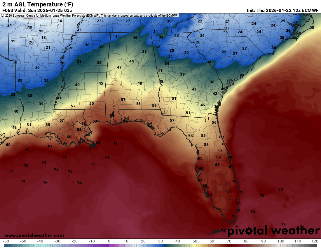
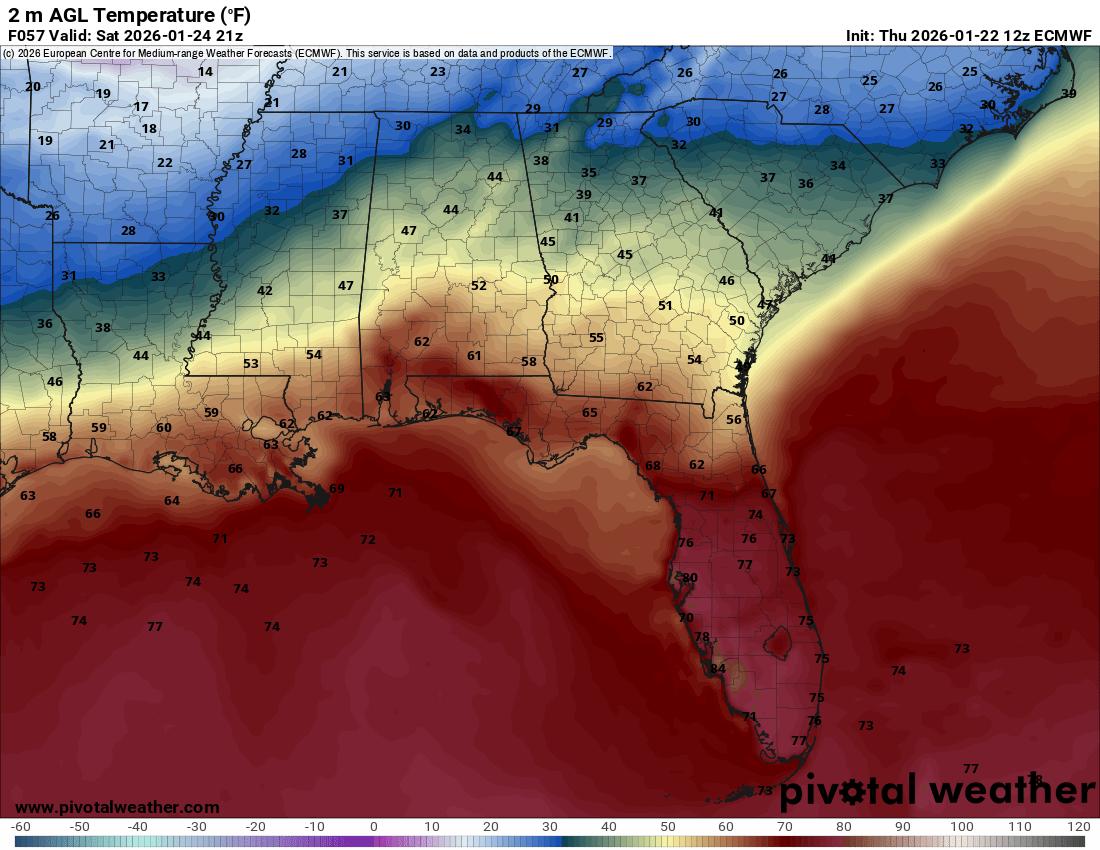
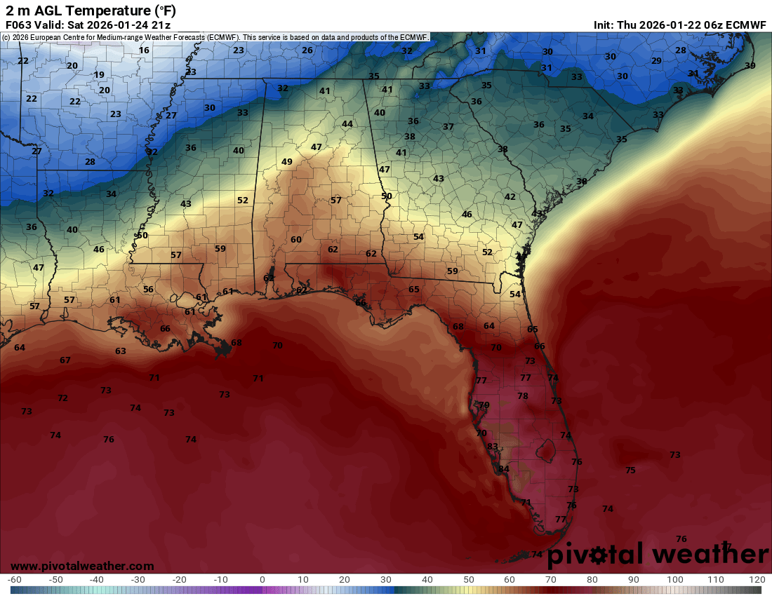
Well it caved on temps early on .
-
It's way cooler on the front end
-
EURO now showing the CAD coming up into Chattanooga

-
12z Euro 6z Euro


-
did they euro just cave?? @Carvers Gap
-
they went with WWA for NE Alabama.. Moore-Lincoln-Franklin TN- Including the cities of Town Creek, Arab, Athens, Cullman, Boaz, Lynchburg, Estill Springs, Fayetteville, Sewanee, Decherd, Scottsboro, Moulton, Guntersville, Winchester, Fort Payne, Huntsville, Cowan, Rainsville, Decatur, and Albertville 1104 AM CST Thu Jan 22 2026 ...WINTER WEATHER ADVISORY IN EFFECT FROM MIDNIGHT FRIDAY NIGHT TO 6 PM CST SUNDAY... * WHAT...Mixed precipitation expected. Total snow accumulations up to one inch and ice accumulations between 0.05-0.10 inches. * WHERE...Portions of north central, northeast, and northwest Alabama and southern middle Tennessee.
-
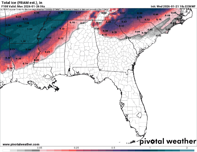
are they riding the ICON and GFS?? if so Chattanooga would get a good coating of ice
-
I have a feeling this thing is going to throw us some curve balls in the next 24/36 hours.
-
Looks like it’s time to prepare for an ice storm in Chattanooga .
-
EPB in Chattanooga is calling in 86 additional crews .
-
I know the EURO is the EURO but it’s only model not East Tennessee Ice which I’m hoping for, but seems like the outlier at this point. .
-
Thank you. I have not lived through an ice storm... Haven't sorta started to prepare, but honestly don't know what to prepare for here in Chattanooga.
-
would rain at 33 or even 34 not freeze on contact if we already have .75 of ice ?
-
but not before getting an inch of ice.... getting an inch of ice then going into a thunderstorm is something.
-
and we lost the GFS...
-
Also, to note on the ICON .
-
ICON… This screams trapped cold air in the valley which our in-house met said today. The icon also handled today’s system the best 2-3 days out. (I know that doesn’t mean much m) .
-
I can’t remember… Is NAM usually warm or lacking precip ? I know it’s one of them .
-
Interesting... the new recon data was not in the 0z NAM will be in the GFS and EURO
-
yeah.... Chattanooga at .38 and Knoxville at .73 already in that run
-
This feels like a good step... 18z 0z
-
I’m guessing if we don’t see it trend back towards us at the 0Z tonight we are officially cooked ?? .
-
Sorta reads we are gonna wait and not make changes till we get the flight data. .
-
Hopefully they are seeding it for a southern storm .