Chicago Storm
-
Posts
19,232 -
Joined
-
Last visited
Content Type
Profiles
Blogs
Forums
American Weather
Media Demo
Store
Gallery
Everything posted by Chicago Storm
-
The surface reflection, and whole storm for that matter, is a product of the Cali cut off wave that ejects out and interacts with the lead wave diving through the West. Really isn’t all that wrapped up or strong of a system, which is not surprising given what’s shown aloft. .
-
There’s even more to it than that. Obviously the lobe in Canada acting as a block and associated confluence, as you mentioned. …But also the fact there are three different waves coming into the west. There’s the initial wave, which is sort of cut off near the Cali Coast, and then two additional waves that dive south out of Canada, which will interact with said Cali wave. So in the end, there’s probably at least 4 different moving parts to watch. .
-
that’s not how it works. .
-
Less phased and more strung out.
-
Both Pac and Gulf, but much more-so Gulf.
-
EPS are far different than the GEFS. EPS spread is far less, and most are noteworthy.
-
Would be very true in many cases. However with this one, moisture transport is Pac supplied, not Gulf.
-
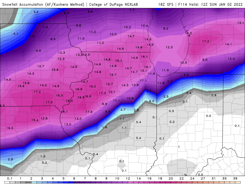
1.6” at MDW and 1.9" at RFD. .
-
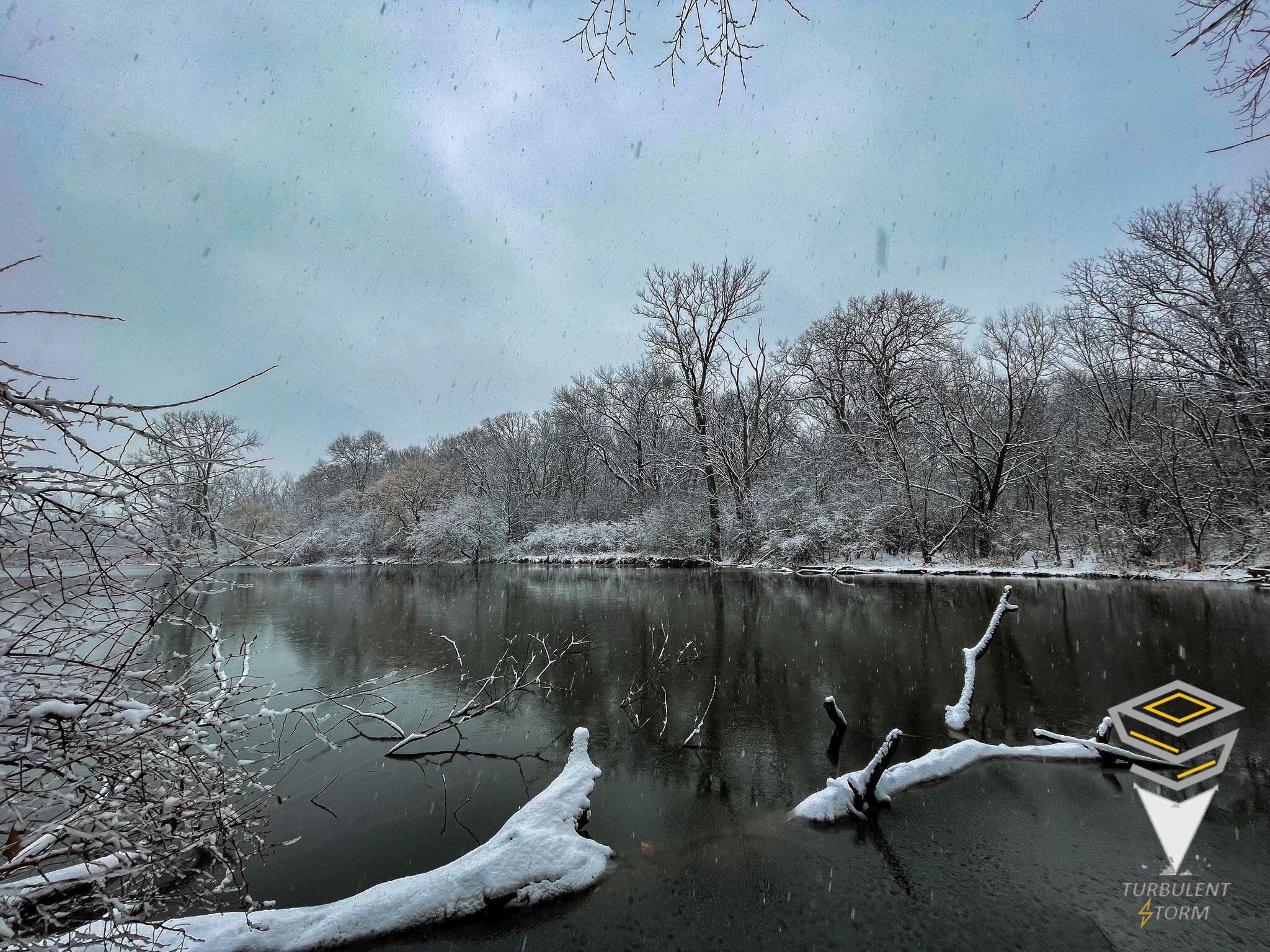
Finished with 2.7" here at home.

-
chefs kiss.
-
when are they not. their 'local tools and techniques' are always hoppin'.
-
+SN here under 30dbz returns. .
-
PIA area surprised, with several 2-3” reports. .
-
0.4” RFD and 0.1” at ORD. .
-
Widespread 2-4" reports in the QC area, as snow comes to an end.
-
0.5" at MDW as of noon...Not bad for there actually.
-
Waves within the mean trough are less strung out, and have more positive interaction.
-
Yea, that's one issue in this sub-forum. There has been plenty of big events in the region this season, but they've been up north where we have few posters.
-
Can confirm it's over.
-

Winter 2021-22 Short/Medium Range Discussion
Chicago Storm replied to Chicago Storm's topic in Lakes/Ohio Valley
Trend the past few runs has actually been less strung out. . -
Seeing pictures of ~1” in the PIA area, which bodes well for N IL. .
-
i’ve said it before and will say it again, please pay my next speeding ticket. i’m due for one. .
-
Winter 2021-22 Short/Medium Range Discussion
Chicago Storm replied to Chicago Storm's topic in Lakes/Ohio Valley
Agree. Trend this winter is for a the last wave coming down the backside of the trough to try and dig into the west, and it gets left behind a bit. That is where the GFS went that run. Even the Euro solution, albeit snowy, is also strung out. -
better find a ride for tomorrow, slick. .