
Kentucky
-
Posts
369 -
Joined
-
Last visited
Content Type
Profiles
Blogs
Forums
American Weather
Media Demo
Store
Gallery
Posts posted by Kentucky
-
-
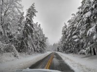
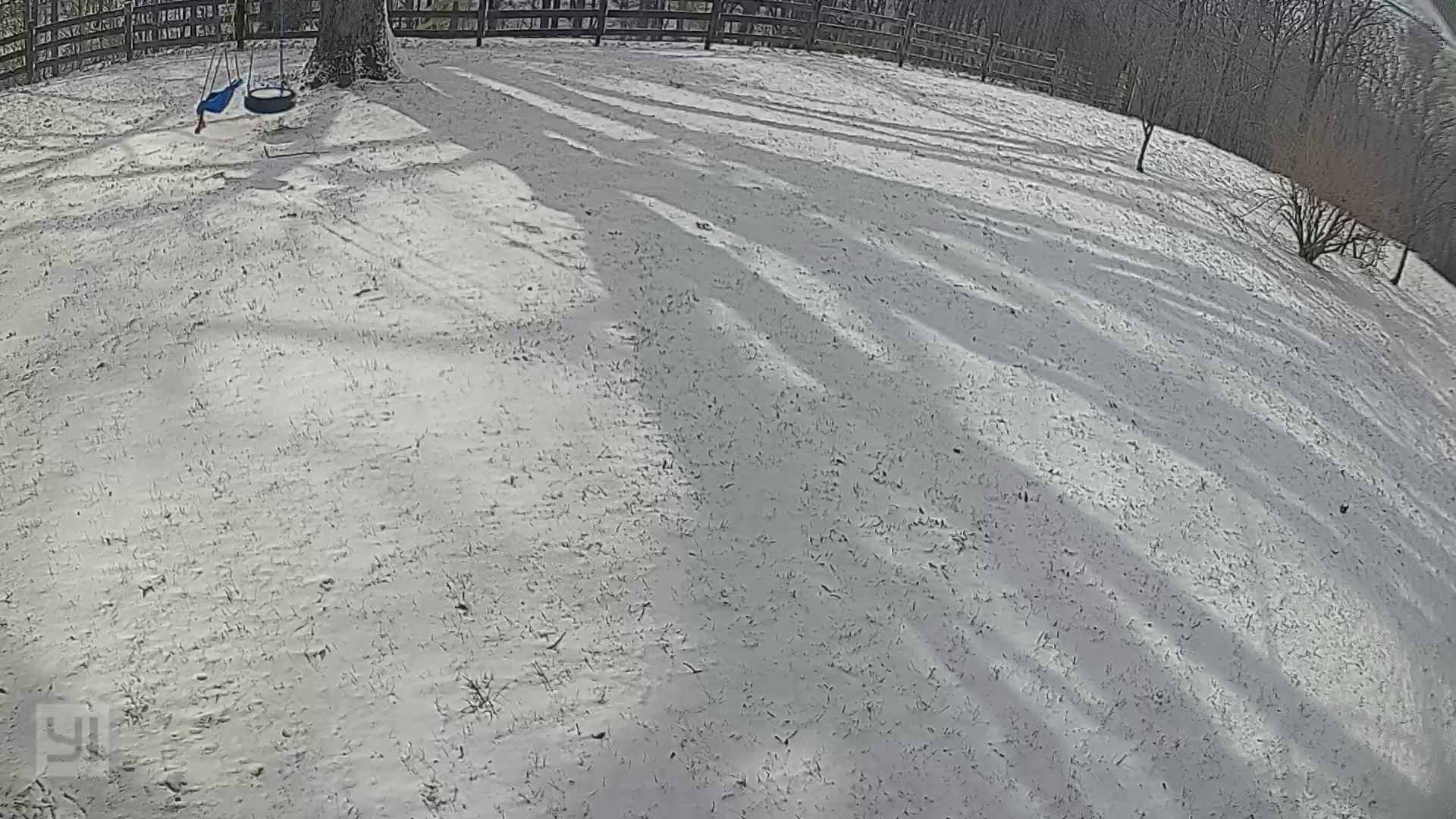
Pretty rare, but getting some flow snow in Corbin.
-
 6
6
-
-
Started and stayed mostly mix but picked up additional inch near the end. Had it arrived later, may have by a different story.
-
2
-
-
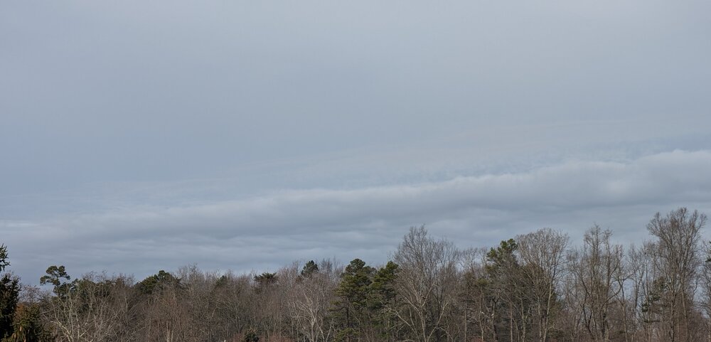
Isn't reaching the ground yet, but looking west...
-
5
-
-
Warming up fast in Corbin, now 29
-
1
-
-
I'm not an expert on this, by any means. But is the NAM not initializing with the snowpack in S/SE TN?
Not sure it will matter in the end as @jaxjagman mentioned but found it interesting.
.jpg.c3161beed47e5b606d71030a0ec50e1f.jpg)

-
1
-
-
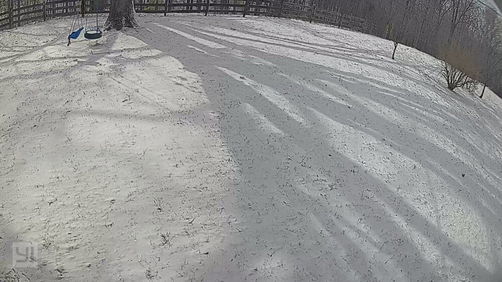
What a rare old school long duration event.
5 1/2" here just south of Corbin.
-
2
-
 1
1
-
-
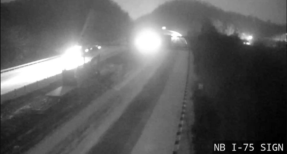
I-75 Exit 25
-
6
-
-
Light snow in Corbin,
game on folks
-
6
-
-
Couple of 20 dbz Virga passed overhead in Corbin. But finally getting some decent flurries now.
-
3
-
-
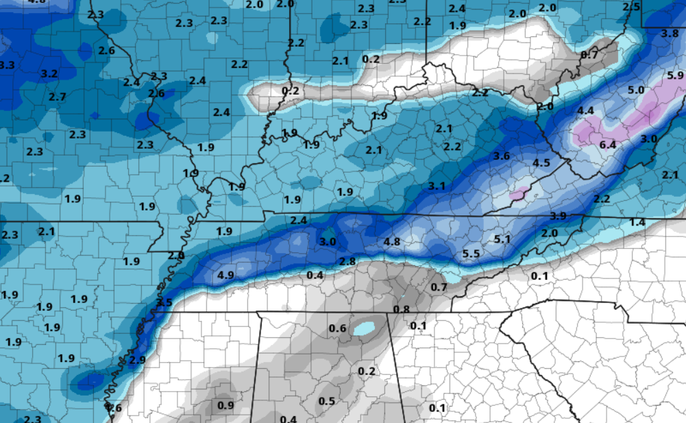
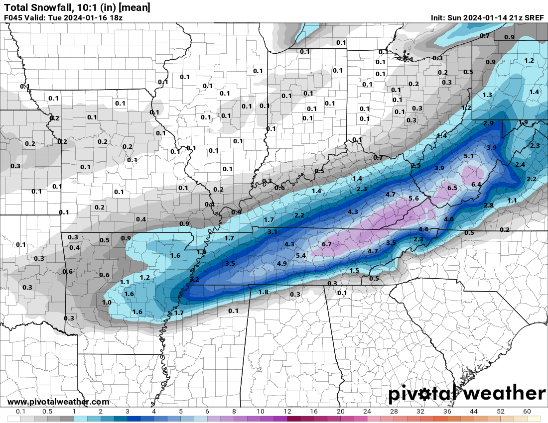
21z SREF thru 45 - this is 10:1 ratios

-
2
-
1
-
-
23z RAP thru 21
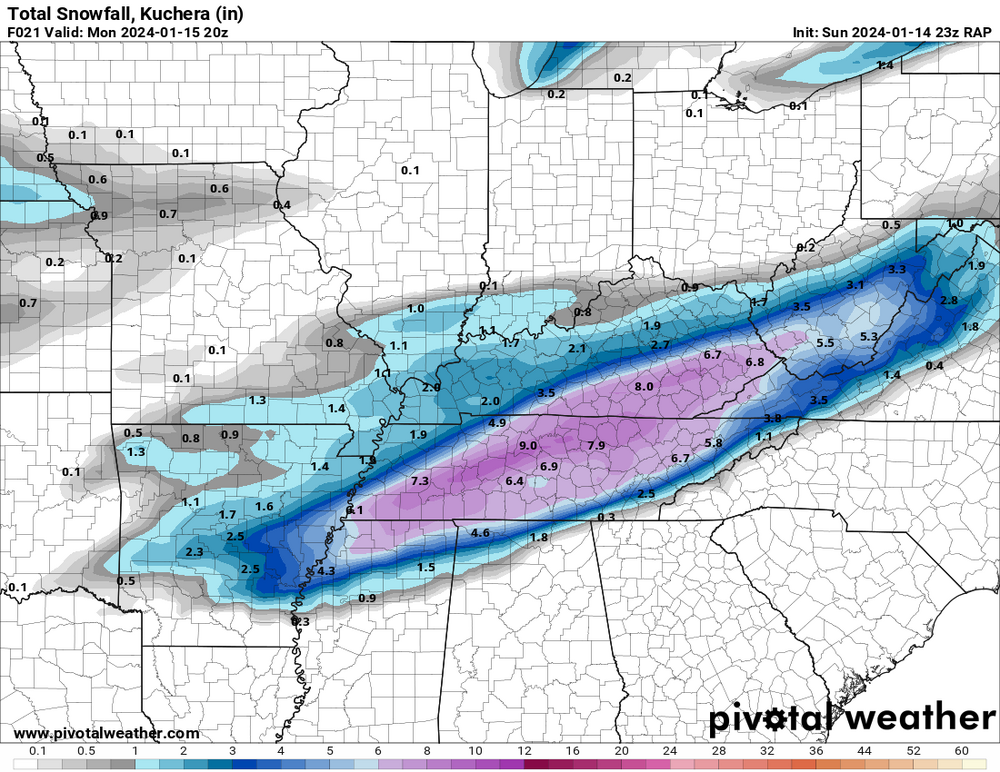
-
5
-
-
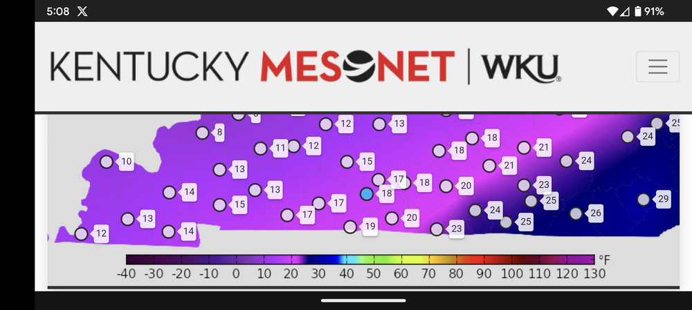
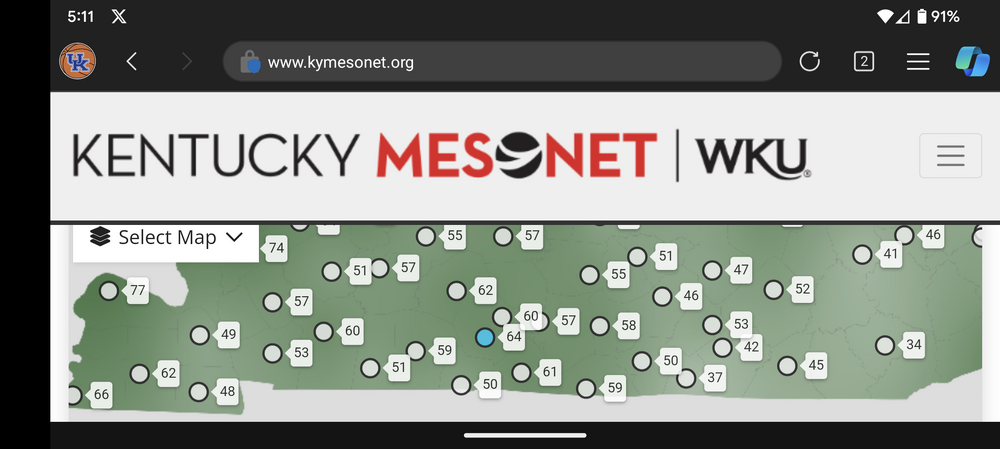
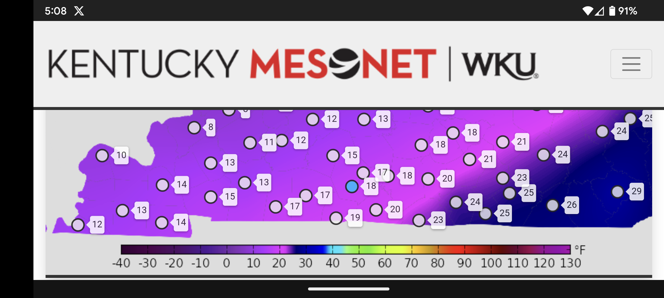
Current Dew Points, Temps & Humidity over Southern Kentucky

-
1
-
1
-
-
Good luck everyone, it's been a while. I'm more optimistic seeing JKL cave.
-
7
-
-
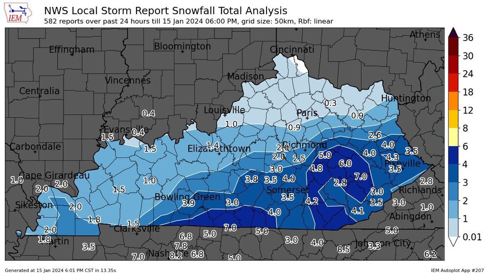
URGENT - WINTER WEATHER MESSAGE
National Weather Service Jackson KY
229 PM EST Sun Jan 14 2024

KYZ084>088-110-113-115>120-150330-
/O.UPG.KJKL.WW.Y.0003.240115T0500Z-240116T1700Z/
/O.NEW.KJKL.WS.W.0001.240115T0200Z-240116T1700Z/
McCreary-Whitley-Knox-Bell-Harlan-Floyd-Knott-Perry-Clay-Leslie-
Letcher-Martin-Pike-
Including the cities of Stearns, Whitley City, Corbin,
Williamsburg, Barbourville, Middlesboro, Pineville, Cumberland,
Harlan, Prestonsburg, Wheelwright, Hindman, Pippa Passes, Hazard,
Manchester, Hyden, Jenkins, Whitesburg, Inez, Coal Run,
Elkhorn City, Pikeville, and South Williamson
229 PM EST Sun Jan 14 2024

...WINTER STORM WARNING IN EFFECT FROM 9 PM THIS EVENING TO NOON
EST TUESDAY...

* WHAT...Heavy snow expected. Total snow accumulations of 3 to 8
  inches. Locally higher amounts in excess of 8 inches are
  possible, particularly at elevations above 1,500 feet.

* WHERE...Portions of northeast, south central and southeast
  Kentucky.

* WHEN...From 9 PM this evening to noon EST Tuesday.

* IMPACTS...Travel could be very difficult to impossible. The
  hazardous conditions could impact the morning or evening
  commute.

PRECAUTIONARY/PREPAREDNESS ACTIONS...

If you must travel, keep an extra flashlight, food, and water in
your vehicle in case of an emergency.
-
3
-
-
This would be a rug pull for the ages, for SE KY

-
URGENT - WINTER WEATHER MESSAGE
National Weather Service Jackson KY
205 PM EST Sun Dec 17 2023

KYZ044-050>052-058>060-068-069-080-085>088-104-106>120-180500-
/O.NEW.KJKL.WW.Y.0006.231218T1600Z-231219T0900Z/
Fleming-Montgomery-Bath-Rowan-Estill-Powell-Menifee-Rockcastle-
Jackson-Laurel-Whitley-Knox-Bell-Harlan-Elliott-Morgan-Johnson-
Wolfe-Magoffin-Floyd-Lee-Breathitt-Knott-Owsley-Perry-Clay-Leslie-
Letcher-Martin-Pike-
Including the cities of Flemingsburg, Camargo, Jeffersonville,
Mount Sterling, Owingsville, Morehead, Irvine, Ravenna,
Clay City, Stanton, Frenchburg, Brodhead, Mount Vernon, McKee,
Annville, London, Corbin, Williamsburg, Barbourville,
Middlesboro, Pineville, Cumberland, Harlan, Sandy Hook,
West Liberty, Paintsville, Campton, Salyersville, Prestonsburg,
Wheelwright, Beattyville, Jackson, Hindman, Pippa Passes,
Booneville, Hazard, Manchester, Hyden, Jenkins, Whitesburg, Inez,
Coal Run, Elkhorn City, Pikeville, and South Williamson
205 PM EST Sun Dec 17 2023

...WINTER WEATHER ADVISORY IN EFFECT FROM 11 AM MONDAY TO 4 AM
EST TUESDAY...

* WHAT...Snow squalls and showers developing. Total snow
  accumulations of up to one inch most places, though up to a
  couple of inches are expected above 1500 feet. The snow squalls
  of Monday afternoon into the evening will be accompanied by
  westerly wind gusts of up to 35 mph leading to times of low
  visibility.

* WHERE...Portions of east central, northeast, south central and
  southeast Kentucky.

* WHEN...From 11 AM Monday to 4 AM EST Tuesday.

* IMPACTS...Plan on slippery road conditions at times, along with
  reduced visibility. The hazardous conditions could impact the
  evening commute. Caution is urged for travellers Monday
  afternoon into Monday night.

* ADDITIONAL DETAILS...Most places will see only light snow
  amounts on grassy and elevated surfaces, but brief snow
  accumulations from any heavier snow showers would lead to
  driving impacts.

PRECAUTIONARY/PREPAREDNESS ACTIONS...

Slow down and use caution while traveling. Consider postponing
travel Monday afternoon and evening.

The latest road conditions for Kentucky can be found by visiting
https://goky.ky.gov.

&&

$$

GREIF
-
2
-
-
.30 of Rain in Corbin.
-
Some much-needed rain in Corbin, 1.07 for today.
-
4
-
-
Kentucky got smashed, hardly any rain in Corbin (0.04)
Long duration, wind event here

-
3
-
 1
1
-
-
Back to 0, high of 6 in Corbin today
-
2
-
-
2 minutes ago, Holston_River_Rambler said:
From a friend in Oak Ridge:

-
1
-
1
-
-
9 minutes ago, Daniel Boone said:
How much did you wind up with ? I've been looking at cams and Lexington got hammered. Just eyeballing, it looks like probably .5-6" there with 2 foot drifts
I'd say around an inch, side roads are solid ice underneath from the .10 rain prior.
-
4
-
1
-
-
Imagine this will be quite the streamer event for Eastern Kentucky.
-
1
-
-
31 minutes ago, BlunderStorm said:
@Kentucky@Jesse from KY@AnthonyEC How're things going west of the KY/VA line fellas?
Frozen Tundra, solid dusting of snow with good layer ice underneath. 20 degrees now, wind straight ripping.
-
2
-


Cold Shot: Part Duex - January 18-20th Arctic Blast and Freezing Rain/Snow Event
in Tennessee Valley
Posted
Side roads here today are worse than they been thru the entire event. Whitley County came thru yesterday and plowed off the fresh snow that had fallen on top of the pack and spread salt for the first time. The packed snow and ice packed melted slightly but they couldn't plow it off, they tried all afternoon. Then artic air "part duex" arrived refroze it all into even a thicker layer of ICE.
old school snow event, reminds me of 90's