
.png.faa34308b4202ddfdf5ad595624f7d9a.png)
Blue Dream
-
Posts
389 -
Joined
-
Last visited
Content Type
Profiles
Blogs
Forums
American Weather
Media Demo
Store
Gallery
Posts posted by Blue Dream
-
-
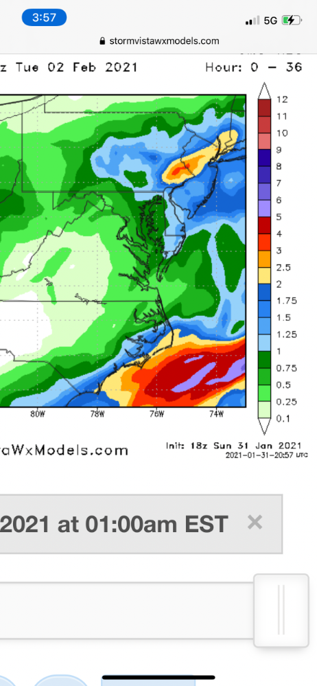
Feels good to have the NAM on board
-
That snowfall map is gonna be huge
-
1 minute ago, Newman said:

Beautiful
-
2 minutes ago, Birds~69 said:
I don't think the sleet/mix line is near them. It's in SNJ/N Del last I heard...right or wrong I don't know.
Yeah doesn’t look like the mix line is that close
-
Coming down really nicely in Langhorne now. 3-4” so far
-
 1
1
-
-
18 minutes ago, Violentweatherfan said:
Anyone south of Bucks County can get shafted by Miller B's, sorry MontCo
Yeah we usually do okay with Miller Bs in Lower Bucks
-
1
-
-
2 minutes ago, jrodd321 said:
Rgem continuously saying Nam is on absolute crack.

Looks ideal! Is the RGEM ever right?
-
Uhhh
-
1
-
 1
1
-
 1
1
-
-
Just now, nj2va said:
Will PSU worry about suppression though?
") 27 minutes ago, jaydreb said:
27 minutes ago, jaydreb said:Incoming on Euro!

Wow would love to see the snow map for that lol
-
1
-
-
1 minute ago, Newman said:
Euro definite shift SE with heaviest totals. Not bad for most. Still very very worried here about being on the edge. At this point, what can you do though. Time to let it all play out. It's been fun tracking this one with y'all
Looks really nice to me for the whole area?
-
Euro looks great!
-
1
-
-
Coming down pretty nicely in Langhorne. 26 F
-
18 minutes ago, Snowman1986 said:
I'm central bucks... so I hope so!
Nice! I’m in Langhorne area so not too far
-
3
-
-
Just now, mattinpa said:
And Montgomery County looking good for 12+ inches. This should be the best kind of storm where there are good totals region wide.
Yup, our whole area looks great right now. Hope it holds!
-
2 minutes ago, The Iceman said:
Judging by the snow maps, looks like another maximum from west central to nw NJ. Maybe multiple jackpots?
Bucks County looks good too
-
3
-
-
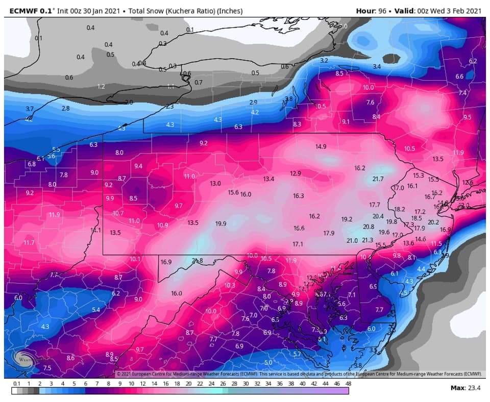
16 minutes ago, ChescoWx said:
My 1st Call Forecast for the area

Shift that S & E a bit ha
-
1
-
1
-
-
Wow, the Canadiens destroy most of our area and give Boston rain?
-
-
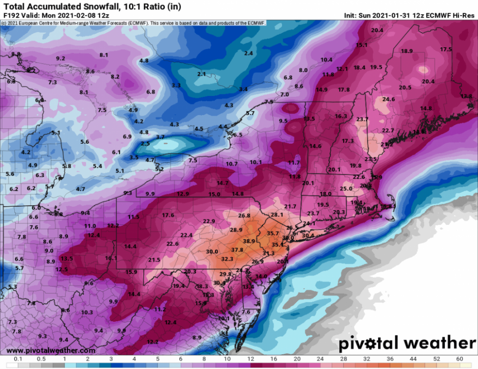
1 minute ago, Newman said:
Total Euro snow

Wow
-
Wow great runs tonight, thanks for the pbp guys
-
Can't really get any better for SE PA on that run...wow
-
5-6” in Langhorne. Any chance the sleet changes back to snow later?
-
Steady snow at the onset here in Langhorne. Hoping we can get somewhere around 6” before the flip
-
6 minutes ago, The Iceman said:
My expectations all along have been warning level event. Should still score that in Hopewell with the initial WAA thump. 6-10" sounds about right though I'm expecting more like 4-8". This is my first winter being in a traditional CAD zone with some elevation so I'm not as sure.
Based on my old spot in Levittown though, I'd only be expecting 2-4" there. 1-3" on the WAA thump then over to mainly sleet with light rain during the dry slot. Similar for philly. Feel for you guys and I hope the trend stops because I'm on the edge of warning snow now...
Hopewell has elevation? Yeah, I'm not expecting much of anything in Langhorne, PA besides sleet at this point. Hope you do a little better up there!


Jan. 31-Feb. 2 Miller B storm
in Philadelphia Region
Posted
NAM has snow through Tuesday night