
.png.faa34308b4202ddfdf5ad595624f7d9a.png)
Blue Dream
-
Posts
389 -
Joined
-
Last visited
Content Type
Profiles
Blogs
Forums
American Weather
Media Demo
Store
Gallery
Posts posted by Blue Dream
-
-
Definitely seems like high ratio, like walking through powder.
-
Just now, Birds~69 said:
Back to normal size..winds have kicked in a bit though.
Down to 21F...haven't been outside yet but looks like fluffy stuff. (high ratio)

It’s straight powder
-
2 minutes ago, The Iceman said:
Wow!! May have to take a trip down to lower bucks. My brother in lower makefield said he's getting raked and has over 3" so far. Best banding has been south of me so far in Hopewell, only about an inch here.
Yeah I wasn’t expecting much and I didn’t know it was starting this early!
-
Shocked to wake up to nearly 6” in Langhorne, damn I should’ve gotten up earlier lol
-
 1
1
-
-
2 minutes ago, Ralph Wiggum said:
Over the past 18 hours we have seen the trend across guidance for less thump/overall snow with less extreme f gen banding, less of a 700mb jet, and a faster transition from snow to sleet/slop from S to N hence the lower snow depth maps. In my experience when we see these changes leading up to game time that means mixing will be the primary p type from around 202 (maybe a bit farther N and W) on South and East.
Expecting snow to break out here in lower central Bucks by 7am Thursday. Moderate for a few hours maybe even a burst on SN+ right before the switch over to sleet by around lunchtime. Should be 2-5" on the ground by that point then sleet and fzra continue thru the afternoon before dry slotting in the evening with more showers type mixed precip ending shortly after midnight on Thursday. Total snow/sleet by finish here 4-7".
Not bad when it looked like a rain storm a few days ago
-
3
-
-
5 minutes ago, RedSky said:
It's even got the Hopewell hole
Lower Bucks hole
 lol
lol
-
 1
1
-
-
Will this effect travel on Saturday as well?
-
1
-
-
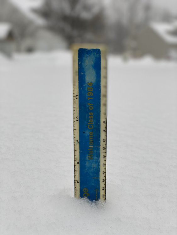
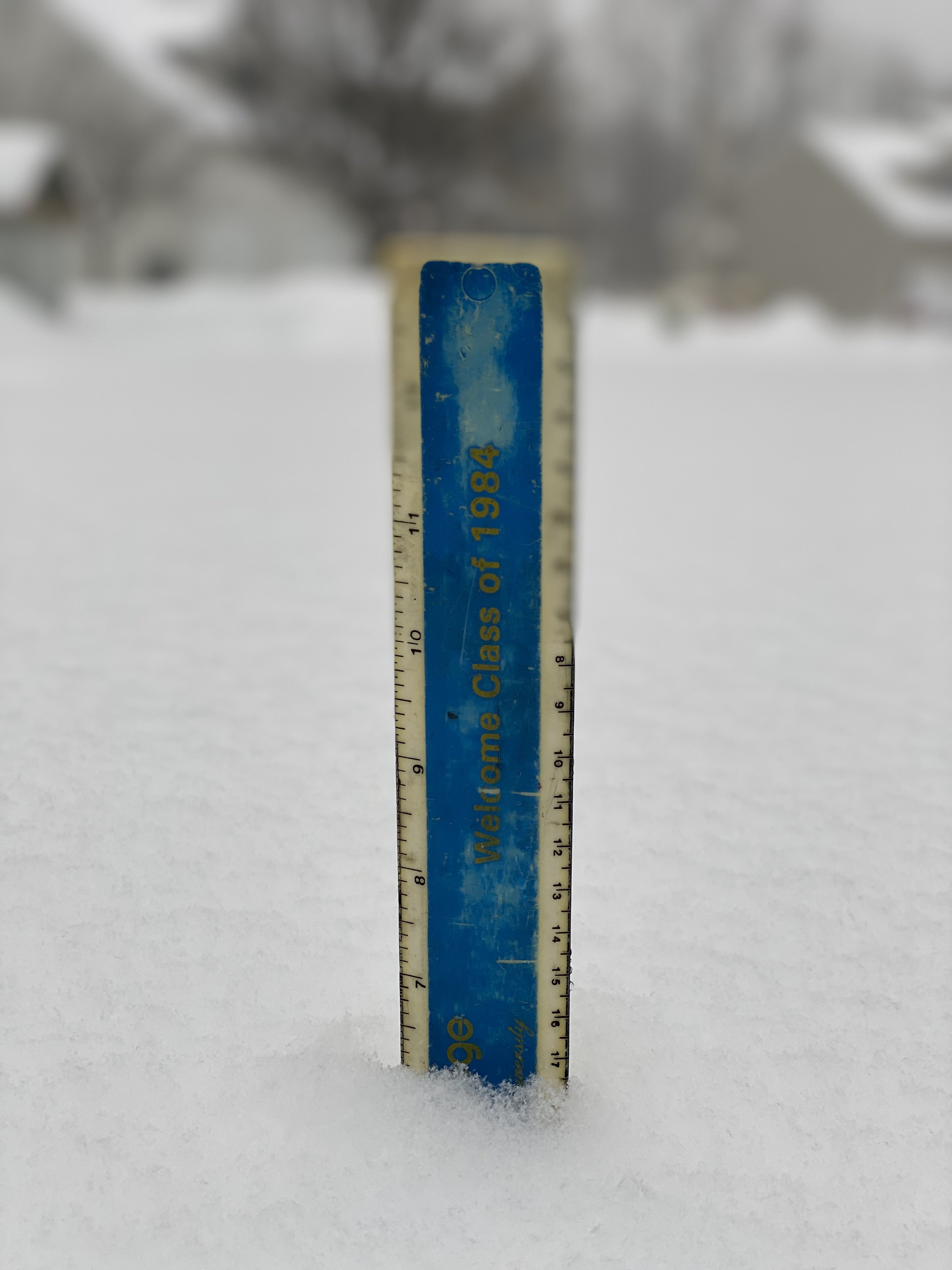
I don't have an exact number for Langhorne in Lower Bucks but I'd say about 25" give or take.
-
Man I feel kinda bad for the DC folks but I'll gladly take another few inches
-
How much longer for the heavy stuff? Dumping in Lower Bucks still
-
Puking snow in Langhorne, heavier than any of the bands last week. Starting to cover the roads here.
-
1
-
-
2 minutes ago, Wentzadelphia said:
I’d favor just SE of the city right now for the isolated 8-9” pops but that could change if this trend continues
I'm going to be in Ocean City this weekend...rough commute home on Sunday morning?
-
1
-
-
Looks like we just got NAM'd
-
5 minutes ago, RedSky said:
23"
something feels....askew
Yeah that seems a little off
-
6 minutes ago, RedSky said:
^^^^^ ok wait a minute Cooperburg 31" really! I am 3.3 miles away there is no way
You don't measure the snow piles in the parking lot people!
A friend of mine measured 24” in Coopersburg, weird. How much did you get?
-
About 10” in Langhorne, the sleet really killed our totals. Maybe squeeze out a few more inches today and get to a foot. Snowing decently now.
-
Very light now in Langhorne. Can we expect it to pick up again?
-
Just now, Birds~69 said:
Decent shot Allentown hits 30"+...
27F / hvy snow
Friend in Coopersburg has 20 already
-
Just now, Violentweatherfan said:
I think that sleet packed down an inch at least. There might be more than that since the beginning.
Good point, hope we get to double digits!
-
7" in Langhorne, moderate snow
-
1
-
-
Just now, Violentweatherfan said:
Yeah, been light to moderate snow since the changeover.
Where in Langhorne are you? Seems to be picking up
-
Finally snowing pretty good in Langhorne
-
1
-
-
2 minutes ago, The Iceman said:
Well looks like it's dry slot time lol another thing that wasn't modeled at all. Just an unbelievable bust here...
Wont it fill in soon?
-
Changed to snow but now appear to be in a lull lol
February 18-19 Event
in Philadelphia Region
Posted
Yeah definitely a little graupel mixed in here in lower Bucks at the moment. 7” of new snow so far