BornAgain13
-
Posts
4,464 -
Joined
-
Last visited
Content Type
Profiles
Blogs
Forums
American Weather
Media Demo
Store
Gallery
Everything posted by BornAgain13
-
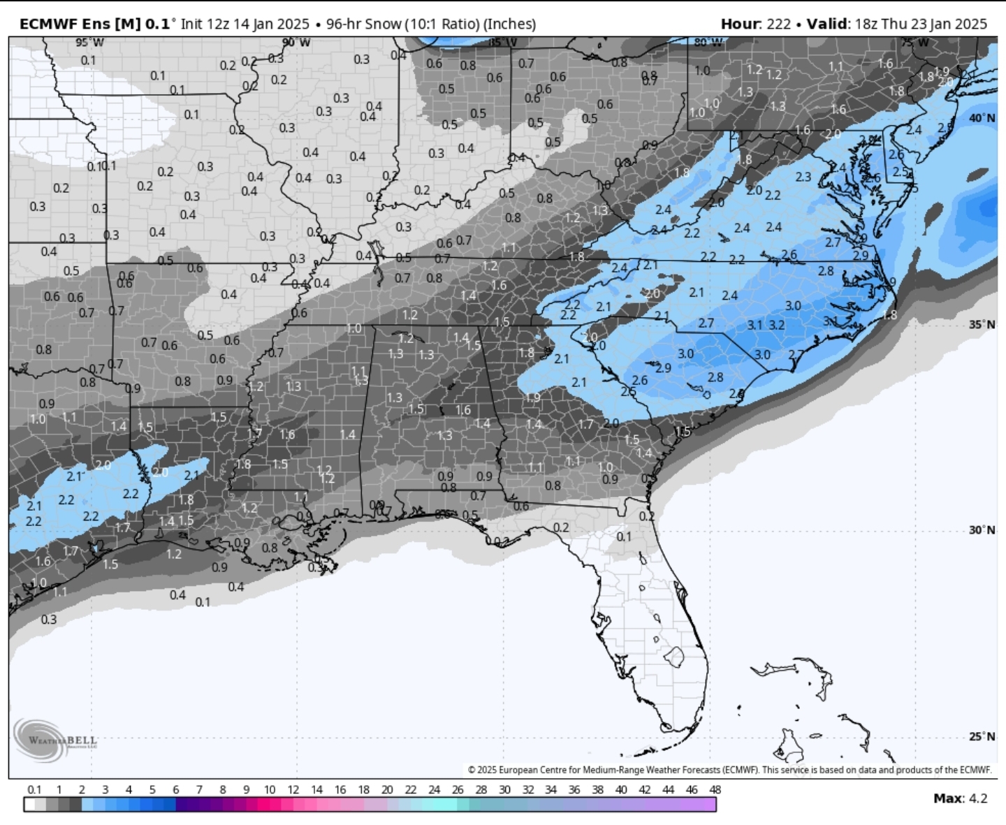
96 HR EPS for that time period

-
Some monster hits in their!
-
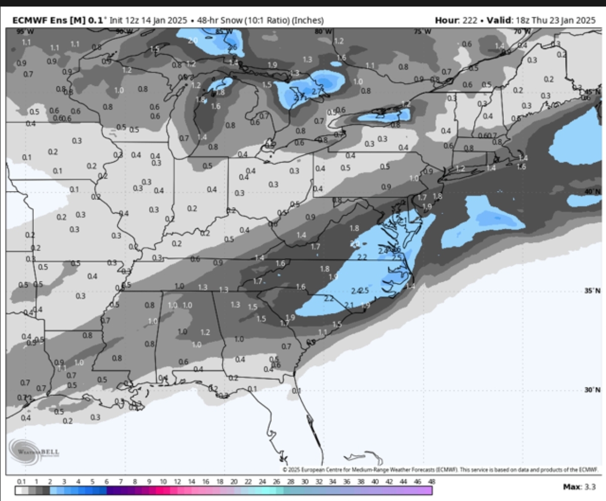
This is a pretty significant jump from 0z

-
Don't think the run is finished...
-
Ouch, Durham with Freezing Rain at 25 degrees.... That is a catastrophic ICE event.
-
5-6" of Snow/Sleet with ZR on top of it. I'll take lol
-
SW VA and Central and Northern VA are the big Snowfall Winners per EURO. Huge Mess and ICE storm elsewhere
-
12z EURO with a massive Winter Storm... But it's warmer than the GFS... It's an upper SE, Mid Atlantic special
-
Well, maybe not to much of a step back just a little later... Still a big run NC and VA
-
Would love to see the Euro show what the EPS was showing... I have a feeling the euro will be suppressed today but maybe not...
-
12z GEFS has the storm but a small step back from 6z
-
The UK I believe was about to bring a big storm!
-
12z CMC with a storm as well but looks further south and ICY
-
Foot to a Foot in a half in central and eastern NC and Southern and SE VA
-
@Brick Tamland, 12z GFS says hey Brick, this run is Sick!
-
This is a Major ICE and SNOW Storm for certain areas per GFS
-
12z GFS With another Low pressure incoming right after this one....
-
Good Winter Storm for a lot of the SouthEast.
-
Snow starting in Georgia at 159
-
12z GFS with a storm forming in Texas at 153...
-
The 0z Euro AI is a big Winter Storm for next week as well.
-
Shall we name this possible storm, The Brick Storm? Lol
-
And yes the Euro OP was dry but the EPS is not. Decent signal on their to.
-
Y'all check out the 6z GEFS. It shows a decent support for the monster OP run that just happened.
-
6z GFS with a massive Winter Storm for day 8/9