

Runman292
-
Posts
698 -
Joined
-
Last visited
Content Type
Profiles
Blogs
Forums
American Weather
Media Demo
Store
Gallery
Posts posted by Runman292
-
-
17 minutes ago, nrgjeff said:
Good point Dusty. Actually the morning (or just earlier) rain likely laid down an outflow boundary which enhanced local storm relative shear SRH. Absolute instability is not always as important as the rate of destabilization - which is fast going from rain back to sun. Speaking of all that, East Tennessee had morning rain today (Friday May 6).
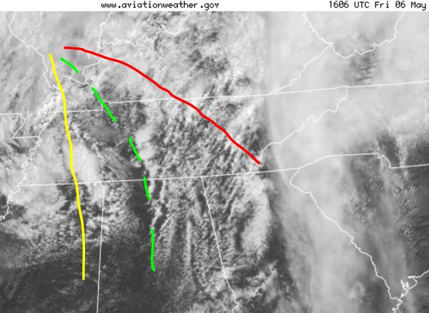
Surface low in IL about to track into IN. Cold front in Missouri is not drawn. Quasi dry line DL in yellow, hailers probably on it under colder mid-levels. Warm front WF in red should host some hailers with some wind. Prefrontal trough dotted green is most interesting. Should have a blend of instability and some wind shear.
Low level shear is a little better on the WF, but instability is just-in-time. DL is a little veered off both sides for tor. Prefrontal trough PFT might have that low top arc. We'll see. PFT could also accelerate (actually mix east faster with background wind) and/or merge with WF. Faster would put the area of interest east of Chattanooga later. Knoxville depends on instability and storm interaction.Just in 16:30 SPC shows that arc shape with the ENH part. Flexible forecast for either WF or trough East Tenn. Arc into Georgia.
This post is an example of why i love being on this board. I learn more about the weather than i ever would anywhere else.
-
 2
2
-
 1
1
-
-
As i just made my post, it looks like the sun is trying to come out in Oak Ridge.
-
I wonder if all of this lingering rain is going to limit the overall severe threat this afternoon.
Edit: Dsty beat me to the punch, lol.
-
10 AM update from MRX:
An active severe weather day is expected. The main driver of this
event will be a negatively-tilted trough with a strong vort max
that will be rotating around a closed upper low, and the
associated jet streak at the base of that trough. Over the next
few hours, we expect that convection will develop along and west
of I-75, where the RAP and HRRR show an axis of higher CAPE
values. We are already starting to see this development in NE AL
at the moment. This instability axis shifts east into the central
Valley during the early afternoon, and into NE TN/SW VA in the
late afternoon. Aloft, we will have a surge of dry and cooler air
aloft that will aid in destabilization by steepening midlevel
lapse rates. In the 12Z OHX sounding, we are seeing values of 7.5
C/km, which will be advecting east. Deep shear will be adequate
for supercells, and 0-1 km shear values and LCL heights suggest a
tornado threat, mainly for areas south of I-40 and east of I-75.
However, it is notable that the HREF shows some updraft helicity
tracks north of I-40 this afternoon, so a tornado threat can`t be
ruled out anywhere.

This initial round of storms between 11-4 pm are expected to
mainly pose a damaging wind threat with a lower threat of
tornadoes, then a second round is expected to develop in the mid
to late afternoon near the Plateau, which may be primarily a hail
threat as WBZ heights quickly drop as the closed upper low
approaches. The HRRR shows this second round crossing our area
between 4-8 pm.
-
1
-
-
3 hours ago, nrgjeff said:
Wednesday afternoon the SPC updated Day 2 (for Thursday) pushing Slight into Nashville and adding 5% tornado from West Kentucky through Clarksville TN into the Nashville metro.
That is along the Wednesday cool front, retreating as warm front and/or outflow boundary Thursday. See if any morning rain, which would actually enhance local SRH if rain departs by Noon.
I'm not really expecting anything big. Just need to give our region some attention. I can't get to the Plains yet, ha. Most likely Thursday Tenn / KY is just clusters and straight wind.
What are your thoughts on Friday?
-
6 minutes ago, Greyhound said:
My wife said the same thing.
Is that it for the night???? Looking at radar to the west doesn’t look that impressive.That was the front, so that's it for the severe weather.
-
2
-
-
Had a good downpour and a few rumbles of thunder in Oak Ridge. Not a lot of wind was at my house.
-
2
-
-
According to MRX, the high in Oak Ridge was supposed to be 76 degrees. It's 80 degrees with the sun out.
-
1
-
-
MRX AFD:
Discussion:

As of 3PM ET temperatures were warming into the low to mid 70`s
underneath partly cloudy skies. Radar shows a line of showers and
a few thunderstorms developing across middle Tennessee associated
with an approaching front. SW low level flow continues to advect
a moist and increasingly unstable airmass northward this afternoon
with RAP analyzing MLCAPE`s between 500-1000j/kg across the
central/southern valley and plateau areas. The front will continue
to progress east this afternoon with moisture advection
continuing. Expect a gradual increase in storm coverage and
intensity over the next couple of hours as this current activity
moves into a more favorable airmass situated across east
Tennessee. Shear will be more than adequate for updraft
organization as deep layer shear increases to 40-50 knots (higher
north of I-40). Shear vectors oriented just off the boundary will
promote at least some discrete convection and line/bowing segments
into the evening. While damaging winds will continue to be the
main hazard, the threat of tornadoes certainly shouldn`t be
ignored. Shear within the lowest 1km between 15-25 knots along
with favorable LCL heights will maintain the tornado risk through
the evening, especially south of I-40 where better instability
will be located. Additionally, any rotating updrafts will contain
a risk of large hail.
-
1
-
-
The sun is out in Oak Ridge. I can definitely feel the air getting more humid.
-
1
-
-
Got about 3 inches on my car in Oak Ridge.
-
2
-
-
Don't have a ruler, but i would guess a little over 1 inch so far in Oak Ridge.
-
4
-
-
5 minutes ago, PowellVolz said:

.I can confirm that lightning strike. The thunder shook my house. Speaking of which, it's all snow in Oak Ridge now. Heavy quarter size flakes!
-
3
-
-
Very loud thunder that shook my house in Oak Ridge.
-
4
-
-
Nickel size flakes mixing in with sleet and rain in Oak Ridge.
-
3
-
-
Heard on WBIR weather's live video on facebook that people heard thunder and saw lightning in Rockwood and Harriman.
-
3
-
-
Very heavy sleet in Oak Ridge. It's really loud outside.
-
3
-
-
1 minute ago, John1122 said:
Very heavy snow now. Ripping in sideways. Amazingly the ground is getting white quickly. No puddles I guess.
Must be the pesky random band of snow.
-
2
-
-
14 minutes ago, Dsty2001 said:
Clearly the pictures of snow sticking are photoshopped, grounds too warm
-
1
-
 1
1
-
-
12 minutes ago, John1122 said:
WVLT met is killing me again. He just said "We've got some warm rain falling, it's not going to be enough to make puddles, but it will be enough to stave off accumulation for a while."
I've never seen anyone more obsessed with puddles and anyone so wrong about the dynamics of sticking snow.
I've seen more intelligent discussions about the weather here than i've heard from Ben Cathey and Ken Weathers combined.
-
1
-
2
-
-
3 minutes ago, TellicoWx said:
That's like a carpenter who doesn't being a hammer to work, instead he brings a spoon lol...someone needs to ask him what he uses then..tea leaves, 1-900 psychic hotline from the 80's...im curious now
I've heard from the grape vines that he gets his forecasts from Miss Cleo.

-
1
-
4
-
-
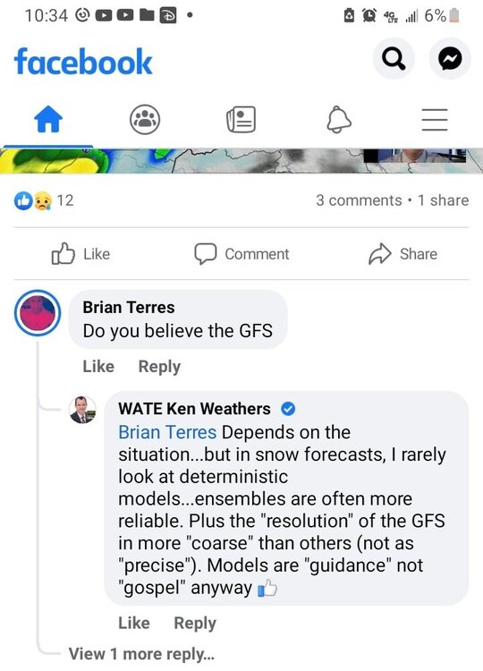
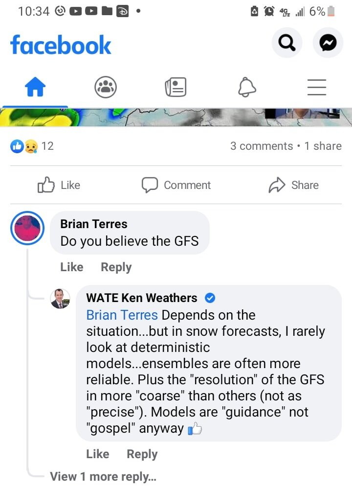
Lol at "rarely looks at deterministic models".
-
1
-
3
-
-
-
1
-
-
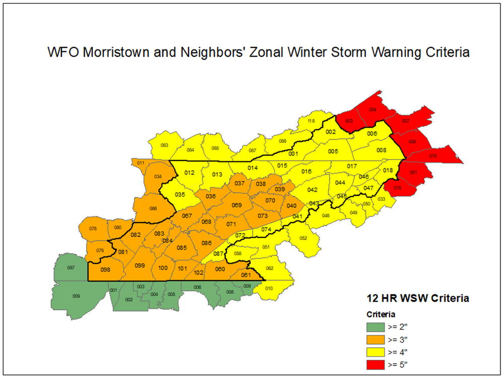
19 minutes ago, John1122 said:
No, the criteria is generally always the same in each CWA. It's different in Georgia vs Chattanooga but usually the same for all of MRX's area.
Just found this on MRX's website. Th3 critera is actually different based on location. The central and southern valley are in the 3" or greater zone, while the "horseshoe" counties are in the 4" or greater zone. That is the reason why NE TN is under an advisory and not a warning.
-
3
-
1
-


Tn Valley Severe Weather
in Tennessee Valley
Posted
I have a question. Will the storms down in Florida and Georgia have any notable impacts on the storms that form up here?