MazooWeather
-
Posts
3,865 -
Joined
-
Last visited
Content Type
Profiles
Blogs
Forums
American Weather
Media Demo
Store
Gallery
Everything posted by MazooWeather
-
Tornado on the ground near Youngstown right now
-
The amount of rain, thunder and cloud to ground lightning earlier tonight was absolutely wonderful
-
Storm that popped up overhead went from nothing to producing 80 mph wind gusts immediately
-
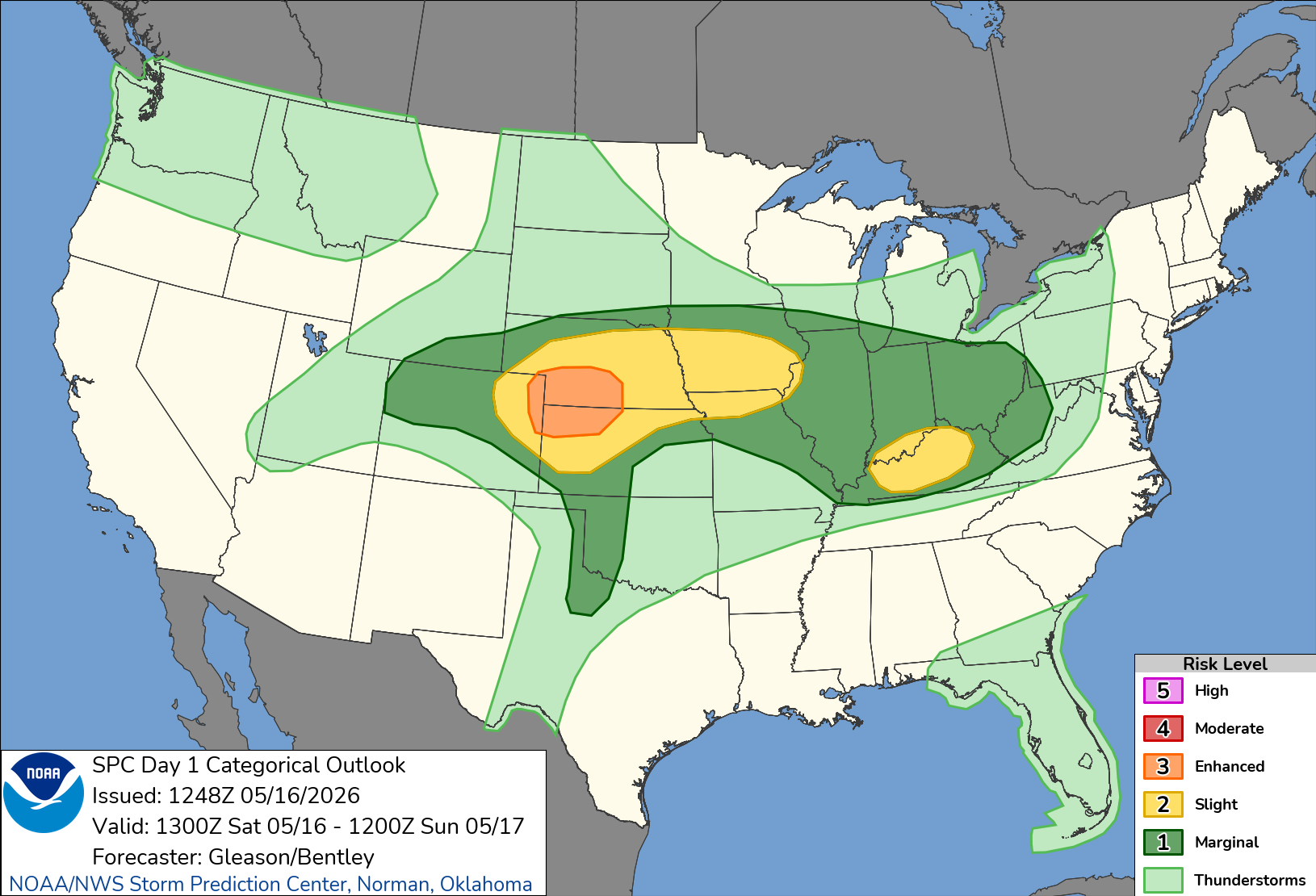
Tne SPC upgraded Oklahoma for wind to enhanced at 01Z but not where there's an ongoing tornado outbreak lol
-
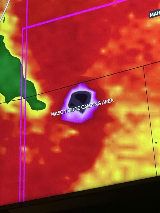
Looks like it direct hit a campground
-
Spc discussion on it says the environment out ahead of it has fully recovered, this might be the storm of the event, definitely a violent tornado.
-
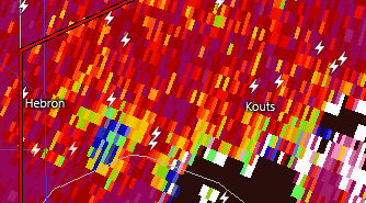
Monster debris ball and cc drop near Gosport IN
-
The fact we've managed to get a couple of big ones in what should have been a completely rained out event just shows how this event could've been something historical if things went a little differently
-
Yeah, the blob of rain is only really hitting the first row of counties and is nowhere near as heavy as predicted lol
-
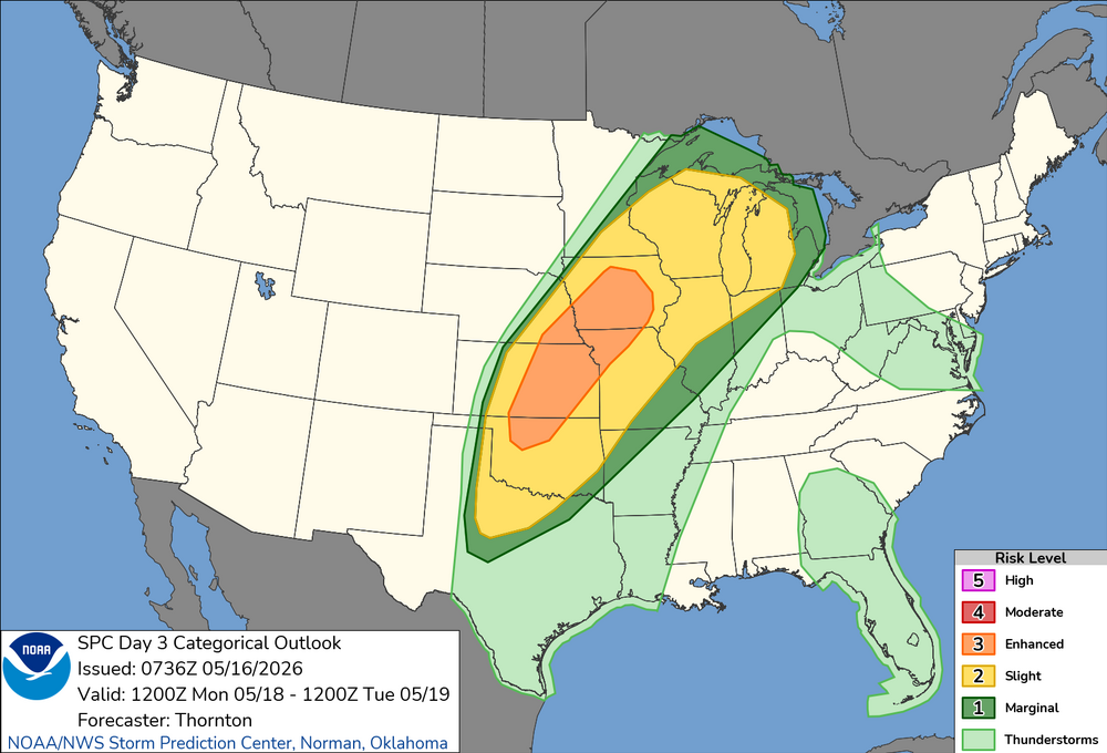
Slight risk introduced for today for Michiana, 5% TOR
-
"A few strong tornadoes" 100% verified yesterday
-
holy shit
-
Possible tornado moving onshore near Holland, MI
-
Gonna need a downstream watch soon, environment in Michigan the storms are gonna be entering is juiced
-
The rain is decaying pretty fast
-
Looking like it's just gonna be some rain that should be long gone by daybreak instead of sustained overnight development, could be a rocking day
-
CAMS show a violent atmosphere in Western MI tomorrow night, if we don't get rained out could be a high end event for around here
-
PDS Severe Thunderstorm Warning for the SW Chicago burbs
-
finally some action soon
-
What a lovely introduction to Kalamazoo storm wise, probs was close to 65mph here. Thankfully didn't lose power.
-
looks like you're probs getting 70 mph gusts rn
-
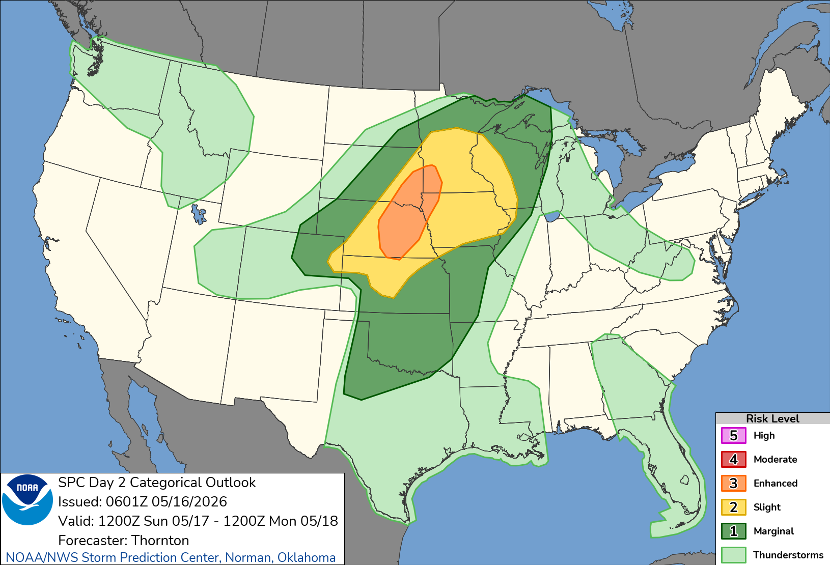
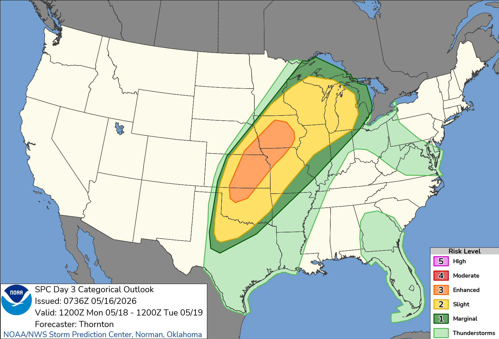
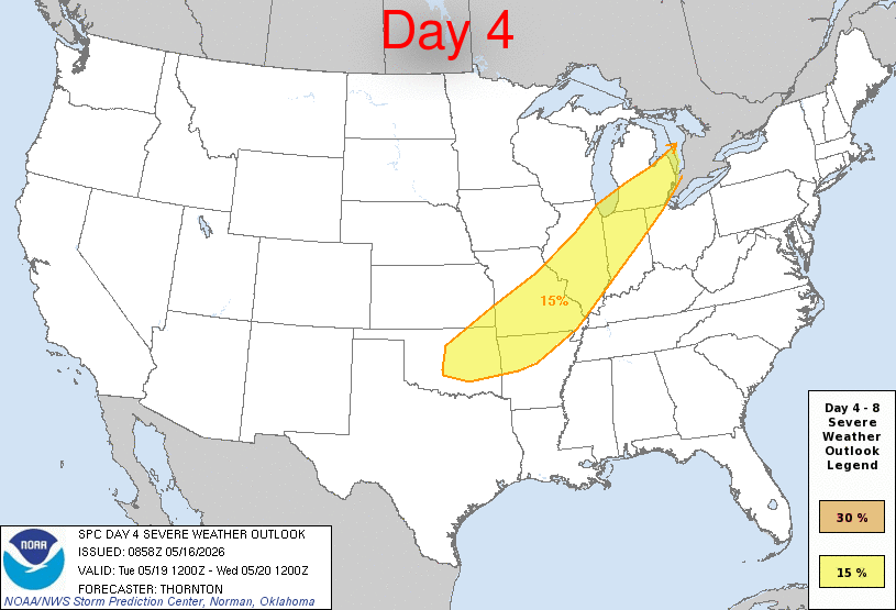
Gonna be a long couple of days, Monday looks particularly like it has a lot of chances for long track tornadoes.


-
SPC made an oopsie last night on the 01Z outlook First ever 0% CIG1 lol
-
For sure! It's weird having options of stuff to do compared to Hillsdale lol
-
Moved today, new name and everything.