

lakeeffectkid383
-
Posts
5,052 -
Joined
-
Last visited
Content Type
Profiles
Blogs
Forums
American Weather
Media Demo
Store
Gallery
Posts posted by lakeeffectkid383
-
-
16 minutes ago, MJO812 said:
Oswego only has 53 inches? That seems really low.
Yep lake view 50” is def way low. I know I’m higher then them in several events but I’m only 5 miles away from them and I’m almost at 80” they gotta be closer to 70”. No idea where these numbers are from.
-
 1
1
-
-
17 minutes ago, Geez150 said:
I too am wishing for another 10 plus state wide event to break out. I would also love for an arctic outbreak. But would settle for high 20s. To me winter should last until mid March then start having the ups and downs like we are seeing this week. If only....
Give me cold and snow till end of March. Love big storms in middle to end of March like 2017 I believe it was when I got 27” in that storm/lake enhanced in the middle of March. Once it hits April bring the warmth but we all know that doesn’t happen around here.
-
4
-
-
51 minutes ago, 96blizz said:
Man. You guys are lucky. You mustn’t have young children! Can’t wait till they’re a bit older to do more things like this!!
Someone that feels my pain! I have 3 kids under 3! Haha
-
 1
1
-
-
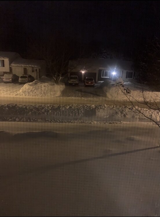
Snow banks are about 4-5 feet high all the way down my road. Had to dig out the mail box as it was literally completely buried in snow.
-
9
-
-
Heavy snow in Boston the last hour or so. About 2” of pure fluff in the last hour. Just perfect dendrites.
-
1
-
-
1 minute ago, BuffaloWeather said:
Snow moving back in
Was just gonna post this. Moderate snow in Boston and best flake size of the whole event now. Not gonna accumulate much with the rate but enough to keep things freshly coated.
-
Surprised to wake up and only find another 1.7” here. Snow is just about done here. Final total as of now is 12.5”. This now makes two 1 foot + synoptic storms in the last 3 weeks with a 14” lake effect event sandwiched in between. Pack is at 21” otg. Definitely some decent compaction given over 12” fell.
Brings me up to 78” on the dot for the season.
-
1
-
 1
1
-
-
10.2” as of 10pm. Think we’ll end up somewhere between 12-14” before all is said and done. This stuff is no joke, pure paste on the bottom and sand and sugar grains on top. Still had almost 11” glacier before this event so pack is around 20” right now. Still snowing nicely.
-
3
-
-
Just measured 8.2”. This storm is a banger man! Just DUMPING out there. Better flake size and snowing at probably 1.5”/hr. Radar looks beautiful. Bout to go out and snow blow!
-
3
-
-
Measured 6.3” in the driveway that was clear last night. Ripping out there but flake size isn’t ideal.
-
1
-
-
-
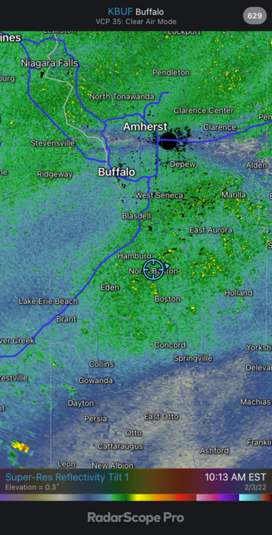
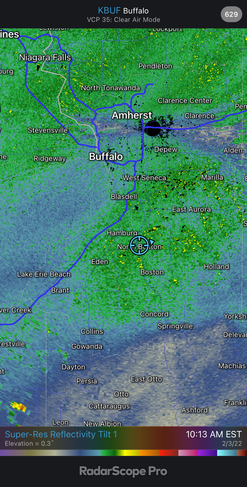
5 minutes ago, BuffaloWeather said:
Confirmed reports of mixing line just south of Cleveland. Definitely further north than modeled.
Dude look at CC on RadarScope. It’s mixing down in Olean. Not far away at all.
-
3
-
-
There’s not a doubt in my mind we’re gonna see a foot easy from this storm here. It’s just ripping.
-
1
-
-
1 minute ago, PerintonMan said:
Yeah this is kind of what I'm saying. The jackpot zone isn't going to be BUF-SYR (though the whole region will cash in pretty well). It's going to be just north of the mix line.
Once you factor in better ratios from BUF to ROC well all do about the same. We already have 5” here. I’m fully expecting another 7-10” here which would put us at 12”+
-
1
-
-
Totally thought there was going to be a break or at least a period of time of the flurries between this mornings batch and this afternoon/tonight’s heavier stuff but radar looks phenomenal for this area and the snow just continues to pound even though flake size has decreased again we’re still probably at .75”/hr or so.
we’re at 5” here already.
-
4
-
-
Totally thought there was going to be a break or at least a period of time of the flurries between this mornings batch and this afternoon/tonight’s heavier stuff but radar looks phenomenal for this area and the snow just continues to pound even though flake size has decreased again we’re still probably at .75”/hr or so.
-
1
-
-
Only 26 here but snow is still pure paste. Pound town baby!!
-
1
-
-
Crush job in progress here snowing easily 1” hr +. 4 “ down. Don’t see any way we don’t see a foot or more here. Just awesome out right now.
-
5
-
-
Just now, Thinksnow18 said:
Pure currier and Ives…not feeling this storm. 1.9” and light snow with small dendrites. I’m going at the low end of 8” for KBUF and Williamsville…but if an underachiever
Were already at almost 3” in the southtowns and we’ll likely see another 1-2” before the real good come this afternoon and tonight. I see double digits here by tomorrow midday.
-
4
-
-
And just like that I go to leave for work and snow growth is vastly improved with much better flake size and structure and pounding out there now!
-
2
-
-
1.8” here and snowing decently but snow growth is horrendous. Snow is like sugar crystals or sand.
-
5 minutes ago, Thinksnow18 said:
This system seems to be dwindling more and more. When it looked like 12-18” fir many it had more appeal. This is meh.
Man 6 weeks ago we were all cutting off our nuts for 3-6” now we’re gonna meh a 8-12” storm. Funny how fast things change around here.
-
1
-
-
17 hours ago, BuffaloWeather said:
Lake Erie today

WIDDEEEEE OPEN BABY!
More ice in Lil Jons mouth then Lake Erie!
Plenty of time for another February 30”+ event like last year thought I’m not expecting it.
-
1
-
1
-
-
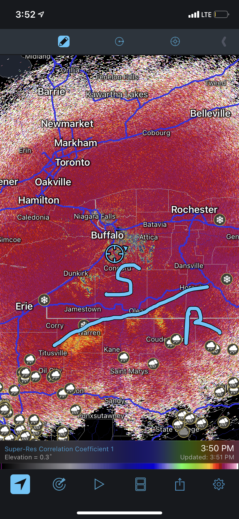
6 minutes ago, Thinksnow18 said:
Looks like the NWS has not moved off their accumulations at this time. If the trend holds we might see an 8-12 instead of 12-18”. My first thought is about a foot at KBUF for the event a little more towards Lake Ontario due to enhancement and more in the hills to the south. Might be looking at 4”per 12/hour period which may not meet the Winter Storm Warning criteria however the total amount will. Interesting 24 hours ahead.
Hey just a few days ago we thought this week would be a thaw with 50s and rain. Even 8-12” would be a delight with the pack we already have and the temps forecasted to stay cold even after the storm with more possibilities for snow next week..
-
5
-


Upstate/Eastern New York-Pattern Change Vs Tughill Curse?
in Upstate New York/Pennsylvania
Posted
1” on the dot here.