HO1088
-
Posts
106 -
Joined
-
Last visited
Content Type
Profiles
Blogs
Forums
American Weather
Media Demo
Store
Gallery
Everything posted by HO1088
-
CLE had a diurnal variation of 2 degrees on Saturday. This is my last post on this thread. My family is moving soon and I thank everyone who has contributed to this very nice discussion on NE Ohio weather.
-
Just a dusting here in Chagrin overnight. Another dusting this morning. It's nice to see the sun a little bit. Too bad it doesn't come out more often.
-
Amazing. Even with not many cold days, CLE will end the month about 0.5 F below normal. Excited for the warm up this weekend? I'll be happy to see the lower layer of compacted ice on the ground to go away.
-
https://weather.cod.edu/satrad/exper/?parms=local-LakeErie-02-24-1-25-1&checked=map&colorbar=undefined The band coming off the small opening in the ice north of Pelee Island is neat.
-
CLE has hit 0 F already today. Yawn. I'll await the next media apocalypse weather creation next week.
-
Forecast to finish the month at CLE below normal average temp. Impressive after the warm start to the month. Above normal precip, a significant snow storm and several days with strong winds. Not too much lake effect but it was an active month with something for everyone. More ice on the ground than I've ever seen living here. South Russell Park was closed today. I tried to walk in Bainbridge but even open fields were ridiculously slippery.
-
Still about 2" on the ground this evening at CLE.
-
I've noticed driving east on Miles Rd from I-271 the temperature drops several degrees as I enter the Chagrin Valley, sometimes it's coldest in the river valley near the South Chagrin Reservation. Perhaps we don't get as much mixing as the west side which seems flatter.
-
https://www.cleveland.com/expo/news/g66l-2019/01/381ddf89dd5071/everything-to-know-about-belowzero-temperatures-in-cleveland-history-coldest-most-recent-how-common.html
-
https://fox8.com/2019/01/27/25-years-since-northeast-ohio-experienced-cold-like-were-expecting-this-week/amp/
-
Still at +2.5 degrees above normal temperature at CLE for January. I wonder if the Arctic air this week will put us below normal for the month?
-
How cold will it get next week? 10 days since the last "non cloudy" day at CLE. The ground is a sheet of frozen slush. Is life really worth living in NE Ohio in the winter? ;)
-
My snow is extremely heavy and still deep, if it all melts today I'd be surprised. Gutters are jammed with ice, I hope the basement doesn't flood.
-
https://forecast.weather.gov/product.php?site=NWS&issuedby=cle&product=PNS&format=CI&version=1&glossary=0&highlight=off
-
Per the 12 Z METARs, storm snowfall: CLE 8" YNG 7" CAK 5" I'm excited to see the spotter and CoCoRAHS reports this morning.
-
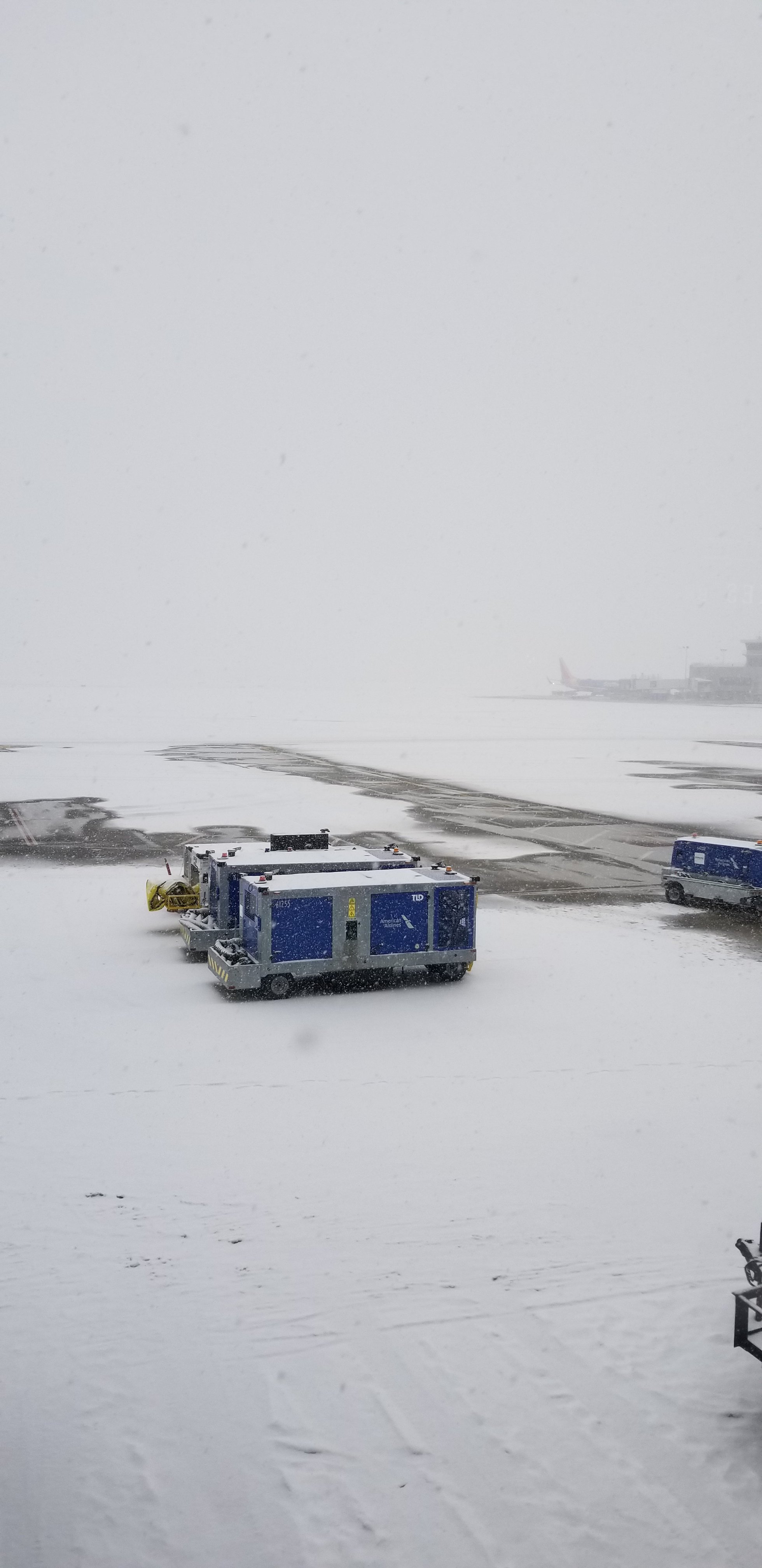
The airport has 3" for the event as of 7 pm, but that number is probably effected by the strong wind.
-
Snowing moderately at the airport at 3:25.

-
The runway visibility has been a bit better than reported at CLE. https://rvr.data.faa.gov/cgi-bin/rvr-details.pl?content=table&airport=CLE&rrate=medium&layout=2x2&gifsize=large&fontsize=large&fs=lg It's been up and down but more often than not better than the 1/2 mile reported.
-
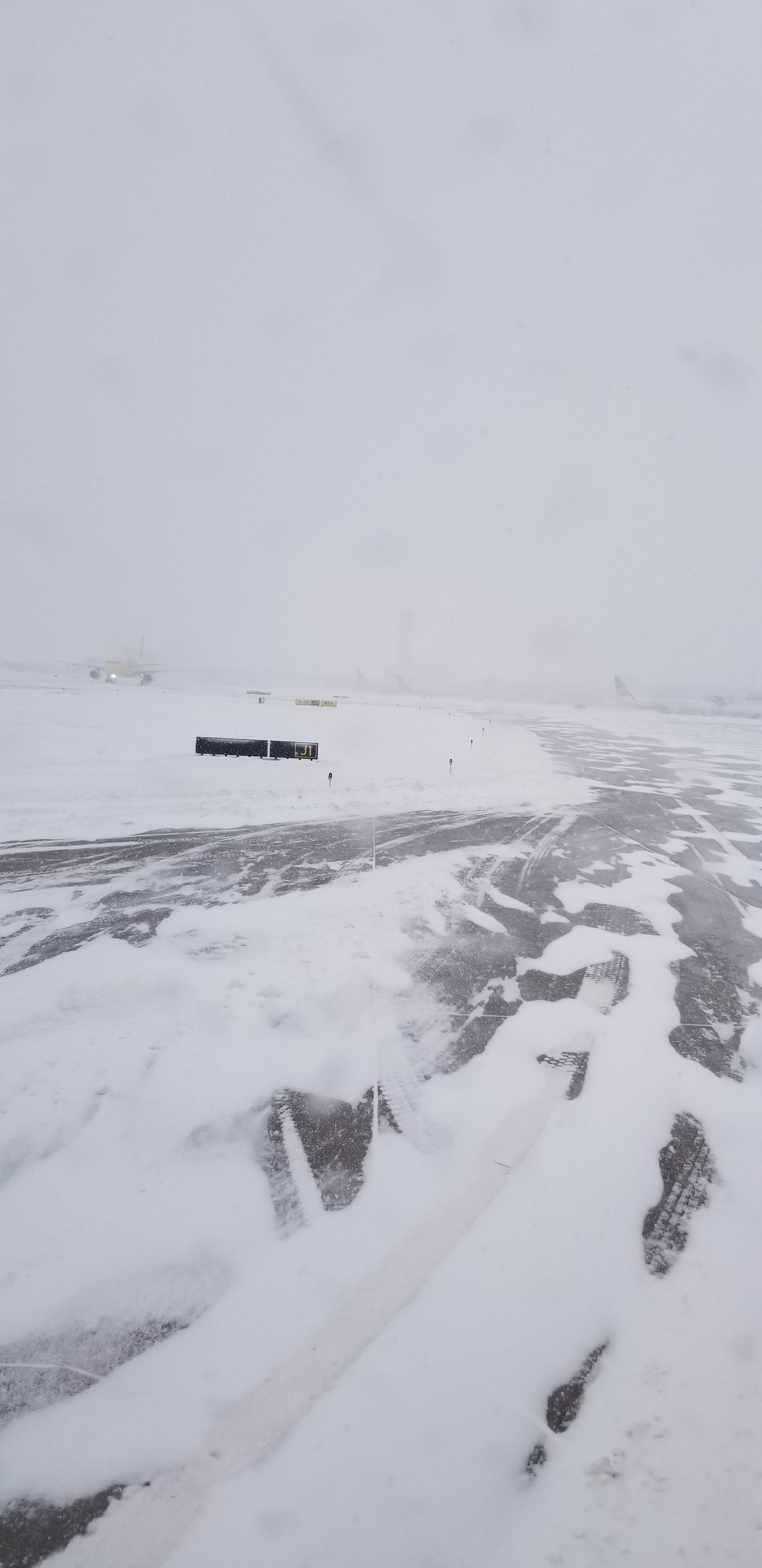
CLE Airport at 12:50 pm with 1/2 sm visibility.

-
The 00 Z and 06 Z runs weren't kind to CLE. 6" tops for the airport more south and east. Per the GFS it should have started snowing hours ago, yet it looks like it will be dry until at least 10 a.m.
-
12 Z GFS did a bit better with event total precip for CLE. About 0.75".
-
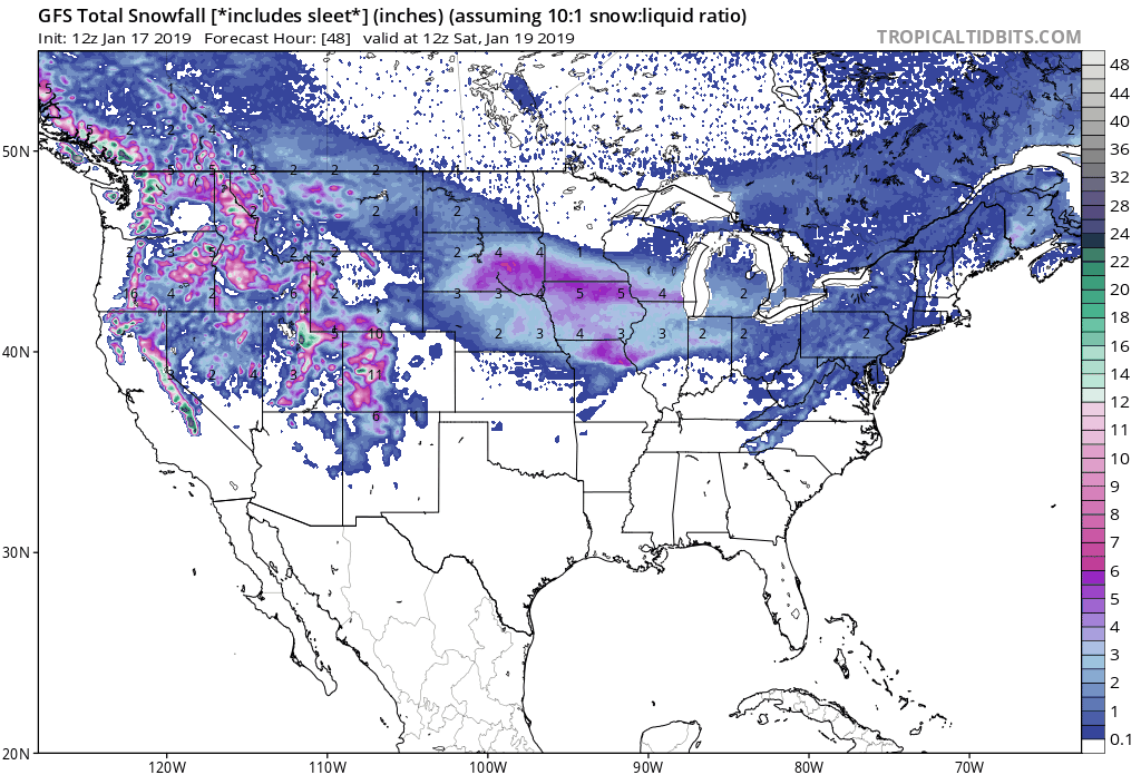
The 18Z GFS is just over 0.6" event total precip for the closest grid interpolation to KCLE. The latest AFD is below, I'm still thinking their totals are a bit on the high side. Time will tell. The main problem however with the lake effect event is building high pressure, a lowering inversion and dry air filling in behind the storm. Through Sunday morning, snow totals are 10-11 inches at KCLE and KERI, 6 to 7 KTOL, 11 to 12 KMFD and KCAK and around a foot KYNG. Additional snow will be possible with the lake effect.
-
The 12Z ECMWF shows 6" total for the event. Not sure about post low snow, this pattern is progressive and the air gets dry and cold quick. Can't see too much deformation band or lake enhancement on the backside.
-
Definitely a storm for New England.
-
12Z GFS shows 0.61" for CLE for the event, so that's about 7-8".