Stovepipe
-
Posts
4,357 -
Joined
-
Last visited
Content Type
Profiles
Blogs
Forums
American Weather
Media Demo
Store
Gallery
Everything posted by Stovepipe
-
All snow currently in Halls, light to moderate with dimes. No mixing that I can tell yet. Temp was up to 32 earlier, down to 29 currently.
- 618 replies
-
- 6
-

-
- observations
- obs thread
- (and 1 more)
-
Not sure what is and isn't virga on the radar, but Memphis webcams show a snow covered interstate. Jackson cams are inconclusive.
-
That is a powerful blast of warm air at the surface narrowly shooting all the way to Pennsylvania. I guess we will find out soon if that is in the cards.

-
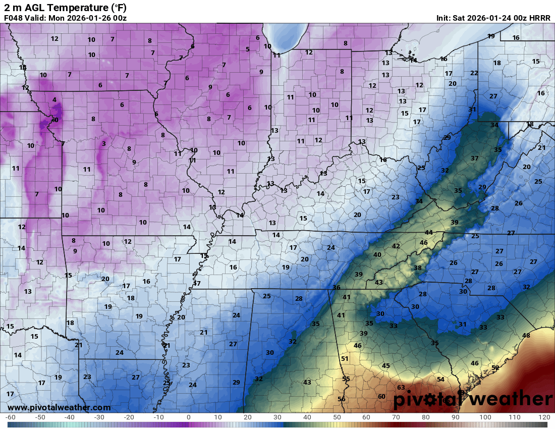
I'm very curious to see how the surface temps play out in east TN. MRX has Knox hitting 42 and HRRR currently shows 40 peak, but 3k NAM only 35. We'll most likely have a nice heavy cleansing rain to wash away the slop, but it'll be interesting to see how much the surface temps climb with this much variation in the modeling still. Also will be interesting to see what if any backside thump of snow is possible as the 850s crash.
-
18z NAM has TYS topping out at 48 degrees Sunday evening. At the same time it's hi-res version and GFS are 34.
-
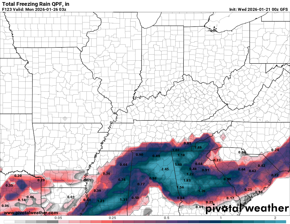
HRRR shows 2 inches of snow for Knox followed by an inch of ice prior to hitting 33 and going full rain.
-
I'm trying to understand how much plain rain to expect and what the duration could be, because there seems to be quite a bit of variation in the models still today. Surface temps at TYS range from mid 30s to mid 40s at peak depending on the solution you look at. That has a lot to do with how much rain falls to wash away the slop. I guess the models that are punching the low right up through TN will be correct and we'll have more rain and maybe a minimal ice problem when the temps crash. But, if the low slides below, we're looking at the potential for concrete. Can someone explain it to me like I'm a 5 year old, which low path and rain scenario seems more realistic at this point and why?
-
So the banana highs are just too wide and weaker and that's why the low cuts up through TN on higher res models? I'm trying to understand the basics here. Ending the event on rain and a squall line is just wild to me considering what we've been watching on the models all week. Granted, I'm glad the heavy rain can wash away all the ice and prevent hardships, even if it hurts my inner weenie. Edit: Looking at the 06z NAM.
-
0z GFS put down a little over 2 inches of snow at TYS followed by .33 sleet then a half inch of ice and back to snow for another half inch. Tops out a 33 degree surface before crashing.
-
Is it realistic at this point to think the low might not cut? Is that just a function of how quickly the high moves across?
-
GFS is significantly colder at surface and 850 based on the maps; I've not looked at the numbers yet. There is certainly a period of some ice Sunday but that solution is very different from the NAM.
-
The low slides under TN rather than cutting; still some rain but much better situation that any other model that I've seen today.
-
0z GFS is great if you prefer more snow/sleet and less ice in TN.
-
It looks to me like the 0z NAM quickly puts down .85 inches of freezing rain on TYS before switching to rain Saturday night and climbing to 48 degrees. Total of about 2.5 inches of QPF.
-
OMG Frankie! I haven't heard from him in years, glad he's still at it! To hear him do Tennessee... nearly brings a tear to my eye.
-
I'm just looking at the same stuff y'all are, hoping the GFS is closer to accurate. That 18z run put about 4 inches of snow down at TYS before switching to half inch of freezing rain and then back to snow for 3 more inches. That's with the cobb snow algorithm. Temps in the upper 20s through all of it until crashing to zero Sunday night. That frozen sandwich would be around for while. Better than pure ice, and better than ending on rain!
-
@Carvers Gap Full speed ahead!!
-
Brutal!
-
That guy really fell on hard times after Jackass. Might be back on the sauce again.