

Stovepipe
-
Posts
4,279 -
Joined
-
Last visited
Content Type
Profiles
Blogs
Forums
American Weather
Media Demo
Store
Gallery
Posts posted by Stovepipe
-
-
4 minutes ago, Holston_River_Rambler said:
This is the biggest Euro run of the millennium....

-
 1
1
-
 2
2
-
-
This is not all snow of course, but it's amazing to see how relatively little frozen gets past the plateau.

-
6
-
-
6 minutes ago, Mrwolf1972 said:
18z gfs takes the ice on the 14th to ohio but has a storm with snow in east tn 16th into 17th like cmc and euro. 210 snow forecast below.
A great low track for us and for once no marginal temps to deal with. Sign me up.
-
2
-
-
MRX getting cute with the Canadian joke.
Quote000 FXUS64 KMRX 082030 AFDMRX AREA FORECAST DISCUSSION National Weather Service Morristown TN 330 PM EST Mon Feb 8 2021 .SHORT TERM...(Tonight and Tuesday)...Sluggish return flow trying to get started ahead of inverted trough to our northwest. Low clouds are expected to spread across the area late tonight in return flow aloft--little bits of QPF are shown in some model output late tonight in the deeper moisture, but this low level moisture is not connected to anything aloft to get any ice crystal growth, etc., so will keep QPF zero through Tuesday, along with mainly single digit POPs in the grids. Could see some patchy drizzle in a few places, but not much else. Guidance temps look good with notably milder night tonight, and warmer Tuesday. GM .LONG TERM...(Tuesday Night through Monday)... Frontal boundary will focus precip Tuesday night and Wednesday mostly to our north over KY before it finally surges south Wed night, bringing precip in from the northwest such that the entire forecast area should receive precip...mostly rain...on Thursday. As post-frontal cold air continues to invade the area, the precip will be trying to exit, but the back side of the precip area will probably experience a transition to snow before ending by Friday. Precip chances (mostly 30-40%) return Friday night and Saturday according to the NBM, and the ECMWF has suggested the same, although the 12Z GFS is notably more skimpy. However, beyond Saturday, the models are struggling to resolve the energy in this progressive pattern. For it is then that the GFS really rushes a strong weather system in from the southwest for Saturday night and Sunday morning with lots of precip falling upon our cold airmass, which is a potentially messy solution indeed. The NBM and ECMWF (and even the Canadians eh) are much more conservative with lingering and mostly insubstantial precip. We and surrounding offices are going with the NBM-led majority but will watch what happens to the GFS solution with interest.
-
2
-
2
-
-
The OHX and HTX radar feeds look ridiculous.
-
2
-
-
6 minutes ago, Blue Moon said:
Ground is white now. I'm guessing we have between a quarter and a half inch. If we get past 0.6 then I'm above 4" for the year, which is on pace with average.

-
1
-
-
I'm proud that so many people are up at 3 in the morning watching the ground turn white!

-
7
-
-
Getting dimes now, just a beautiful snow at this point.
Edit: Dripping nickels now and the ground getting white. Worth staying up for!
-
7
-
-
Certainly low ratio stuff here, very wet flakes. Hasn't had a chance yet to pile up. 33/32
-
1
-
-
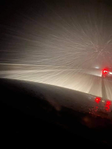
2 minutes ago, John1122 said:
I-75 in Campbell County.
Not driving. Got it from a friend who was caught out.

-
1
-
2
-
-
I'm really glad I stayed up for it. Finally transitioned to a full blown fat flaked snow. The real change over happened a little before 2am, MRX said it would start mixing in at 5am. Regardless, I'm grateful!
-
5
-
-
Slopping pretty good here, even getting a coating going. Beats the rain!

-
3
-
-
-
Just now, 1234snow said:
Half rain and snow here at 34. Always the last to switch over. A painful wait.
You're not the last my friend. I'm under 35 and rainin nice and cold. Waiting for the POP!
-
2
-
-
8 minutes ago, John1122 said:
Silver dollar goosefeather fatties.

I'm not one to judge. You go on with ya bad self!
-
1
-
-
Just now, bearman said:
Still nothing but a cold rain in West Knox County.
Yeah, I've been back to rain after the mega sleet bursts. We'll get our real change over I think soonish.
-
1 minute ago, John1122 said:
Half dollar+ super soakers flying now. It's as heavy as it has snowed all winter season.
I'll record the Super Bowl for you.
-
2
-
3
-
-
1 minute ago, ShawnEastTN said:
Seems to be escalating quickly, mostly sleet now and heavy.
Sent from my SM-G965U using Tapatalk

-
3
-
-
The rates really do drop the temps. Went from 40 to 37 in 20 minutes or so.
-
1
-
-
1 minute ago, PowellVolz said:
I’ve got fatties mixing in. About 75/25 sleet/snow
.Oblig

-
1
-
-
Just now, PowellVolz said:
I’ve got heavy sleet now. Sounds like a hail storm
.Exactly, I've not heard that against my windows in a long time.
-
1
-
-
Holy cow I'm all the sudden oscillating between a moderate rain/sleet mix and absolutely ripping sleet! 40T/33D
-
1
-
-
Just now, TellicoWx said:
Heavy rates out that way..Sparta reporting 1/2" in 15 mins

-
1
-
1
-
-
Has anyone checked on Holston?

-
2
-
5
-


Fall/Winter 20-21 General Observations
in Tennessee Valley
Posted
It is absolutely beautiful here today. Sunny and 64 degrees! Already been on two walks, may have to go on another.