Blizzard of 93
-
Posts
13,087 -
Joined
-
Last visited
Content Type
Profiles
Blogs
Forums
American Weather
Media Demo
Store
Gallery
Everything posted by Blizzard of 93
-
Central PA - Winter 2020/2021
Blizzard of 93 replied to MAG5035's topic in Upstate New York/Pennsylvania
Let’s do this! -
Central PA - Winter 2020/2021
Blizzard of 93 replied to MAG5035's topic in Upstate New York/Pennsylvania
The 12z GFS continues to keep the Christmas Eve front more progressive with a change to snow for most of PA! -
Central PA - Winter 2020/2021
Blizzard of 93 replied to MAG5035's topic in Upstate New York/Pennsylvania
The 6z GEFS is really barking over the next 16 days. This map just as a general guide just screams with potential with the 7 inch or more snow line covering all of CTP. Now it’s just a matter of identifying the individual threats. -
Central PA - Winter 2020/2021
Blizzard of 93 replied to MAG5035's topic in Upstate New York/Pennsylvania
Yes, blocking can give models a tough time to resolve storms tracks at long range. The good part is that blocking is showing on most guidance. Someone in the Mid Atlantic forum recently said in reference to blocking, “If you build it, they will come”. I think we will see good storms showing on the models soon for the week between Christmas & New Years. -
Central PA - Winter 2020/2021
Blizzard of 93 replied to MAG5035's topic in Upstate New York/Pennsylvania
Hopefully it’s not long before we see DT say, ALEET , ALEET !!! -
Central PA - Winter 2020/2021
Blizzard of 93 replied to MAG5035's topic in Upstate New York/Pennsylvania
Also, today, do you think any of your snow might survive the trip over the mountains to the Susquehanna Valley? -
Central PA - Winter 2020/2021
Blizzard of 93 replied to MAG5035's topic in Upstate New York/Pennsylvania
The 6z GEFS is on board for Christmas post front snow as well for all of CTP! -
Central PA - Winter 2020/2021
Blizzard of 93 replied to MAG5035's topic in Upstate New York/Pennsylvania
The Christmas wave on the front idea improved the snow chances slightly on the GFS & Euro. -
Central PA - Winter 2020/2021
Blizzard of 93 replied to MAG5035's topic in Upstate New York/Pennsylvania
Congrats! Do you think that the Clipper on Monday night will produce much of anything outside of the mountains for the Susquehanna Valley? -
Central PA - Winter 2020/2021
Blizzard of 93 replied to MAG5035's topic in Upstate New York/Pennsylvania
Don’t worry, it the Christmas frontal snow doesn’t work out, we might not care that much, because we are busy tracking this potential coastal storm that could be en route a few days later according to the 12z GFS. This pattern is loaded with opportunities over the next few weeks! -
Central PA - Winter 2020/2021
Blizzard of 93 replied to MAG5035's topic in Upstate New York/Pennsylvania
Yes, several pieces to the puzzle at this time. It’s great to even be able to discuss even the chance of snow on Christmas Eve. If we are left with just the Ana-front potential as currently modeled, do you think that there would be enough moisture left behind the front from the trailing wave to deliver a few hour period of snow that could even put down a couple of inches of snow in the Susquehanna Valley? -
Central PA - Winter 2020/2021
Blizzard of 93 replied to MAG5035's topic in Upstate New York/Pennsylvania
Here is the 6z GFS for Christmas Eve night! Rain changes to snow as soon as the cold front comes through. This run verbatim it delivers 3 or 4 inches of snow to a good chunk of CTP just in time for Christmas! -
Central PA - Winter 2020/2021
Blizzard of 93 replied to MAG5035's topic in Upstate New York/Pennsylvania
The 6z GFS has a little period of light snow tomorrow for a good part of CTP. -
Central PA - Winter 2020/2021
Blizzard of 93 replied to MAG5035's topic in Upstate New York/Pennsylvania
Great analysis @showmethesnow I would be happy with just a few snow showers or minor period of light snow over the next couple of days to give a coating to the current snowpack. What are your thoughts on the chances for the Christmas Eve front and potential for a post front period of snow ? -
Central PA - Winter 2020/2021
Blizzard of 93 replied to MAG5035's topic in Upstate New York/Pennsylvania
@showmethesnow Thanks for posting in here and please come back as much as possible! This pattern is loaded with potential! Before we even get to the Christmas possibility, there are a couple of small events to keep an eye on from Sunday to Tuesday that could freshen up our snowpack with light snow. -
Central PA - Winter 2020/2021
Blizzard of 93 replied to MAG5035's topic in Upstate New York/Pennsylvania
The 12z Euro & 18z GFS are on board with the post front snow chance on Christmas! If we lose some of our snow pack before the front, so be it if that is the price to pay for a several hour period of Christmas Eve or Christmas Day snow that could put down a few inches. It’s just great that this is even on table to track this week! -
Central PA - Winter 2020/2021
Blizzard of 93 replied to MAG5035's topic in Upstate New York/Pennsylvania
The radar is really looking great! Enjoy the snow today everyone! We do not know when the next chance of a major storm will come....it could be weeks, months, or years from now, so please try to take it all in and enjoy! -
Central PA - Winter 2020/2021
Blizzard of 93 replied to MAG5035's topic in Upstate New York/Pennsylvania
It’s nice to be starting an event with temps in the 20’s and dew points in the low to mid teens! -
Central PA - Winter 2020/2021
Blizzard of 93 replied to MAG5035's topic in Upstate New York/Pennsylvania
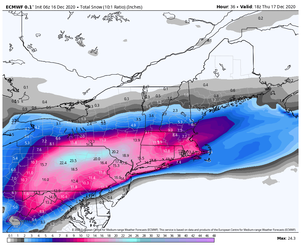
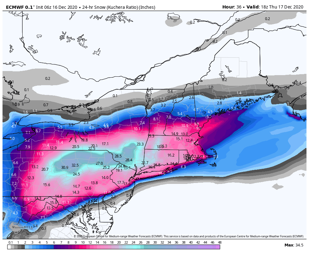
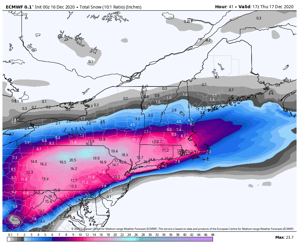
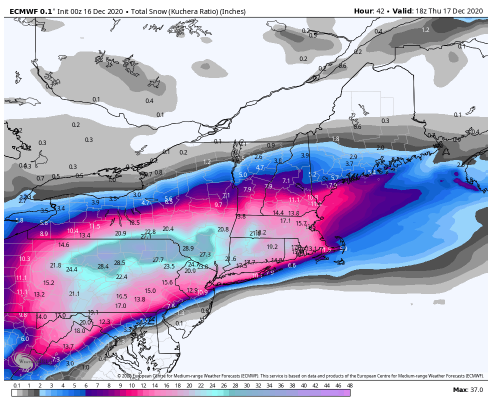
Here are the 6z Euro snow maps.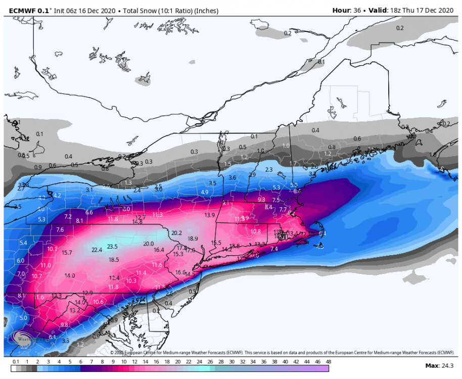
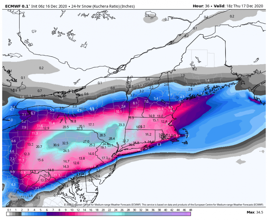
-
Central PA - Winter 2020/2021
Blizzard of 93 replied to MAG5035's topic in Upstate New York/Pennsylvania
This is the best GFS run yet for the LSV....just wait until @pasnownut sees this run for his backyard! -
Central PA - Winter 2020/2021
Blizzard of 93 replied to MAG5035's topic in Upstate New York/Pennsylvania
That’s the best GEFS run yet...wow! -
Central PA - Winter 2020/2021
Blizzard of 93 replied to MAG5035's topic in Upstate New York/Pennsylvania
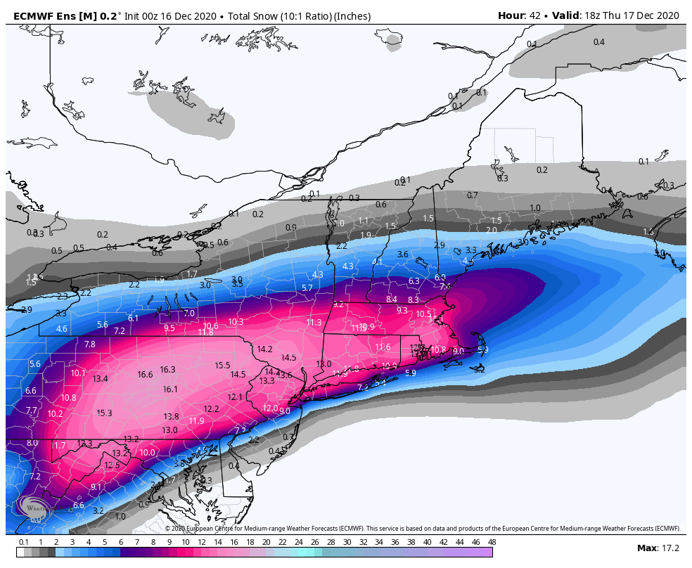
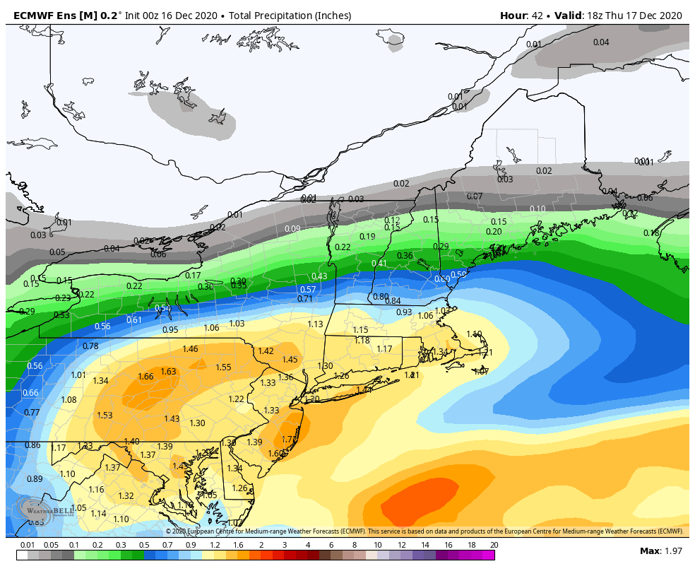
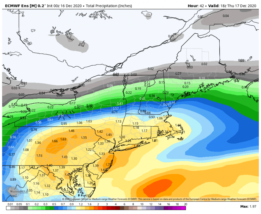
The 0z EPS still looks good and even improved slightly for our southeast crew.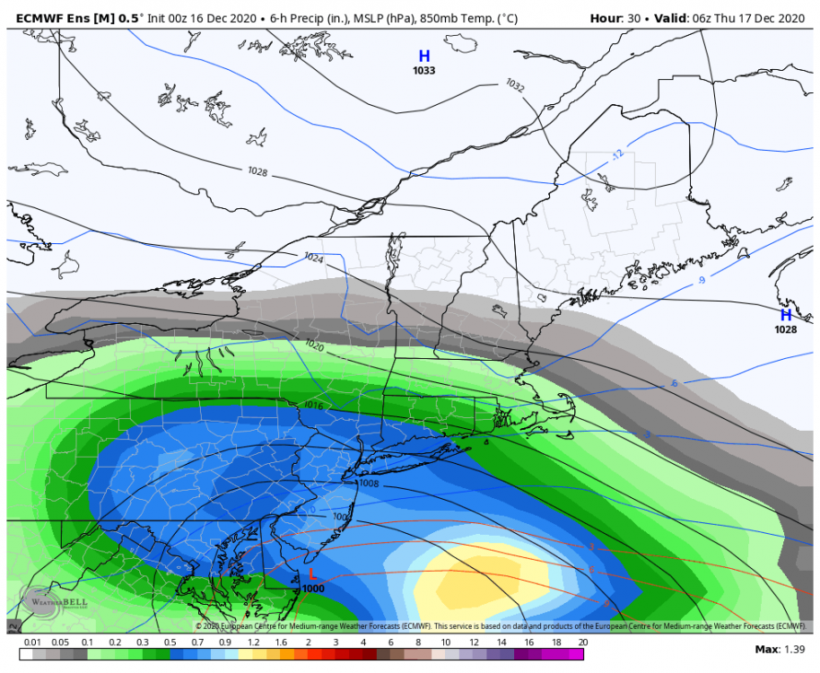
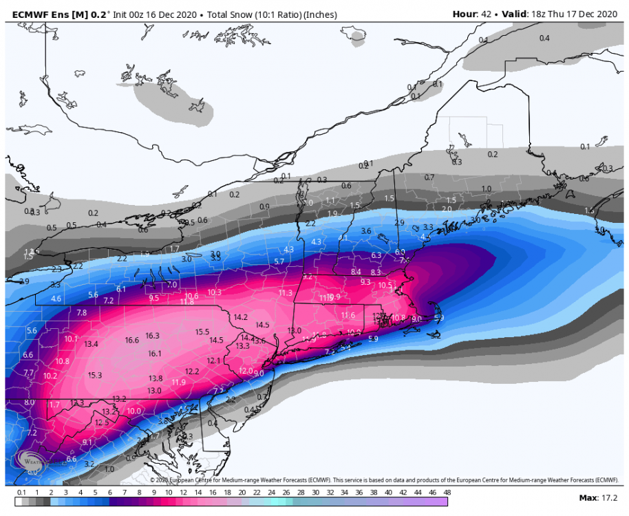
-
Central PA - Winter 2020/2021
Blizzard of 93 replied to MAG5035's topic in Upstate New York/Pennsylvania
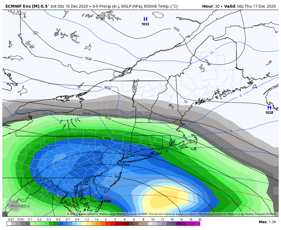
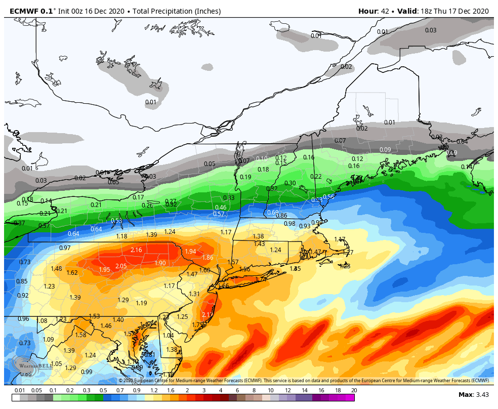
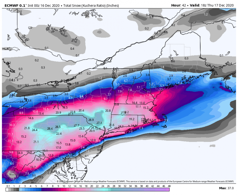
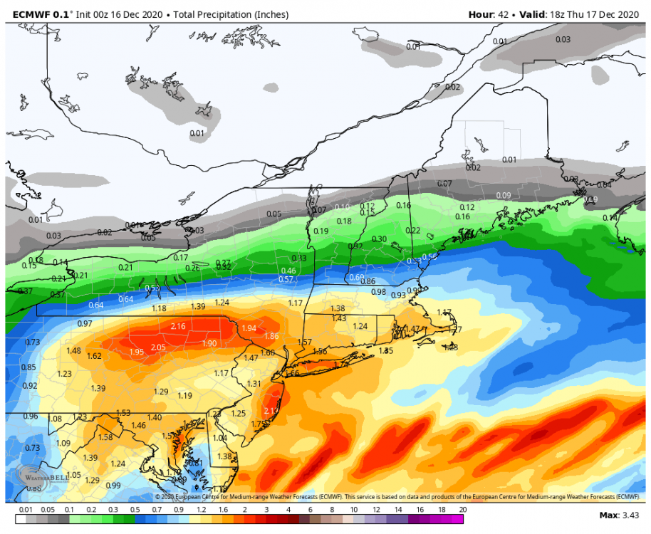
0z Euro still looks good for all of CTP. I added the total precip map to give an idea of where the max zones look to set up this run. It also indicated very little mixing in the LSV this run.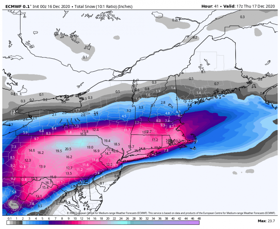
-
Central PA - Winter 2020/2021
Blizzard of 93 replied to MAG5035's topic in Upstate New York/Pennsylvania
Here is the 0z UKMET...the 0z party continues for CTP. -
Central PA - Winter 2020/2021
Blizzard of 93 replied to MAG5035's topic in Upstate New York/Pennsylvania
Oh yes, I want thunder snow too! @MAG5035 or @MillvilleWx or @psuhoffman How is the thunder snow chance looking now?