dilly84
-
Posts
4,093 -
Joined
-
Last visited
Content Type
Profiles
Blogs
Forums
American Weather
Media Demo
Store
Gallery
Everything posted by dilly84
-
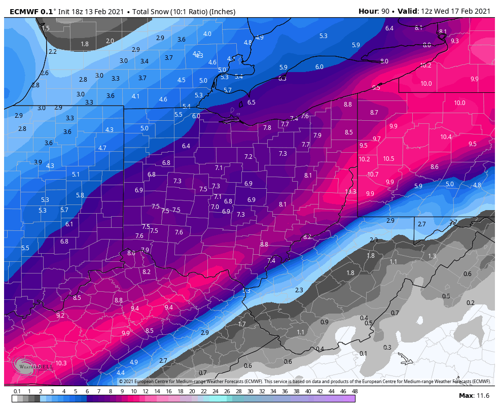
Nam doesn't look like it's gonna be good at all.
-
Go big or go home. Just not buying the low position, the cold air and dropping 2"of sleet. If I'm wrong I'll go down burning with the ship lol
-
Low appears very close to same spot as 18z, looks more like it's just expanded the precip shield further NW.
-
No. Not to any knowledge I've ever seen.
-
I'd guess 18:1 or 20:1
-
0 chance it'll be 10:1
-
Think she's gonna be a monster. Hoping this first system is throwing off the following system.
-
Oh, he's around lol. Me and Pondo talk to him.
-
Yep. Complete trash and pretty much every model was wrong with placement of this system.
-
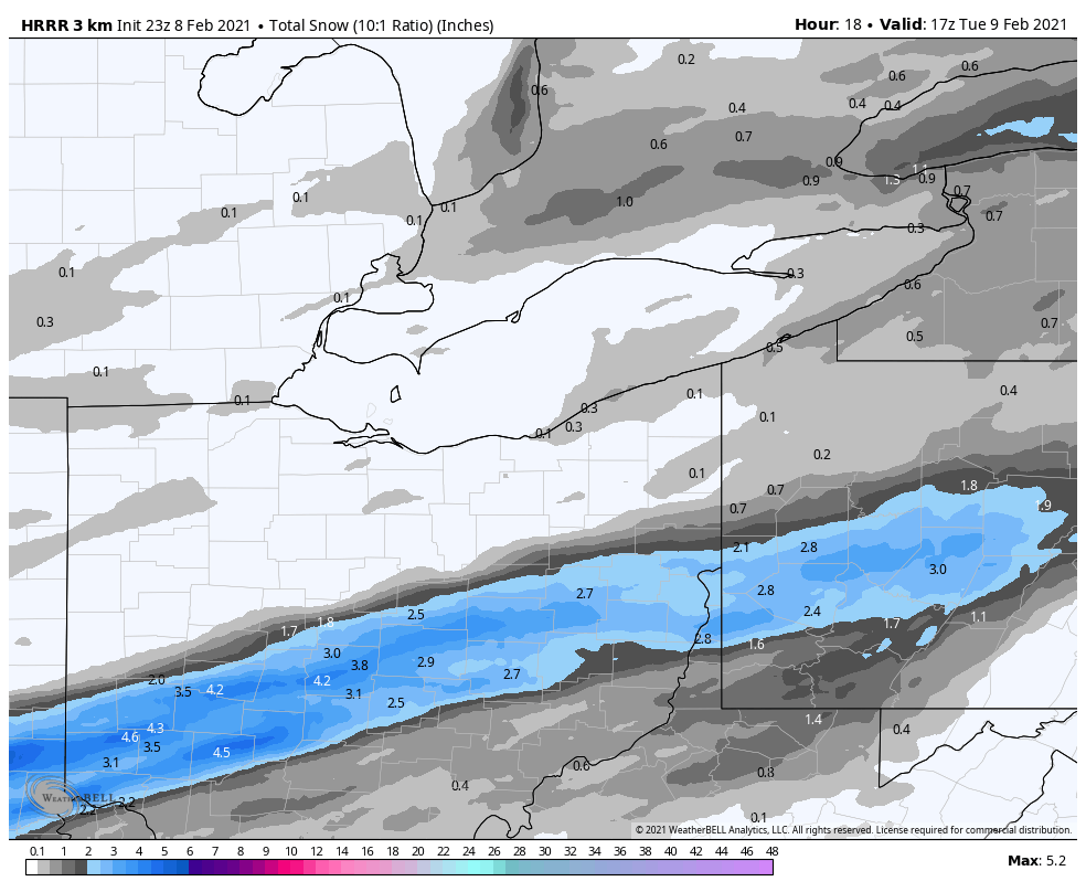
I'm specifically talking totals. Hrrr still has south not getting much more than an inch maybe 2

-
HRRR is further north for tonight.. not sure which model to buy.
-
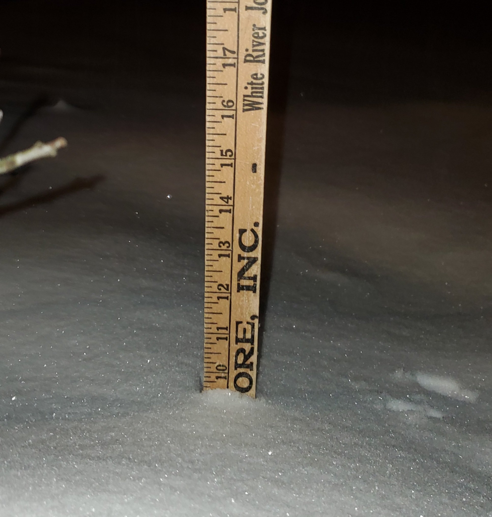
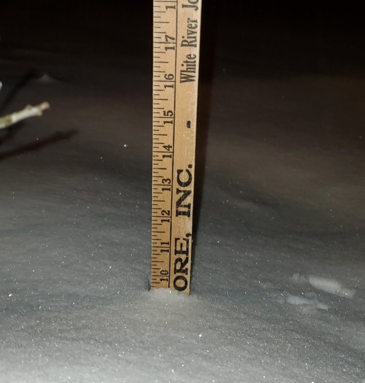
Definitely not a pro measurement, but figured 6 main part, 3 last night and another inch when I took it.
-
We're at 10" or close. Will reach 10 by end of night. Not looking like my call was too far off when you account for melting.
-
My cousin measured 7" in coshocton at 8am. But they switched to rain and with compacting took them back to 2. Models still showing another 3-4 for most of us east of cmh. So we'll see.
-
Have picked up probably 2.5" so far back side here in knox county. Futures looking like snow til at least 3am.
-
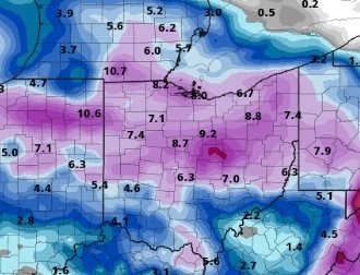
I agree, but I factored that into the gradient. Can only go by models or by just gut. I went kodels.
-
There was mine. Someone shared it in other thread. Got called nuts for the gradient in the sw. Lol. But... we'll see. Im using the models, not my gut.
-
Well we'll see. I'm going by nearly every model. Also the post with it clearly says because of tighter gradients, some areas could see a couple inches more or less in those tighter areas.
-
The different offices but still. Im not too crazy lol.
-
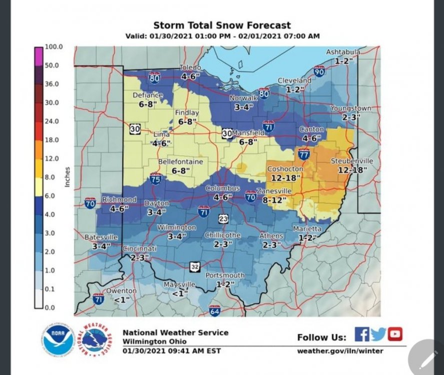
That be me lol. I'm just going by model guidance. I'm absolutely shocked that NWS hasn't issued warnings.. blows my mind. The only reason to not is if theyre only going by their gut and not the models. Hell even iln map has 12-18 in coshocton county.
-
I'm in knox. County outside the 12-18, but every model has me getting a foot
-
Good lord youre a bundle of joy for the ohio crowd lol
-
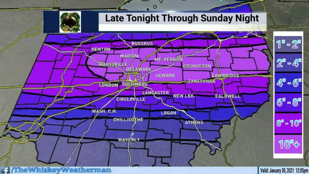
That little worm of 12" is over my house so I'm all in for 18z nam lol
-
Literally imby. That little worm area of 12" right over my house so I'm taking the 18z nam ftw lol

-
Lol that's how I wanna call Ohio sometimes. Whatever the low end on models are subtract 50% lol