

OhioWX
-
Posts
173 -
Joined
-
Last visited
Content Type
Profiles
Blogs
Forums
American Weather
Media Demo
Store
Gallery
Posts posted by OhioWX
-
-
Anxiously waiting for recon to arrive. Zeta's presentation has done nothing but improve since the last one departed.
-
-
Radar presentation has improved. NHC is now forecasting Delta to reach category 4 before landfall near Cancun.
-
PDS severe thunderstorm watch issued for portions of MN, ND, and SD. >95%/80% severe wind probabilities.
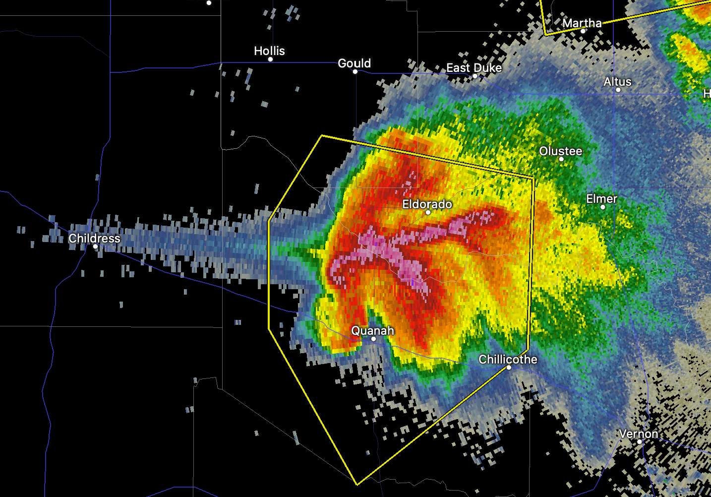
The NWS Storm Prediction Center has issued a * Severe Thunderstorm Watch for portions of Northern and central Minnesota Southeast North Dakota Northern South Dakota * Effective this Friday afternoon and Saturday morning from 535 PM until 100 AM CDT. ...THIS IS A PARTICULARLY DANGEROUS SITUATION... * Primary threats include... Widespread damaging winds expected with scattered significant gusts to 90 mph likely Scattered large hail and isolated very large hail events to 2.5 inches in diameter possible A couple tornadoes possible SUMMARY...An intense linear-type complex of storms is expected to evolve into a derecho this evening and produce widespread/significant damaging winds as it accelerates east-southeastward across the region. Isolated large hail is also possible, and a tornado risk cannot be ruled out, particularly near the warm front. ...Guyer -
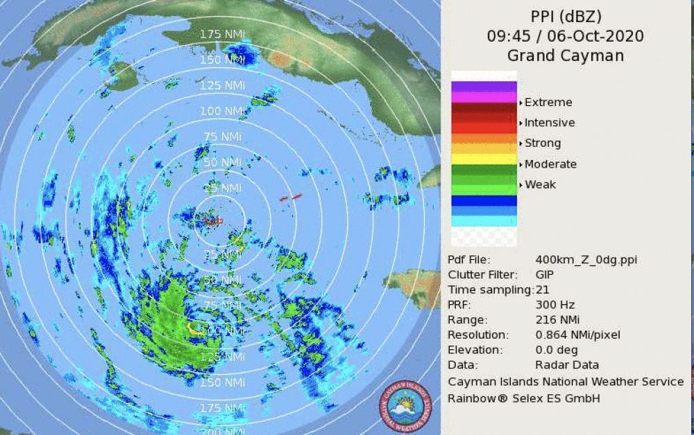
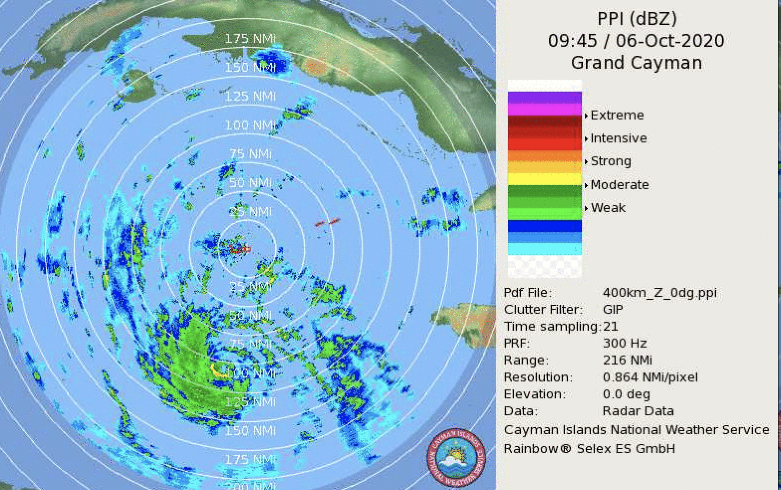
That looks like a tropical storm on KCLX. Observations from buoy 41004 are pretty compelling as well.
-
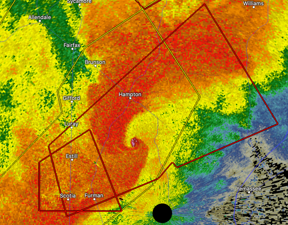
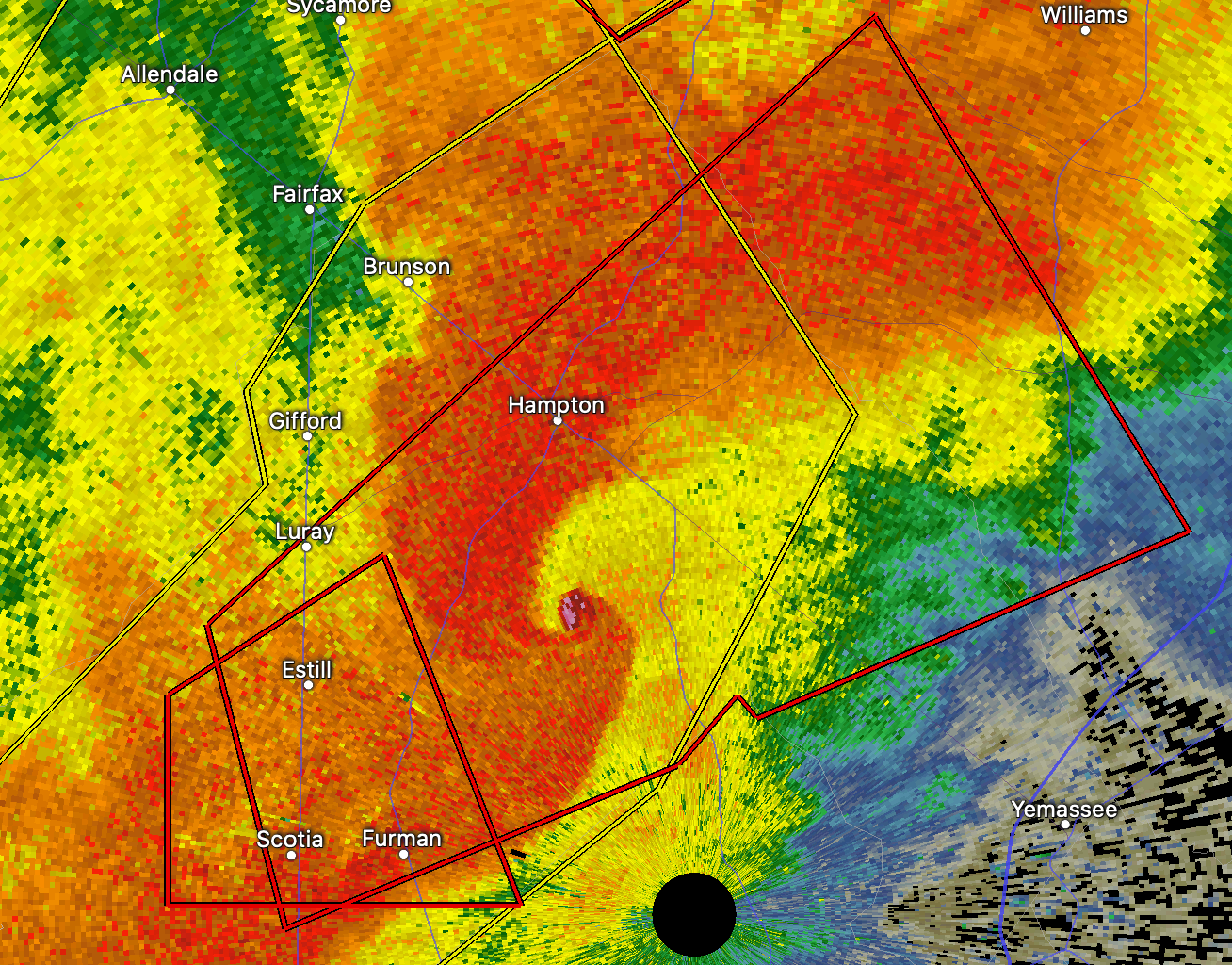
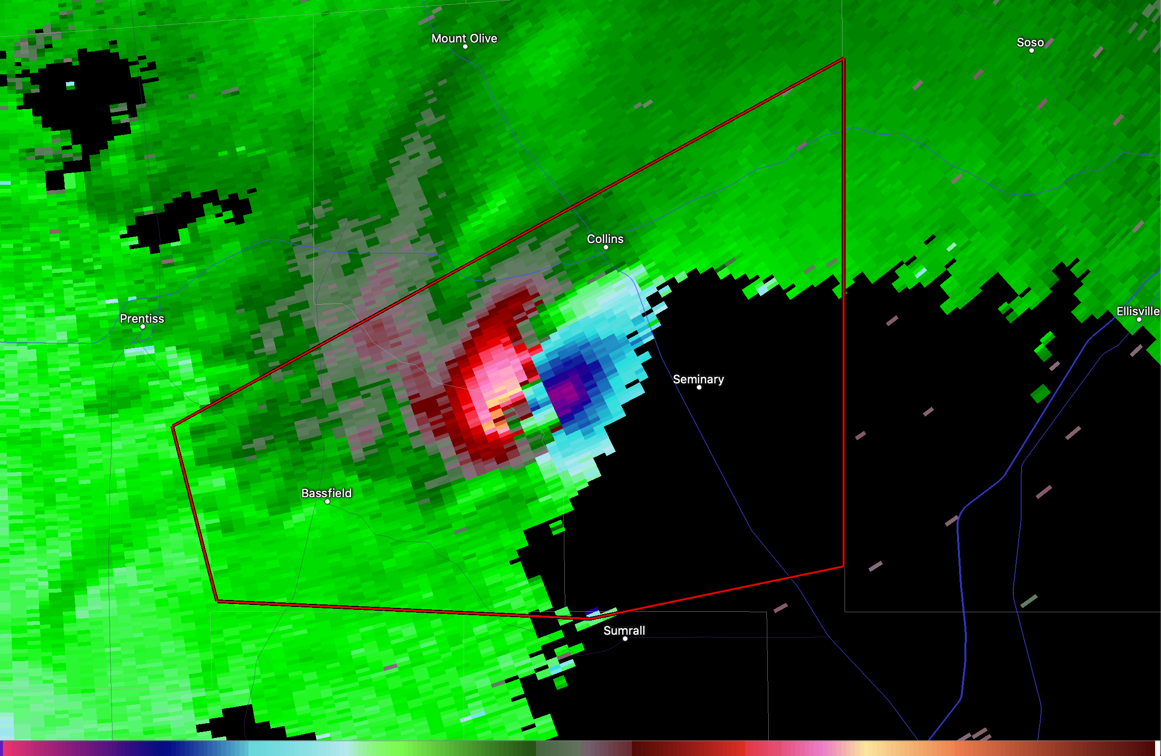
Check out the hail spike on this thing!

-
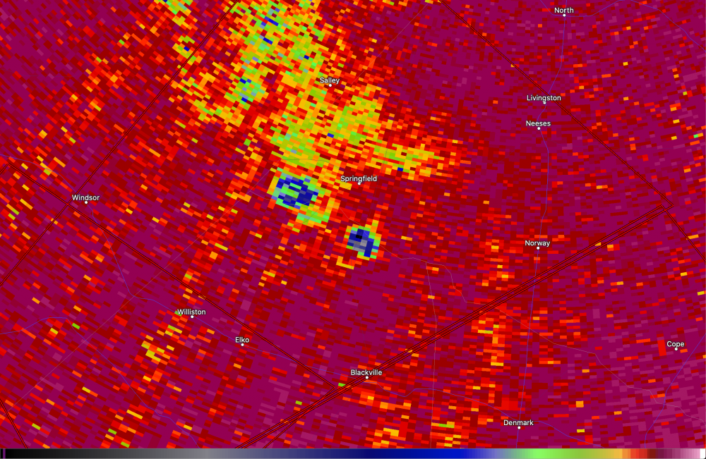
Big time CC drop south of Paris, TX. Evident on Ft. Smith radar at a beam height of over 15 kft.
-
-
Brief tornado on John Humphress' stream
Edit: Bigger one wrapped in the rain
-
I'm thinking tornadogenesis might be occurring near Pauls Valley, OK. That cell's riding a boundary.
-
-
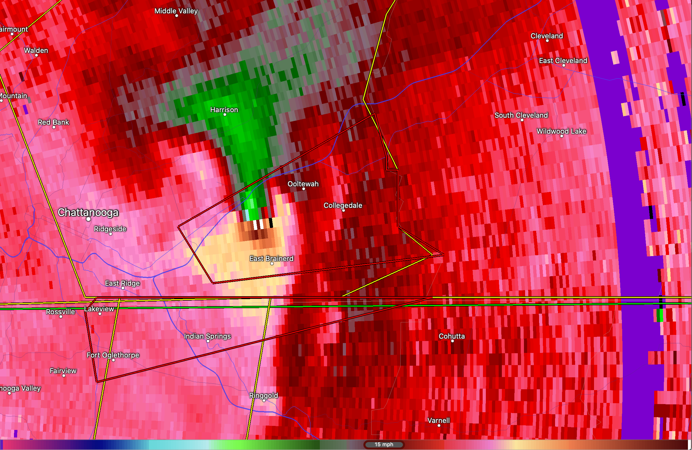
This isn't over. There's a damaging tornado moving into Ludowici, GA.
-
Tornado in progress about 25 miles west of Durham, NC. It's going to hit Hillsborough if it holds together.
-
Awful!
-
Just an all around horrifying situation for SC this morning. Multiple damaging tornadoes in progress.
-
 1
1
-
-
Another just hit Hilda, SC. Heading right for Denmark.
Edit: This is insane. More debris signatures. One NE of Newington, GA and another NE of Unionville, GA.
-
Still going!!!
-
Not good!
-
-
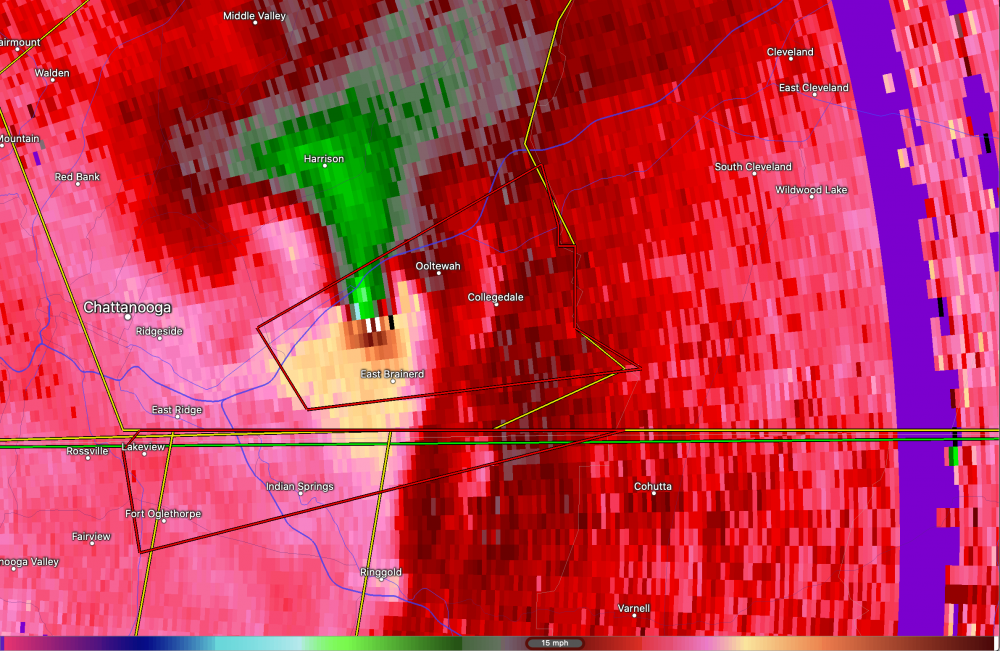
Both the Macon and McComb cells look very problematic.
Macon cell is going nuts!
-
-
Awful situation in Jonesboro. Seeing reports of a possible train derailment resulting in a hazmat spill.
-
That KAIT8 footage gave me Tuscaloosa flashbacks.
-
 3
3
-
-
1 minute ago, CheeselandSkies said:
Just dropped LIVE on KAIT.
That's a lot of debris. Looks really bad.


Tropical Storm Eta
in Tropical Headquarters
Posted
Eta's about to go nuts.