

WXMan42711
-
Posts
106 -
Joined
-
Last visited
Content Type
Profiles
Blogs
Forums
American Weather
Media Demo
Store
Gallery
Posts posted by WXMan42711
-
-
1 minute ago, MUWX said:
The storms on Mississippi side are largely messy and linear, with the exception of storms in the northern part of the state.
gotta think this reduces the threat of discrete supercells in MS.
-
URGENT - IMMEDIATE BROADCAST REQUESTED
Tornado Watch Number 19
NWS Storm Prediction Center Norman OK
135 PM CDT Sat Mar 13 2021
The NWS Storm Prediction Center has issued a
* Tornado Watch for portions of
East-central New Mexico
Northwest Texas
* Effective this Saturday afternoon and evening from 135 PM until
700 PM CDT.
* Primary threats include...
A few tornadoes and a couple intense tornadoes possible
Scattered large hail and isolated very large hail events to 2.5
inches in diameter possible
Isolated damaging wind gusts to 70 mph possible
SUMMARY...Initial discrete supercells should develop east-northeast
from the east-central New Mexico and northwest Texas border region.
Tornado and large hail will be the primary hazards.
-
50/30 probs -
after a brief stint with fat flakes, it’s now back to sleet. it lasted all of 20 minutes, i want to say.
-
If Fairfield is any indication, it's coming. These flakes are massive.
they’re starting to come down now. i don’t recall ever seeing them this big. i kinda love it. -
very long time lurker, figured i should chime in. i live on the western doorstep of mason, ohio. currently lots of sleet but as i write this, i see a couple big flakes starting to drop in & the sleet rate pick up/slow down randomly.
hoping for some good stuff here shortly...
-
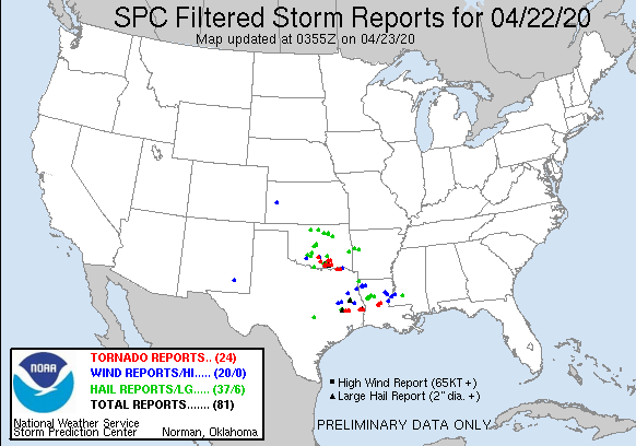
interesting day
-
-
interesting tail end of that: “Subject matter experts continue to review the areas of most intense damage, and additional adjustments remain possible over the coming weeks.” -
31 minutes ago, snowlover2 said:
3 different tornado warnings around the Cincy area now.
BULLETIN - EAS ACTIVATION REQUESTED
Tornado Warning
National Weather Service Wilmington OH
1103 PM EDT Wed Apr 8 2020The National Weather Service in Wilmington has issued a
* Tornado Warning for...
Mason County in northern Kentucky...
Robertson County in northern Kentucky...
Bracken County in northern Kentucky...
Southeastern Pendleton County in northern Kentucky...
Southeastern Clermont County in southwestern Ohio...
Brown County in southwestern Ohio...
Western Adams County in southwestern Ohio...* Until 1145 PM EDT.
* At 1102 PM EDT, severe thunderstorms capable of producing both
tornadoes and extensive straight line wind damage were located near
Brooksville, moving east at 50 mph.HAZARD...Tornado and quarter size hail.
SOURCE...Radar indicated rotation.
IMPACT...Flying debris will be dangerous to those caught without
shelter. Mobile homes will be damaged or destroyed.
Damage to roofs, windows, and vehicles will occur. Tree
damage is likely.* Locations impacted include...
Maysville, Georgetown, Falmouth, Washington, Ripley, Aberdeen,
Augusta, Winchester, Seaman, Felicity, Lewisburg, Brooksville,
Decatur, Russellville, Hamersville, Mount Olivet, Dover,
Higginsport, Cherry Fork and Germantown.PRECAUTIONARY/PREPAREDNESS ACTIONS...
TAKE COVER NOW! Move to a basement or an interior room on the lowest
floor of a sturdy building. Avoid windows. If you are outdoors, in a
mobile home, or in a vehicle, move to the closest substantial shelter
and protect yourself from flying debris.Heavy rainfall may hide this tornado. Do not wait to see or hear the
tornado. TAKE COVER NOW!Tornadoes are extremely difficult to see and confirm at night. Do not
wait to see or hear the tornado. TAKE COVER NOW!To report severe weather, go to our website at weather.gov/iln and
submit your report via social media, when you can do so safely.This cluster of thunderstorms is capable of producing tornadoes and
widespread significant wind damage. Do not wait to see or hear the
tornado. For your protection move to an interior room on the lowest
floor of a building.&&
LAT...LON 3849 8393 3847 8396 3851 8418 3856 8416
3855 8421 3858 8421 3857 8440 3898 8403
3899 8356 3852 8367 3846 8386
TIME...MOT...LOC 0302Z 285DEG 44KT 3872 8417TORNADO...RADAR INDICATED
HAIL...1.00IN$$
KC
five seperate areas around cincy (one dropped a tds, per ILN) and three in this warning alone.
-
possible tornado just passed over fort mitchell, KY. brief and only on a couple scans. a second circulation briefly showed up north of it and moved eastward.

-

genuine question. is the northern circle debris that has been lofted from the tornado? (the bottom circle colocates to the the suspected tornado)-
 1
1
-
-
that was an incredibly violent tornado, based off of this alone.
-
-


unbelievable. -


it’s trying. -

without context, it looks like something you’d see in dixie alley. nope, this is literally southwest ohio. unbelievable. -
-
just south of middletown, ohio and it is literally constant lightning looking to my north. unbelievable to think there’s a beast going on just thirty minutes to my north.


Severe Event March 25th 2021
in Southeastern States
Posted
that is a big tds