

dryslot
-
Posts
58,691 -
Joined
-
Last visited
Content Type
Profiles
Blogs
Forums
American Weather
Media Demo
Store
Gallery
Posts posted by dryslot
-
-
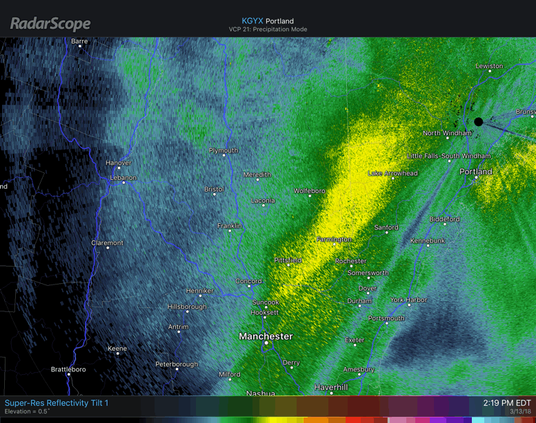
Sitting under the fronto band

-
 1
1
-
-
Nuking, Awesome growth to boot.

-
15 minutes ago, tunafish said:
Yup, you can see the heavier band in York county, east of the death band, trying to link up with heavier band coming on shore SE of Augusta.
That process is almost complete.
-
Back to +SN, Ripping here again 30dbz's+
-
6" here so far and the wind has really picked up gusting in the 30 mph range, Must have another band coming.
-
3 minutes ago, dendrite said:
Getting another push west of the main band up into the Lakes Region of NH. Now or never.
Kezar Falls been under that death band for like 4 hrs.
-
2 minutes ago, TheSnowman said:
Looks like 1-1.5 hours of the death band in RI and random stuff after unless that new Western sliver turns into something. Think I have 13.5"-14" Total, so 16"-18" maybe final? God that's right in the zone where I am going to be Half furious and half ok I missed this. 20" I'll lose my ****. I'm still fuming over missing the Blizzard of 2011 21" in 14 hours.
I didnt miss any 2.5"+ Per Hour stuff I know yet. Ray had that 5" an hour band though!

Need to rip us off a few notes.....................

-
Picking up again, Really never went below 20 dbz’s

-
5 minutes ago, mahk_webstah said:
well modeled though with the consistent western qpf symbol despite the various tracks modelled. Getting heavy here now.
Yeah, Models showed the two bands quite well and there were going to be some losers caught in between.
-
1 minute ago, powderfreak said:
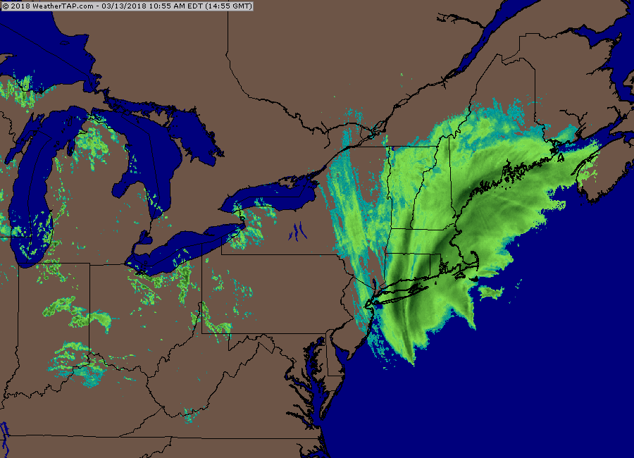
I can't believe its been sustained 1/4sm snow way out here from a low that far away.
Definitely bucks the trend. The mountains are going to get feet from a storm that went what east of the Benchmark?
We still have days to go up here.
Yup, Its SE of the BM, Just nuts.
-
25 minutes ago, mahk_webstah said:
Is the low fully captured? might we not get another push west if that happens? It is so close..we just have to get the goodies to I93 on radar and the wind will blow it to us.
Amazed we are even snowing with a low that is 420+ miles away.
-
 1
1
-
-
10 minutes ago, dendrite said:
I can’t see you in your subby zone from my subby zone through that band.

Loooks like we will fill it in though
-
2 minutes ago, dendrite said:
I can’t see you in your subby zone from my subby zone through that band.
Even despite that.
KLEW 131656Z AUTO 01013G19KT 1/2SM -SN FZFG OVC007 M02/M03 A2957 RMK AO2 CIG 003V010 SLP031 P0000 T10171028 FZRANO
-
Just now, moneypitmike said:
LOL--too funny. That is a painful sight though.
It really sucks when you end up in the sinking air behind those bands
-
2 minutes ago, moneypitmike said:
Melting? What's the temp?
Temps have risen with some posters melting.
-
 1
1
-
-
23 minutes ago, JC-CT said:
Lol


-
1
-
2
-
-
Looks like some gravity wave action just SE of PWM in the GOM.
-
1 minute ago, tunafish said:
This one is crushing me right now. best rates since the xmas storm for me.
That bad boy is still building, The vertical lift has to be thru the roof.
-
1
-
-
Just now, moneypitmike said:
Great--I'm glad s/he is a spotter. It's going to be tough to get anything accurate. I've been in 1/4 visibility for what seems like hours and I have no snow on my car, a road that's mostly snow-free and a deck that doesn't have a flake.
That's good Kennebec River living right there..........lol
-
Going to replacing that first band with another one developing to the SE and moving to the NW.

-
1
-
-
15 minutes ago, moneypitmike said:
Getting smoked down here. Little to show for it with the howling winds I have no snow on the deck, very little knew snow in the yard and the street it blown clear. I hope they're getting good measurements away from the water.
There is somebody that is a spotter in North Bath away from the water.
-
1 minute ago, dendrite said:
Starting to ramp up. Dryslots band is moving in. Up to 27.6°
Its a good one 1/8 mi vis
-
5 minutes ago, MaineJayhawk said:
Yeah, we're getting smoked in North Windham
3" right now on the ground, This is 1-3"/hr rates right now easily, 37 dbz

-
1
-
-
5 minutes ago, Lava Rock said:
Still thinking 12-18"?
Yes, These are feathers here now, Snow Growth has really stepped up.
KLEW 131530Z AUTO 01015KT 1/4SM +SN FZFG BKN007 OVC012 M02/M03 A2963 RMK AO2 CIG 004V009 P0000 FZRANO


March 12/13/14 Blizzard/Winter Storm/WWA etc
in New England
Posted
*Spring Cancel*