
Jim Martin
-
Posts
2,469 -
Joined
-
Last visited
Content Type
Profiles
Blogs
Forums
American Weather
Media Demo
Store
Gallery
Everything posted by Jim Martin
-
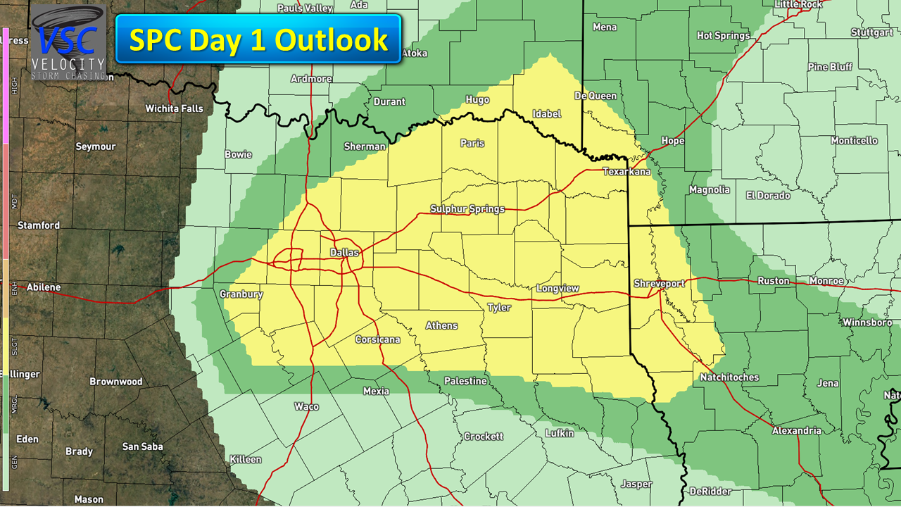
 Slight risk for severe thunderstorms today in Northeast Texas. Large hail/isolated tornado main risks.
-
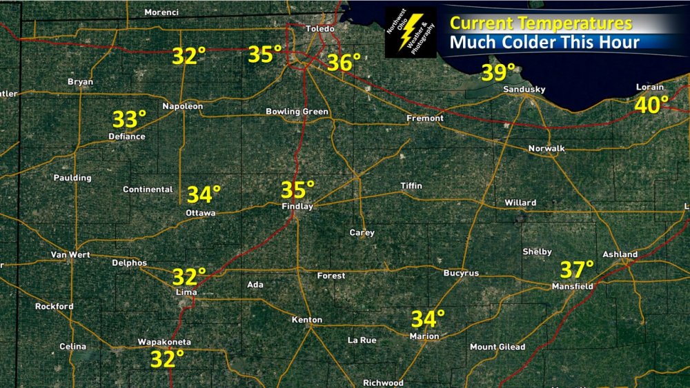
20° to 30° colder now in Northwest Ohio than this time 24 hours ago.
-
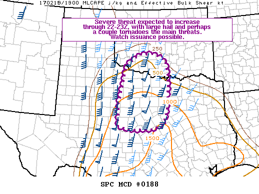
Weather Watch possible later today for Northwest Texas. All severe hazards look to be in play.
-
12z Euro basically saying Deep Freeze & Plentiful snow pack by next week...
-
Nice view of the Supermoon tonight in Findlay.

-
Saturday Morning is starting to look a bit nippy for Northern Ohio. The Forecast Models showing low temperatures Saturday down into the lower 30s. Even though the growing season is finished, a heavy frost is looking to be a distinct possibility.
-
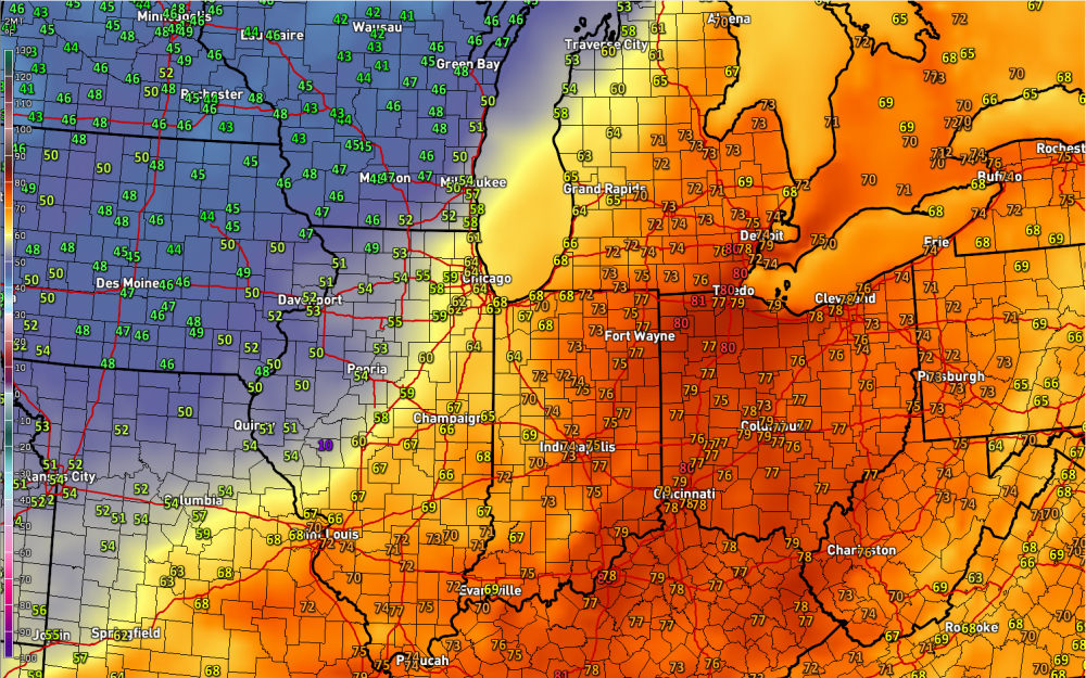
Not too hard to find where the Cold Front is here late this afternoon and early evening.
-
Historic Tornado Outbreak April 27, 2011
Jim Martin replied to CUmet's topic in Weather Forecasting and Discussion
I have had some people on my Weather or Knot blog comment that saying in their home town of Taft, Tennessee, debris from the Hackelburg AL tornado actually fell in their town.