HVSnowLover
-
Posts
2,952 -
Joined
-
Last visited
Content Type
Profiles
Blogs
Forums
American Weather
Media Demo
Store
Gallery
Everything posted by HVSnowLover
-
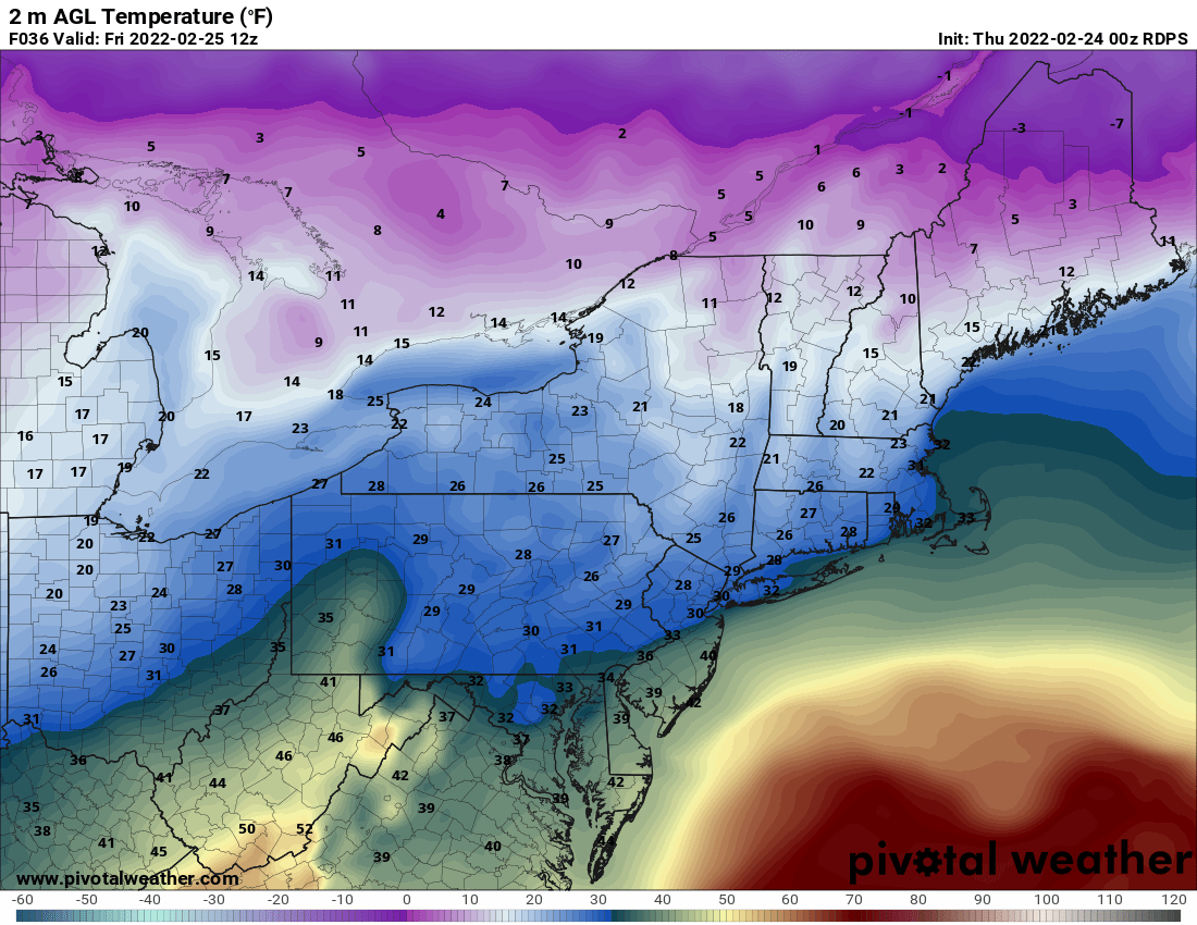
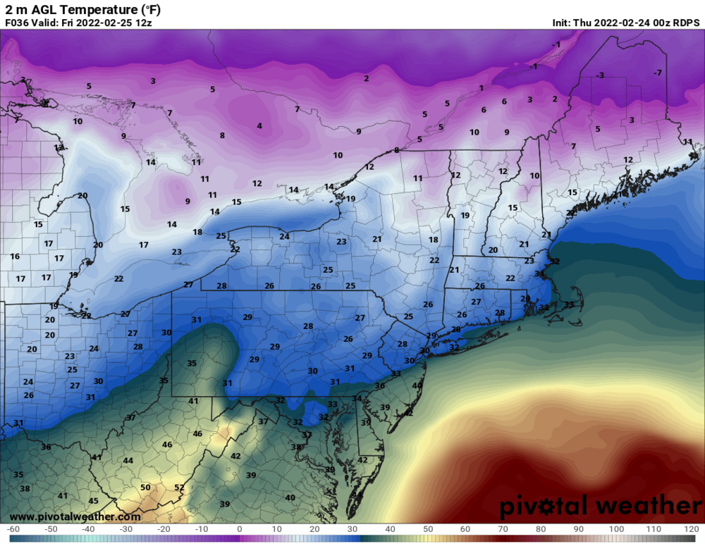
I think we saw from the last storm below 30 is the key temp for ice accretion however if there is some snow/sleet on the ground already I would imagine that might help increase accretion?
-
Would be a nightmare during rush hour with these temps
-
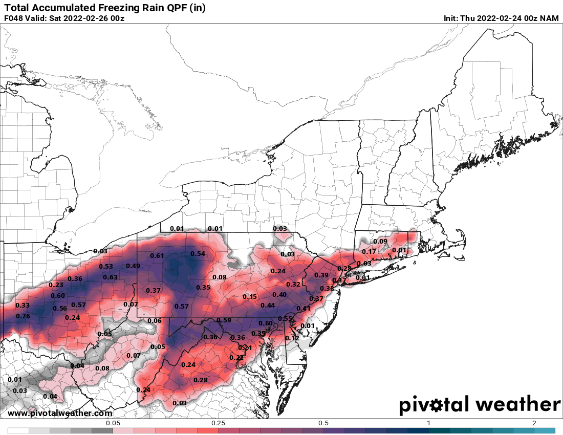
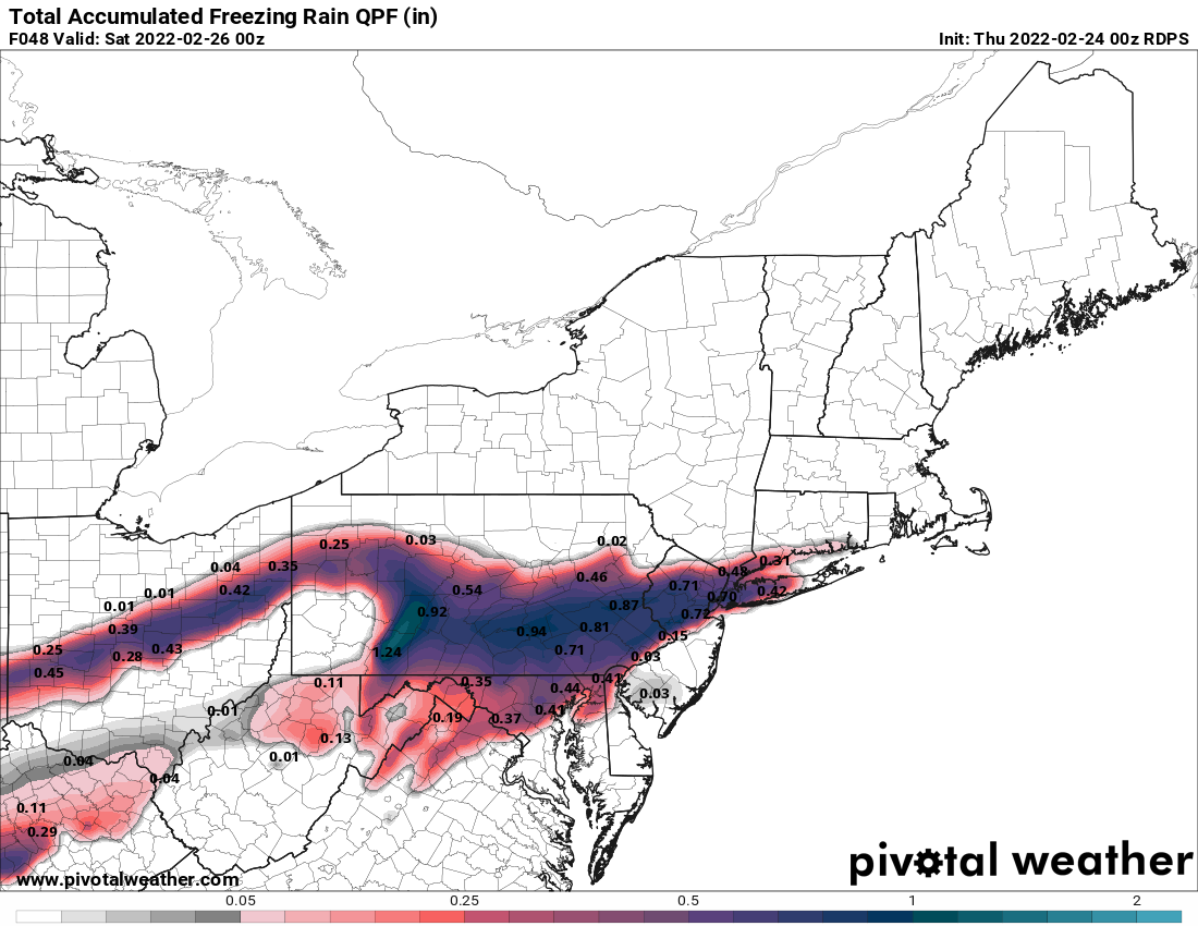
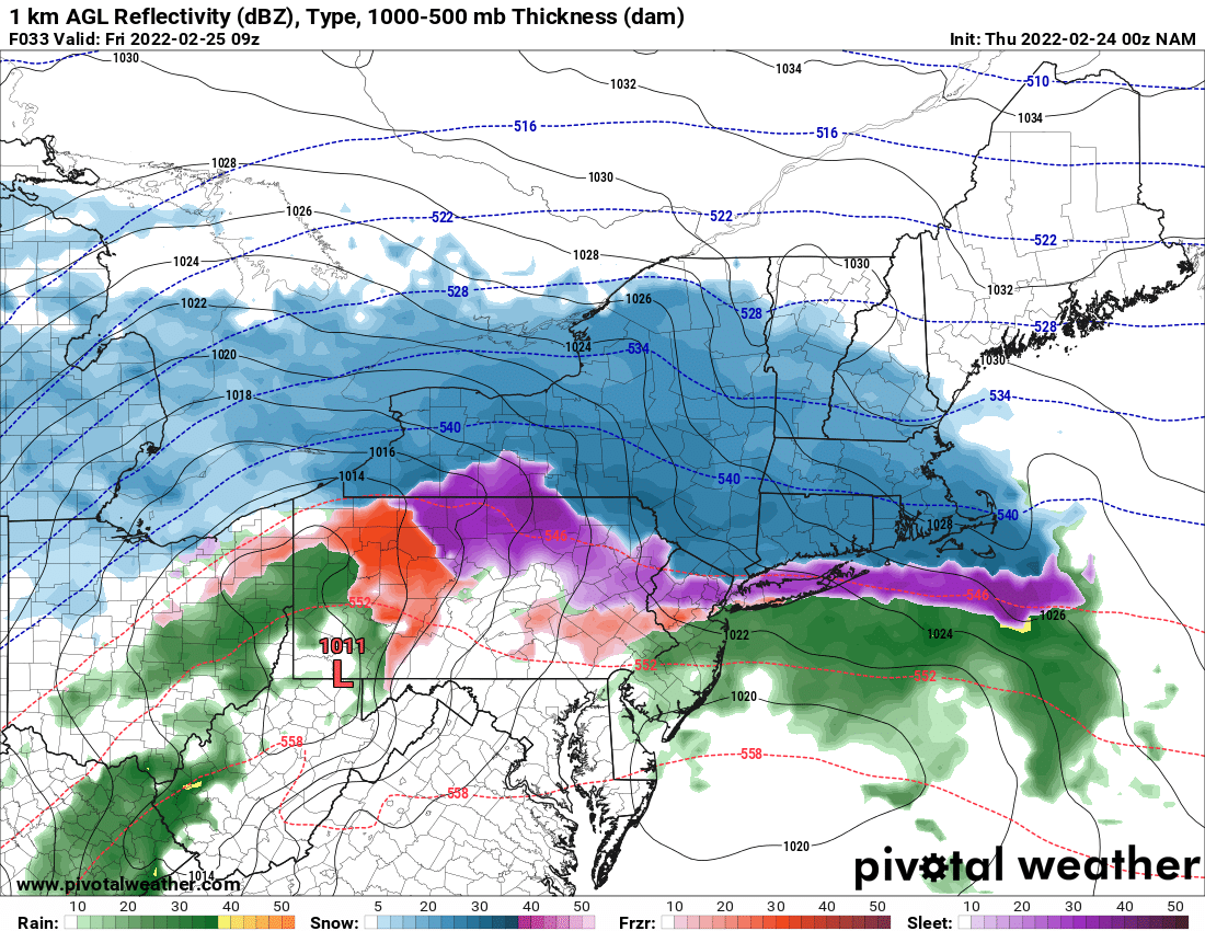
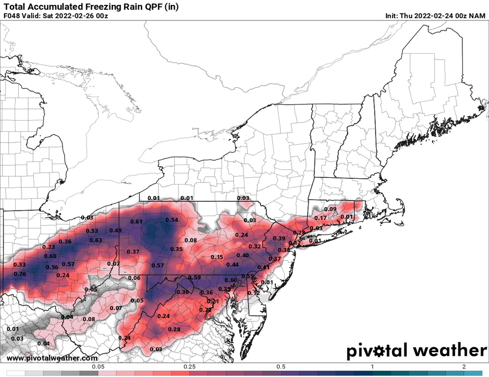
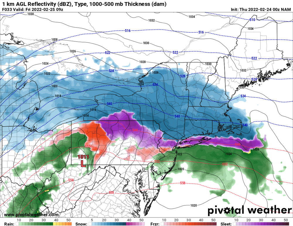
Nam more modest with the ZR but the signal is still there for same locations
-
-

-
Yes LI goes over to heavy rain for a few hours but the city is all frozen ending as drizzle.
-
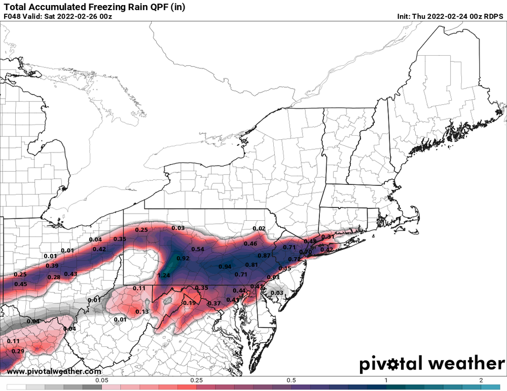
RGEM looks like it nudged north from 18z but not by much.
-
I agree with you but this is the kind of storm that could come in as a wall and dump 1-2 inches of snow in an hour at the start.
-
Colder doesn't necessarily equal snowier-although thus far the trend today has been for the snow line to also be dropping south.
-
I wouldnt really take the NAM very seriously until other models shift toward it.
-
3k still looks pretty terrible.
-
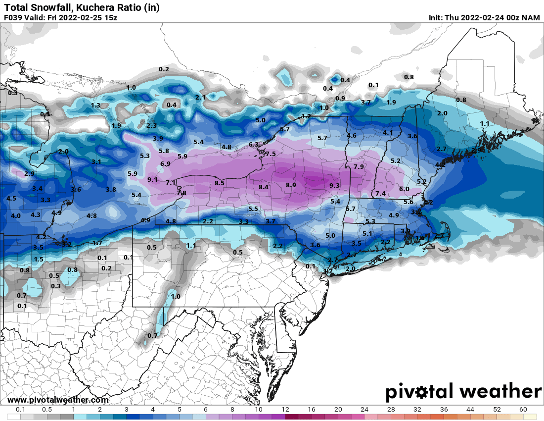
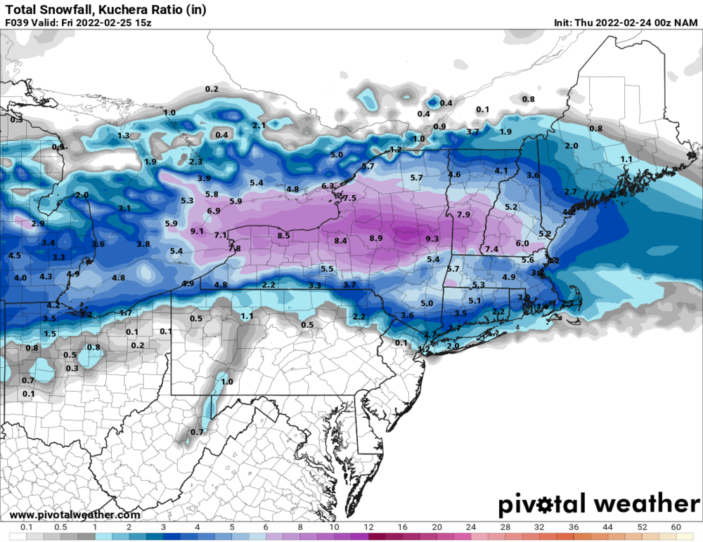
I mean it went from 2.4 for Albany to 6.3 so it's a step toward returning to the planet.
-
-
-
NAM already way south and has snow some snow for NYC.
-
12Z Ukie shifted north from previous runs.
-
The models aren't really going in different directions, theyll all either basically stayed the same or trended a bit south except the NAM is a whacky model that can't be trusted at all this winter. We didn't get 30 inches of snow on 1/29 and it was also way too warm for the 1/16 event.
-
Every winter is like this especially for coastal storms or challenging precip type events.
-
Definitely November or early December coastals would be the most likely chance of big gradients in the NYC area. However don;'t need a big gradient temp wise to get big gradient in winter precip, 33 vs 30 in the same locations for hours could do it.
-
I could see something along those lines happening with this storm, maybe less extreme where it's more like 33-35 on the S shore.
-
The Euro has 7 inches in Yonkers and like 2 inches at JFK but again I think the gradient will set up further north where its more like 2 inches at Yonkers and maybe 7 inches at Peekskill.
-
I;m interested in the 0Z runs tonight, I'd think if there is a big shift it will happen by 0Z tonight.
-
Agree the distance in the city is small but the best chance of a big north/south gradient is a storm like this. I still think the snow gradient will ultimately set up north of the city probably somewhere around Central Westchester/Rockland.
-
Somewhat but sometimes they are less sharp than others and also we haven't had one set up right over or near the NYC area in a while that I can think of.
-
I don't think Euro is right but we haven't had a gradient storm across the city in a while so maybe we are due. However Its probably way to cold in the mid levels.