


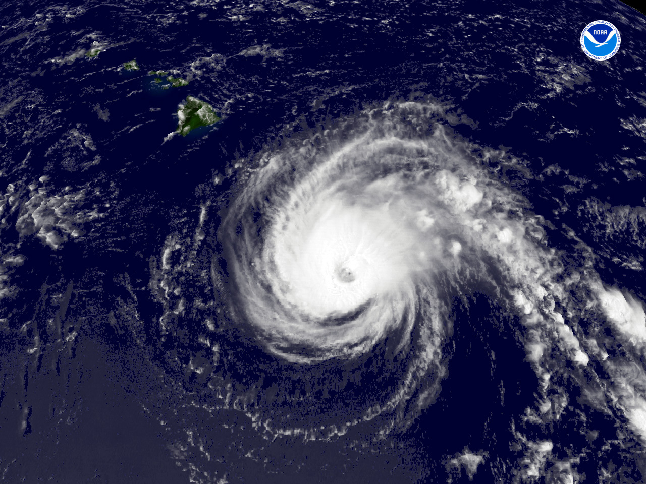
An interesting and potentially historic week ahead, tropically speaking for Hawaii. The last 12 suite of operational Global guidance suggest a rather strong TS Iselle will make its approach late Thursday into Friday from an Easterly direction. While the intensity remains very uncertain, there is warmer water E of Hawaii that may keep Iselle a bit stronger and possibly allow for a steady state as it approaches.
The global guidance is suggesting Julio may fair a bit better and provide for a stronger cyclone as it approaches Hawaii on Sunday from a ESE direction, slightly S of the Iselle expected track and receive the benefit of enhanced moisture throughout the column in the wake of Iselle. The intensity guidance is split between a stronger 100 kt cyclone to a near 70 kt cyclone. The NHS is taking a reasonable conservative approach and with additional data arriving particularly from the G-IV tasked missions this week, we should see some changes in what may well be two cyclones passing very near or over the Hawaiian Islands with a matter of 3-4 days later this week into the upcoming weekend.


Recommended Comments
There are no comments to display.
Create an account or sign in to comment
You need to be a member in order to leave a comment
Create an account
Sign up for a new account in our community. It's easy!
Register a new accountSign in
Already have an account? Sign in here.
Sign In Now