
From: 1/21/13 Dixie Alley Severe Threat

Entry posted by thunderman ·
1,918 views
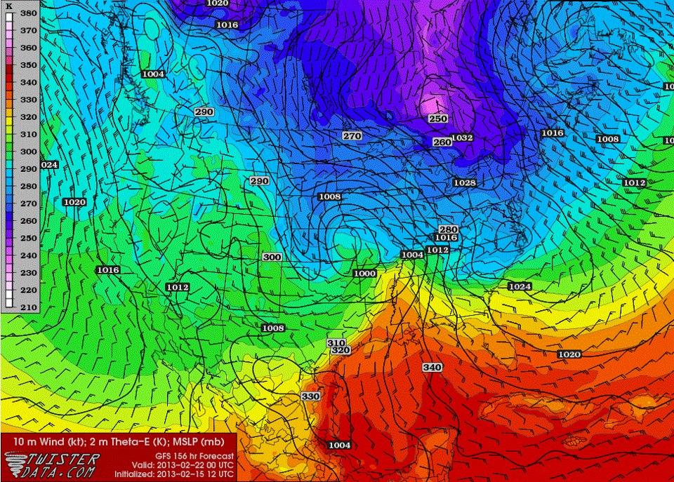
The area of low pressure that we are all watching for winter weather possibilities next towards next weekend, looks as if it may have quite the significant severe weather side as well on Thursday. The area of interest will be from east Texas into Dixie Alley.
As we saw with the last event on Sunday, there looks to be a small area of sufficient moisture return along and ahead of the front across LA, MS, AL, southern AR, and east TX. This area of better moisture/theta-e looks to also be co-located with 50+ knts of mid/upper level shear with surface winds containing an easterly component … yielding large and open hodographs. It still remains to be seen how much forcing we get into this area. If storms can manage to stay semi-discrete and surface based then we could be looking at another round of tornadoes … with strong to violent tornadoes in the cards.
Definitely need to keep an eye on this.
0 Comments
Recommended Comments
There are no comments to display.
Create an account or sign in to comment
You need to be a member in order to leave a comment
Create an account
Sign up for a new account in our community. It's easy!
Register a new accountSign in
Already have an account? Sign in here.
Sign In Now